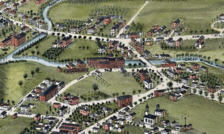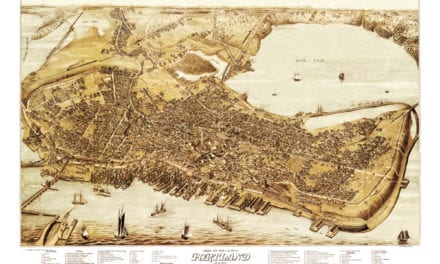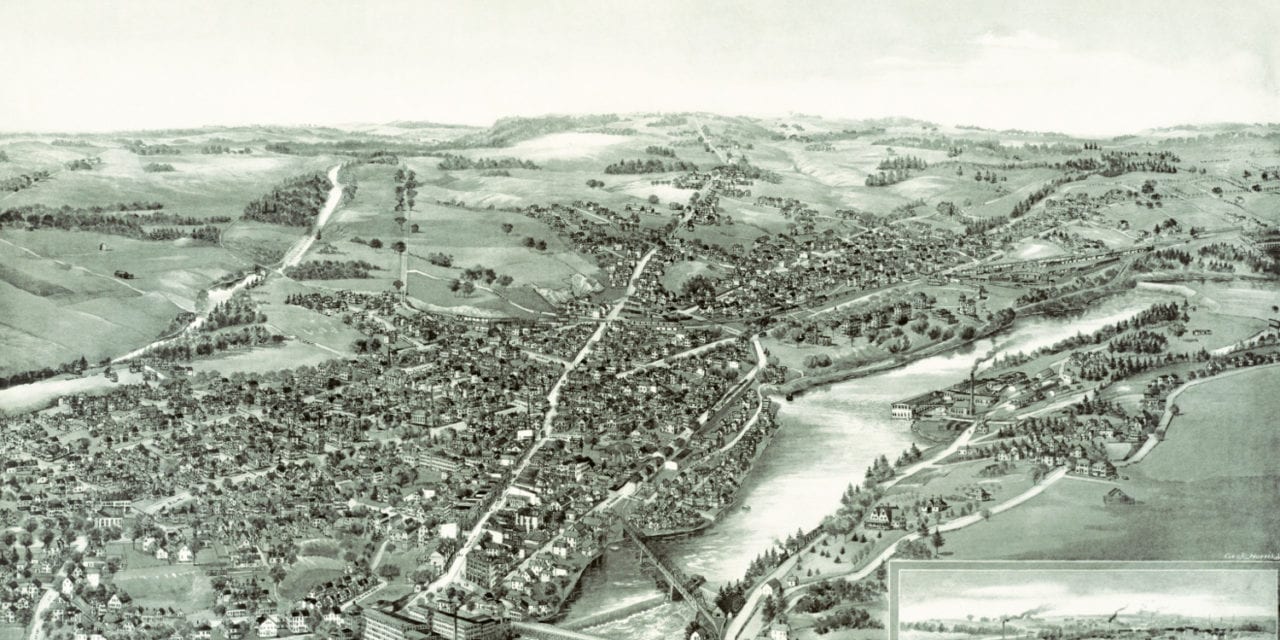
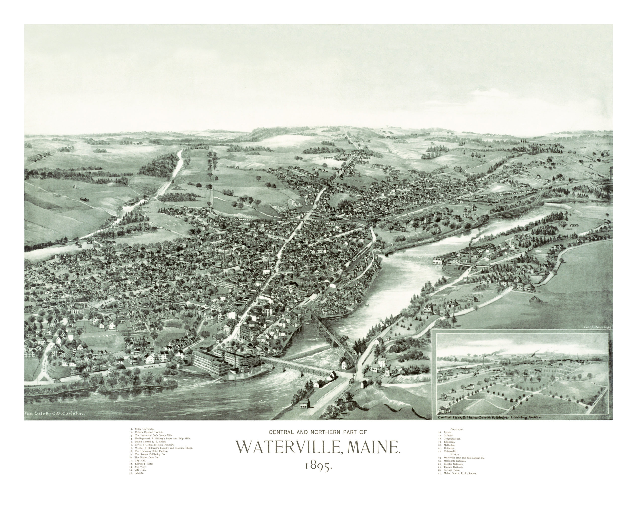
This map of Waterville, Maine was created in 1895 by George E. Norris, a prominent 19th century map maker. The map shows a detailed bird’s eye view of Waterville as it was, including street names and old landmarks.
Landmarks on the map include Colby University, Coburn Classical Institute, The Lockwood Company Cotton Mills, Maine Central Railroad Shops, The Hathaway Shirt Factory, The Groder Cure Company, Waterville City Hall, Elmwood Hotel, Peoples National Bank and more.
This historic map of Waterville, Maine has been lovingly restored by the team at KNOWOL. A limited number of reproductions are available through our online store.
Bird’s Eye View of Waterville, Maine in 1895
This old map of Waterville will make an attractive addition to your office, library, or den, and can even be used to teach children the geography and history of the area. When you’re done exploring, click here to get your copy.