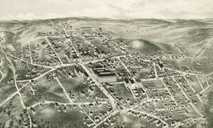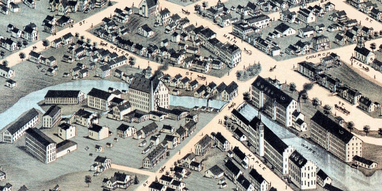
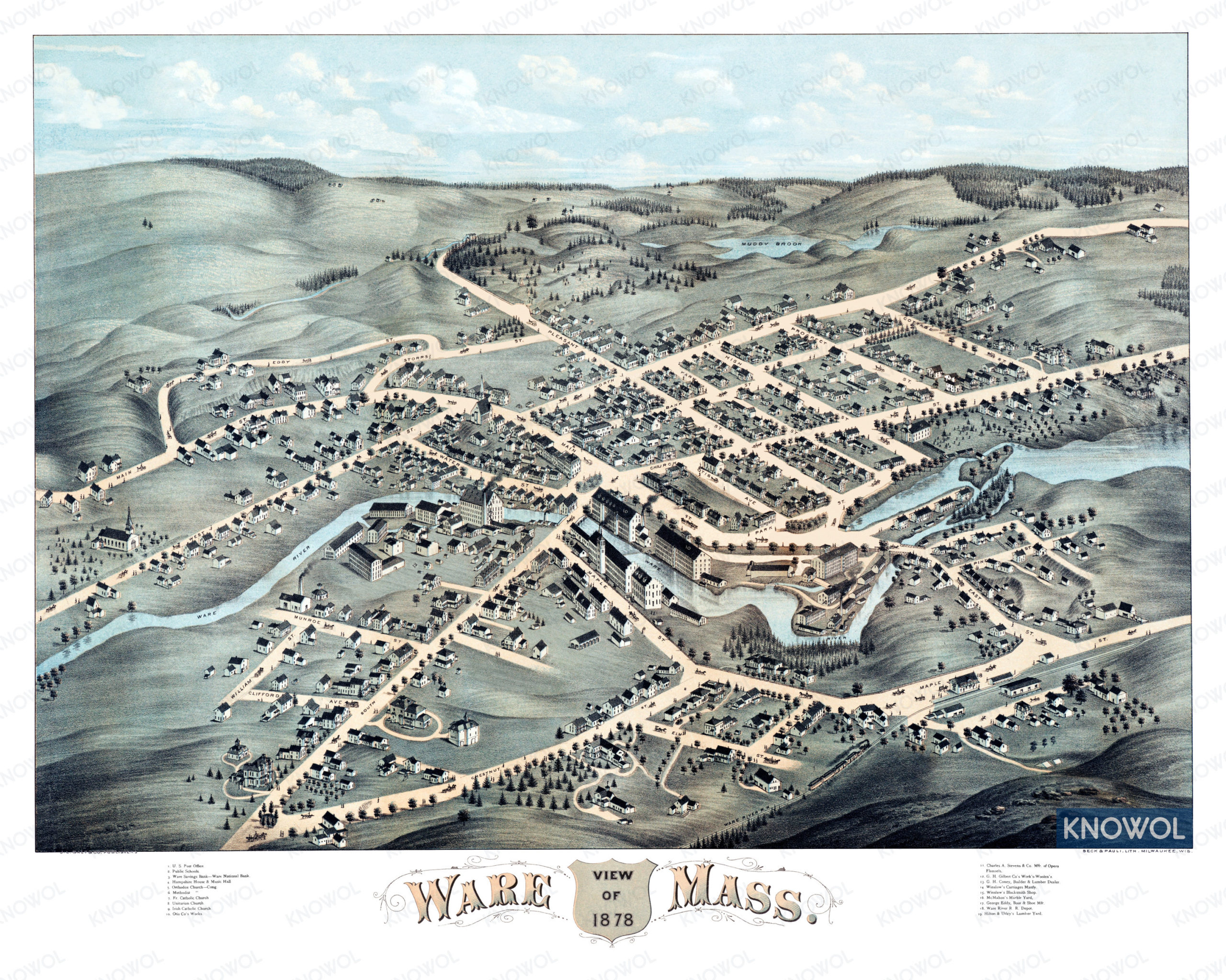
This historic map of Ware, Massachusetts was created in 1878 by Beck & Pauli, a prominent 19th century map makers. The map shows a bird’s eye view of the town as it used to be, including street names and old landmarks.
Landmarks on the map include McMahon’s Marble Yard, Winslow’s Blacksmith Shop, Ware River Railroad Depot, Hilton & Utley’s Lumber Yard, Ware Savings Bank, Hampshire Music Hall, Otis Works, Charles A. Stevens Opera Flannels, and more.
This historic map of Ware has been restored by KNOWOL. Reproductions of the restored map are available here.
Bird’s Eye View of Ware, Massachusetts in 1878
This vintage map of Ware makes an attractive addition to your office, library, or den, and can even be used to teach children the geography and history of the area. When you’re done exploring, click here to get your copy of the restored map.