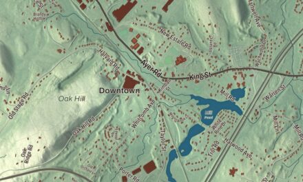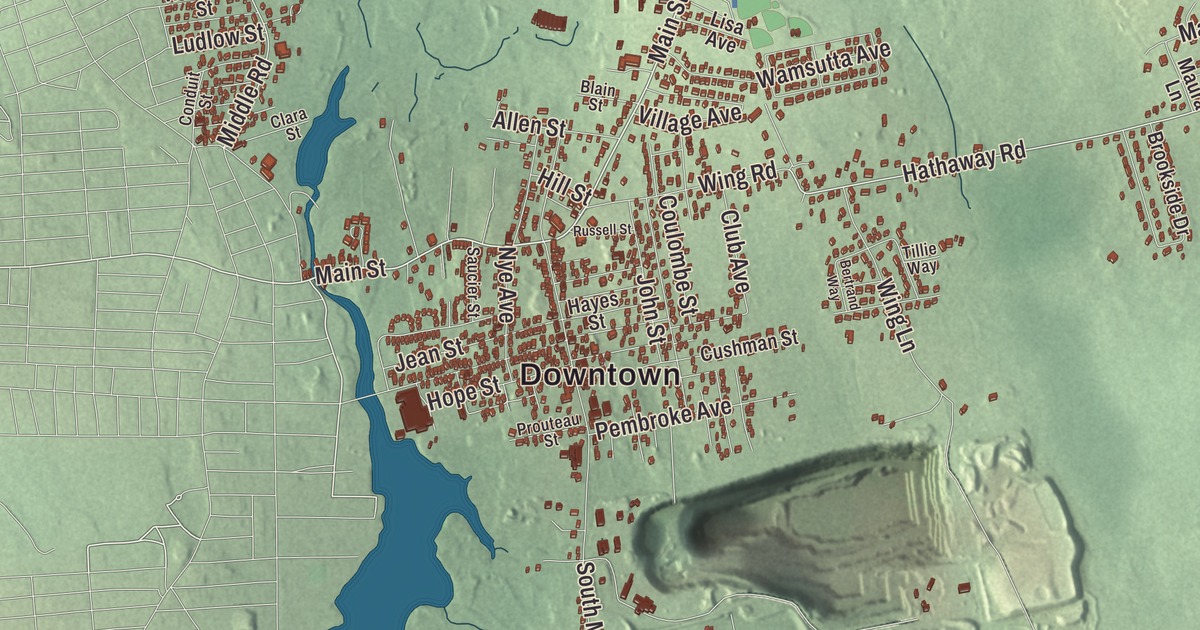
Acushnet takes its name from the river that fills the New Bedford Reservoir and then forms the town line with New Bedford. This map prints the reservoir, Hamlins Pond and Tinkham Pond along with Main Street, Middle Road, Hathaway Road, Robinson Road, Peckham Road and Braley Hill Road, and the high spots at Braley Hill, Mendall Hill and Tarkiln Hill. Click here to purchase a print of this map for your wall.
Acushnet is in Bristol County, on the South Coast near Buzzards Bay.
KNOWOL made this map in 2026 from public survey data and gave it the look of an old atlas. The shaded terrain comes from United States Geological Survey elevation data. Acushnet lies on the coastal plain, mostly below 80 feet, and its highest ground rises just past 160 feet in the Sassaquin area in the northwest corner. The roads and the town line come from the Census Bureau. Acushnet had 10,559 people at the 2020 census.
Three towns before its own
The land was bought from the Wampanoag in 1652. Its name, shared with the river, comes from the Wampanoag word Cushnea. The town page translates it “peaceful resting place near water,” for the people who lived along the river and sold the land, while the river’s page gives “as far as the waters,” the words the owners used to describe how far the sale reached. Acushnet belonged to three towns in turn. It was the northeastern part of Dartmouth, then part of New Bedford when New Bedford separated from Dartmouth in 1787, then part of Fairhaven when Fairhaven was incorporated in 1812. The Town of Acushnet’s recorded history dates European settlement to 1659, according to the state’s list, and Acushnet was incorporated as a town in 1860. The town remains part of Bristol County today.
The Long Plain Friends Meetinghouse, at 1341 North Main Street, was built in 1759, and its page calls it the oldest ecclesiastical building to survive in southeastern Massachusetts. It was listed on the National Register of Historic Places in 1986. Quakers met there until 1985, when the Long Plain Museum took it over, and it’s open for tours on weekends with pews from three centuries and exhibits about the Quakers.
A whaler and a golf ball
The town’s name went to sea on the whaler Acushnet. Herman Melville joined her crew in 1841, and he later wrote about his travels at sea, work that culminated in Moby-Dick. In 1910 Philip E. “Skipper” Young founded the Acushnet Process Company in town to remove the resin from latex and supply rubber to industry. Over time it made its own rubber goods, then golf equipment. The company split into rubber and golf divisions in 1932, and three years later the golf division brought out the Titleist ball. The company, now the Acushnet Company, still owns the Titleist name, and the town page calls it one of Southeastern Massachusetts’s most enduring industries; its headquarters today is in neighboring Fairhaven. Acushnet’s people include Gideon Nye, a merchant in the China trade, the painter Clement Nye Swift and Antonio Gattorno, a leader in Cuban modern art.
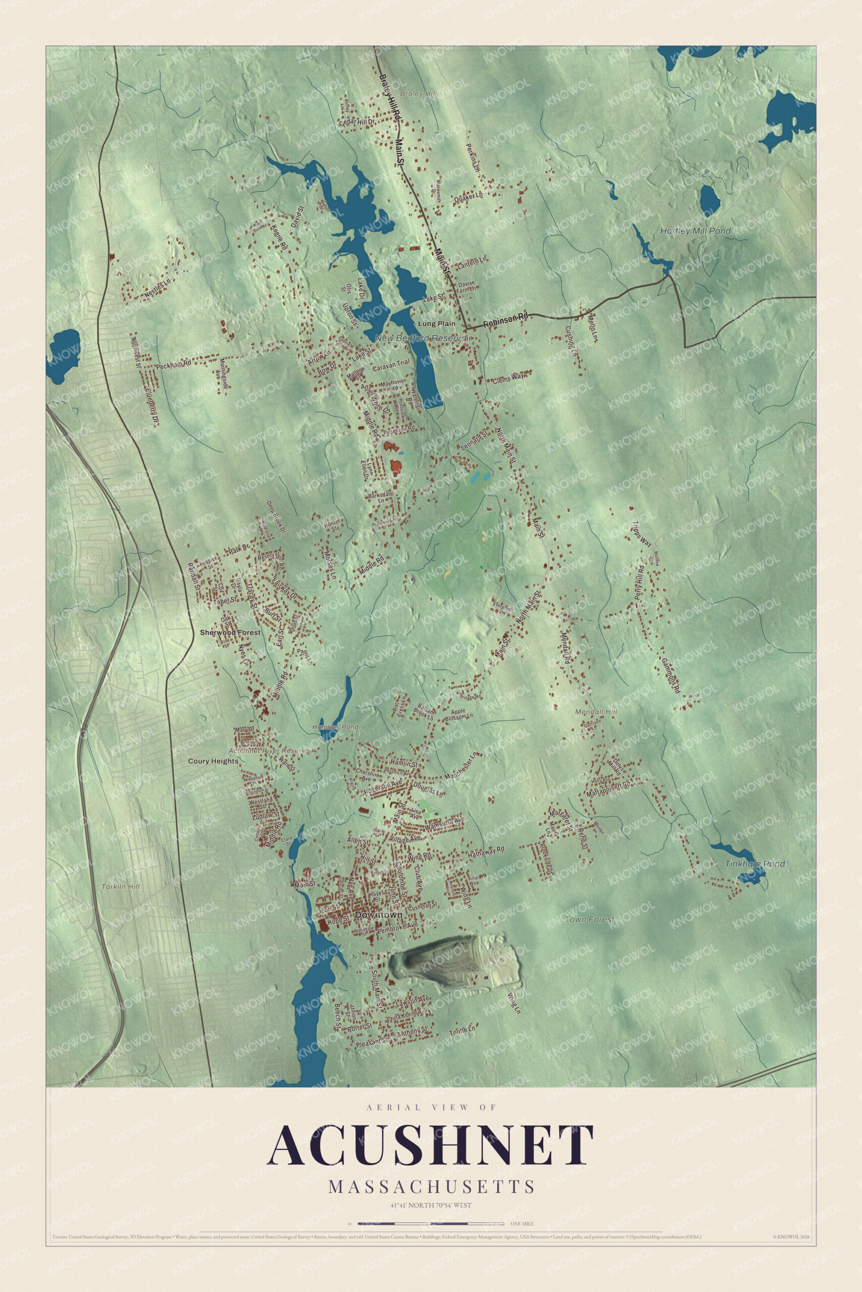
Click to explore a larger preview. The digital watermark does not appear on printed maps.
Names on this map
These names are printed on this map.
Places: Downtown, Coury Heights, Braley Hill, Mendall Hill, Tarkiln Hill, Acushnet River Reservoir, Hamlins Pond, New Bedford Reservoir, Tinkham Pond, Hartley Mill Pond, Town Forest, Long Plain and Sherwood Forest.
Streets and roads: Robinson Road, Main Street, Braley Hill Road, Hathaway Road, Middle Road, Peckham Road, North Main Street, Mattapoisett Road, Mendall Road, Keene Road, Perry Hill Road, South Main Street.
More street names, A to Z
Allen Street, Angora Avenue, Ansel White Drive, Anthony Street, Apple Blossom Lane, Arrow Lane, Ashley Lane, Balsam Brook Lane, Barksdale Lane, Beech Street, Bertrand Way, Blacksmith Drive, Blain Street, Blueberry Drive, Bow Drive, Brookside Drive, Budano Drive, Burt Street, Caravan Trial, Carol Street, Cedar Hill Drive, Chershire Avenue, Clara Street, Clems Way, Club Avenue, Conduit Street, Coulombe Street, Cox Street, Cushing Lane, Cushman Street, David Street, Davis Farm Lane, Deep Brook Drive, Dotys Mill Road, Douglas Lane, Earl Street, Evergreen Drive, Fairway Drive, Gabriel Farm Drive, Gammons Road, Garrison Lane, Gayla Drive, Golfview Road, Hamlin Street, Hayes Street, Heritage Road, Hill Street, Holly Avenue, Hope Street, Hunter Street, Jean Street, John Street, Lake Drive, Lake Street, Lantern Lane, Laura Keene Avenue, Lawson Avenue, Leonard Street, Lisa Avenue, Ludlow Street, Lussier Street, Lynn Ellen Drive, Mallory Street, Manchester Lane, Margaret Street, Marion Street, Mary Drive, Matthew Lane, Maura Lane, Mayflower Road, Mello Lane, Middlefield Place, Middlewood Drive, Monmouth Street, Morningside Avenue, Morses Lane, Morton Lane, Nestles Lane, Northwest Street, Nye Avenue, Nyes Lane, Oak Street, Otis Street, Park Drive, Parris Lane, Pembroke Avenue, Perkins Lane, Pershing Avenue, Pine Street, Pleasant Street, Pondview Road, Porter Street, Prouteau Street, Quaker Lane, Randall Street, Rene Street, Reservation Road, Reservoir Road, Rock Cress Lane, Rogerson Avenue, Russell Street, Saucier Street, Taber Street, Tillie Way, Tootle Lane, Tracey Street, Tripps Way, Union Street, Upton Street, Village Avenue, Wamsutta Avenue, Ward Street, Waterfall Road, Westland Street, Wildrose Lane, Wing Lane, Wing Road, Wood Duck Road.
Along the river
The Acushnet River rises at Long Pond in Lakeville and runs through Freetown before it fills the New Bedford Reservoir. From the reservoir it heads south, and below Main Street it forms the town line with New Bedford. The Keene River feeds the reservoir too, and the town page lists Hamlin’s Mill Pond along the river. Three short bridges cross the river in Acushnet, where it’s narrow, before it widens into New Bedford harbor. Part of Tinkham Pond lies in town, along the Mattapoisett line. Hamlins Pond, the Acushnet River Reservoir, the Town Forest, Braley Hill, Mendall Hill and Tarkiln Hill are printed on the map as well. Most people live along the New Bedford line, with the biggest group in the southwest corner near the town hall, and the Acushnet Center census area holds 28.7% of the town’s people on 7.7% of its land. Start with Coury Heights, follow Robinson Road, Main Street, Braley Hill Road, Hathaway Road, Middle Road or Peckham Road across town, then look outward toward Long Plain and Sherwood Forest.
This Acushnet map makes an attractive addition to your office, library or den, and it can help teach children the geography and history of the town that gave its name to Melville’s whaler and a famous golf ball. It’s made for people who call Acushnet home, from Long Plain to the New Bedford line. KNOWOL created it in 2026, and it’s printed on museum quality archival paper. Zoom in on the preview above to explore the details, then click here to get your copy of the Acushnet, Massachusetts map.

We made a map for every town and city in Massachusetts. Explore the complete Massachusetts map collection and find your town.
Sources