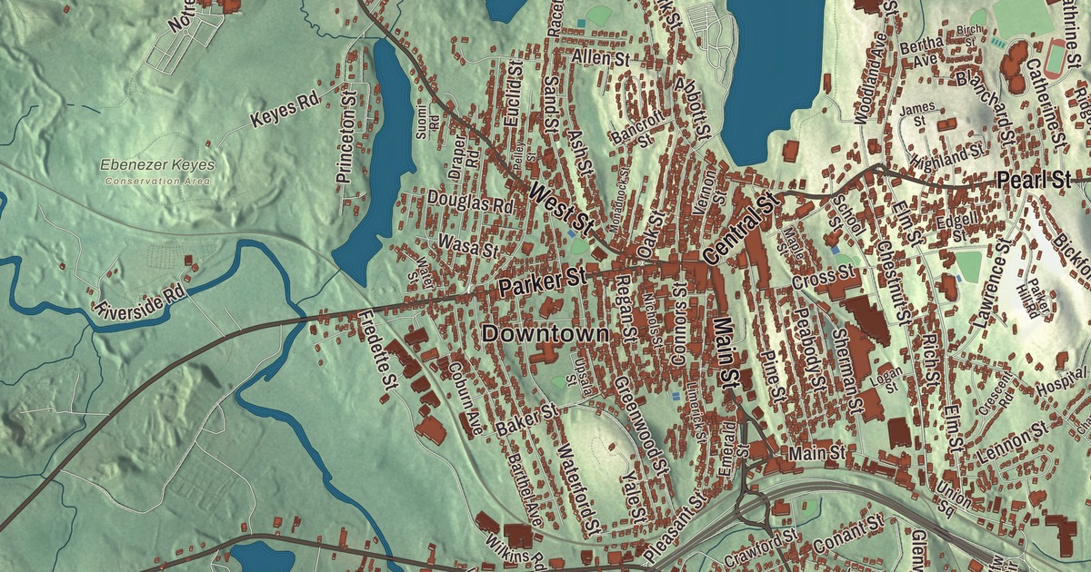
Gardner is known as the Chair City, and its chair making goes back to five brothers working in a barn in 1826. This map prints Central Street, Pearl Street, Parker Street, Timpany Boulevard, West Broadway and East Broadway, with Crystal Lake, Lake Wampanoag, Beagle Pond, Perley Brook, Barber Hill, Beaman Hill and the Olde English Village. Click here to purchase a print of this map for your wall.
Gardner is in Worcester County.
KNOWOL made this map in 2026 from public survey data and gave it the look of an old atlas. The relief comes from United States Geological Survey elevation data, and the roads and the city line come from the Census Bureau. Gardner covers 23.0 square miles, 22.2 of them land, and the city sits on Crystal Lake. Winchendon and Ashburnham lie to the north, Westminster to the east, Hubbardston to the south and Templeton to the west. The highest point is Reservoir Hill, close to the city center, at more than 1,280 feet. Gardner had 21,287 people at the 2020 census.
Four towns’ worth of land
Gardner is named for Thomas Gardner. The City of Gardner’s recorded history, in the Secretary of the Commonwealth’s list, dates European settlement to 1764, and Gardner was incorporated as a town in 1785, on land granted by the neighboring towns of Ashburnham, Templeton, Westminster and Winchendon. The state list gives 1922 as the year it was incorporated as a city, while the city’s page says 1923. In 1922 the Gardner-born illustrator Harrison Cady, best known for the Peter Rabbit comic strip he drew for 28 years, designed the city seal. It shows Thomas Gardner standing before Crystal Lake with Mount Monadnock in the distance, a chair for the furniture trade, and the letters W, W, A and T for the four towns that gave the land.
The Chair City
Around 1805 Gardner became a center for lumber and furniture, and it’s still known as the Chair City and the Furniture Capital of New England. In 1826 the five Heywood brothers, Walter, Levi, Seth, Benjamin and William, began making wooden chairs in a barn near their family farm, with Walter turning chairs by hand and on a foot lathe. In 1831 Levi went to Boston to open a store to sell them, while Benjamin and William stayed in Gardner to make them, and a fire destroyed their shop in 1834. Heywood Brothers later merged with the Wakefield Company in 1897 to form what became the Heywood-Wakefield Company, whose older pieces are now collected and have appeared on Antiques Roadshow. By 1910 Gardner had twenty chair factories turning out four million chairs a year. The Conant Ball Company and the Nichols and Stone Chair Company made furniture here too, and the city was also known for silversmithing.
Gardner also gave the world the first practical time clock. Edward G. Watkins, an engineer at Heywood-Wakefield, invented it in 1894 when he was asked to build a better way to keep track of workers. He went on to open the Simplex Time Recorder company, which his family ran for more than a century. Since 2009, on the last Saturday in September, the Annual Chair Luge has sent teams of two racing down the streets of downtown Gardner in homemade chairs on wheels.
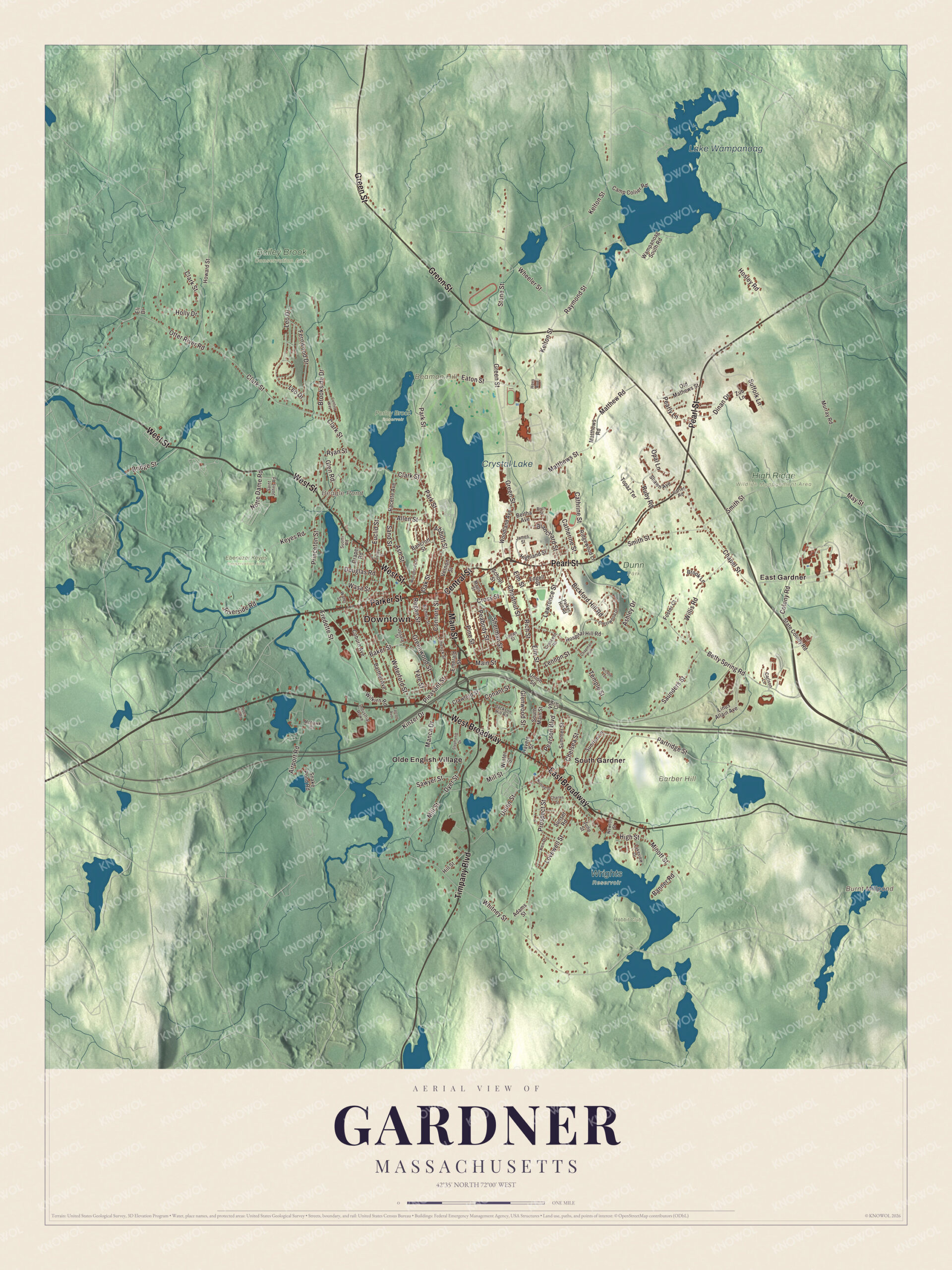
Click to explore a larger preview. The digital watermark does not appear on printed maps.
Names on this map
These names are printed on this map.
Places: Downtown, Barber Hill, Beaman Hill, Beagle Pond, Burnt Millpond, Lake Wampanoag, Crystal Lake, Bailey Brook Conservation Area, Dunn Park, Ebenezer Keyes Conservation Area, High Ridge Wildlife Management Area, Perley Brook Reservoir, Rabbit Club, Wrights Reservoir, East Gardner, Olde English Village, South Gardner and Chapman Park.
Streets and roads: West Broadway, Central Street, Pearl Street, Timpany Boulevard, Parker Street, East Broadway, Main Street, West Street, Green Street, Chestnut Street, Elm Street, Pearson Boulevard.
More street names, A to Z
Abbott Street, Adams Street, Airport Road, Allen Street, Ashley Drive, Ash Street, Baker Street, Bancroft Street, Banner Road, Barthel Avenue, Bertha Avenue, Betty Spring Road, Bickford Hill Road, Birch Street, Blanchard Street, Bridge Street, Brook Lane, Brookside Drive, Camp Collier Road, Carlson Lane, Carter Road, Catherine Street, Cathrine Street, Century Way, Chapel Street, Charles Street, Chelsea Street, Clark Street, Coburn Avenue, Colony Road, Conant Street, Connors Street, Crawford Street, Crescent Road, Crestwood Drive, Cross Street, Deer Hill Road, Dinan Drive, Douglas Road, Draper Road, Dyer Street, Eaton Street, Edgell Street, Eli Drive, Emerald Street, Euclid Street, Fernwood Drive, Foster Court, Fredette Street, Glen Road, Glenwood Street, Greenwood Street, Hero Avenue, Highland Street, High Street, Hill Street, Holly Drive, Hosley Road, Hospital Hill Road, Howard Street, Industrial Rowe, Jackson Hill Road, James Street, June Street, Kelton Street, Ken Drive, Keyes Road, Kinzer Drive, Lakeview Drive, Lawrence Street, Lennon Street, Leo Drive, Limerick Street, Linus Allain Avenue, Logan Street, Lovewell Street, Manca Drive, Maple Street, Matthew Road, Matthews Road, Matthews Street, May Street, Mill Street, Minott Street, Mohawk Drive, Monadnock Street, Murray Road, Newton Street, Nichols Street, Nicolle Terrace, Notre Dame Road, Nutting Street, Oak Street, Old Mathews Street, Opal Lane, Otter River Road, Parker Hill Road, Park Street, Partridge Street, Peabody Street, Pearly Lane, Pelley Street, Pine Street, Pleasant Street, Princeton Street, Prospect Street, Racette Avenue, Raymond Street, Regan Street, Rich Street, Ridgewood Lane, Riverside Road, Ruby Road, Ryan Street, Saint Johns Road, Sand Street, Saunders Street, Sawyer Street, School Street, Shawn Avenue, Sherman Street, Smith Street, Snake Pond Road, South Main Street, State Colony Road, Stephanie Drive, Stone Street, Suffolk Lane, Summer Street, Sunrise Lane, Sunset Road, Suomi Road, Talcott Avenue, Temple Street, Topaz Terrace, Travers Street, Union Square, Union Street, Upsala Street, Vernon Street, Vfw Circle, Wampanoag South Road, Wasa Street, Waterford Street, Water Street, Wheeler Street, Whitney Street, Wilkins Road, Willis Road, Winter Street, Woodland Avenue, Yale Street, Zub Lane.
See it on a wall
The Gardner map as a framed print. Swipe for more.


Diners, parks and a college
The Blue Moon Diner, built in 1949 by the Worcester Lunch Car Company as the Miss Toy Town Diner, has stood on Main Street since 1954 and is on the National Register of Historic Places. Dunn State Park covers 132 acres around a 20-acre pond, on land that the furniture maker John Ainsworth Dunn left to the city when he died in 1915. Mount Wachusett Community College, founded in 1963, has its 269-acre main campus on Green Street. The Gardner Public Library opened in 1885, and its original building is now a museum of the city’s history.
Around the map
Start with East Gardner, then follow West Broadway, Central Street, Pearl Street, Timpany Boulevard, Parker Street and East Broadway across the city. Look outward toward the Olde English Village and South Gardner. Beagle Pond, Lake Wampanoag, Crystal Lake, Perley Brook, Barber Hill and Beaman Hill are all printed on the map.
The Gardner map makes a fine addition to an office, library or den, and it can help teach children the geography and history of the Chair City. It’s made for people who call Gardner home, from East Gardner to South Gardner, and it shows the city as it looks today. Zoom in on the preview above to explore the details, then click here to get your copy of the Gardner, Massachusetts map.

Sources
- Gardner, Massachusetts, Wikipedia
- Harrison Cady, Wikipedia
- Heywood-Wakefield Company, Wikipedia
- Blue Moon Diner, Wikipedia
- Dunn State Park, Wikipedia
- Mount Wachusett Community College, Wikipedia
- City and Town Incorporation and Settlement Dates, Secretary of the Commonwealth of Massachusetts (archived copy)