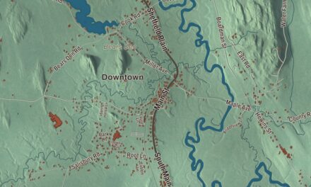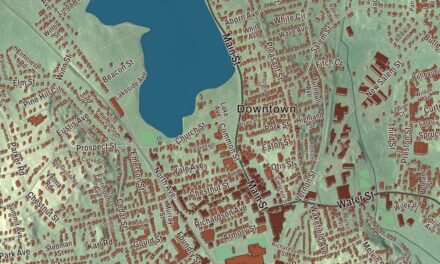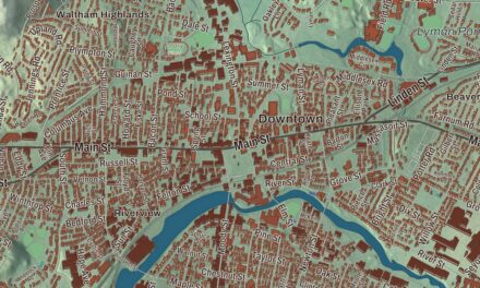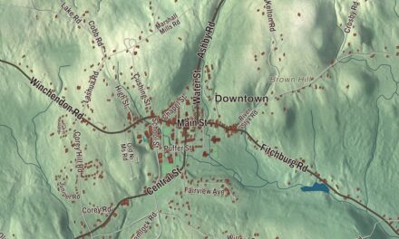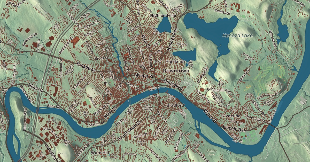
Haverhill people grow up with the Merrimack, Bradford across the river, the old shoe factories downtown, and Kenoza Lake and Winnekenni Castle beyond the Highlands. This map prints River Street, Water Street, Winter Street, Lincoln Avenue, Broadway and Amesbury Road, with Kenoza Lake, Johnsons Pond, Brandy Brow Forest and Ayers Hill. Click here to purchase a print of this map for your wall.
Haverhill is in Essex County.
KNOWOL made this map in 2026 from public survey data and gave it the look of a vintage city atlas. The drumlins and river valleys come from United States Geological Survey elevation data, and the streets and the city line come from the Census Bureau. Haverhill covers 35.6 square miles on the New Hampshire border, about 35 miles north of Boston, and it had 67,787 people at the 2020 census. The Little and Merrimack rivers drain it, with the Merrimack dividing the Bradford section from the rest of the city. Ayers Hill, a drumlin with two knobs of almost equal height, is its highest point.
Pentucket
Settlers from Newbury founded the town in 1640 and first called it Pentucket, which the city page translates as “place of the winding river.” The City of Haverhill’s recorded history, in the Secretary of the Commonwealth’s list, dates European settlement to 1640. Haverhill was incorporated as a town in 1641, and the land was bought from the Pentucket people on November 15, 1642. The town took its new name from Haverhill in Suffolk, England, the birthplace of its first pastor, the Reverend John Ward. The first settlement stood near the corner of Water Street and Mill Street, by the Linwood Cemetery and Burying Ground, and the house of William White, one of the founders, still stands, much enlarged.
Haverhill began as a Puritan farming community and grew into an industrial center, first with sawmills and gristmills run by water, then woolen mills, tanneries, shipping and shipbuilding. George Washington visited on November 4, 1789. In the summer of 1835 Ezekiel Hale Jr. and his son, Ezekiel James Madison Hale, put up a brick woolen flannel factory on Winter Street, and the younger Hale later gave large sums to build the city’s hospital and library. Haverhill was incorporated as a city in 1869, by the Secretary of the Commonwealth’s list; the city page gives 1870.
The Queen Slipper City
Shoemaking was Haverhill’s big industry for many decades. By the end of 1913, the city page says, one tenth of the shoes made in the United States came from Haverhill, and the city was known as the “Queen Slipper City.” The Washington Street Shoe District, two blocks of Washington and Wingate streets between Railroad Square and Essex Street, held more than 60 shoe factories built in the late 1800s, mostly brick Italianate buildings of three or four stories. It was listed on the National Register in 1976. The Highlands, next to downtown, show the many kinds of Victorian mansions built in the shoe boom years.
The shoe trade shaped Haverhill’s politics too. John C. Chase came to Haverhill in 1890 to work in a shoe factory, helped start a cooperative grocery store and in 1898 won the mayor’s office on the Social Democratic ticket. His page says he is considered the first socialist elected mayor of an American city. Alexander Graham Bell spent considerable time in Haverhill as a tutor to the deaf son of a leading shoe manufacturer, who later invested in Bell’s idea for the telephone.
Whittier and the antislavery town
The poet and abolitionist John Greenleaf Whittier was born in December 1807 in the farmhouse that Thomas Whittier, his great-great-grandfather, built in 1688 beside Fernside Brook. That homestead is the setting of his long poem Snow-Bound, an instant bestseller when it came out in 1866, and it has been a museum since 1893. Whittier’s first poem appeared in 1826 in a newspaper edited by William Lloyd Garrison, who helped him attend Haverhill Academy. The city page says Haverhill people were early advocates for ending slavery, and a number of houses that served as stops on the Underground Railroad still stand. A branch of the American Anti-Slavery Society formed here in 1834.
Bradford, across the river, was its own town until January 1, 1897, when it joined the city of Haverhill. The Bradford Common Historic District keeps its old center around the common at South Main and Salem streets, with the White Church of 1848 and a tavern of about 1690. Bradford Academy, founded in 1803, began as a coeducational school and became a school for women in 1836, and the district page calls Bradford College one of the first coeducational academies to be founded.
Main Street, the castle and the Rocks
The Main Street Historic District is the city’s civic core. Its 1909 high school building, now Haverhill City Hall, is the school the city page names as the inspiration for Bob Montana’s Archie Comics. In 1932 French residents put up a statue of the Marquis de Lafayette at Lafayette Square, and in 2016 a former electrical supplies building in Haverhill was donated to house the Museum of Printing.
Above Kenoza Lake, the chemist James R. Nichols built Winnekenni Castle between 1873 and 1875 as a summer home, inspired by stone buildings he had seen in England, and named it with an Algonquin word meaning “very beautiful.” The city bought it in 1895, and it stands in the Winnekenni Park Conservation Area of more than 700 acres. Out at the eastern end of the city, Rocks Village grew from 1640 as a ferry crossing to West Newbury. Its historic district holds 25 buildings, 15 of them from the 1700s, and the Ingalls House there has wall murals by the traveling artist Rufus Porter. Whittier, born nearby, wrote “The Countess” about Mary Ingalls, who was born in that house.
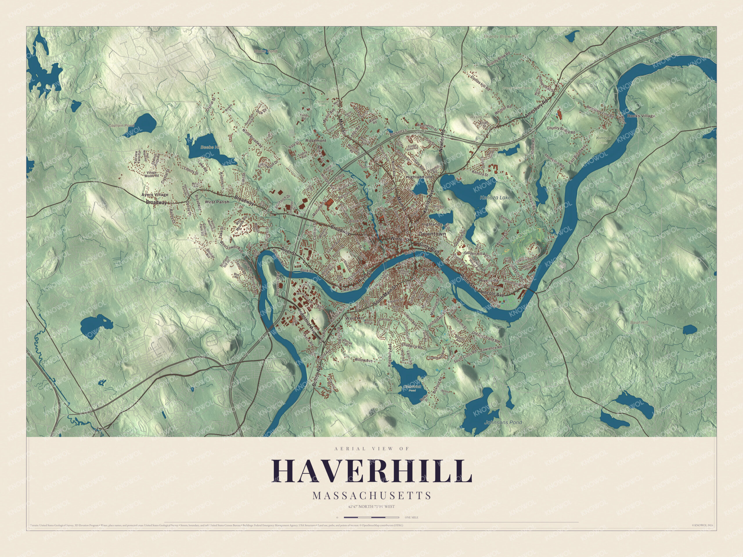
Click to explore a larger preview. The digital watermark does not appear on printed maps.
Names on this map
These names are printed on this map.
Places: Downtown, Rocks Village, Ayers Hill, Bear Hill, Beebe Hill, Brandy Brow Hill, Blunts Pond, Captain Pond, Kenoza Lake, Johnsons Pond, Brandy Brow Forest, Chadwick Pond, Clement Farm, Kimball Farm, Silsby Farm, Viburnum Woods, Ayers Village, Bradford, Highlands, Highlandville, Riverside, Rosemont, Ward Hill, West Parish and Tyler Park.
Streets and roads: River Street, Water Street, Lincoln Avenue, Winter Street, Broadway, Amesbury Road, Main Street, Newton Road, South Main Street, Boston Road, Industrial Avenue, Kenoza Avenue.
More street names, A to Z
14th Avenue, 17th Avenue, Alpha Street, Alpine Drive, Amesbury Line Road, Ann Street, Anson Street, Ashland Street, Atlanta Street, Bailey Court, Baker Road, Bank Road, Barberry Lane, Bard Street, Barker Street, Bateman Street, Beechwood Drive, Blaisdell Street, Blye Road, Boardman Street, Boxford Road, Brandy Brow Road, Brickett Hill Circle, Brickett Lane, Brook Street, Browns Lane, Brown Street, Carleton Street, Cedar Street, Chadwick Road, Clydedale Avenue, Coffin Avenue, Colby Street, Colonial Farm Road, Computer Drive, Concord Street, Corliss Hill Road, Country Bridge Road, Crosby Street Extension, Cross Road, Crystal Street, Dawn Circle, Day Street, Delray Drive, Dorian Drive, Dow Drive, East Broadway, Edgehill Road, Eleventh Avenue, Elijah Street, Elliott Street, Elm Street, Emily Street, Essex Street, Eudora Street, Fairview Farm Road, Farrwood Place, Ferry Road, Fondi Road, Forest Acres Drive, Forest Street, Franzone Drive, Front Street, Gale Avenue, Gary Avenue, Gile Street, Ginty Boulevard, Glen Street, Golden Hill Avenue, Golden Street, Goodale Street, Groveland Street, Grove Street, Hale Street, Hammond Farm Road, High Street, Hilldale Avenue, Homestead Street, Howard Street, Hoyt Road, Hyatt Avenue, Jordan Street, Kathy Drive, Kelly Street, Kenoza Street, Kingsbury Avenue, Klondike Avenue, Kristine Lane, Lake Road, Lake Street, Larch Road, Laurel Avenue, Laurier Street, Lawrence Road, Lawrence Street, Ledge Road, Lela Avenue, Liberty Street, Lincolnshire Drive, Lowell Avenue, Lucas Drive, Lyons Farm Road, Marbles Lane, Margin Street, Marina Drive, Masys Way, Melrose Avenue, Merrill Avenue, Merrill Street, Middle Road, Middlesex Street, Mill Street, Millvale Road, Montclair Road, Montvale Street, Monument Street, Morgan Drive, Muriel Terrace, Myron Road, Neck Road, Newark Street, North Avenue, North Broadway, North Street, Old Ferry Road, Old Groveland Road, Orchard Hill Road, Oxford Avenue, Parkridge Road, Parsonage Hill Road, Pear Tree Road, Pilgrim Road, Pilling Street, Pleasant View Avenue, Portland Street, Powder House Avenue, Primrose Street, Railroad Street, Rainbow Drive, Recovery Way, Red Maple Road, Regent Avenue, Research Drive, Revere Street, Riverside Avenue, Rolling Meadows, Rosedale Avenue, Salem Street, Sawmill Ridge Road, Scotland Hill Road, Seven Sister Road, Shelby Circle, Shelley Road, Sherwood Drive, Silver Street, Snow Road, South Cross Road, South Elm Street, South Kimball Street, South Park Street, South Porter Street, Srybny Avenue, Stephan Avenue, Tersolo Road, Thompson Road, Towne Hill Road, Upland Avenue, Vale Street, Village Woods Road, Wall Street, Ward Hill Avenue, Warrenton Road, Washington Street, Wayne Street, Westchester Drive, Western Avenue, Westland Terrace, West Lowell Avenue, West Meadow Road, Westminster Avenue, Wharf Lane, Wheeler Avenue, Whittier Road, Willow Avenue, Winona Avenue.
See it on a wall
The Haverhill map as a framed print. Swipe for more.


Around the map
Start with Rocks Village. Follow River Street, Water Street, Lincoln Avenue, Winter Street, Broadway and Amesbury Road across the city. Then look outward toward Ayers Village, Bradford, Highlands, Highlandville and Riverside. Blunts Pond, Captain Pond, Kenoza Lake, Johnsons Pond, Brandy Brow Forest, Ayers Hill, Bear Hill and Beebe Hill are all printed on the map, and every one of those names is right there on the artwork.
The Haverhill map makes a handsome addition to an office, library or den, and it can help teach children the geography and history of a Merrimack River city. It’s made for people who call Haverhill home, from Bradford to Rocks Village, and it shows the city as it looks today. Zoom in on the preview above to explore the details, then click here to get your copy of the Haverhill, Massachusetts map.

Sources
- Haverhill, Massachusetts, Wikipedia
- Washington Street Shoe District, Wikipedia
- John C. Chase, Wikipedia
- John Greenleaf Whittier Homestead, Wikipedia
- Bradford Common Historic District, Wikipedia
- Main Street Historic District (Haverhill, Massachusetts), Wikipedia
- Museum of Printing, Wikipedia
- Winnekenni Castle, Wikipedia
- Rocks Village Historic District, Wikipedia
- City and Town Incorporation and Settlement Dates, Secretary of the Commonwealth of Massachusetts (archived copy)