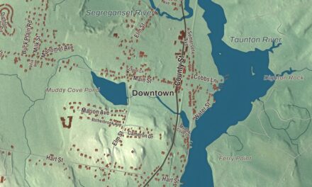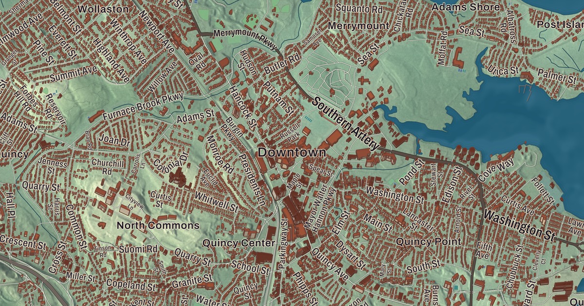
Two presidents, John Adams and his son John Quincy Adams, were born in Quincy, and so was John Hancock, the first signer of the Declaration of Independence. This map of the city prints Hancock Street, Washington Street, Quincy Avenue, Randolph Avenue, Falls Boulevard and Bower Road, with Houghs Neck, Merrymount, Germantown and the Blue Hills Reservation. Click here to purchase a print of this map for your wall.
Quincy is in Norfolk County.
KNOWOL made this map in 2026 from public survey data and gave it the look of an old atlas. United States Geological Survey elevation data shapes the hills, and the streets and the city line come from the Census Bureau. Quincy covers 26.9 square miles, 10.1 of them water, and Quincy Bay, part of Boston Harbor, lies within the city’s limits. The Neponset River separates it from Boston to the north, and the Fore River from Weymouth to the east, with Milton to the west and Randolph and Braintree to the south. It had 101,636 people at the 2020 census, the largest city in the county.
Mount Wollaston and Merrymount
The City of Quincy’s recorded history, in the Secretary of the Commonwealth’s list, dates European settlement to 1625. In that year a party led by Captain Richard Wollaston set up a post on a low hill near the south shore of Quincy Bay, on land the Native people there called Passonagessit, and named it Mount Wollaston. Wollaston soon left for Virginia, and Thomas Morton took over and renamed the post Ma-re-Mount; the Merrymount neighborhood sits on the site of that first settlement and takes its name from Morton’s pun. The land was part of Dorchester, then Braintree from 1640, and from 1708 its present border began to take shape as Braintree’s North Precinct. Quincy was incorporated as a town in 1792, named for Colonel John Quincy, the grandfather of Abigail Adams. It was incorporated as a city in 1888. Of the 17 American cities called Quincy, this is the only one where people say KWIN-zee.
Granite, iron and ships
For more than a century Quincy quarried granite. The Granite Railway, which the city page calls the first commercial railroad in the United States, was built in 1826 to haul stone from a Quincy quarry to the Neponset River in Milton, where boats carried it on to build the Bunker Hill Monument. Stonecutting became the city’s main work, and the old quarries in West Quincy are now the Quincy Quarries Reservation. Earlier still, from 1644 to 1653, the John Winthrop Jr. Iron Furnace, also called Braintree Furnace, ran here, the first iron furnace in the country.
The Fore River area turned to shipbuilding in the 1880s. The yard was founded by Thomas A. Watson, who had made his fortune as Alexander Graham Bell’s assistant on the telephone, and it built the aircraft carrier USS Lexington and the battleships USS Massachusetts and USS Nevada. The warship USS Salem is still at Fore River as the main exhibit of the United States Naval Shipbuilding Museum. Sailing ships were built in Quincy too, among them the Thomas W. Lawson, the only seven-masted schooner ever built. In the 1870s the superintendent of schools, Francis W. Parker, tried out the ideas that became known as the Quincy Method, and a state survey four years later found the city’s students excelling. Howard Johnson’s and Dunkin’ Donuts both started in Quincy, and the city’s Flag Day parade, begun in 1952, is the longest-running in the country.
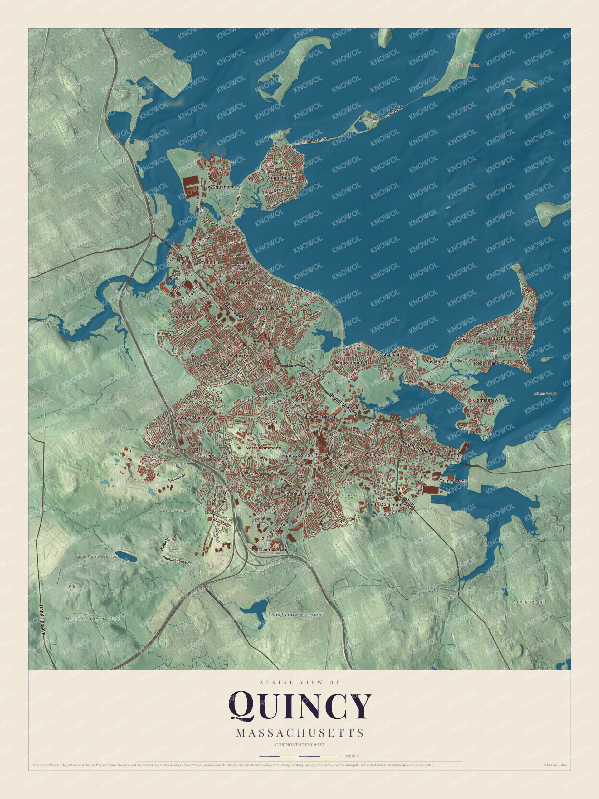
Click to explore a larger preview. The digital watermark does not appear on printed maps.
Names on this map
These names are printed on this map.
Places: Downtown, Babel Rock, Bass Point, Bass Rock, Blue Hills Reservoir, Cranberry Pond, Old Quincy Reservoir, Blue Hills Reservation, Faxon Park, Moon Island, Pine Hill Cemetery, Adams Shore, Atlantic, Five Corners, Germantown, Houghs Neck, Merrymount, Montclair, New Squantum, Norfolk Downs, North Commons, North Quincy, Post Island, Quincy Center, Quincy Neck, Quincy Point, Rock Island, South Commons, South Quincy, Squantum, West Quincy, Wollaston, Batterymarch Park and Russell Park.
Streets and roads: Southern Artery, Hancock Street, Washington Street, Randolph Avenue, Falls Boulevard, Quincy Avenue, Bower Road, Willard Street, Granite Street, Quincy Shore Drive, Bicknell Street, Fenno Street.
More street names, A to Z
Aberdeen Road, Adams Street, Airport Road, Albatross Road, Alvin Avenue, Ames Street, Appleton Street, Ardell Street, Arlington Street, Arnold Road, Arnold Street, Ashland Street, Atlantic Street, Babcock Street, Bartlett Street, Bates Avenue, Bayside Road, Bay Street, Bay View Avenue, Beach Street, Beale Street, Bellevue Road, Belmont Street, Berlin Street, Billings Road, Billings Street, Bird Street, Brae Road, Branch Street, Bunker Hill Lane, Burgin Parkway, Burns Avenue, Butler Road, Carrolls Lane, Casco Street, Centre Street, Chickatabot Road, Chickataubut Road, Chubbuck Street, Churchill Road, Circuit Road, Cityview Lane, Clay Street, Cleverly Court, Cliff Street, Colby Road, Colonial Drive, Commander Shea Boulevard, Common Street, Congress Street, Copeland Street, Cove Way, Crabtree Road, Crescent Street, Cross Street, Crown Colony Drive, Cummings Avenue, Curtis Avenue, Curtis Street, Davis Street, Doane Street, Dorchester Street, Dysart Street, East Howard Street, East Squantum Street, Edgewater Drive, Edison Street, Edwin Street, Elliot Avenue, Elm Avenue, Elm Street, Elmwood Avenue, Enterprise Drive, Essex Street, Euclid Avenue, Evans Street, Everett Street, Farrington Street, Faxon Park Road, Fayette Street, Fifth Avenue, Flynt Street, Follett Street, Forbes Hill Road, Forest Avenue, Franklin Avenue, Franklin Street, Furnace Brook Parkway, Gardiner Road, Granger Street, Greene Street, Gridley Street, Hall Place, Harriet Avenue, Harris Street, Harvard Street, Haviland Street, Heath Street, Heritage Drive, Highland Avenue, High Street, Hillsboro Street, Hilma Street, Holbrook Road, Huckins Avenue, Hudson Street, Hughes Street, Hunt Street, Independence Avenue, Island Avenue, Jenness Street, Joan Drive, Kendall Street, Kent Street, Lancaster Street, Larry Place, Lawn Avenue, Liberty Street, Lind Street, Long Island Road, Macy Street, Madison Avenue, Main Street, Manet Avenue, Maple Street, Marina Drive, Mary Street, Mayor Walter Hannon Parkway, Merrymount Parkway, Miller Street, Moffat Road, Monroe Road, Moon Island Road, Myrtle Street, Newbury Avenue, Newbury Street, Newport Avenue, Oval Road, Palmer Street, Parke Avenue, Parkingway Street, Payne Street, Penn Street, Phipps Street, Pine Street, Pond Street, Presidents Lane, Putnam Street, Quarry Street, Quincy Street, Rawson Road, Reservoir Road, Rhoda Street, Rhude Street, Ricciuti Drive, Rice Road, River Street, Roberts Street, Rock Island Road, Rockland Street, Rodman Street, Rogers Street, Russell Street, Safford Street, Samoset Avenue, School Street, Sea Avenue, Sea Street, Shed Street, Shellton Road, Shennen Street, Sherman Street, Shore Avenue, Smith Street, Sonoma Road, South Street, Spear Street, Spring Street, Squanto Road, Standish Road, Station Street, Stedman Street, Stewart Street, Stoughton Street, Summit Avenue, Suomi Road, Taffrail Road, Taylor Street, Tinson Road, Unity Street, Upton Street, Utica Street, Vassall Street, Victory Road, Viden Road, Walker Street, Walnut Street, Wampatuck Road, Waterston Avenue, Water Street, West Squantum Street, West Street, Wharf Street, Whitwell Street, Willet Street, Williams Street, Willow Avenue, Wilson Avenue, Winthrop Avenue, Wren Terrace.
Around the map
Start with Adams Shore, a neighborhood first built as a summer resort and now lived in year-round. Follow Hancock Street, Washington Street, Randolph Avenue, Falls Boulevard, Quincy Avenue and Bower Road across the city. Hancock Street runs north from Quincy Center, where City Hall, the Thomas Crane Public Library and the United First Parish Church, the Old Stone Church, stand, through Wollaston and North Quincy toward the Neponset River and Dorchester. North Quincy is home to a substantial Asian American population, and as of 2010 Quincy had the highest per capita concentration of residents of Asian origin in Massachusetts. Washington Street comes over the Fore River Bridge from Weymouth and ends at Hancock Street, and Quincy Avenue, Route 53 from Braintree, carries the shops of Quincy Point, where the Fore River Shipyard stands. Randolph Avenue is Route 28, running north from Randolph through a remote part of the Blue Hills.
Then look outward toward Atlantic, Five Corners, Germantown, Houghs Neck and Merrymount. Germantown began in the 1750s as a planned manufacturing village meant to draw German settlers. Houghs Neck is a one-square-mile peninsula between Quincy Bay and Hingham Bay, named for Atherton Hough, who was granted the land for a farm and orchard in 1636; in 1778 John Adams sailed for France from Houghs Neck rather than Boston, to avoid capture by the British. Blue Hills Reservoir, Cranberry Pond, Old Quincy Reservoir, the Blue Hills Reservation and Babel Rock are all printed on the map. Close to a quarter of Quincy’s land lies in the Blue Hills Reservation, the state park that holds the city’s highest point, 517-foot Chickatawbut Hill. The state’s Metropolitan Parks Commission bought the reservation’s lands in 1893 as one of the state’s first areas set aside for public recreation.
The Quincy map makes a fine addition to an office, library or den, and it can help teach children the geography and history of the City of Presidents. It’s made for people who call Quincy home, from Houghs Neck to the Blue Hills, and it shows the city as it looks today. Zoom in on the preview above to explore the details, then click here to get your copy of the Quincy, Massachusetts map.

We made a map for every town and city in Massachusetts. Explore the complete Massachusetts map collection and find your town.
Sources