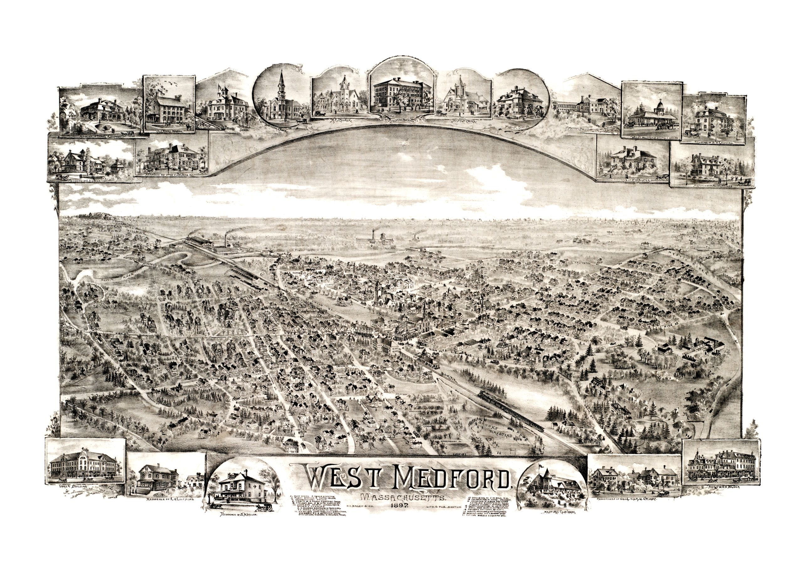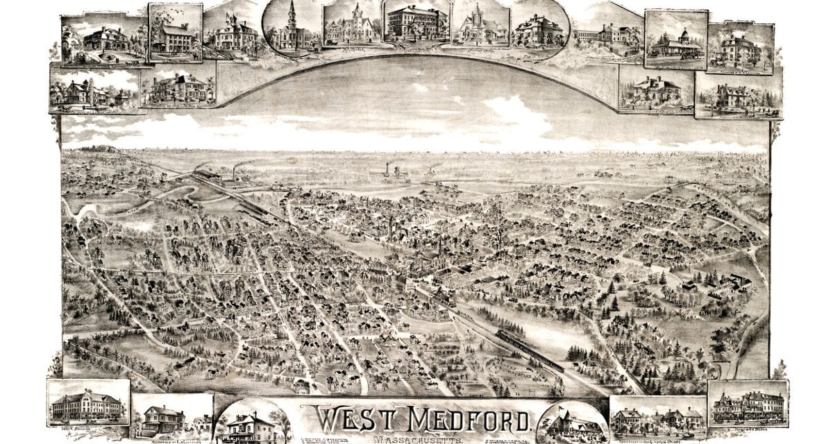
This map shows West Medford as it looked in 1897. West Medford has long been the most affluent of Medford’s many neighborhoods, and was once the home of some of Boston’s elite families. West Medford is also the home of a historic African-American neighborhood dating to the Civil War.
This map of Medford was originally created by O.H. Bailey & Co., and has been carefully restored by KNOWOL. The map includes West Medford landmarks such as Medford Club House, the Usher Building, Holton’s Block, West Medford Railroad Station and Medford Library.
Reproductions of the map are available here.