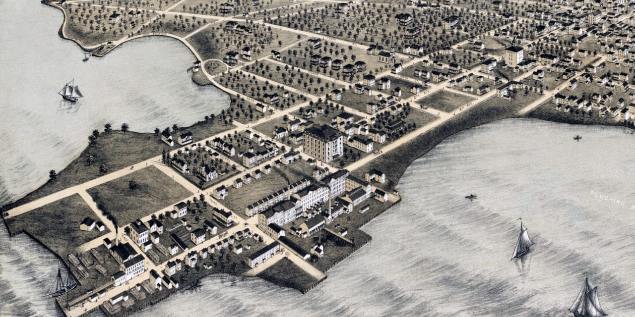
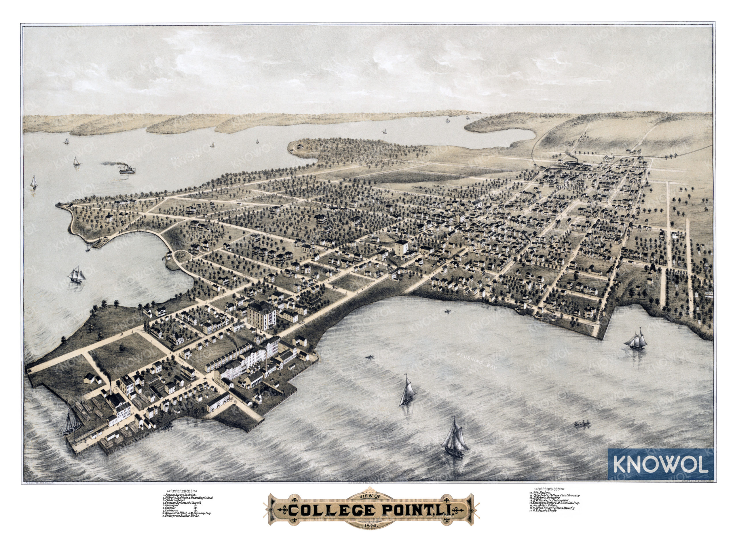
This historic map of College Point was created in 1876 by Thaddeus Mortimer Fowler, a prominent 19th century map maker. The map shows a bird’s eye view of the neighborhood as it used to be, including street names and old landmarks.
Landmarks on the map include College Point Brewery, Fuerst’s Institute & Boarding School, Enterprise Pottery, Kindling Wood Manufactory, Poppenhusen Institute, Enterprise Rubber Works, Boulevard Hotel, Weber’s Brewery, and more. The map is labeled “College Point, Long Island”, as Queens didn’t incorporate as a borough until 1897.
This historic map of College Point has been restored by KNOWOL. Reproductions of the restored map are available here.
Historic Old Map of College Point, L.I. from 1876
This vintage map of College Point makes an attractive addition to your office, library, or den, and can even be used to teach children the geography and history of the area. When you’re done exploring, click here to get your copy of the restored map.