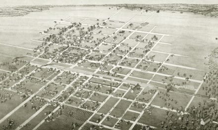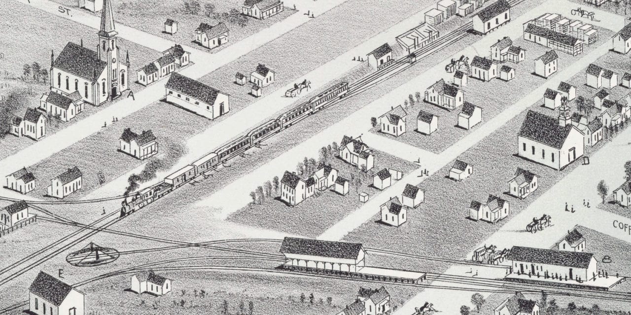
This historic map of Plano, Texas was created in 1891 by Thaddeus Mortimer Fowler, a prominent 19th century map maker. The map shows a bird’s eye view of the area as it used to be, including street names and old landmarks.
Landmarks on the map include Plano Institute, Cotton Belt Railroad, Plano Academy, Livery Stables, Methodist Episcopal, Christian Methodist Episcopal, Baptist, Christian, & Presbyterian churches, Houston and Texas Central Railway Depot, and more.
This historic map of Plano has been restored by KNOWOL. Reproductions of the restored map are available here.
Historic Old Map of Plano, Texas from 1891
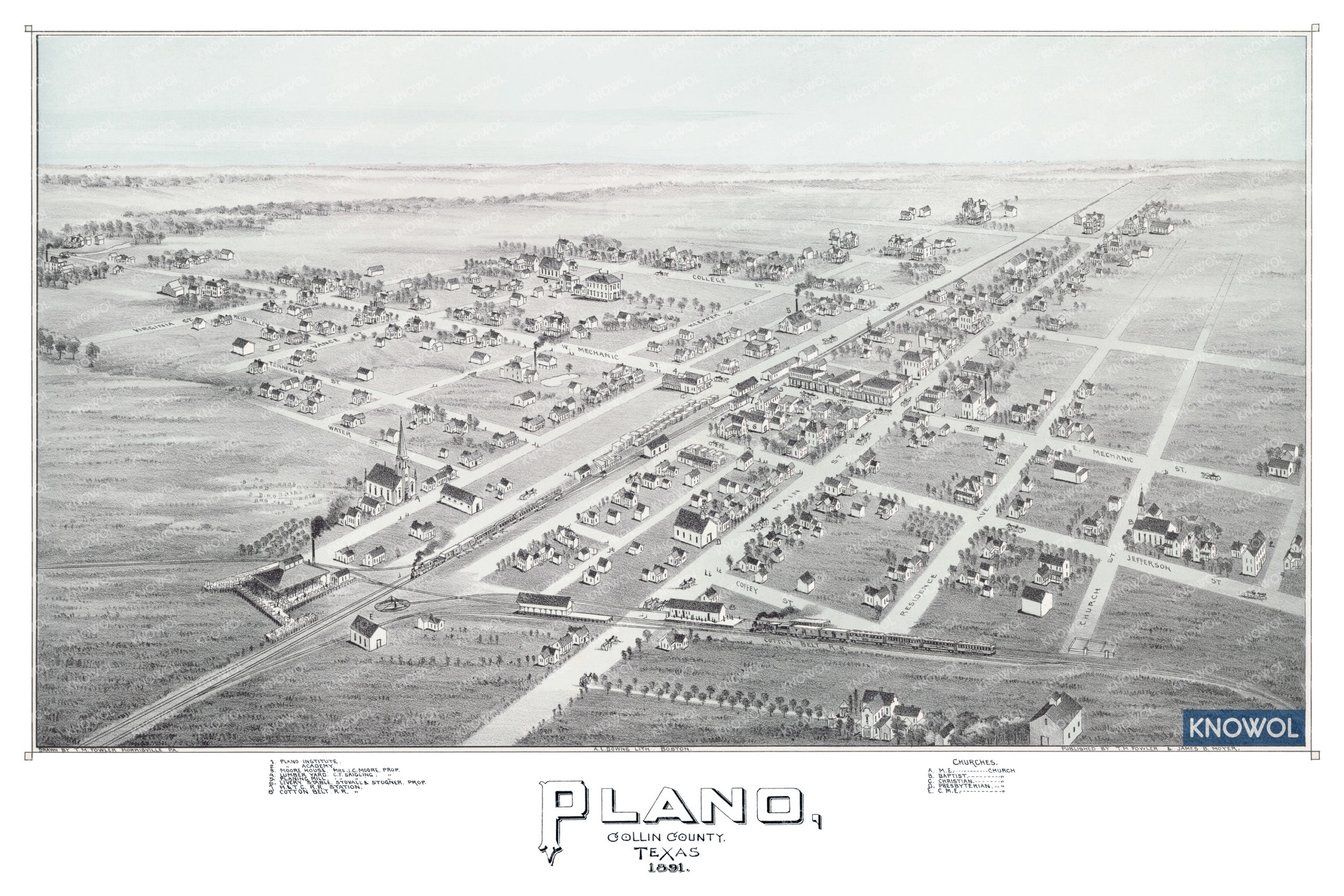
This vintage map of Plano makes an attractive addition to your office, library, or den, and can even be used to teach children the geography and history of the area. When you’re done exploring, click here to get your copy of the restored map.