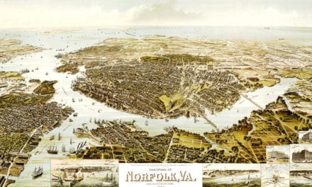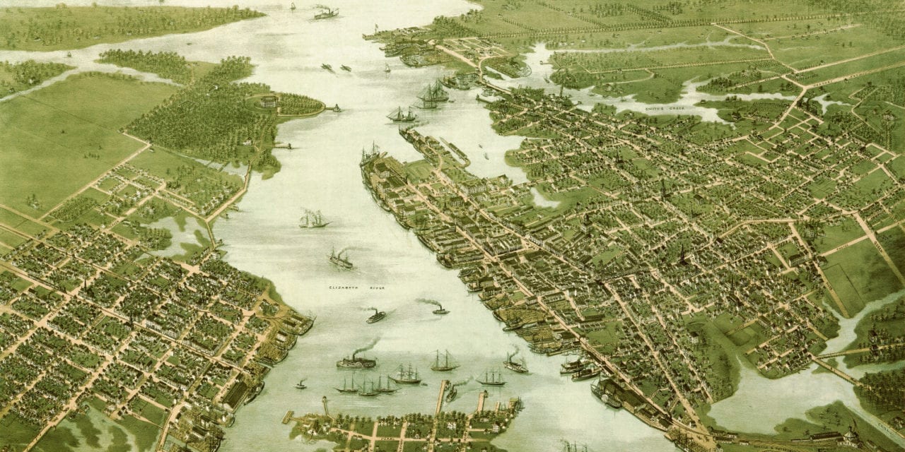
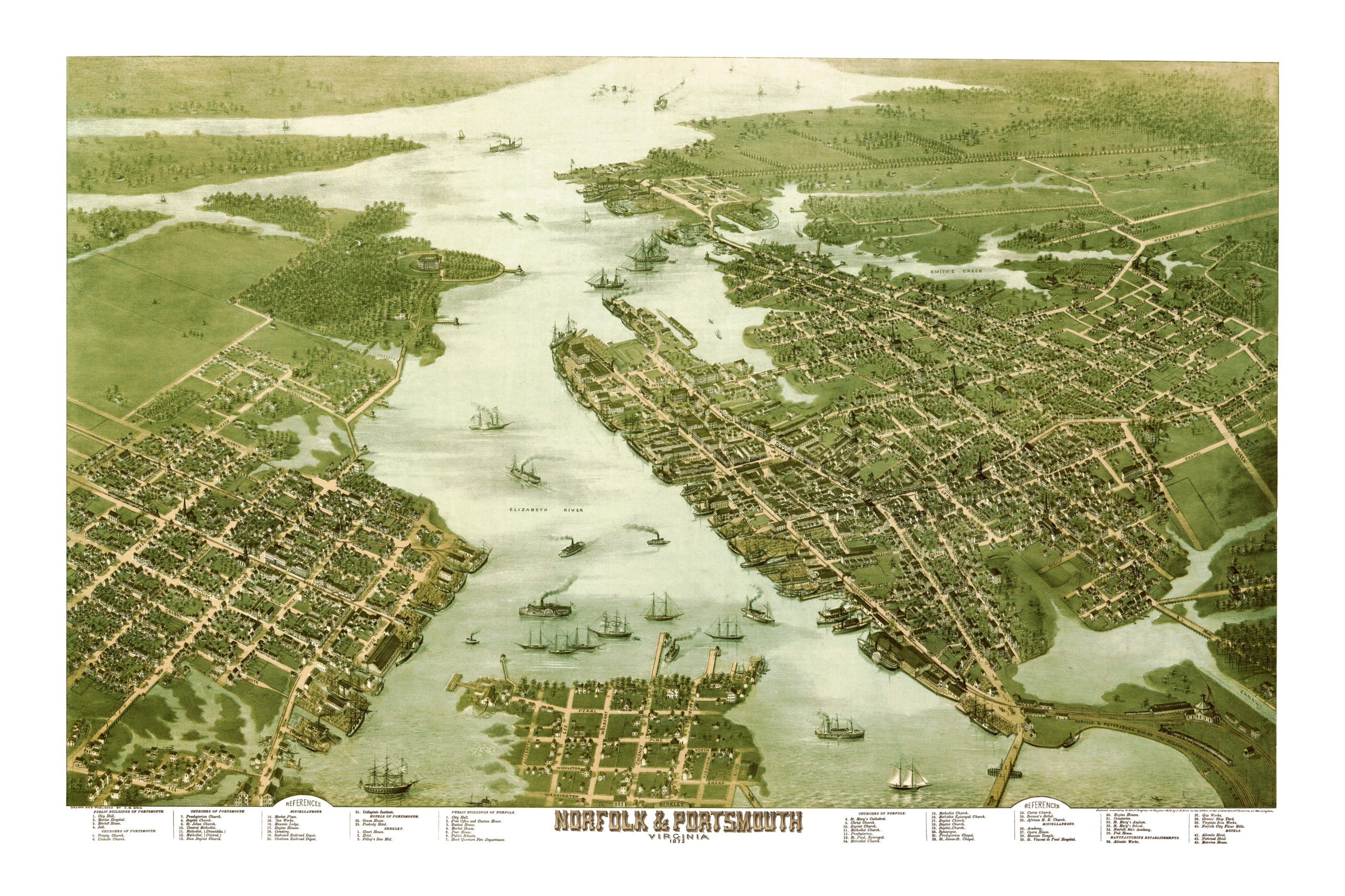
This map of Norfolk and Portsmouth, Virginia was first published in 1873 by C.N. Drie, a prominent 19th century cartographer. The map shows a bird’s eye view of Norfolk and Portsmouth as they used to be, including street names and old landmarks.
Landmarks on the map include the Marine Hospital, Graves’ Ship Yard, Market House, Masonic Lodge, Seaboard Railroad Depot, Ocean House, Opera House, Masonic Temple, St. Vincent DePaul Hospital, Fire Engine Houses, St. Mary’s Asylum, Norfolk Male Academy, and more.
This historic map of Norfolk and Portsmouth, Virginia has been restored by KNOWOL. Reproductions of the map are available here.
Map of Norfolk and Portsmouth, VA in 1873
This historic map of Norfolk & Portsmouth will make an attractive addition to your office, library, or den and can even be used to teach children the geography and history of the area. When you’re done exploring, click here to get your copy.