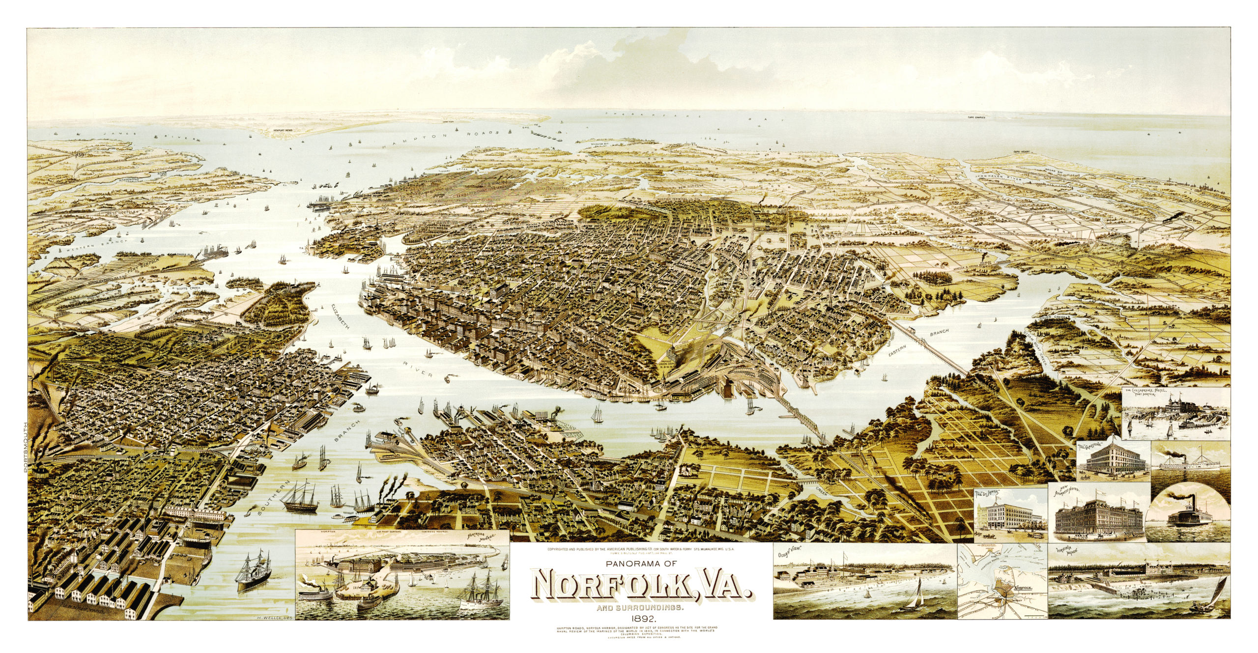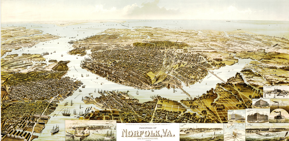
This map shows Norfolk, Virginia and the surrounding area as it looked in 1892. At the time only 35,000 people lived in Norfolk. The map was created by Henry Wellge and restored to its original condition by KNOWOL.
High resolution reproductions of the map are available here.
The map shows Norfolk landmarks such as Virginia Beach, The St. James, The Gladstone, The Chesapeake, Fortress Monroe and more.
Click here to see a full size version of the map.