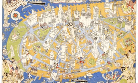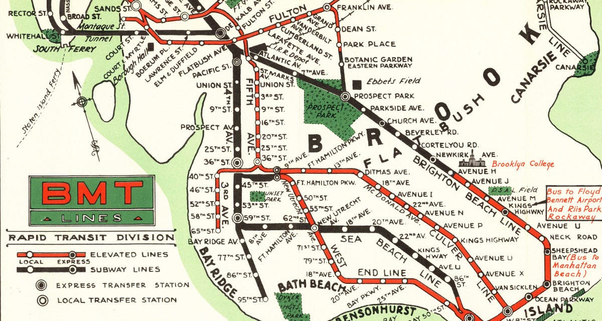
This beautiful color map was created by the Brooklyn-Manhattan Transportation Company for the 1939 World’s Fair in New York City. The map shows elevated railways, subway stations, and NYC landmarks including the New York Public Library, Times Square, Radio City Music Hall, Madison Square Garden, Central Park Zoo and Washington Park.
The map was created by BMT Lines Rapid Transit Division and handed out to visitors of the 1939 World’s Fair so that they could easily make their way from any point in the city to Flushing Meadows-Corona Park. The map was restored by KNOWOL. Reproductions of the map are available here.
Click here to see a high resolution scan of the map.
![]()