
Massachusetts
Browse historical articles, vintage map research, and collectible print discoveries connected to Massachusetts.
 Massachusetts
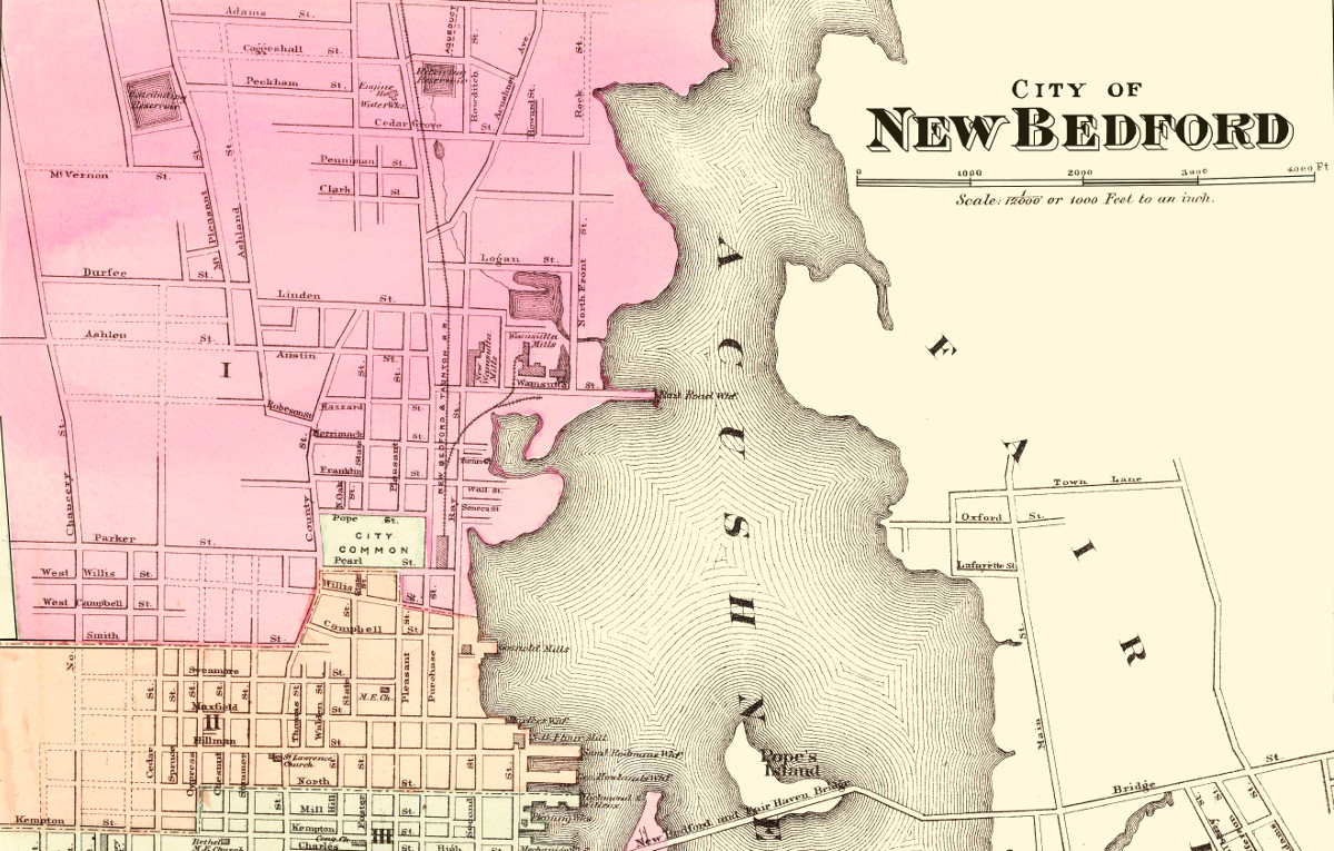
Historical map of New Bedford, Massachusetts from 1871
This amazing map of New Bedford, Massachusetts shows the town as it looked in 1871
 Massachusetts
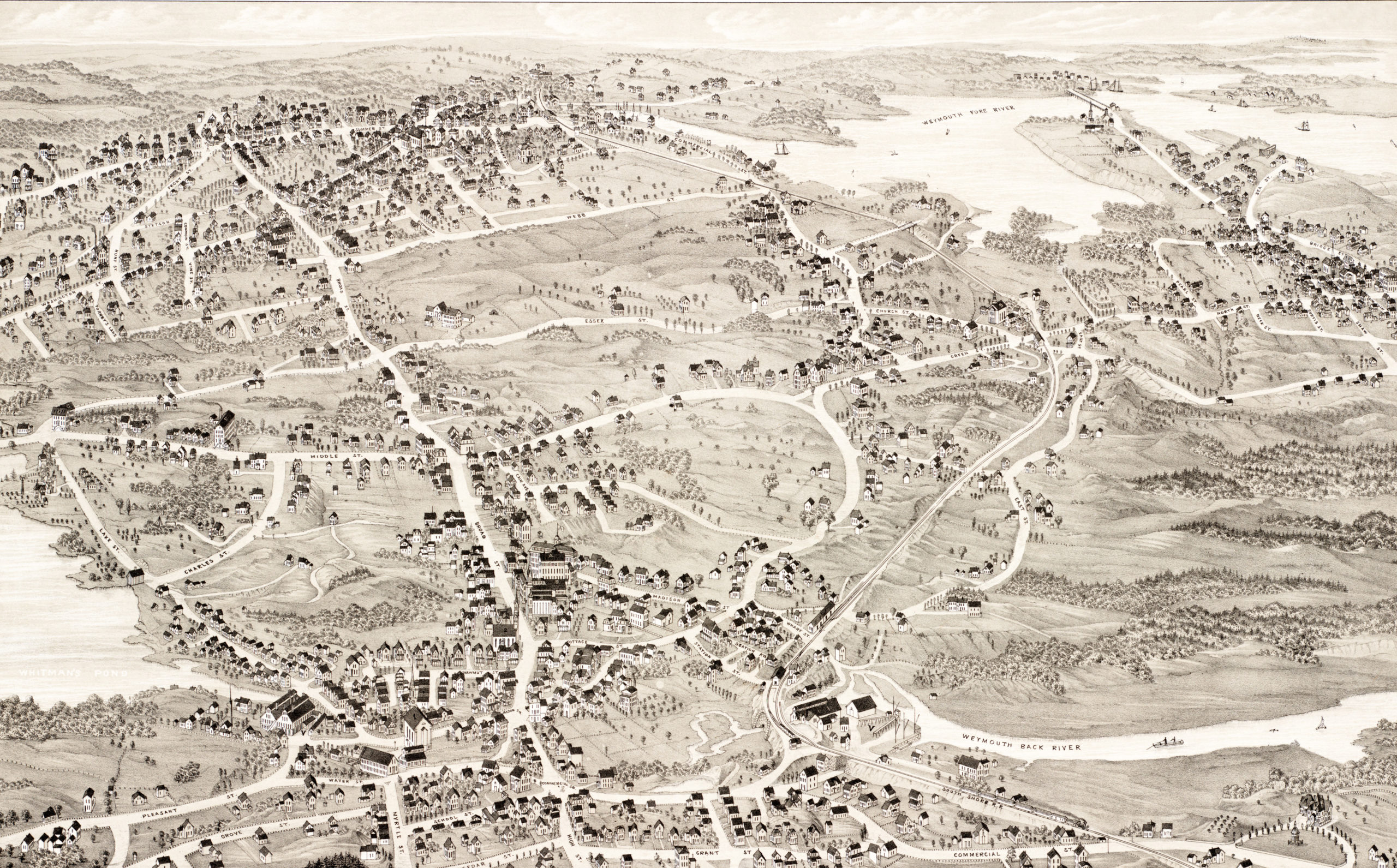
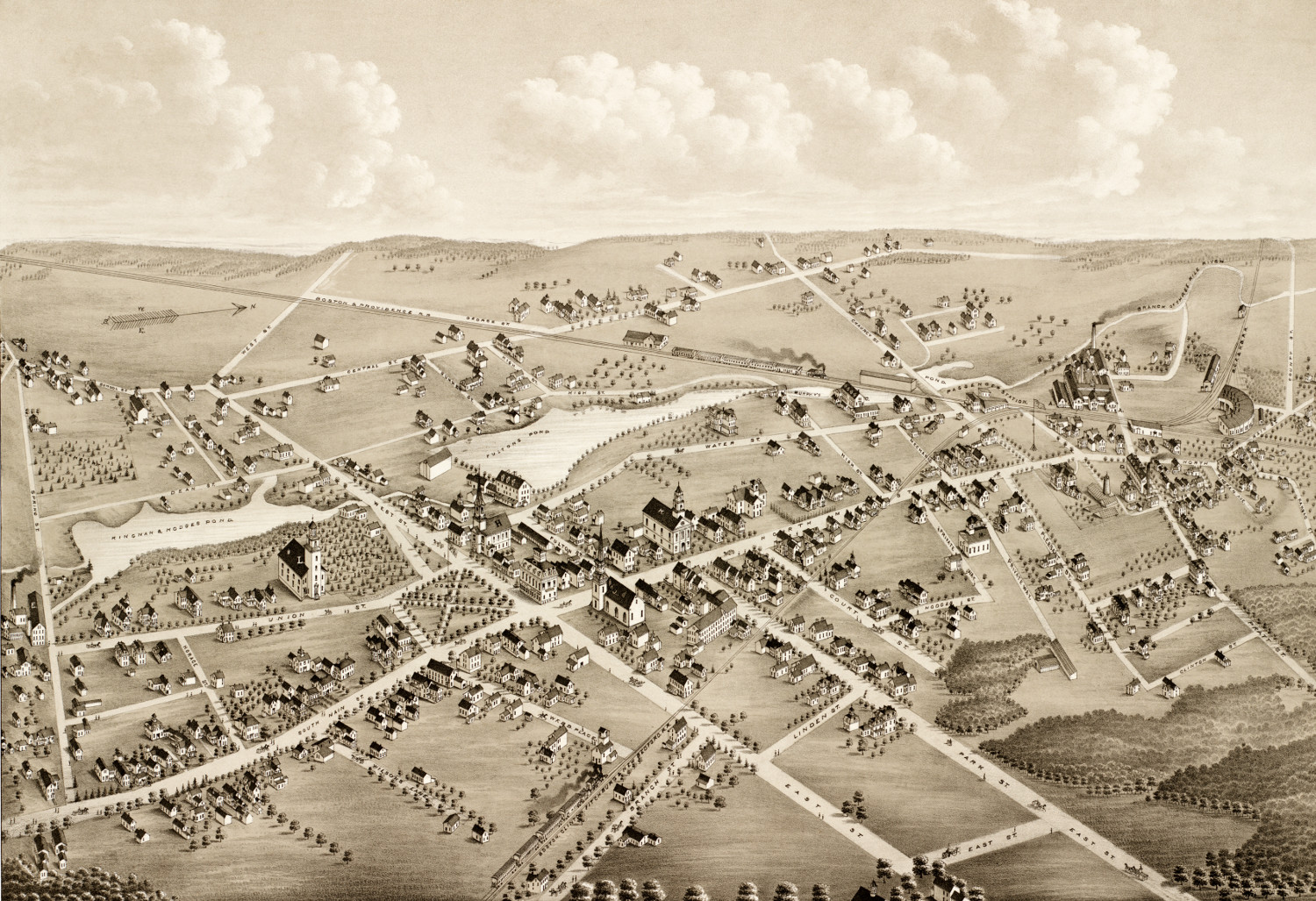
Historical map of Weymouth, Massachusetts from 1880
This amazing map of Weymouth, Massachusetts shows a bird's eye view of the city as it looked in 1880.
 Massachusetts
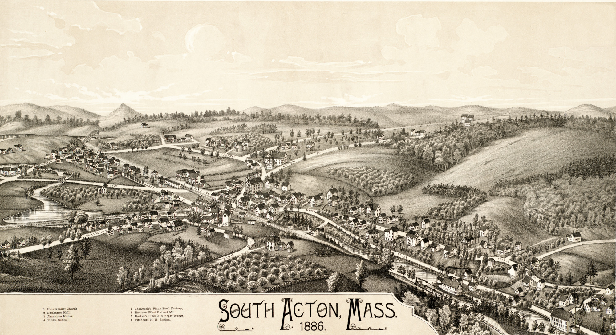
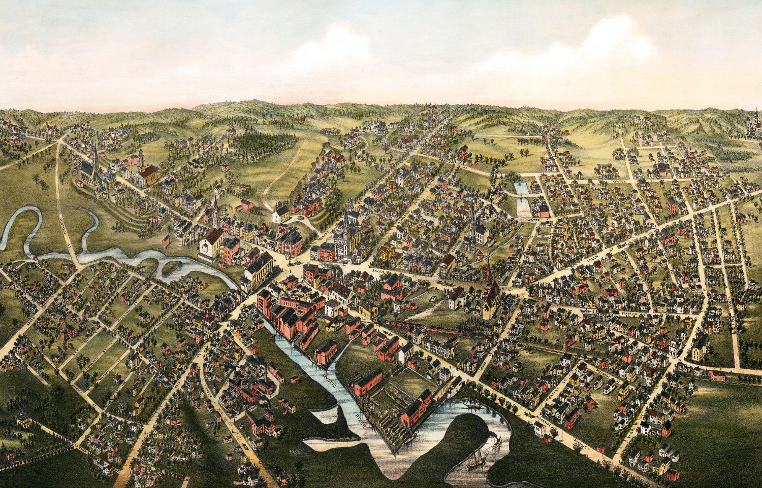
Exploring South Acton, Massachusetts in 1886
This map of South Acton, Massachusetts was created in 1886 by Lucien R. Burleigh, an artist and cartographer who spent his career traveling across…
 Massachusetts
Beautifully detailed map of Leominster, MA from 1886
Historic bird's eye view of Leominster, Massachusetts from 1886
 Massachusetts
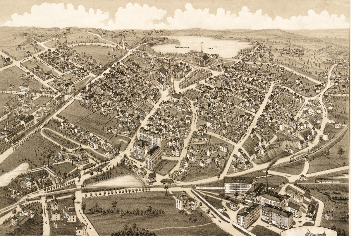
Beautifully restored map of Wakefield, Mass from 1882
This old map shows Wakefield, Massachusetts as it looked in 1882.
 Massachusetts
Old map showing a bird’s eye view of Mansfield, Mass in 1879
This old map shows Mansfield, Massachusetts when only 2,700 people lived there.
 Massachusetts
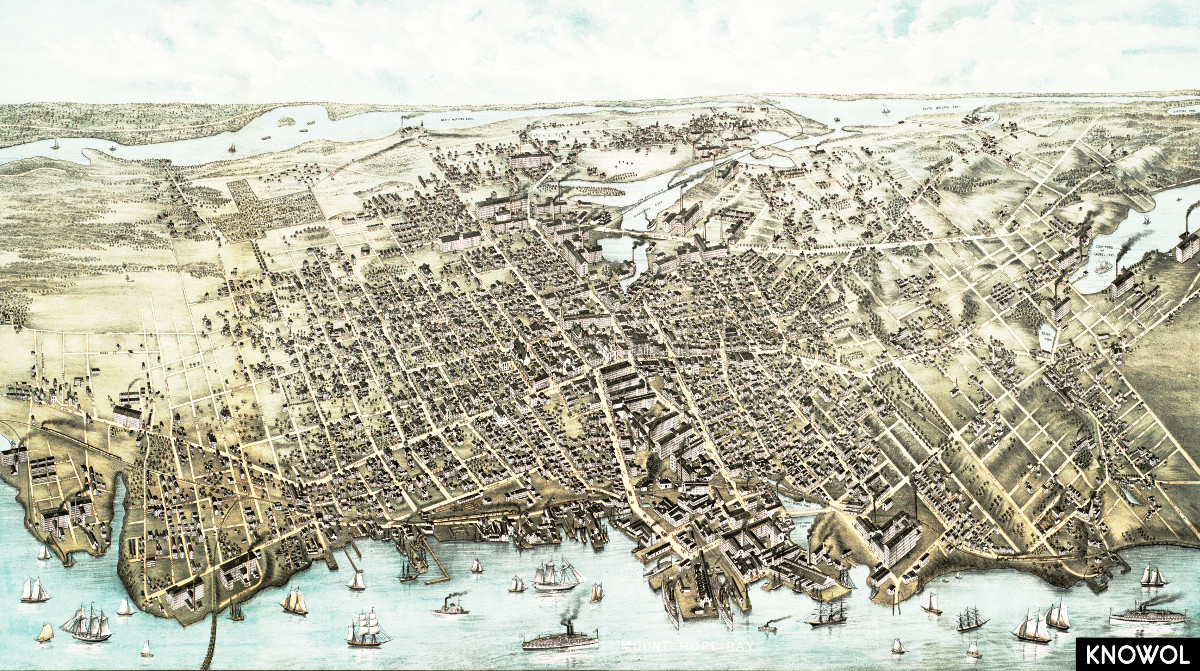
Amazing old map of Fall River, Massachusetts from 1877
This map shows Fall River, Massachusetts as it looked in 1877.
 Massachusetts
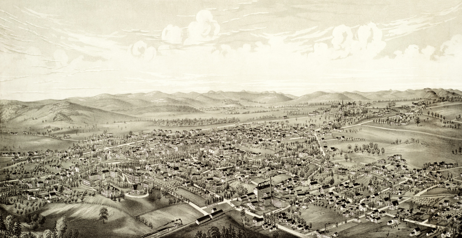
Beautifully detailed map of Athol, Massachusetts in 1887
Historic bird's eye view of Athol, Massachusetts from 1887
 Massachusetts
Vintage travel poster for Martha’s Vineyard, the Enchanted Isle
Martha's Vineyard, the Enchanted Isle was an advertising poster created in 1934.
 Massachusetts
Amazing old map of Medford, Massachusetts from 1880
This old map shows Medford, Massachusetts as it looked in 1880.
 Massachusetts
Old map of Ashburnham, Massachusetts from 1886
Click here to see what Ashburnham looked like in 1886
 Massachusetts
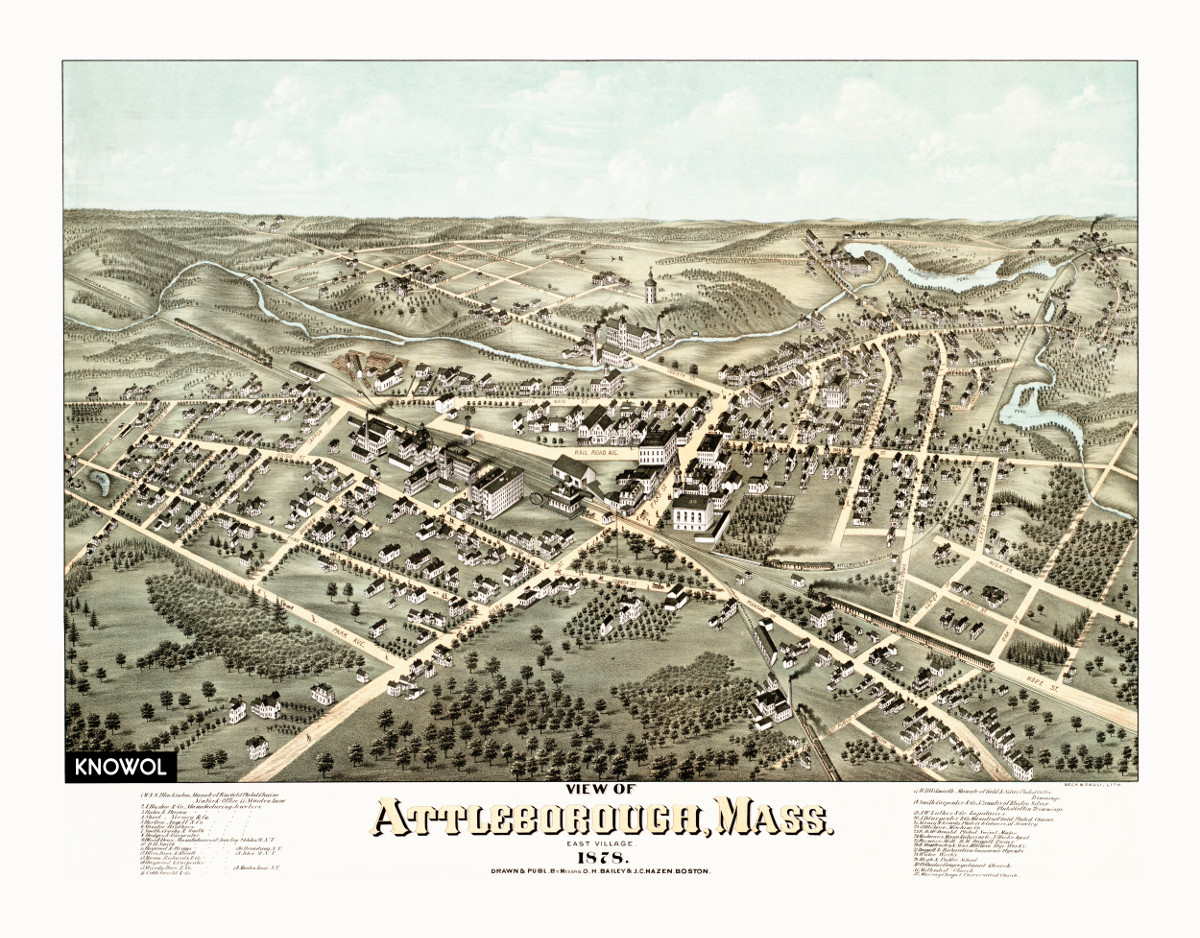
Amazing old map of Attleboro, Massachusetts from 1878
This old map shows Attleboro, Massachusetts as it looked in 1878. The map was created by O.H. Bailey and carefully restored to its original…
 Massachusetts
Beautiful old map of Amherst, Massachusetts in 1886
Click here to see a bird's eye view of Amherst, Massachusetts in 1886.
 Massachusetts
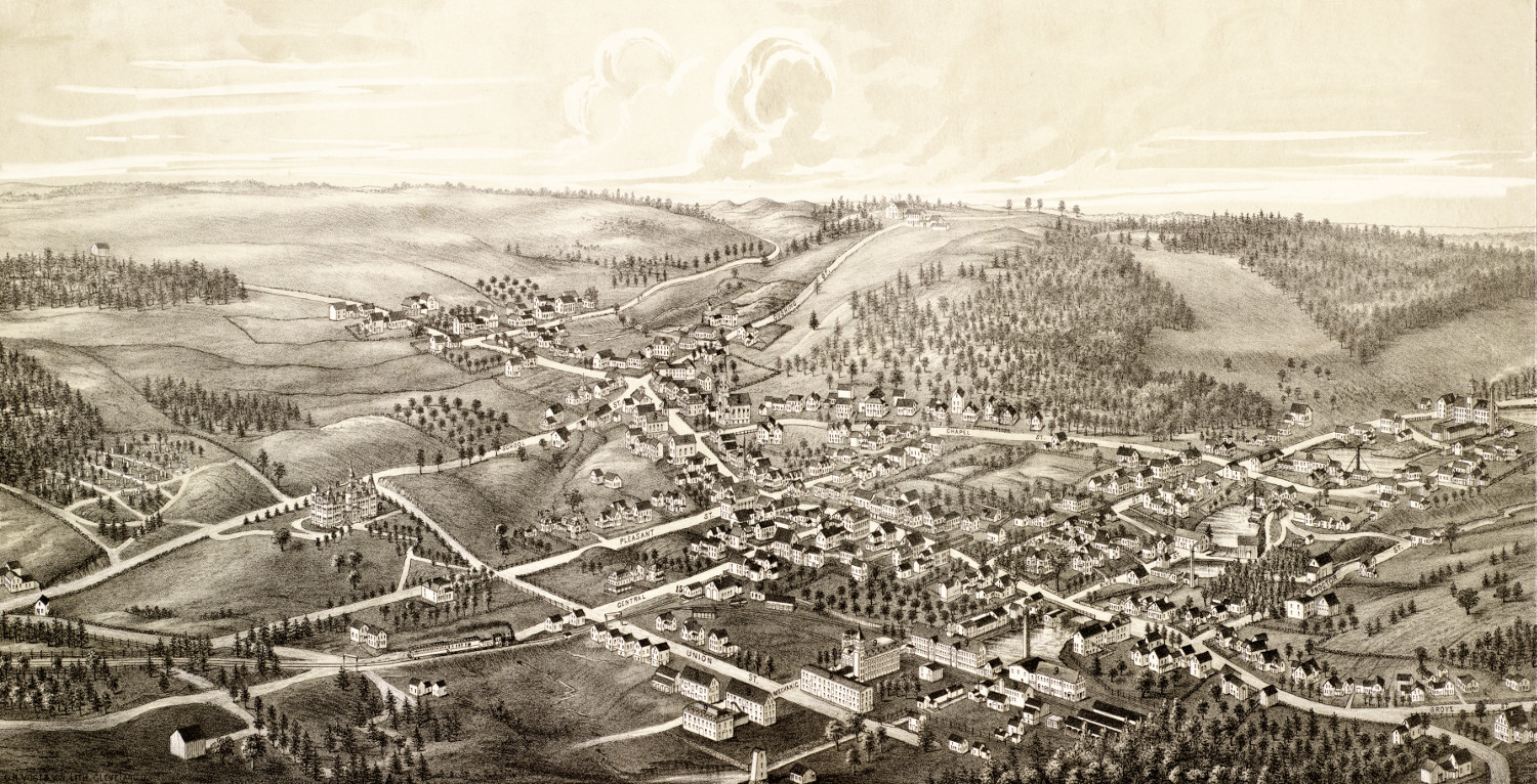
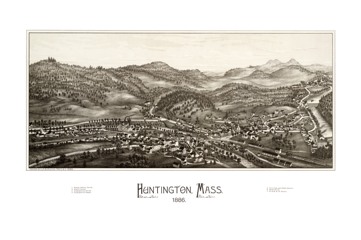
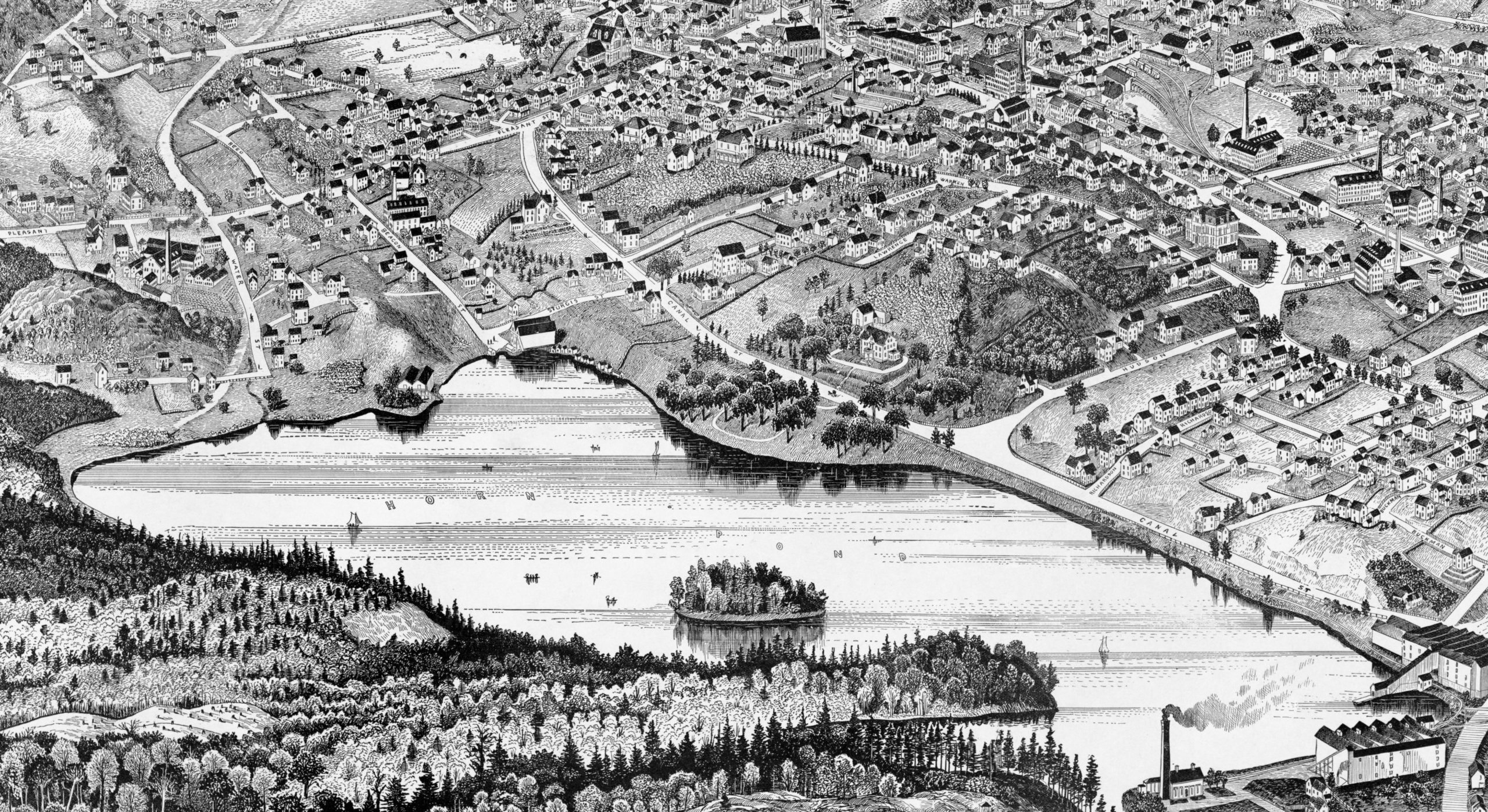
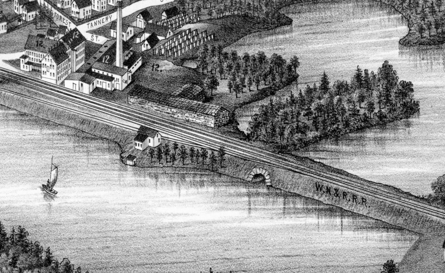
Bird’s eye view of Huntington, Massachusetts from 1886
This beautiful hand drawn map of Huntington, Massachusetts was created by Hughes & Bailey Publishers in 1886. The map shows a bird’s eye view of Huntington, MA surrounded by hand drawn pictures of historic Huntington landmarks.
 Massachusetts
Wonderful vintage travel poster of Nantucket, Massachusetts
This beautiful vintage travel poster was used to promote tourism to Nantucket in the 1950's.
 Massachusetts
Beautifully detailed map of Woburn, Massachusetts in 1883
Historic bird's eye view of Woburn, Massachusetts in 1883
 Massachusetts
Hand drawn map of Plainville, Massachusetts from 1887
Click here to see what Plainville, MA looked like in 1887.
 Massachusetts
Beautifully detailed map of Ayer, Massachusetts from 1886
Historic bird's eye view of Ayer, Massachusetts in 1886
 Massachusetts
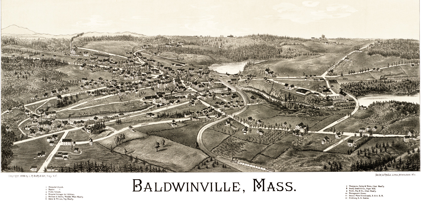
Hand Drawn Map of Baldwinville, Massachusetts from 1886
Click here to see the full map.
 Massachusetts
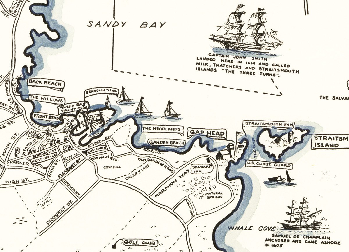
Beautiful map of Rockport, Massachusetts from 1940
This amazing vintage map of Rockport, Massachusetts was created by Jacqueline Hudson in 1940
 Massachusetts
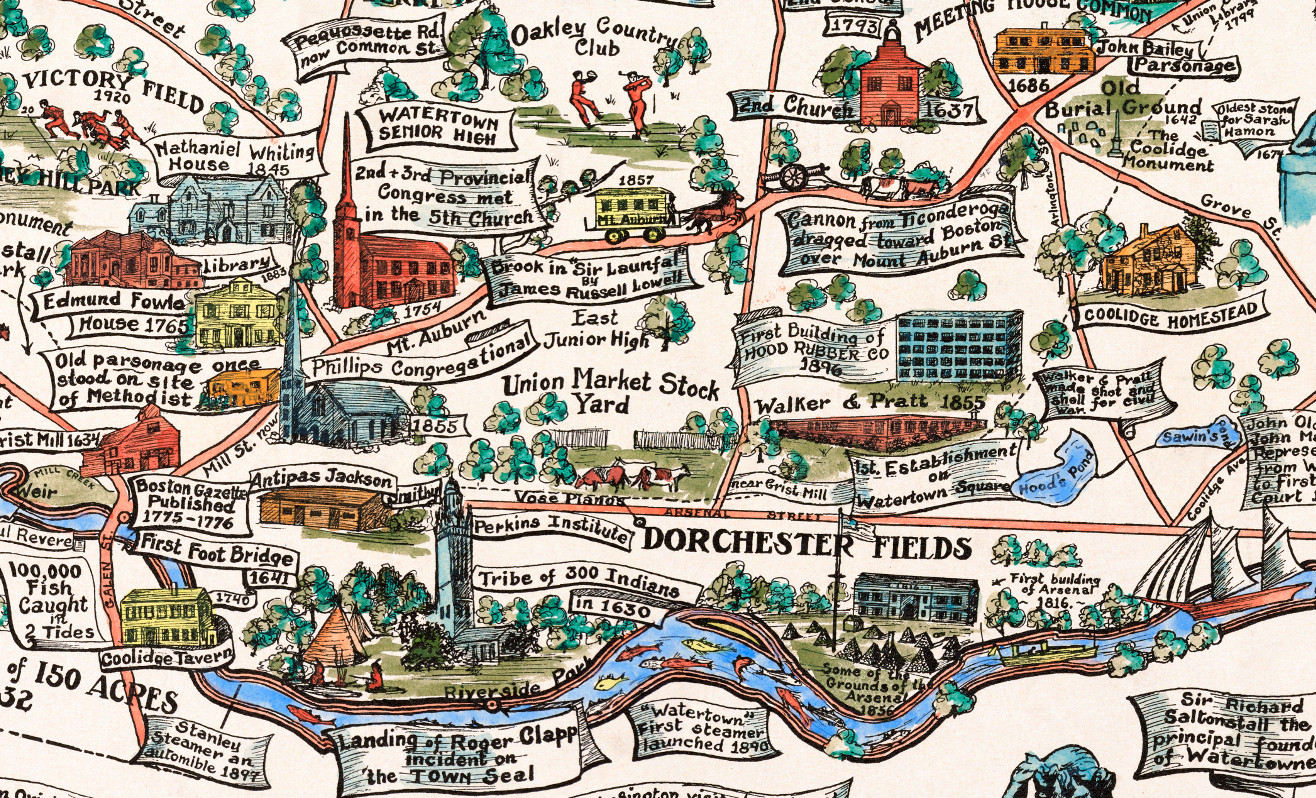
Beautifully restored map of Watertown, MA from 1930
This amazing map of Watertown, Massachusetts was created to celebrate the town's 300th anniversary in 1930.