
Massachusetts
Browse historical articles, vintage map research, and collectible print discoveries connected to Massachusetts.
 Massachusetts
Beautifully detailed map of Martha’s Vineyard from 1954
Historic map of Martha's Vineyard from 1954
 Massachusetts
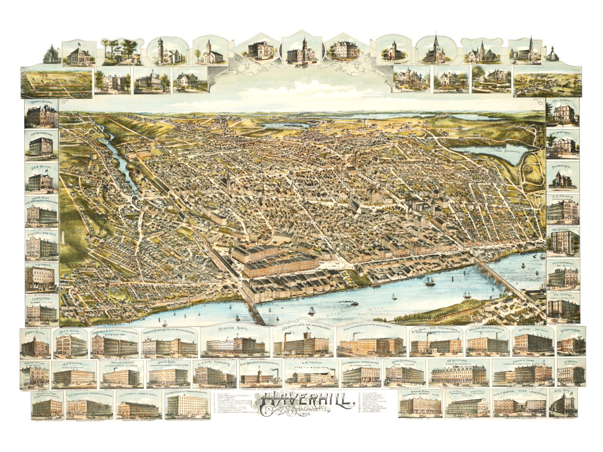
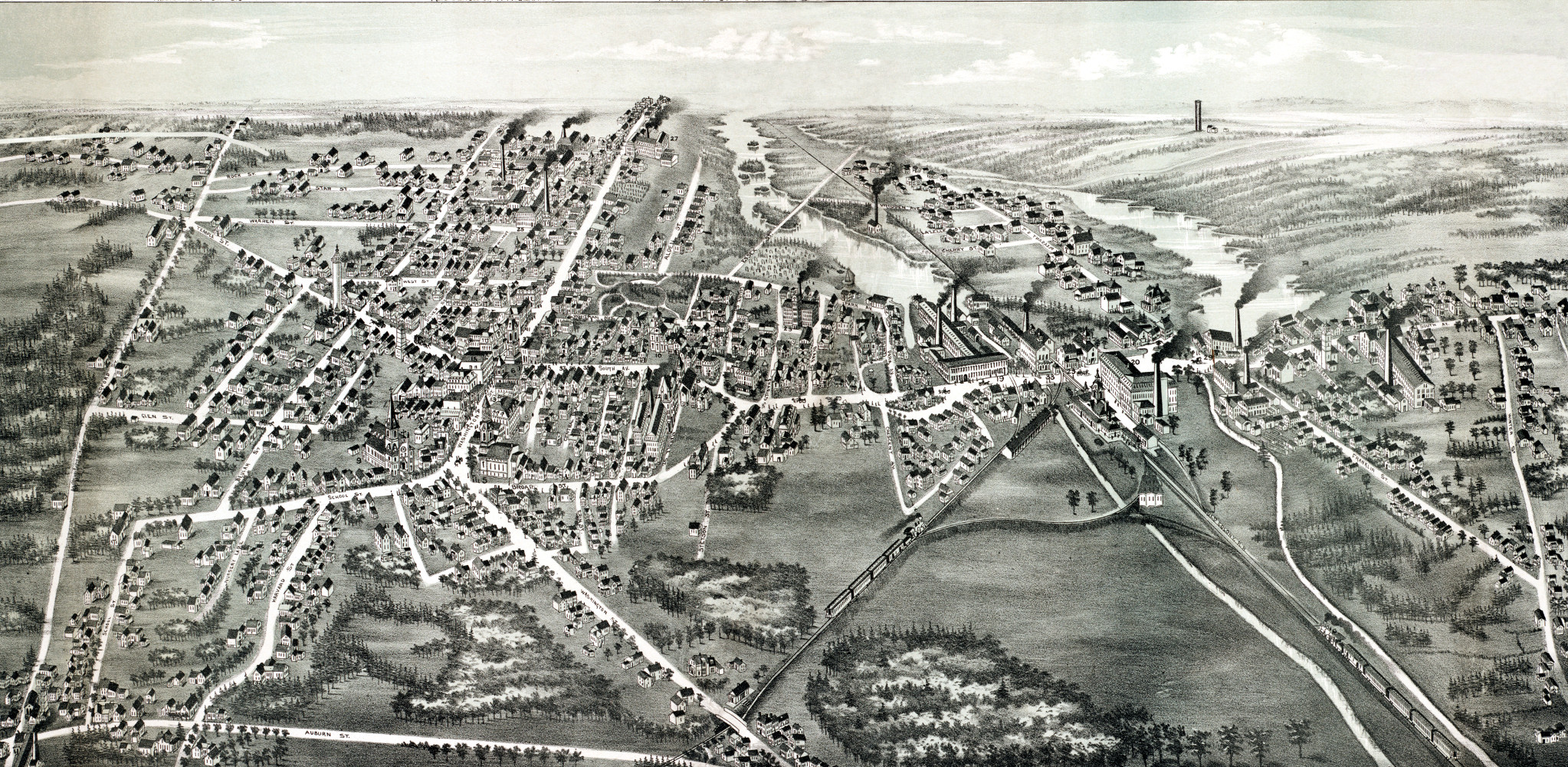
Bird’s eye view of Haverhill, Massachusetts in 1893
This is what Haverhill looked like when only 30,000 people lived here
 Massachusetts
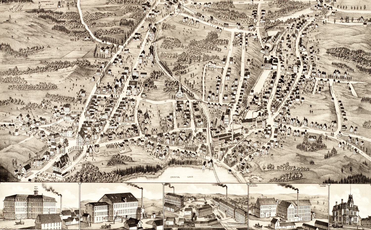
Bird’s eye view of Gardner, Massachusetts in 1880
This map of Gardner, Massachusetts was created in 1880 by Beck & Paul Lithographers and the E.H. Bigelow Publishing Company of Framingham, Mass. The…
 Massachusetts
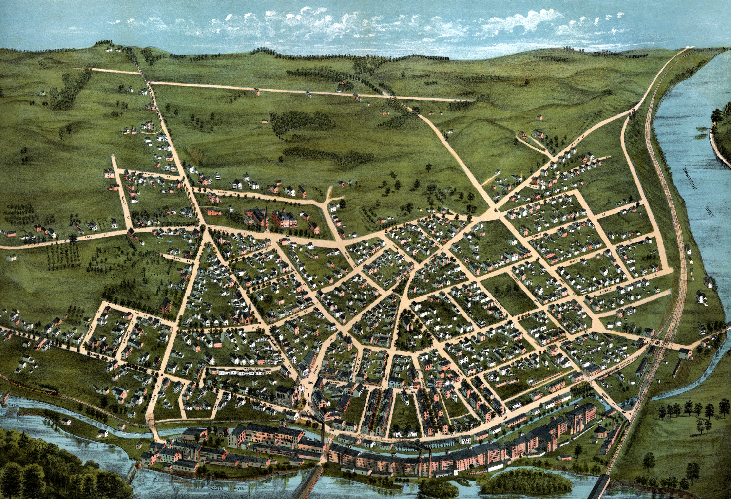
Beautifully detailed map of Chicopee, Massachusetts in 1878
Historic bird's eye view of Chicopee, Massachusetts in 1878
 Massachusetts
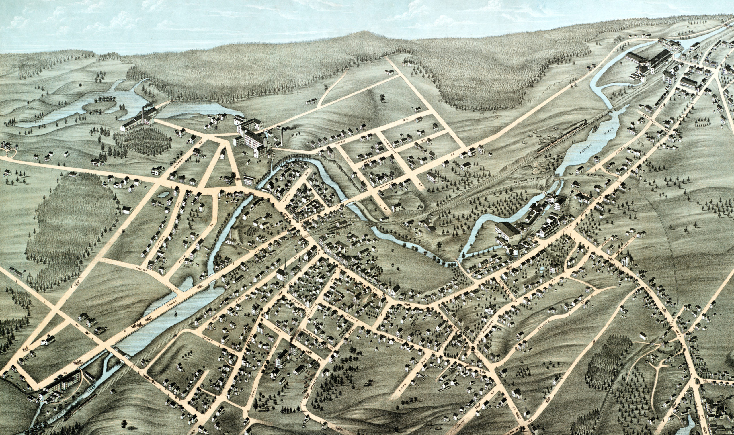
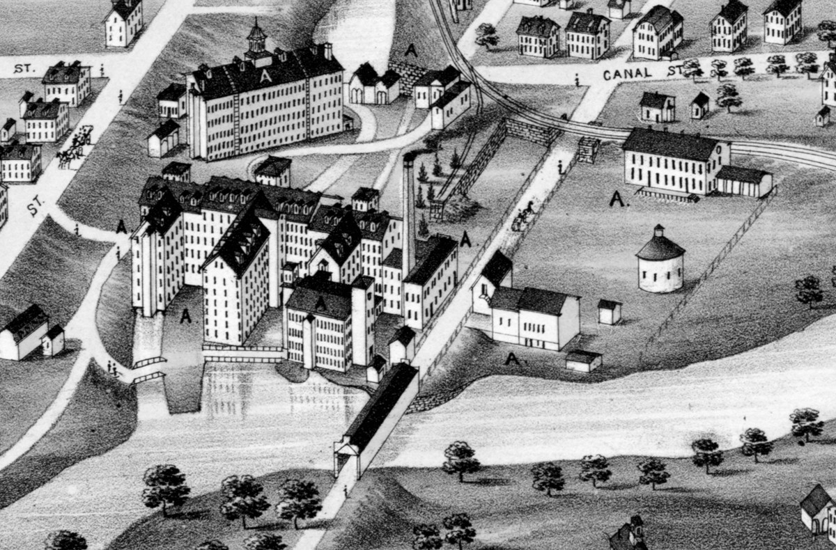
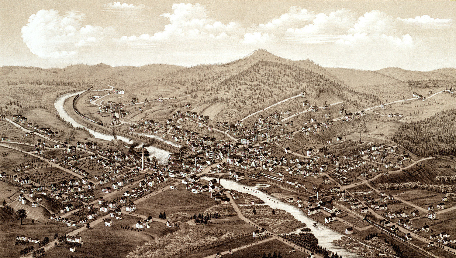
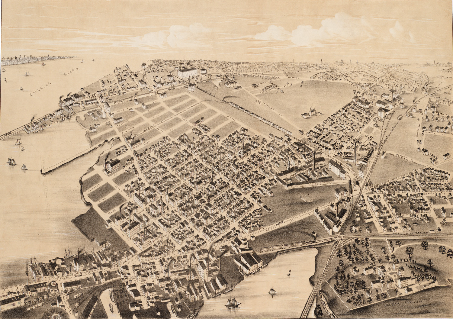
Beautifully detailed map of Webster, Mass in 1878
Historic bird's eye view of Webster, Massachusetts
 Massachusetts
Beautifully restored map of Blackstone, MA from 1879
Historic old map of Blackstone, Massachusetts from 1879
 Massachusetts
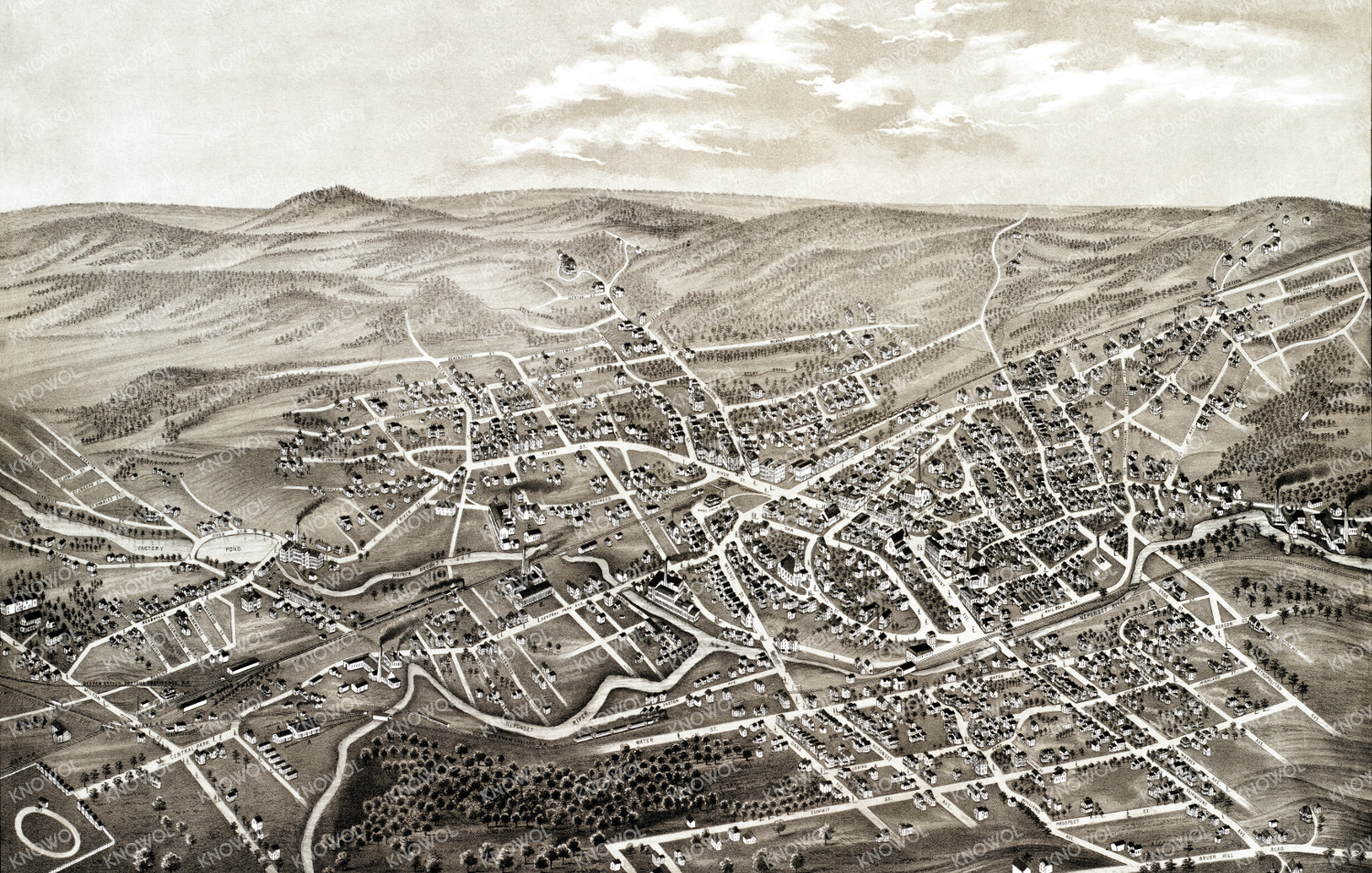
Beautifully restored map of Whitman, MA from 1889
Historic old map of Whitman, Massachusetts from 1889
 Massachusetts
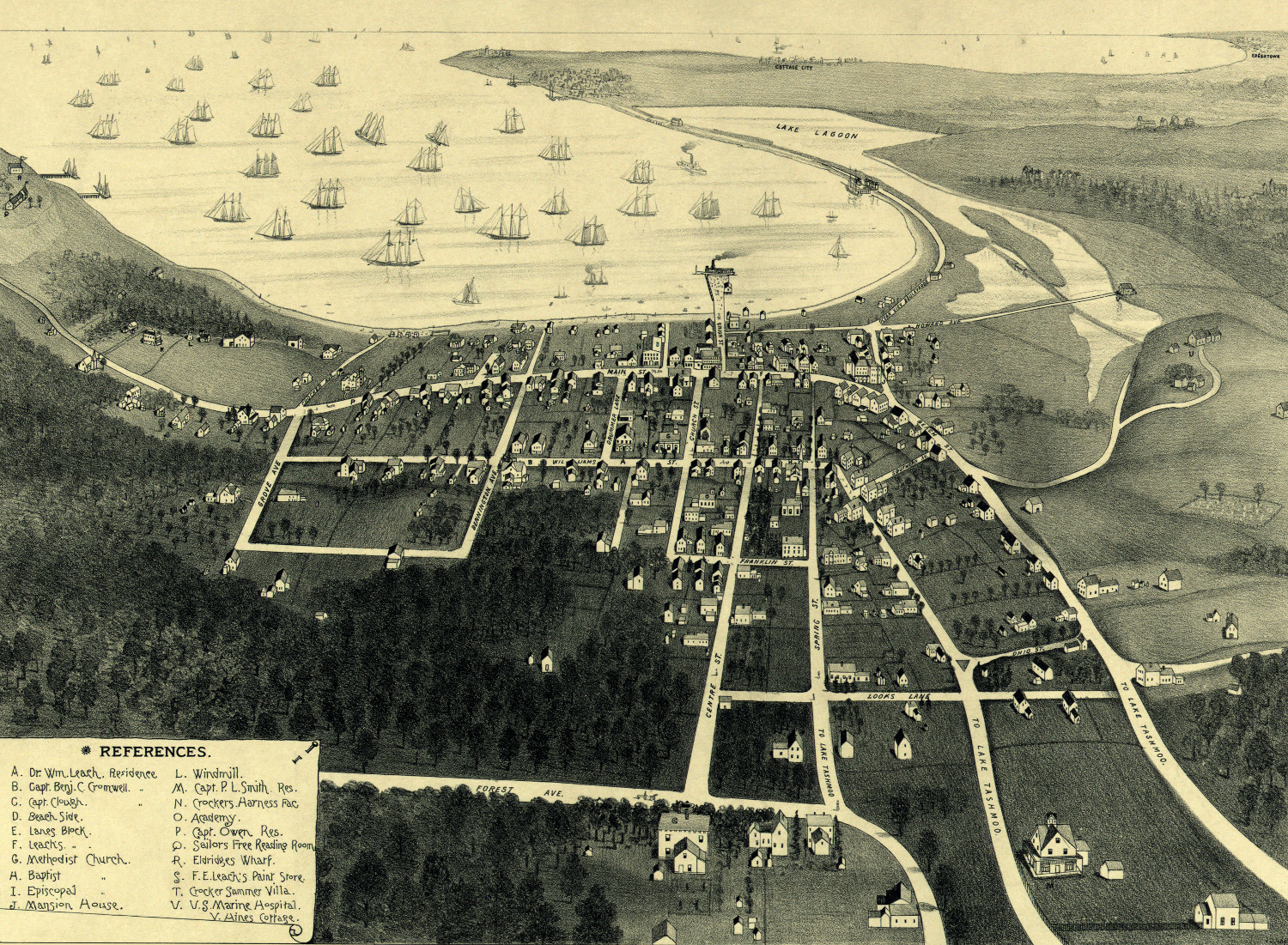
Historic map of Vineyard Haven, Massachusetts from 1893
Detailed bird's eye view of Vineyard Haven, MA in 1893
 Massachusetts
Beautifully detailed map of Stoneham, MA from 1878
Detailed bird's eye view of Stoneham, Massachusetts in 1878
 Massachusetts
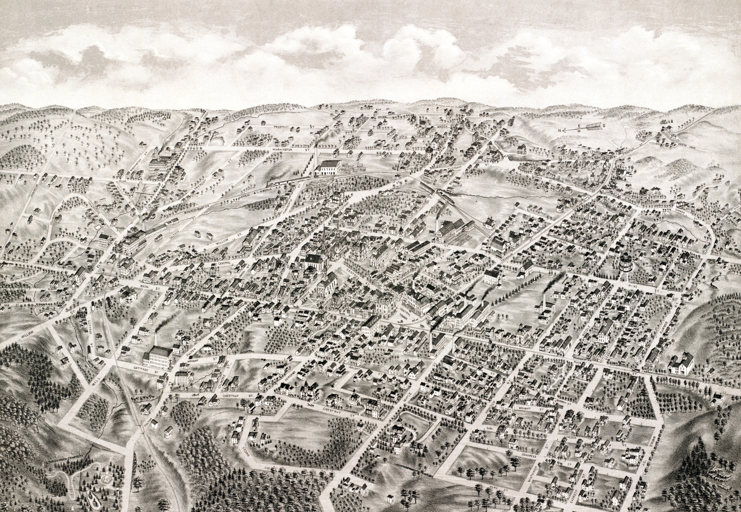
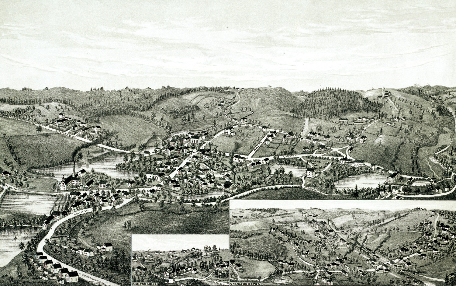
Beautifully restored map of Charlton, MA in 1887
Detailed bird's eye view of Charlton, Massachusetts in 1887
 Massachusetts
Beautifully detailed map of Orange, MA from 1883
Detailed bird's eye view of Orange, Massachusetts in 1883
 Massachusetts
Beautifully detailed map of Hyde Park, Massachusetts from 1879
Historic bird's eye view of Hyde Park, Massachusetts in 1879
 Massachusetts
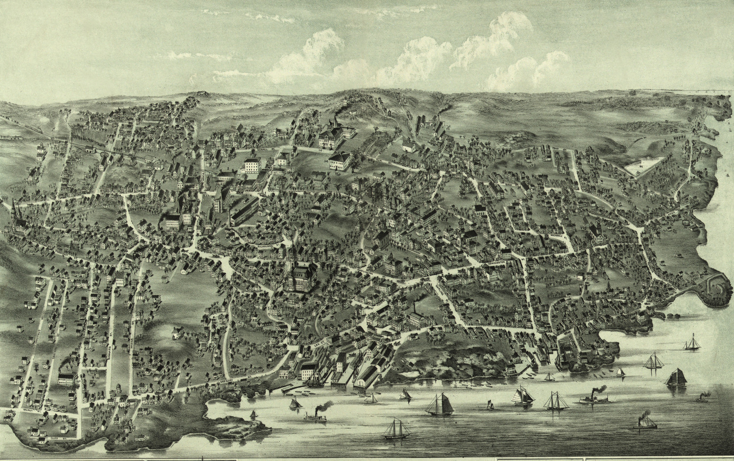
Beautifully restored map of Marblehead, MA from 1882
Detailed bird's eye view of Marblehead, Massachusetts in 1882
 Massachusetts
Beautifully restored map of East Cambridge, MA from 1879
Detailed bird's eye view of East Cambridge, Massachusetts in 1879
 Massachusetts
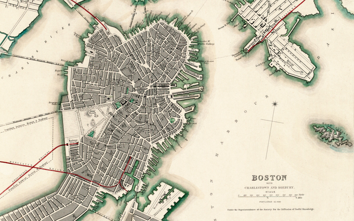
Aerial map of Boston, Charlestown and Roxbury, Massachusetts in 1853
This map of Boston by Benjamin Rees Davies was published in 1853 by the Society for the Diffusion of Useful Knowledge. The society was…
 Massachusetts
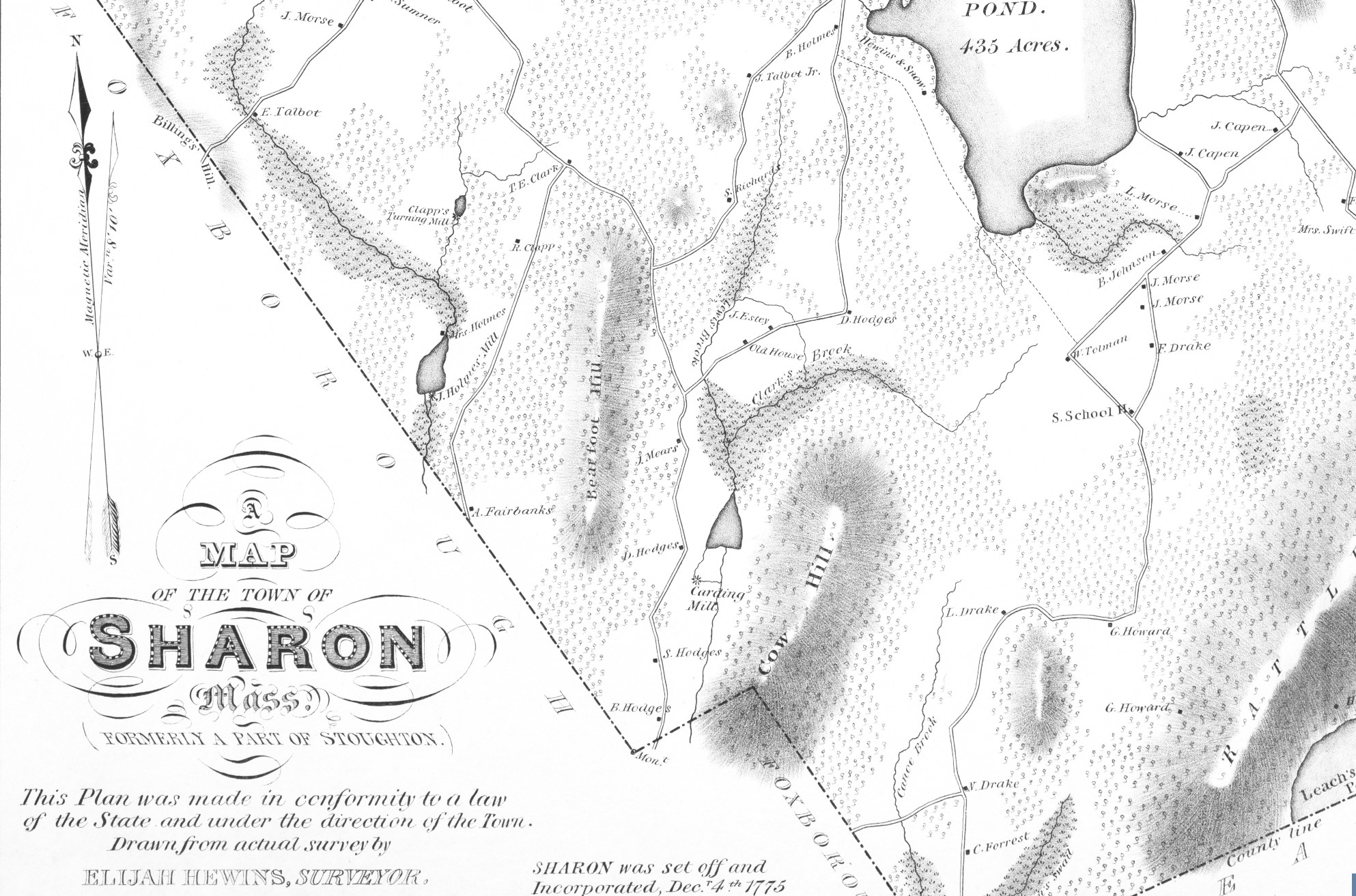
Historic map of Sharon, Massachusetts from 1831
Detailed map of Sharon, MA from 1831
 Massachusetts
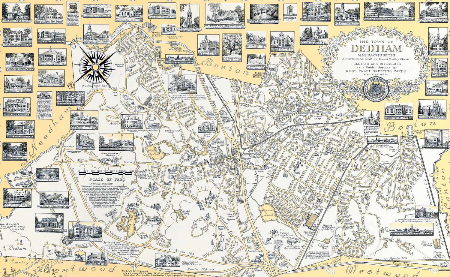
The History of Dedham, MA: beautifully detailed map from 1954
This beautifully detailed map of Dedham, Massachusetts features historical facts and trivia from around the state. It was created by renowned illustrator Ernest Dudley Chase in 1954.
 Massachusetts
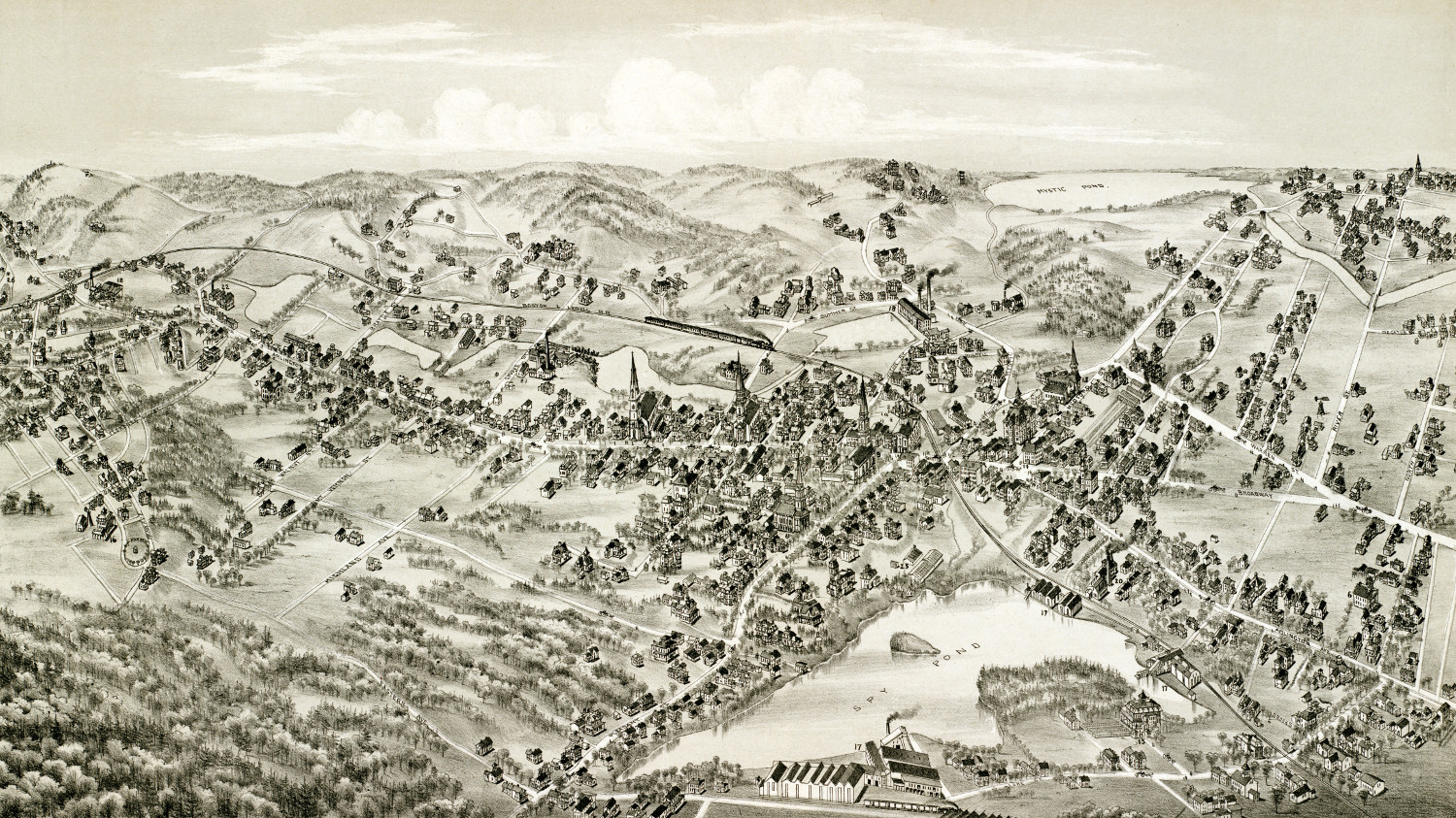
Beautifully restored map of Arlington, Massachusetts from 1884
Bird's eye view of Arlington, MA in 1884
 Massachusetts
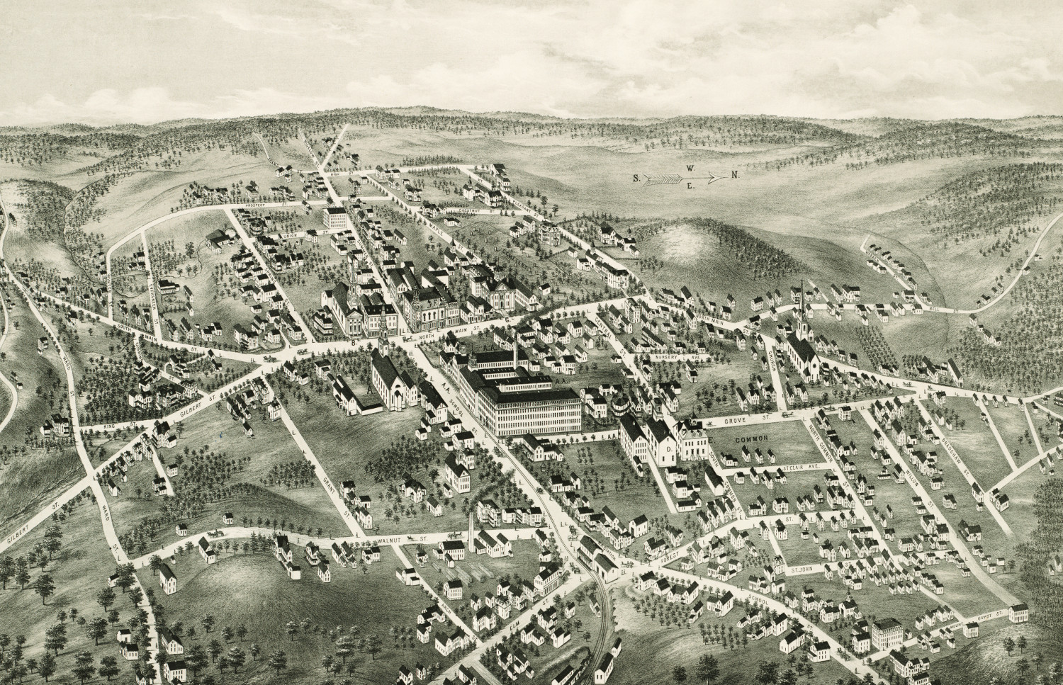
Historic old map of North Brookfield, Mass from 1878
Historic bird's eye view of North Brookfield, Massachusetts in the late 19th century.
 Massachusetts
Historic bird’s eye view of Quincy, MA from 1877
Historic bird's eye view of Quincy, Massachusetts
 Massachusetts
Beautiful vintage map of Buzzards Bay, Massachusetts from 1907
This birds eye view of Buzzards Bay shows the area as it looked in 1907.