
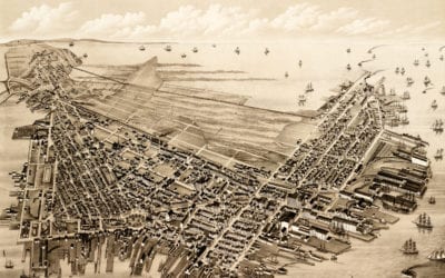
Beautifully restored map of East Boston, Massachusetts from 1879
Vintage map of East Boston, Massachusetts from the late 19th century.
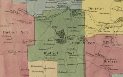
Historic landowners map of Burlington, CT from 1869
Vintage landowners map of Burlington, Connecticut as it used to be
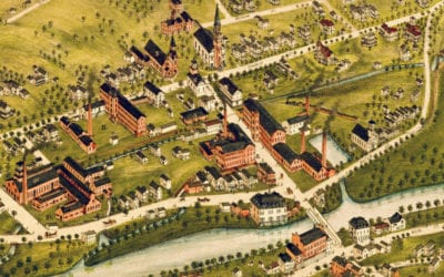
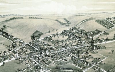
Old map shows bird’s eye view of Bangor, Pennsylvania in 1885
This map of Bangor, Pennsylvania was created in 1885 by O.H. Bailey. Oakley Hoopes Bailey (1843-1947) was one of the most prominent and prolific American map makers of the 19th century. Bangor was first settled around 1760 and incorporated in 1875. The founder and...
Beautifully restored map of Naugatuck, Connecticut from 1877
Historic bird’s eye view of Naugatuck, Connecticut from 1877
Beautifully restored map of Cheshire, Connecticut from 1882
Detailed bird’s eye view of Cheshire, Connecticut as it used to be
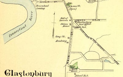
Glastonbury, Rocky Hill, Enfield & Collinsville, CT in 1893
This map shows Glastonbury, Rocky Hill, Enfield & Collinsville, Connecticut as they looked in 1893. The hand colored map was originally printed as a lithograph by D.H. Hurd & Company in Boston, Massachusetts, and was part of a series depicting prominent...
Bird’s eye view of Bath, Pennsylvania in 1885
This bird’s eye view of Bath, Pennsylvania was created more than 130 years ago.
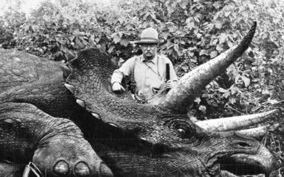
Theodore Roosevelt with a now-extinct Giant Eurasian Rhino
Can’t blame him for killing this majestic beast. These beasts roamed Africa, destroying…

This little boy’s turtle died, so he put on a tie and had a funeral
This little boy’s turtle died, so he dug a grave, built a cross, and put on a tie for the funeral.
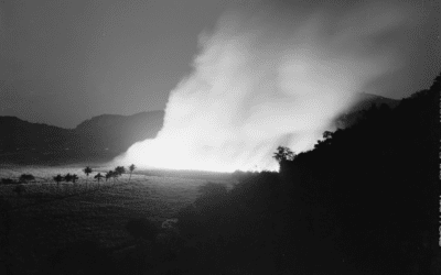
Burning a sugar cane field in Guanica, Puerto Rico. 1942
This is a process that destroys the leaves and makes sugar cane easier to harvest.


