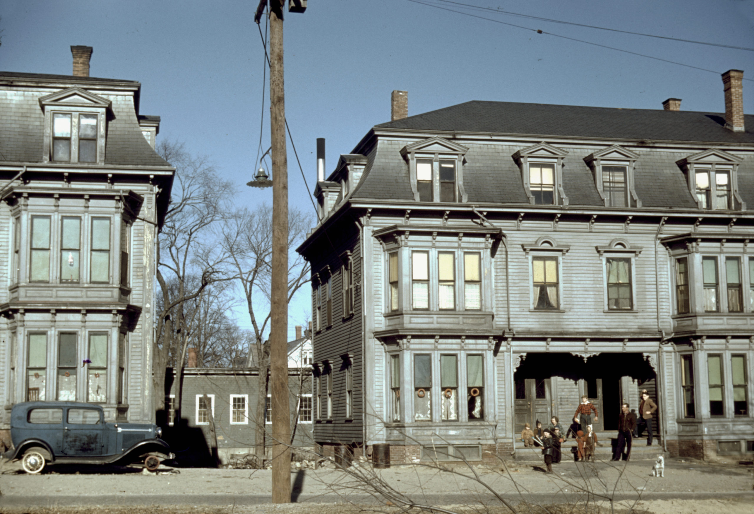
This photo showing children in the tenement district of Brockton, MA was taken by Jack Delano in December, 1940. The building on the left is 14-20 Rosseter St and the one on the right is 22-28 Rosseter St.
More Pictures of Massachusetts
Bird’s Eye View of North Adams, Massachusetts in 1881
Historic bird’s eye view of North Adams, Massachusetts from 1881
Vintage travel poster for Martha’s Vineyard, the Enchanted Isle
Martha’s Vineyard, the Enchanted Isle was an advertising poster created in 1934.
Beautifully restored map of Wrentham, MA from 1888
Detailed bird’s eye view of Wrentham, Massachusetts from 1888
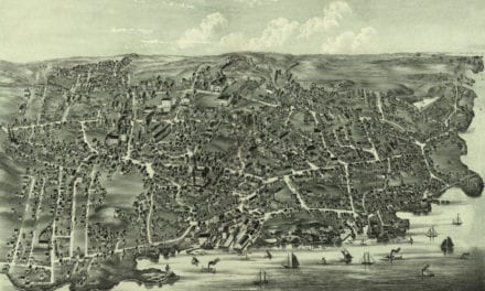
Historical map of New Bedford, Massachusetts from 1871
This amazing map of New Bedford, Massachusetts shows the town as it looked in 1871
Beautifully restored map shows bird’s eye view of Monson, MA in 1879
This old map shows Monson, Massachusetts in the late 19th century.
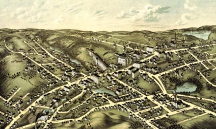
Beautifully detailed map of Webster, Mass in 1878
Historic bird’s eye view of Webster, Massachusetts
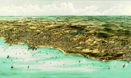
Beautifully restored map of Ipswich, Massachusetts from 1893
Historic bird’s eye view of Ipswich, Massachusetts from 1893
Restored bird’s eye view of Spencer, MA from 1877
This old map shows Spencer, Massachusetts in the late 19th century.
Beautifully restored map of Fitchburg, MA from 1875
Historic old map of Fitchburg, Massachusetts from 1875
This is how Lynn, Massachusetts looked in 1916
See what Lynn looked like more than 100 years ago!
Old map showing a bird’s eye view of Mansfield, Mass in 1879
This old map shows Mansfield, Massachusetts when only 2,700 people lived there.
Beautifully restored map of North Billerica, MA from 1887
Historic bird’s eye view of North Billerica, Massachusetts from 1887
Abraham Lincoln’s travels through Massachusetts, map from 1848
Historic map showing Abraham Lincoln’s route through Massachusetts in 1848
Stunning old map of Holyoke, Mass from 1877
This old map shows Holyoke, Massachusetts as it looked in 1877.
Beautifully restored map of Charlton, MA in 1887
Detailed bird’s eye view of Charlton, Massachusetts in 1887
Beautifully restored map of Arlington, Massachusetts from 1884
Bird’s eye view of Arlington, MA in 1884
Beautifully detailed map of Stoneham, MA from 1878
Detailed bird’s eye view of Stoneham, Massachusetts in 1878
Beautifully restored map of East Boston, Massachusetts from 1879
Vintage map of East Boston, Massachusetts from the late 19th century.
Beautiful old map of Waltham, Massachusetts from 1877
Detailed bird’s eye view of Waltham, Massachusetts in 1877