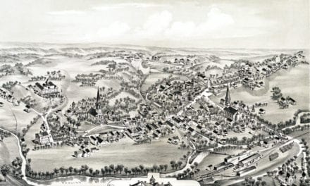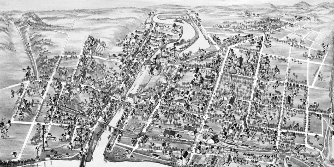
This map of Belvidere, New Jersey was created in 1883 by O.H. Bailey, a prominent 19th century map maker. The map shows a bird’s eye view of Belvidere as it looked at that time, including street names and old landmarks.
Landmarks on the map include the Pennsylvania Railroad Depot, Good Will Hose Company, Warner’s Carriage Wheel Works, Vannatta Billiard & Pool Room, Kisselbach Fish and Oysters, Snyder Jewelry, Reimer Tobacco & Cigars, Belvidere Fire Insurance Agency, and more.
This historic map of Belvidere, NJ has been restored by KNOWOL. Reproductions of the map are available here.
Map of Belvidere, New Jersey in 1883
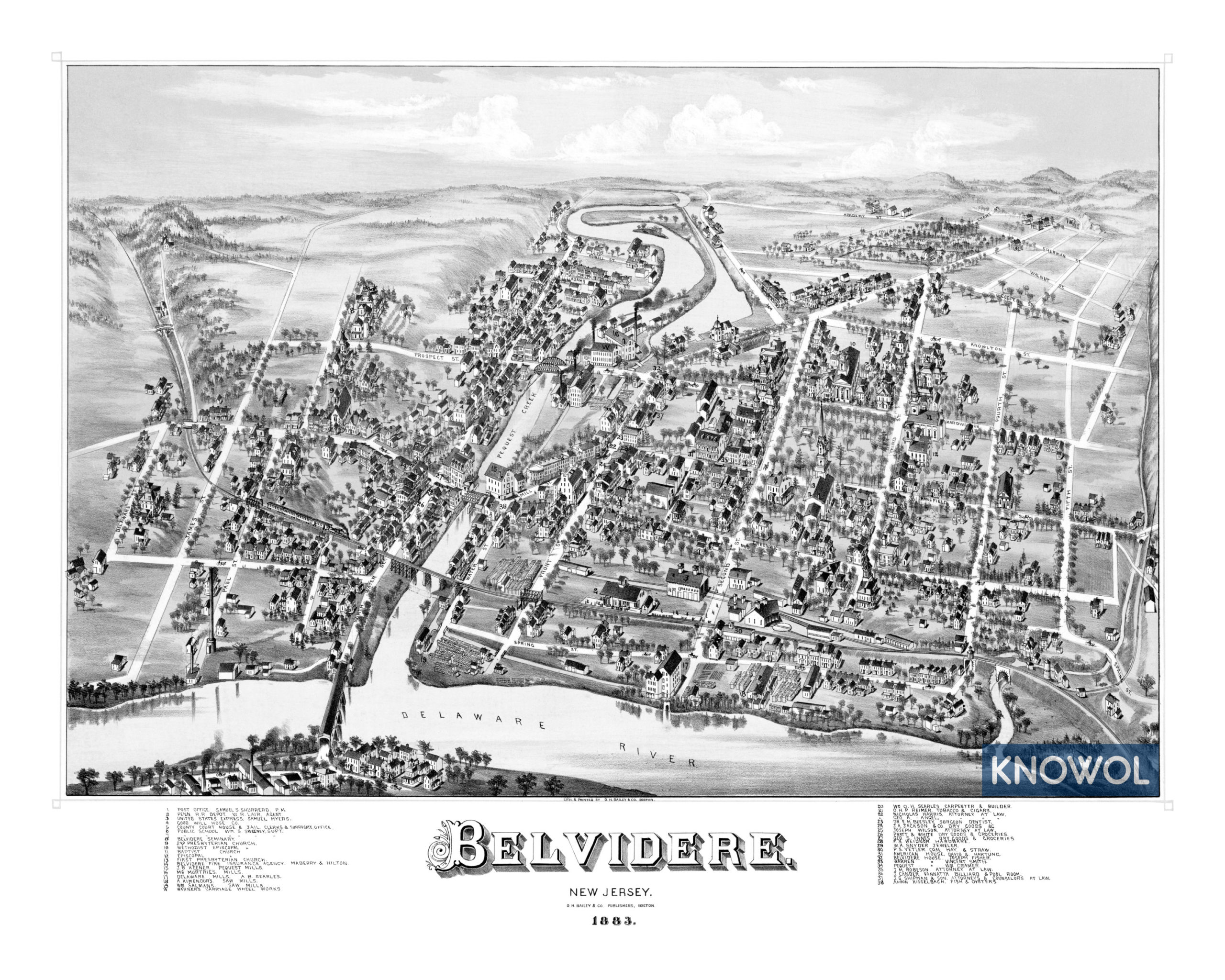
This map of Belvidere will make an attractive addition to your office, library, or den and can even be used to teach children the geography and history of the area. When you’re done exploring, click here to get your copy.