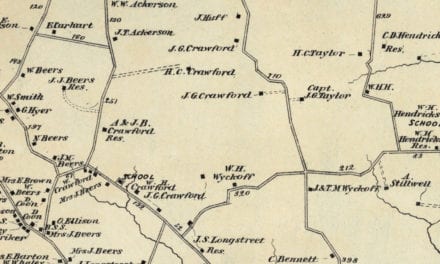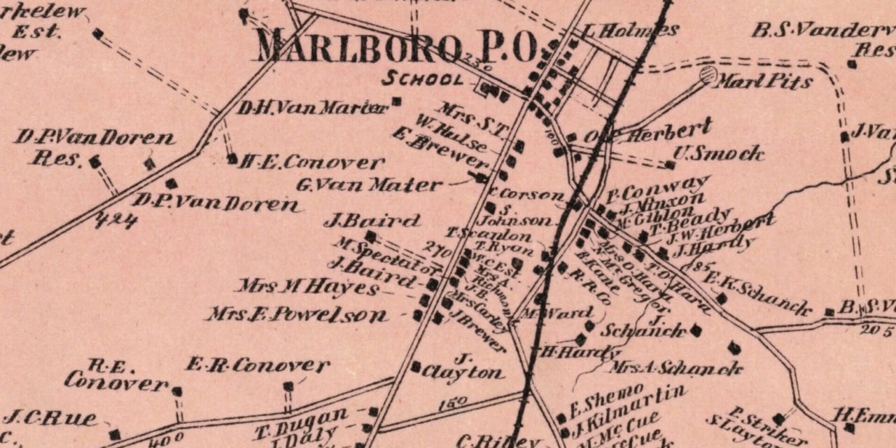
This old landowners map of Marlboro, New Jersey was created in 1873 by Frederick W. Beers, a prominent 19th century cartographer. Each plot of land is labeled with the name of the person or business who owned it at the time.
Landmarks on the map include Robertsville Hotel, Big Woods Settlement, Broach Undertaker & Carriage Maker, Freehold & Keyport Railroad, Kelley’s Distillery, Hillsdale, Beacon Hill, Robertsville, Morganville, and more.
This historic map of Marlboro was restored by KNOWOL. Reproductions of the restored map are available here.
Landowners Map of Marlboro, NJ from 1873
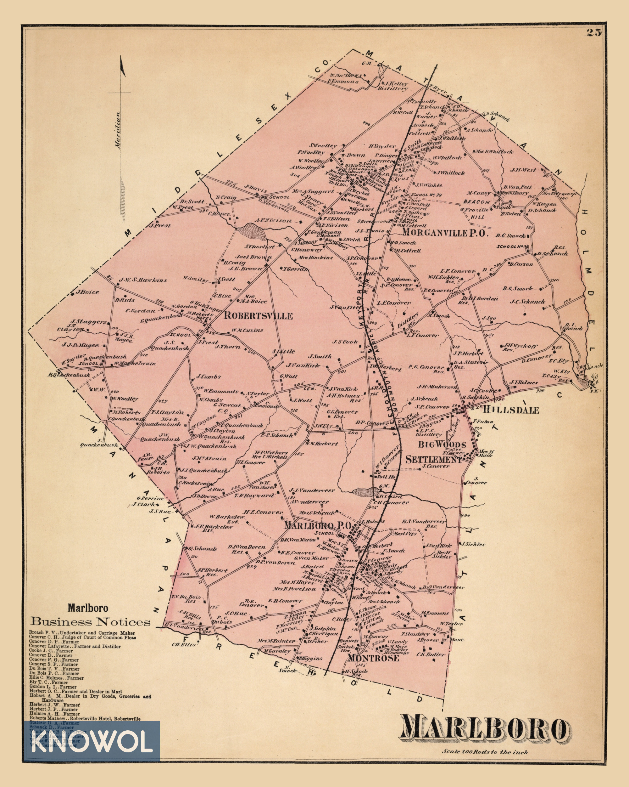
This old map of Marlboro makes an attractive addition to your office, library, or den and can even be used to teach children the geography and history of the area. When you’re done exploring, click here to get your copy.