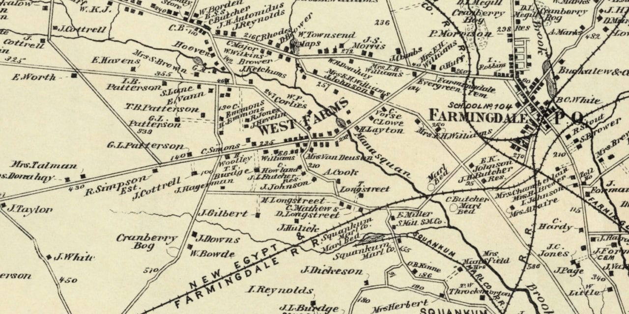
This vintage landowners map of Howell, New Jersey was created in 1873 by Frederick W. Beers, a prominent 19th century cartographer. Each plot of land is labeled with the name of the person or business who owned it at the time.
Landmarks on the map include Homminy Hill, West Farms, Lower Squankum, Metedecunk Creek, Manasquan Brook, Marl Beds, Jerseyville, New Jersey Southern Railroad, New Egypt & Farmingdale Railroad, Cranberry Bogs, and more.
This historic map of Howell was restored by KNOWOL. Reproductions of the restored map are available here.
Landowners Map of Howell, NJ from 1873
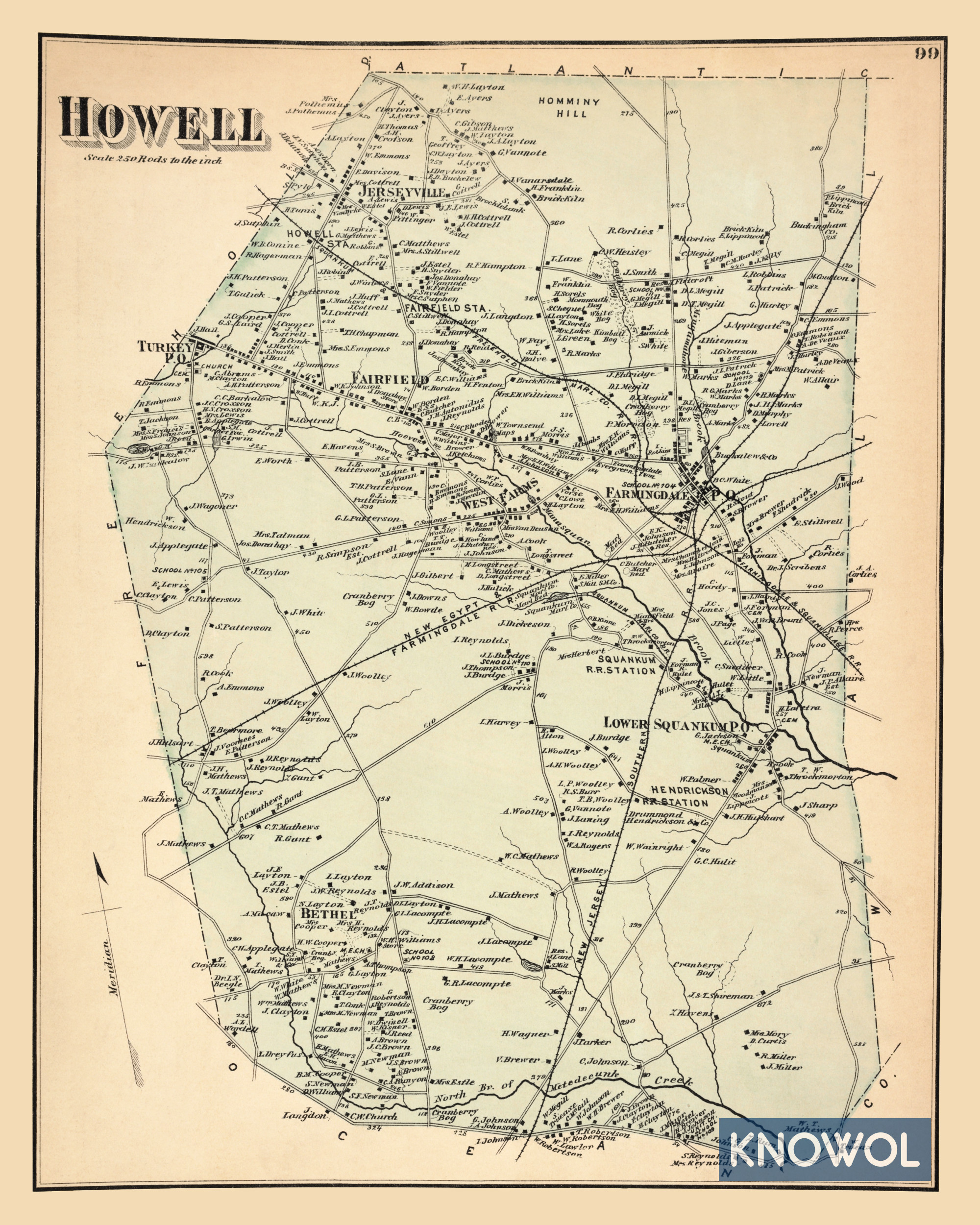
This historic map of Howell makes an attractive addition to your office, library, or den and can even be used to teach children the geography and history of the area. When you’re done exploring, click here to get your copy.