
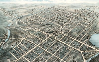
Beautifully restored old map of Pittsfield, MA from 1876
This old map shows Pittsfield, Massachusetts in the late 19th century.
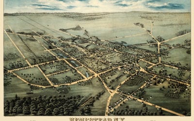
Amazing map showing Hempstead, New York in 1876
This map shows Hempstead, New York as it looked in 1876. It was created by Fowler & Bulger in 1876.
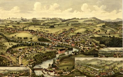
Beautiful old map of Henniker, New Hampshire from 1889
This old map shows Henniker, New Hampshire in the late 19th century.
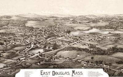
Beautifully detailed map of East Douglas, Mass from 1886
Click here to see the full map.
Beautiful bird’s eye view of Terryville, Connecticut from 1894
This old map shows Terryville, Connecticut in the late 19th century.
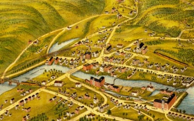
Beautifully restored old map of New Hartford, CT from 1878
This old map shows New Hartford, Connecticut in the late 19th century.
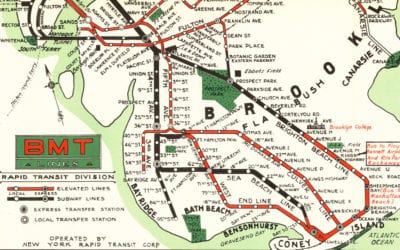
Map of NYC subways created for 1939 World’s Fair
Beautiful color map created by the Brooklyn-Manhattan Transportation Company for the 1939 World’s Fair in NYC.
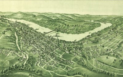
Historic old map of Morgantown, West Virginia in 1897
Detailed bird’s eye view of Morgantown, West Virginia in the late 19th century
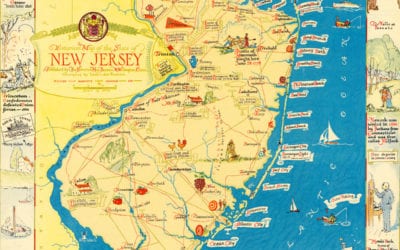
Amazing map of New Jersey filled with historical trivia
This map from the 1930’s is filled with wonderful scenes from NJ history!
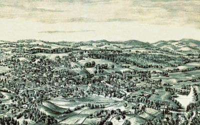
Restored bird’s eye view of Spencer, MA from 1877
This old map shows Spencer, Massachusetts in the late 19th century.


