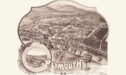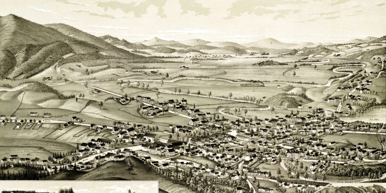
This map of Colebrook, New Hampshire was created in 1887 by George E. Norris, a prominent 19th century cartographer. The map shows a detailed bird’s eye view of Colebrook as it was, including street names and old landmarks.
Old Colebrook landmarks on the map include Graham & Gilkey Iron Founders & Machinists, Monadnock Stock Farm, Village Hotel, Colebrook Academy, Colebrook Publishing, Toad Hill, Canaan Hill, Williams General Store, Remick Jewelry, Upper Coos Railroad Station, and more.
This historic map of Colebrook, NH has been restored by KNOWOL. Reproductions of the map are available here.
Bird’s Eye View of Colebrook, NH in 1887
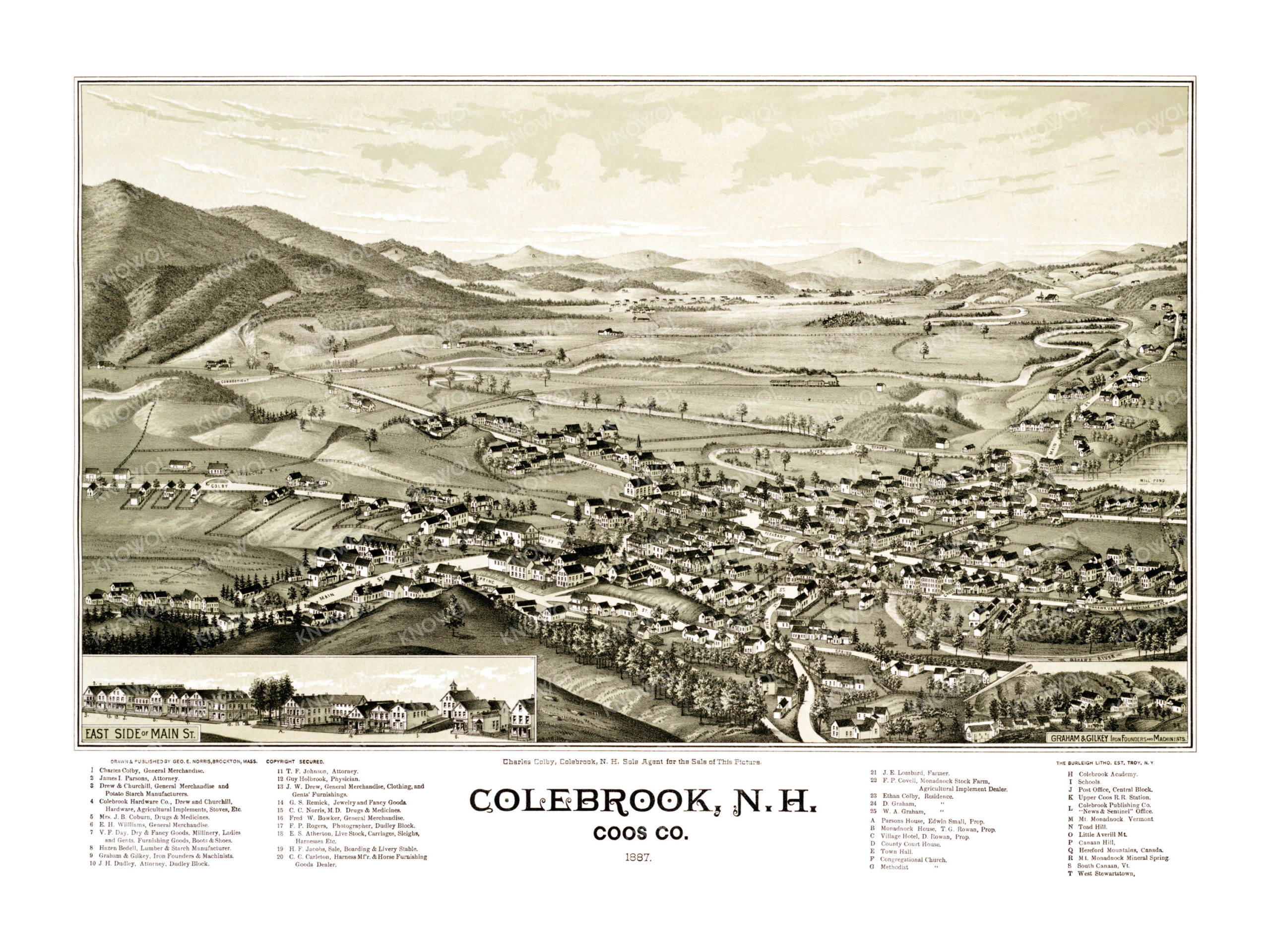
This historic map of Colebrook will make an attractive addition to your office, library, or den and can even be used to teach children the geography and history of the area. When you’re done exploring, click here to get your copy.