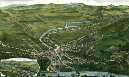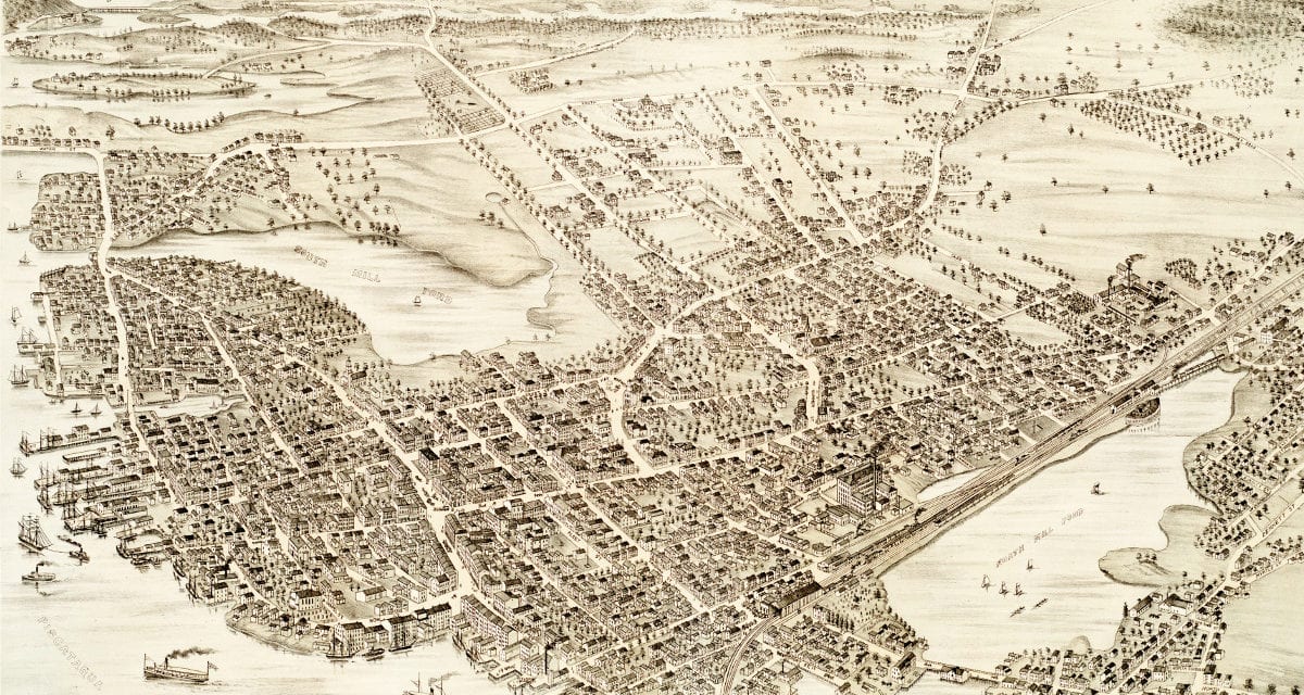
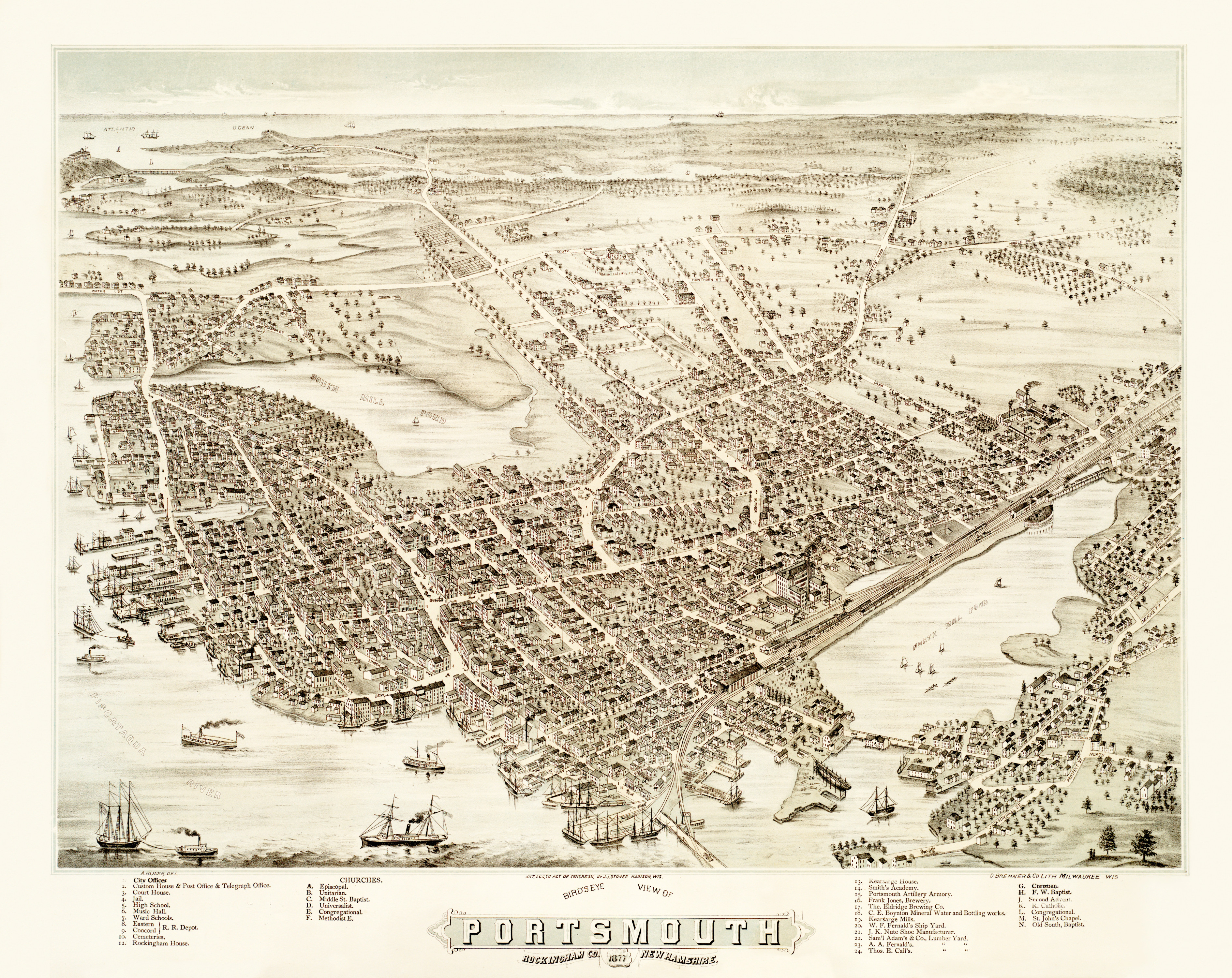
This map shows Portsmouth, New Hampshire as it looked in 1877. It was created by J.J. Stoner, printed by D. Bremner & Co. Lith, and digitally restored by the team at KNOWOL. You can see a larger copy of the map below, or click here to purchase a high resolution poster print of the map.
This vintage map of Portsmouth, NH shows locations such as Rockingham House, Kearsarge House, Smith’s Academy, Portsmouth artillery Armory, Frank Jones Brewery, Eldridge Brewing Co, various ship yards and thirteen different places of worship. Click here to see a larger version.
Click here to get a high resolution poster of this map for only $44.95.