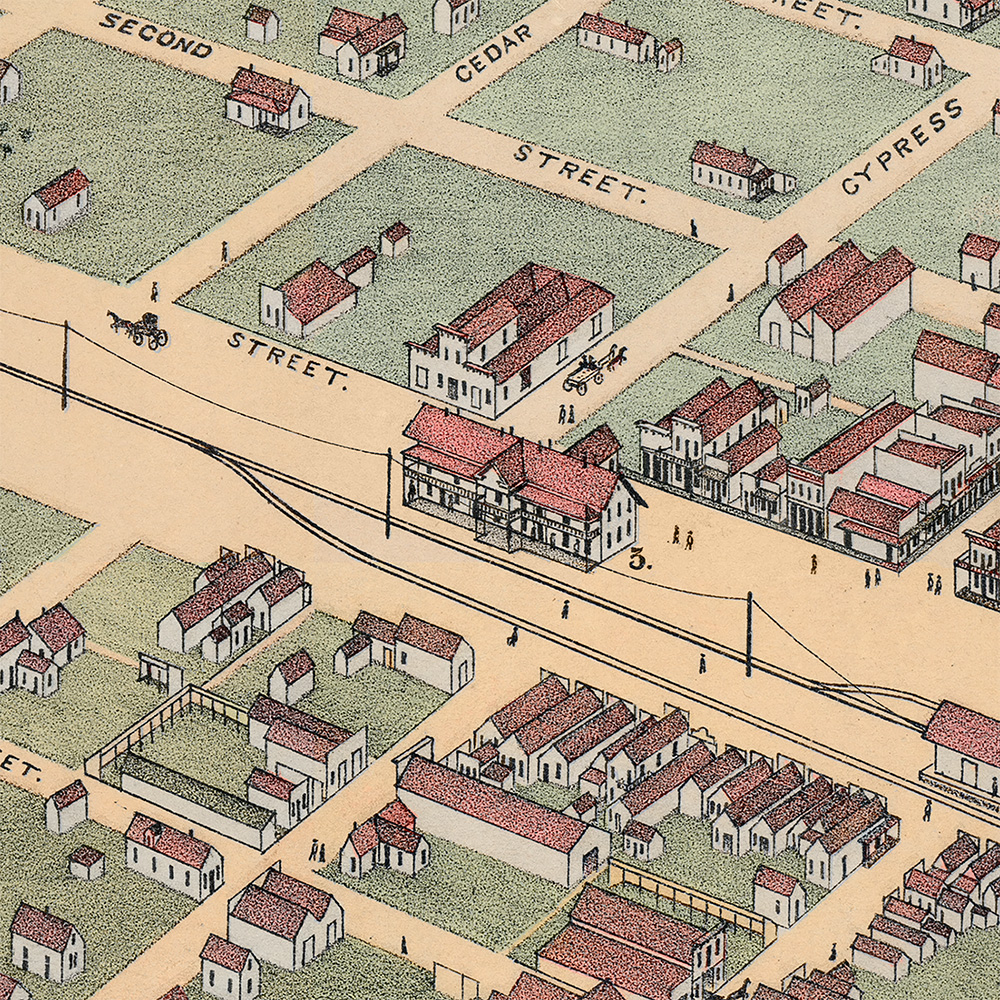
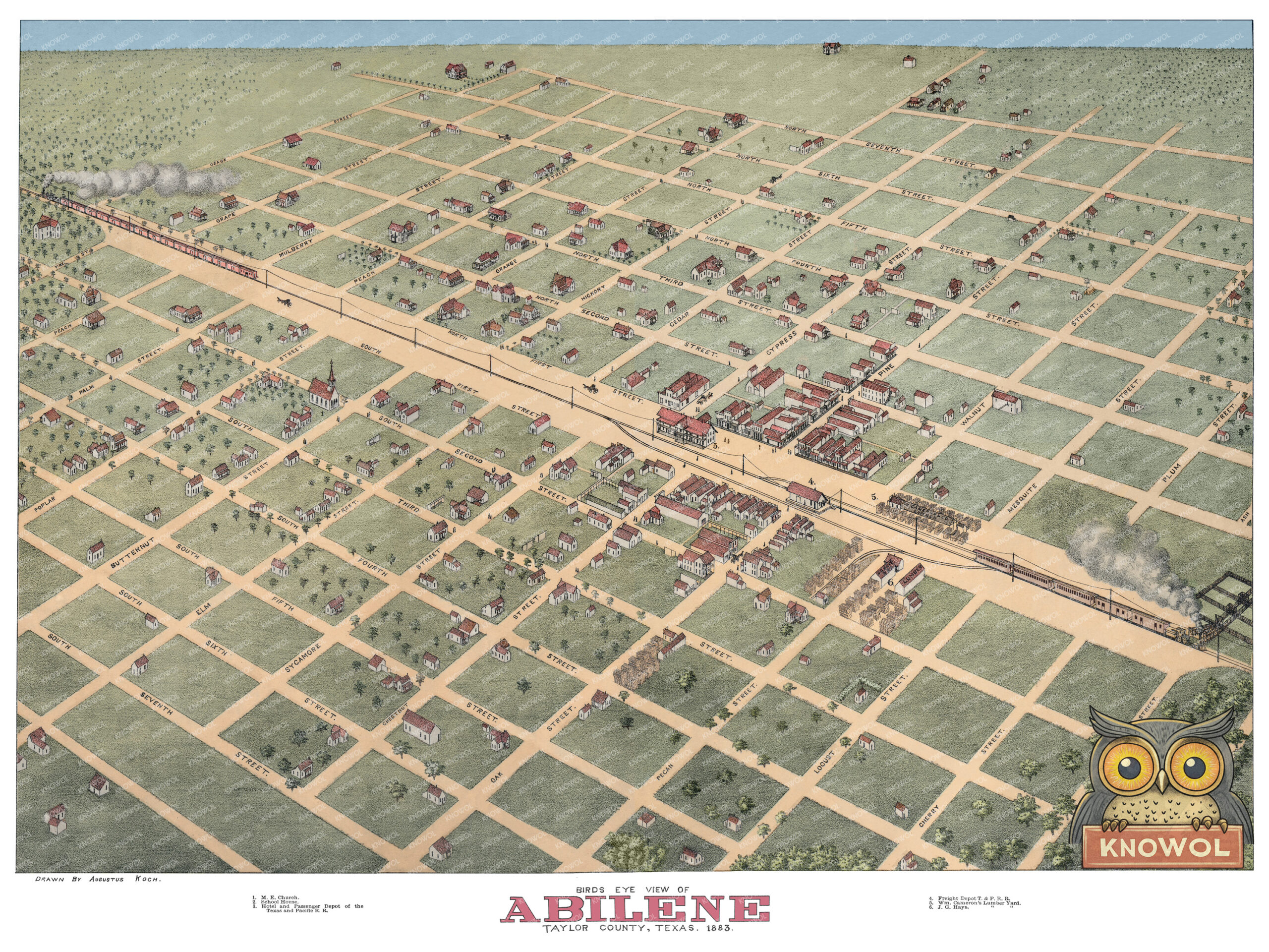
This vintage map of Abilene, Texas was created in 1883 by Augustus Koch, a prominent 19th-century panoramic map maker known for his detailed bird’s-eye views of American towns and cities. The map shows Abilene as it once was, only two years after the Texas and Pacific Railway reached the area, capturing the young West Texas city during its earliest years of growth.
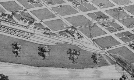
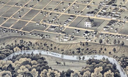
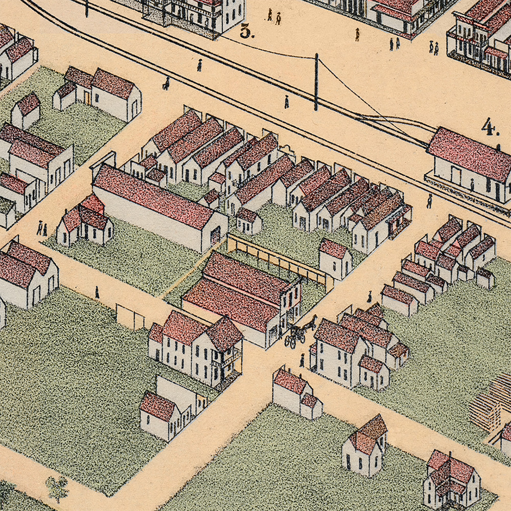
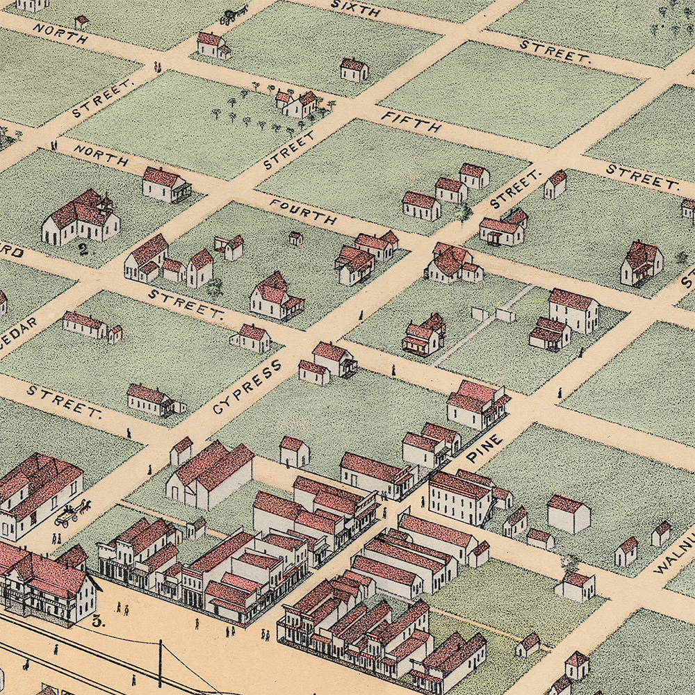
Historic Abilene landmarks on the map include the Hotel and Passenger Depot of the Texas and Pacific Railroad, the Freight Depot, William Cameron’s Lumber Yard, J. G. Hays Lumber Yard, School House, M.E. Church, early homes, rail lines, open town blocks, and the streets, businesses, and railroad features that shaped Abilene in the 1880s.
This vintage map of Abilene has been carefully restored and colorized by KNOWOL. Reproductions of the restored map are available here. You can click on the image below to view a large version.
Vintage Map of Abilene, Texas 1883
Restored and colorized 1883 bird’s-eye view map of Abilene, Texas by Augustus Koch, featuring the Texas and Pacific Railroad, passenger and freight depots, lumber yards, churches, school house, early homes, open blocks, and landmarks from the city’s frontier years.
At the time this map was drawn, Abilene was a new city on the Texas frontier. The town had been officially established in 1881, after the Texas and Pacific Railway pushed westward across Taylor County. Before the railroad, the area was associated with ranching, buffalo hunters, open prairie, and frontier travel. Once the railway arrived, landowners, cattlemen, railroad officials, and town promoters saw an opportunity to create a new commercial center in West Texas.
The Texas and Pacific Railroad is the heart of the image. Passenger and freight depots sit near the center of town, while trains, smoke, rail lines, and telegraph poles give the map a sense of movement. Lumber yards and commercial buildings cluster near the tracks, showing how closely early Abilene’s economy was tied to transportation, construction, cattle, and trade.
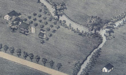
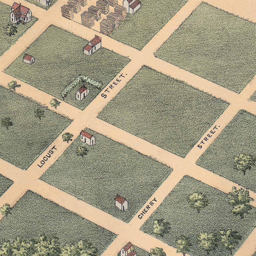
The surrounding neighborhoods are equally interesting. Small houses dot the open blocks, churches rise among the streets, and the town grid stretches far beyond the most developed areas. Many lots are still empty, giving the viewer a rare look at Abilene before it became a settled city. The map captures a moment when Abilene was still partly frontier settlement and partly planned railroad town.
This restored and colorized version brings new life to the original 1883 bird’s-eye view while preserving its historic character. The soft greens of the open land, warm streets, red rooftops, railroad smoke, and blue Texas sky make the map easier to explore and more attractive as a display piece, while the original streets, buildings, rail lines, and landmarks remain the focus.
This beautiful old map of Abilene makes an attractive addition to your office, library, classroom, study, or den. It can also be used to teach children about Texas history, railroad towns, frontier settlement, city planning, and the early geography of Taylor County. When you’re done exploring, click here to get your copy of the restored map.