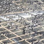
Beautifully restored map of Frankfort, Kentucky from 1871
Historic bird’s eye view of Frankfort, Kentucky in 1871

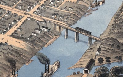
Beautifully restored map of Warren, Ohio from 1870
Historic bird’s eye view of Warren, Ohio in 1870

Beautifully restored map of Jackson, Tennessee from 1870
This historic map of Jackson, Tennessee was created in 1870 by Albert Ruger, a prominent 19th century map maker. The map shows a bird's eye view of the city looking North West, including street names and old landmarks. Landmarks on the map include West Tennessee...

Beautifully restored map of Bowling Green, Kentucky from 1871
Historic bird’s eye view of Bowling Green, Kentucky in the late 19th century.
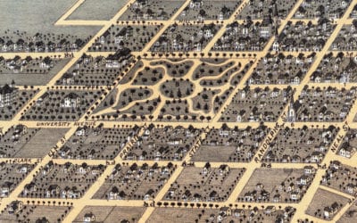
Beautifully restored map of Champaign, Illinois from 1869
This historic map of Champaign, Illinois was created in 1869 by Albert Ruger, a prominent 19th century map maker. The map shows a bird's eye view of the city as it once was, including street names and old landmarks. Landmarks on the map include Illinois State...

Beautifully restored map of Huntsville, Alabama from 1871
Historic bird’s eye view of Huntsville, Alabama in 1871
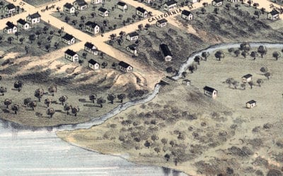
Beautifully restored map of Nebraska City, Nebraska in 1868
Historic old map of Nebraska City, Nebraska in 1868

Beautifully restored map of Mattapan, MA from 1890
Historic bird’s eye view of Mattapan, MA in 1890

Beautifully detailed map of San Antonio, Texas from 1873
Historic bird’s eye view of San Antonio, Texas from 1873

Historic old map of Bristol, Rhode Island from 1891
Historic bird’s eye view of Bristol, Rhode Island from 1891