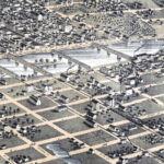
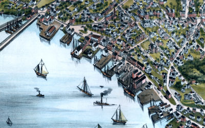
Vintage Map of Columbia, Missouri from 1869
Historic bird’s eye view of Columbia, Missouri from 1869
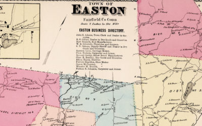
Vintage Property Map of Easton, Connecticut from 1867
This vintage landowners map of Easton, Connecticut was created in 1867 by Frederick W. Beers. a prominent 19th century map maker. Beers was a prominent American map maker and publisher during the 19th century. He began his career as a civil engineer and surveyor, and later established the firm of F.W. Beers, A.D. Ellis & Co. in 1866.

“Emptiness is a symptom that you are not living creatively…”
"Emptiness is a symptom that you are not living creatively. You either have no goal that is important enough to you, or you are not using your talents and efforts in a striving toward an important goal." - Maxwell Maltz This quote is saying that when you feel like...

“The eye through which I see God is the same eye through which…”
“The eye through which I see God is the same eye through which God sees me.” – Meister Eckhart
Vintage Map of Rochester, Minnesota from 1869
Historic Rochester landmarks on the map include Bear Creek, Lumbro River, Rochester Railroad Depot, Public School, Court House, and Baptist, Congregational, Episcopal, Methodist, German Methodist, Presbyteria, Universalist, and Roman Catholic Churches.
Vintage Map of Beverly, Massachusetts from 1886
Vintage Map of Beverly, Massachusetts from 1886
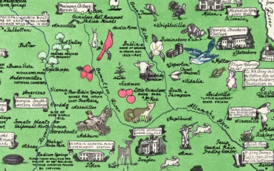
Vintage map of Georgia, one page history dedicated to the Old Timers
Vintage pictorial map of Georgia with amazing hand drawn historical images

45 Patriotic Quotes from Presidents of the United States
Series of 45 patriotic quotes, one from each U.S. President.
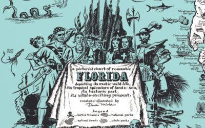
Vintage Map of Florida, a one page history dedicated to Old Timers, 1951
This vintage map of Florida was created in 1951 and is titled "a pictorial chart of romantic Florida depicting its exotic wildlife, its tropical splendors of land and sea; its historic past; its vital and exciting present". The map was created and illustrated by Dave...
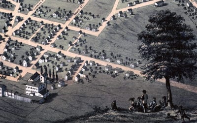
Historic bird’s eye view of Belleville, Illinois in 1867
Historic bird’s eye view of Belleville, Illinois from 1867