
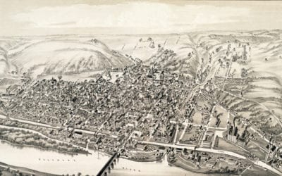
Vintage map of Lambertville, New Jersey in 1883
This old map shows Lambertville, New Jersey in the late 19th century.
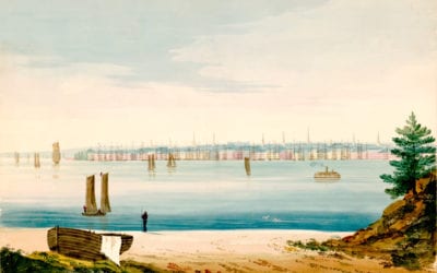
View of lower Manhattan from Brooklyn Strand in 1825
This watercolor by William Wall (1792 – 1864) shows lower Manhattan across the East River as it looked from Brooklyn Strand 1825. The river scene is filled with sailboats, sailing ships, and a steamship. Wall was born in Dublin in 1792 and arrived in New York in 1812....
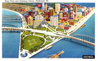
Gateway Center and Point Park, Pittsburgh, PA
The Gateway Center in Pittsburgh, Pennsylvania is a high-rise building complex planned during World War II to redevelop the dense and "blighted" forks of the Ohio River into Point State Park and a "corporate gateway" to numerous companies with offices in the building....
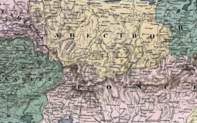
Beautifully restored map of Puerto Rico from 1886
Mapa Topografico De La Isla De Puerto Rico
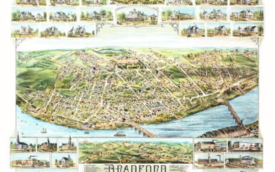
Wonderful old map of Bradford, Massachusetts in 1892
This map shows Bradford, Massachusetts in 1892, five years before it was annexed to the city of Haverhill.
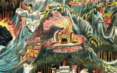
Magical map exposes the ancient lost city of Fairyland
Click here to enter a land of magic

5 reasons every person should visit the Statue of Liberty
"Liberty Enlightening the World", more commonly known as The Statue of Liberty, was a gift from France to the United States commemorating the alliance of France and the United States during the American Revolution and the subsequent abolition of slavery. According to...
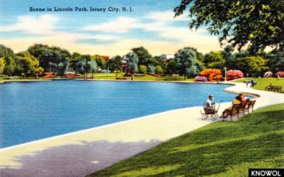
12 beautiful postcards from Jersey City’s glory days
Jersey City is the second-most-populous city in New Jersey, with a population of 264,000 people as of 2010. What is interesting about Jersey City is that in the 1930's the city had a population of more than 300,000 people. The city's population then began to decline...
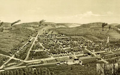
Historical bird’s eye view map of Ironwood, Michigan from 1886
This old map shows Ironwood, Michigan in the late 19th century.
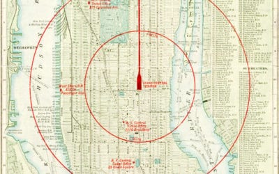
New York City, a map of “the center of the world” in 1902
Vintage Map of NYC, 1902 This map of New York City was engraved for the New York Central & Hudson River Railroad in 1902, and shows routes for the N.Y. Central Railroad, the Underground Rapid Transit, Elevated Railways, Street Car Lines and Ferries. In the center...


