
Old Maps
Explore the archive through editorial features, geography, and historical collections.
 Connecticut
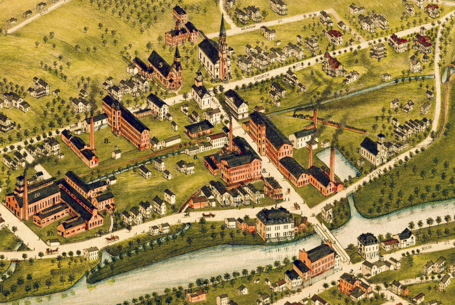
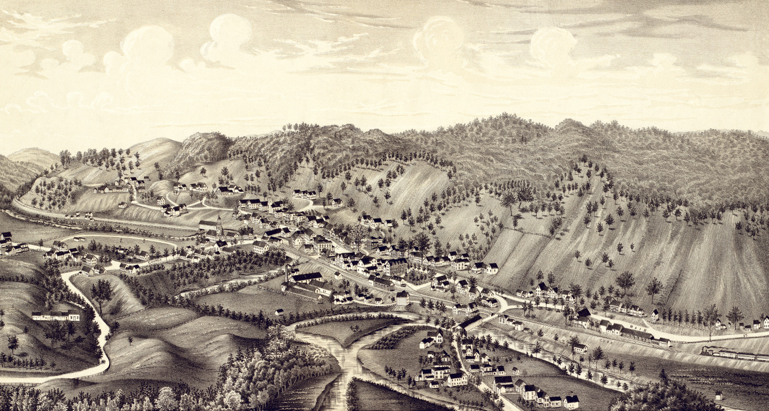
Beautifully restored map of Naugatuck, Connecticut from 1877
Historic bird's eye view of Naugatuck, Connecticut from 1877
 Connecticut
Beautifully restored map of Cheshire, Connecticut from 1882
Detailed bird's eye view of Cheshire, Connecticut as it used to be
 Pennsylvania
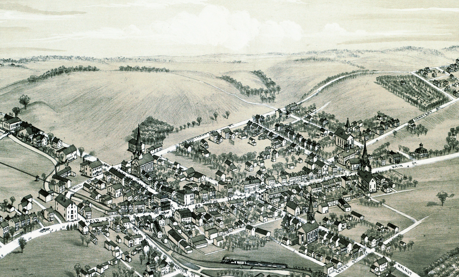
Bird’s eye view of Bath, Pennsylvania in 1885
This bird's eye view of Bath, Pennsylvania was created more than 130 years ago.
 Wyoming
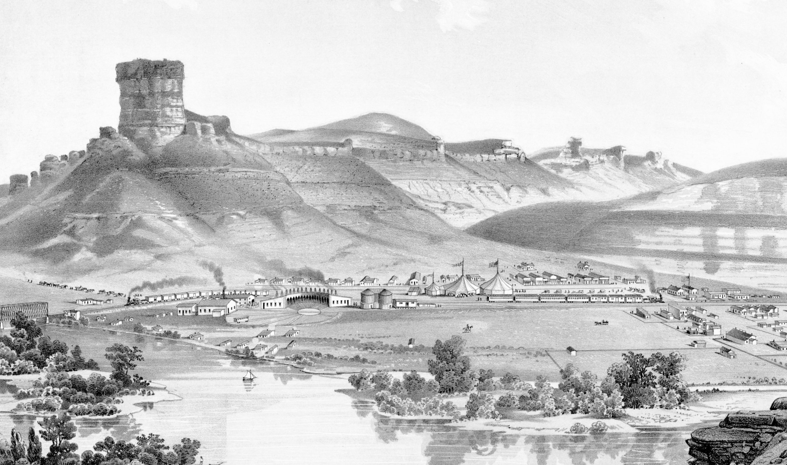
Beautifully detailed map of Green River, Wyoming in 1875
Historic bird's eye view of Green River, Wyoming from 1875
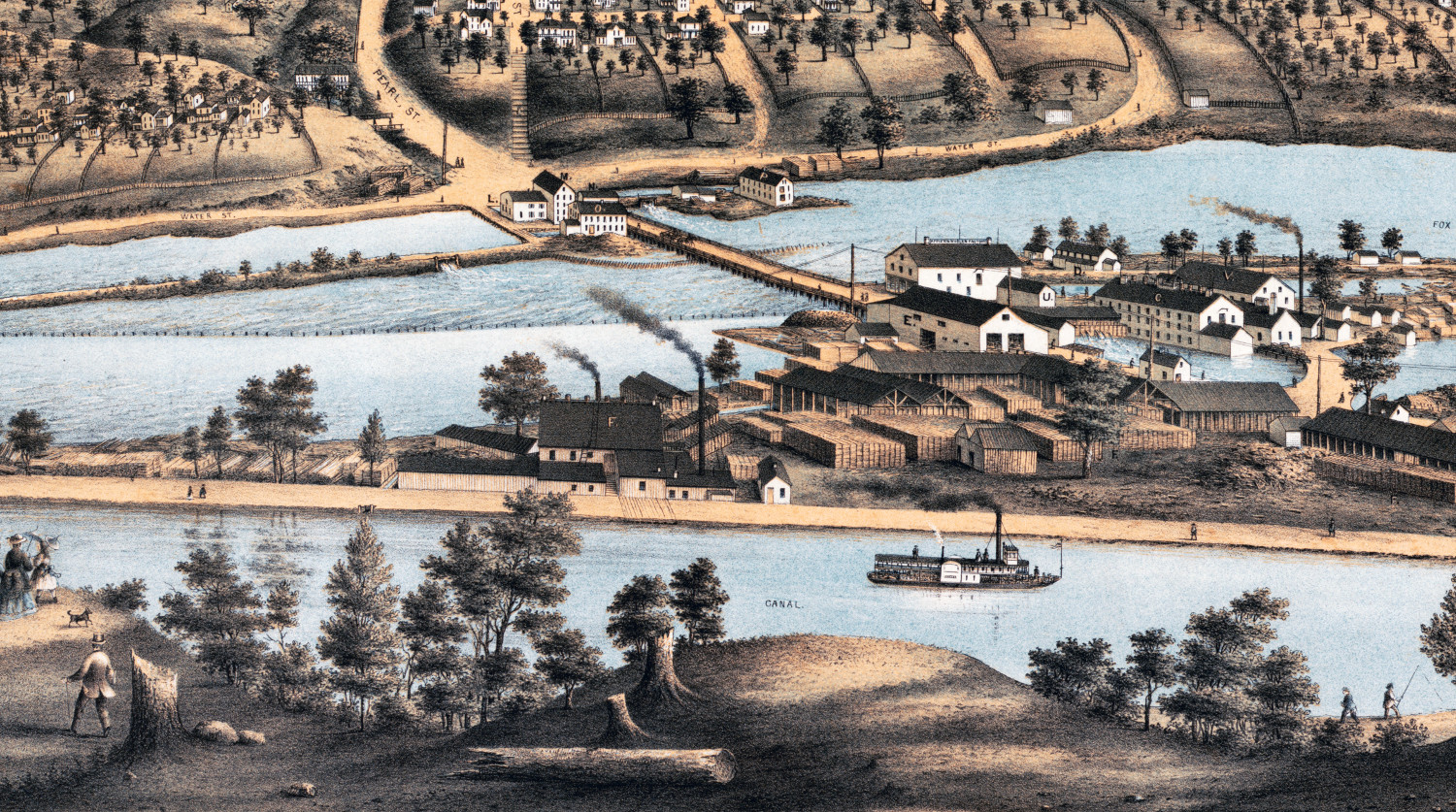
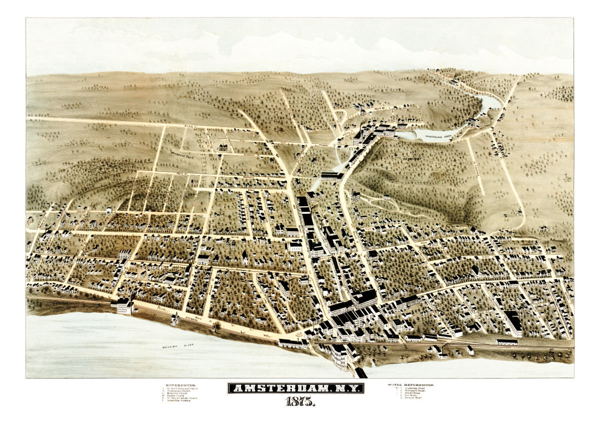 New York
This is what Amsterdam, New York looked like in 1875
Old map showing Amsterdam, New York as it looked when only 5,500 people lived there
 Wisconsin
Beautifully detailed map of Appleton, Wisconsin in 1874
Historic bird's eye view of Appleton, Wisconsin from 1874
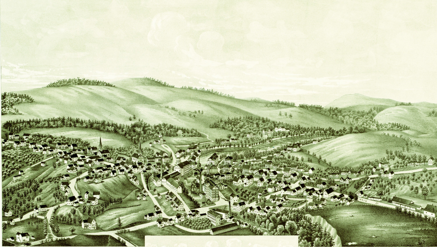
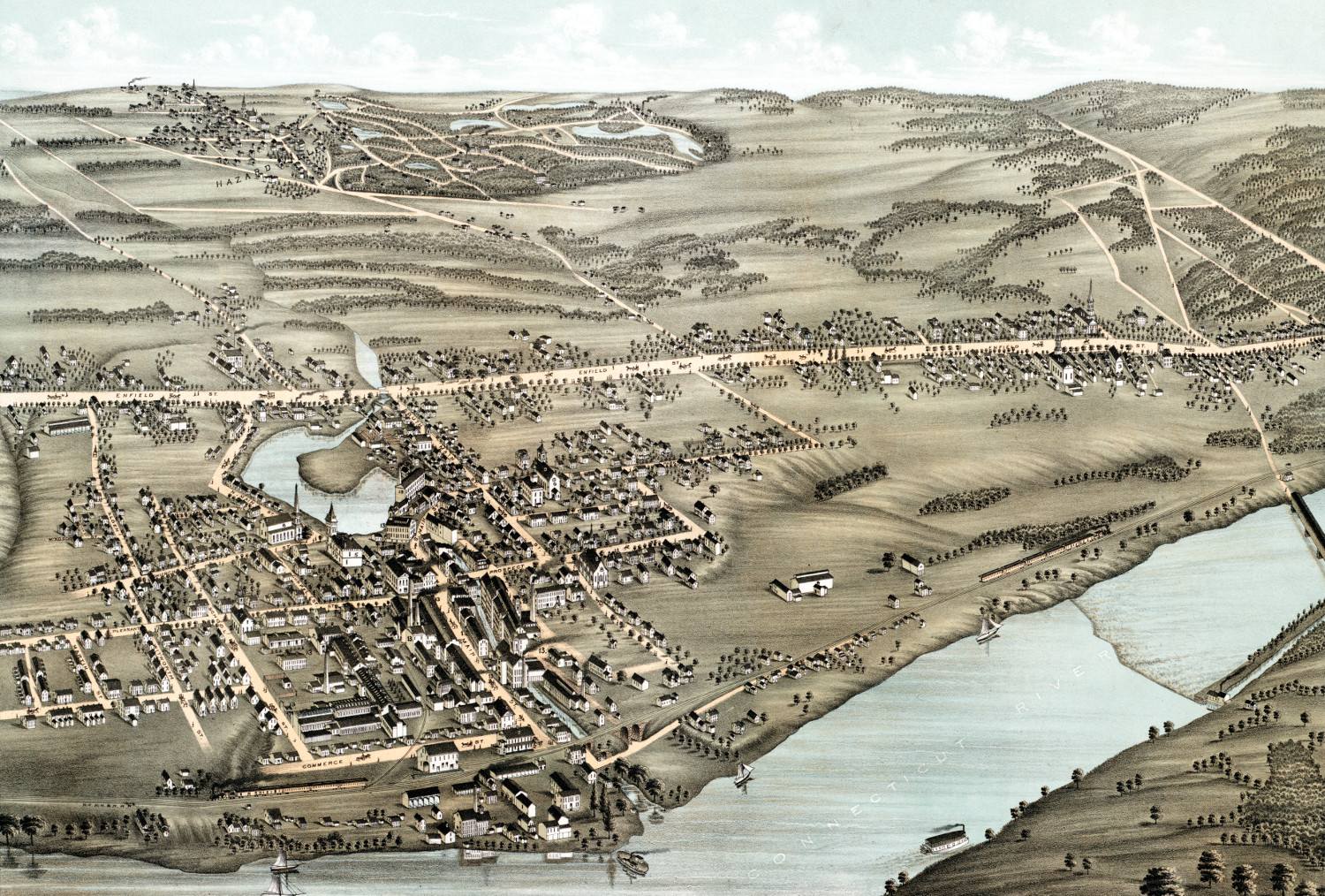 Connecticut
Beautifully restored map of Thompsonville, CT from 1878
This old map shows Thompsonville, Connecticut as it looked in 1878.
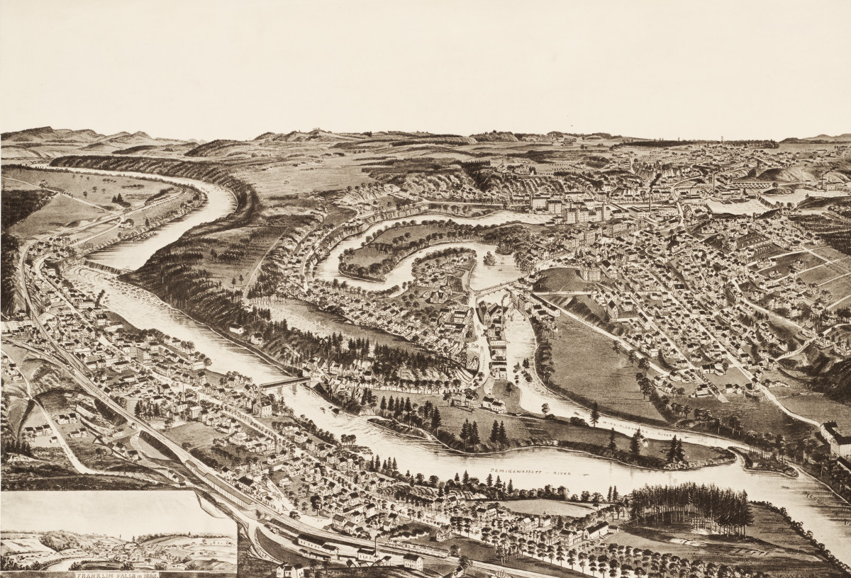 New Hampshire
Amazing vintage map of Franklin New Hampshire from 1884
This map shows Franklin NH as it looked in 1884
 Massachusetts
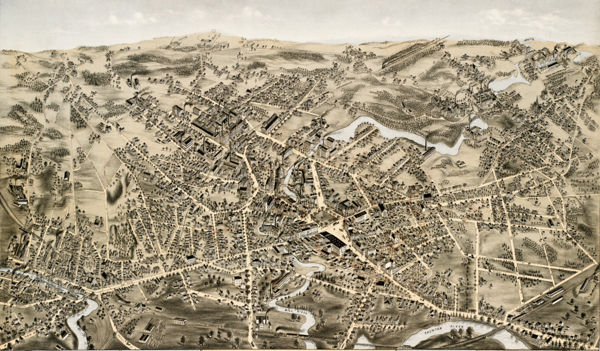
Amazingly detailed map of Taunton, MA from 1875
This map shows Taunton, Mass as it looked in 1875
 Massachusetts
Wonderfully detailed map of East Bridgewater, MA from 1887
This map shows East Bridgewater, Massachusetts as it looked in 1887.
 Connecticut
Beautiful old map of South Coventry, CT from 1878
This vintage map shows South Coventry, CT as it looked in 1878.
 Connecticut
Beautifully restored map of Madison, Connecticut in 1881
Bird's eye view of Madison, Connecticut as it used to be
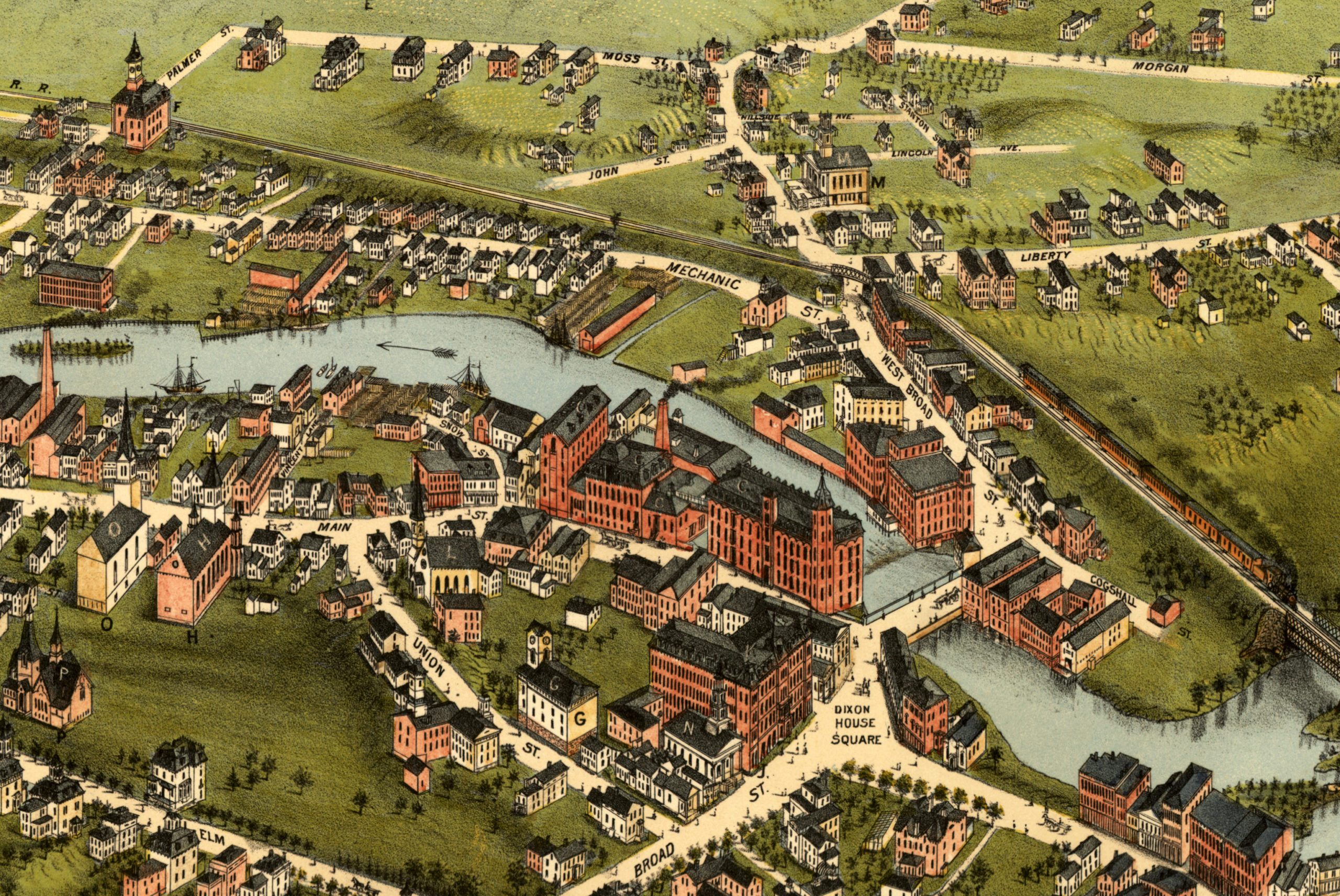
 New York
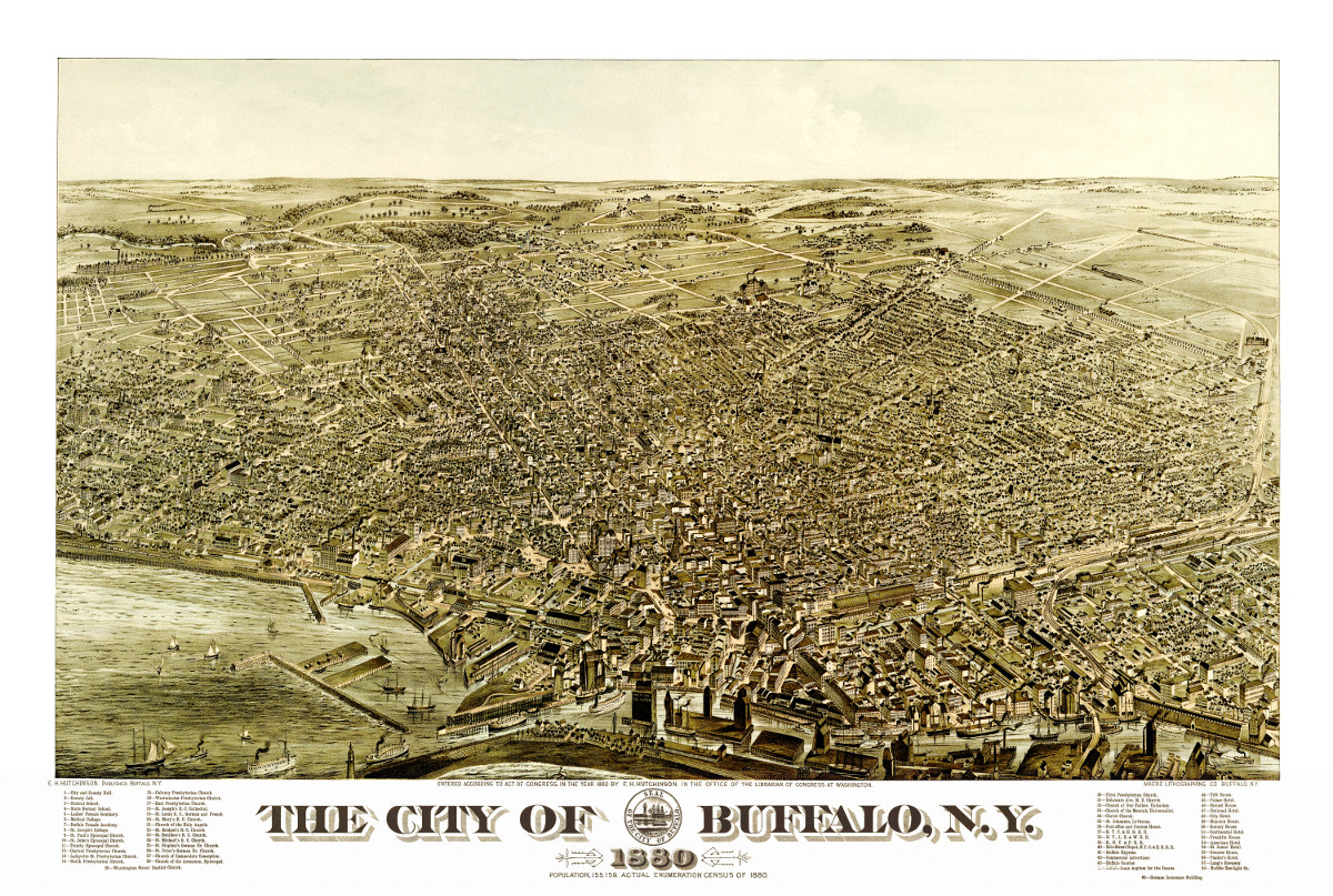
Beautiful vintage map of Buffalo, NY from 1880
This map shows Buffalo, NY as it looked in 1880.
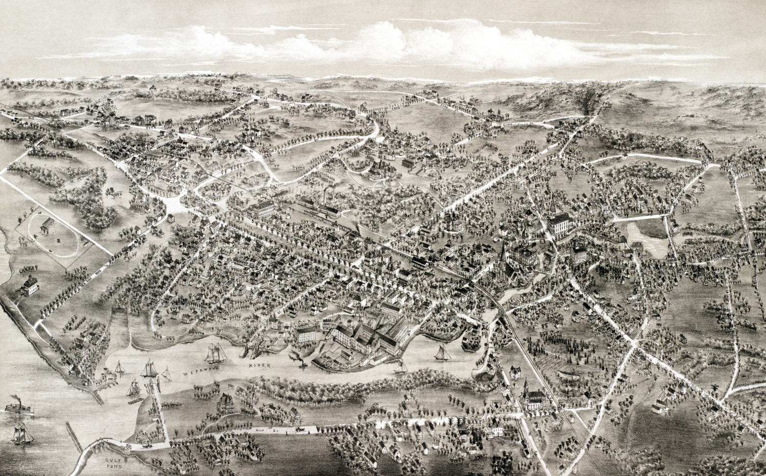 Connecticut
Beautiful vintage map of Milford, Connecticut from 1882
Historic bird's eye view of Milford, Connecticut in the late 19th century.
 New Hampshire
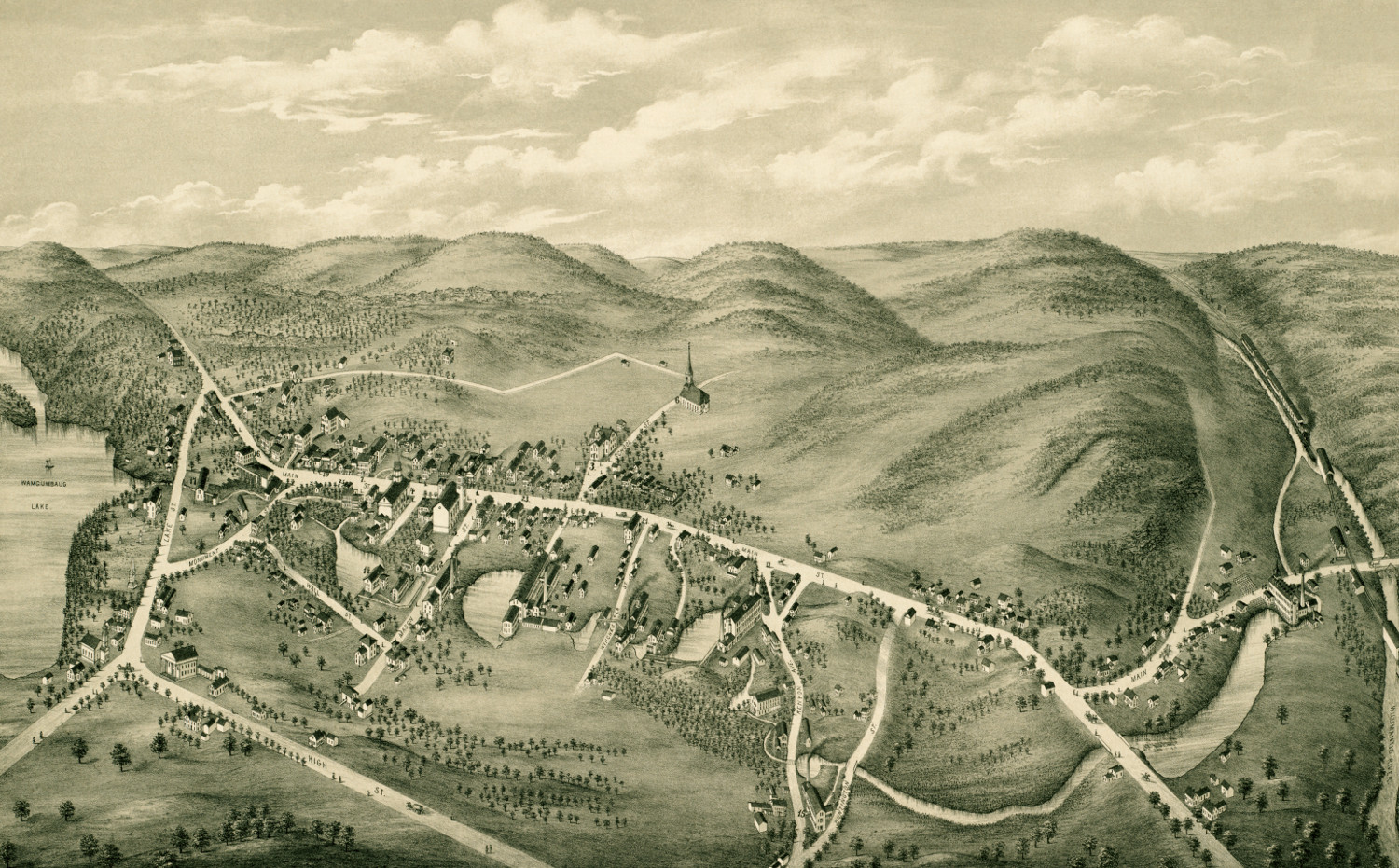
Stunning old map of Greenville, New Hampshire from 1886
Click here to see what Greenville looked like 100+ years ago
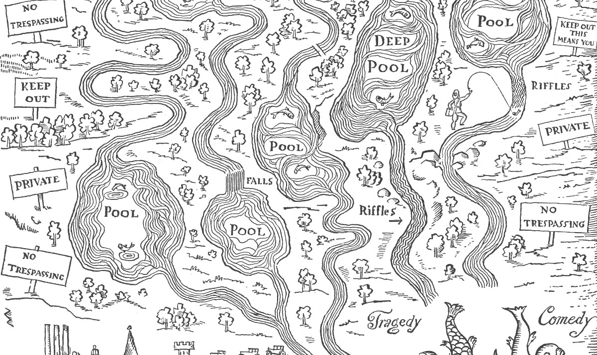 Information
The fly fisherman’s ideal estate, a vintage map from 1931
This map by the satirical artist John Held shows the perfect "estate" for the fly fisherman.
 Rhode Island
Beautifully restored map of Westerly, Rhode Island from 1877
This map shows Westerly, Rhode Island as it looked in 1877
 Connecticut
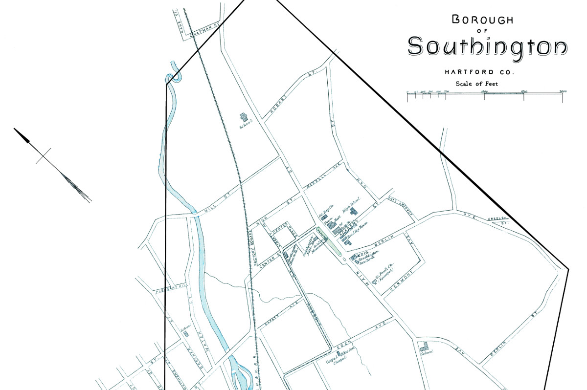
Historic map of the borough of Southington, CT from 1893
This beautiful map of Southington, Connecticut was created using government surveys in 1893.
 Massachusetts
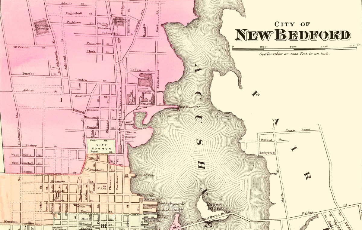
Historical map of New Bedford, Massachusetts from 1871
This amazing map of New Bedford, Massachusetts shows the town as it looked in 1871
 New York
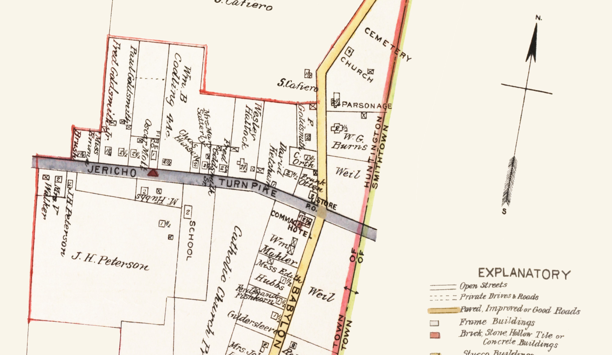
Old road map of Commack, New York from 1915
Click here to see what Commack was like in the early 20th century.
 Vermont
Beautiful old map shows bird’s eye view of Bethel, VT in 1886
Click here to see the full map of Bethel, VT from 1886