
Old Maps
Explore the archive through editorial features, geography, and historical collections.
 Information
Albert Ruger’s Legacy: Capturing the Growth of 19th-Century American Cities
Born in 1829 in Prussia, Albert Ruger emigrated to the United States and transformed his career from a mason to a pivotal figure in…
 Illinois
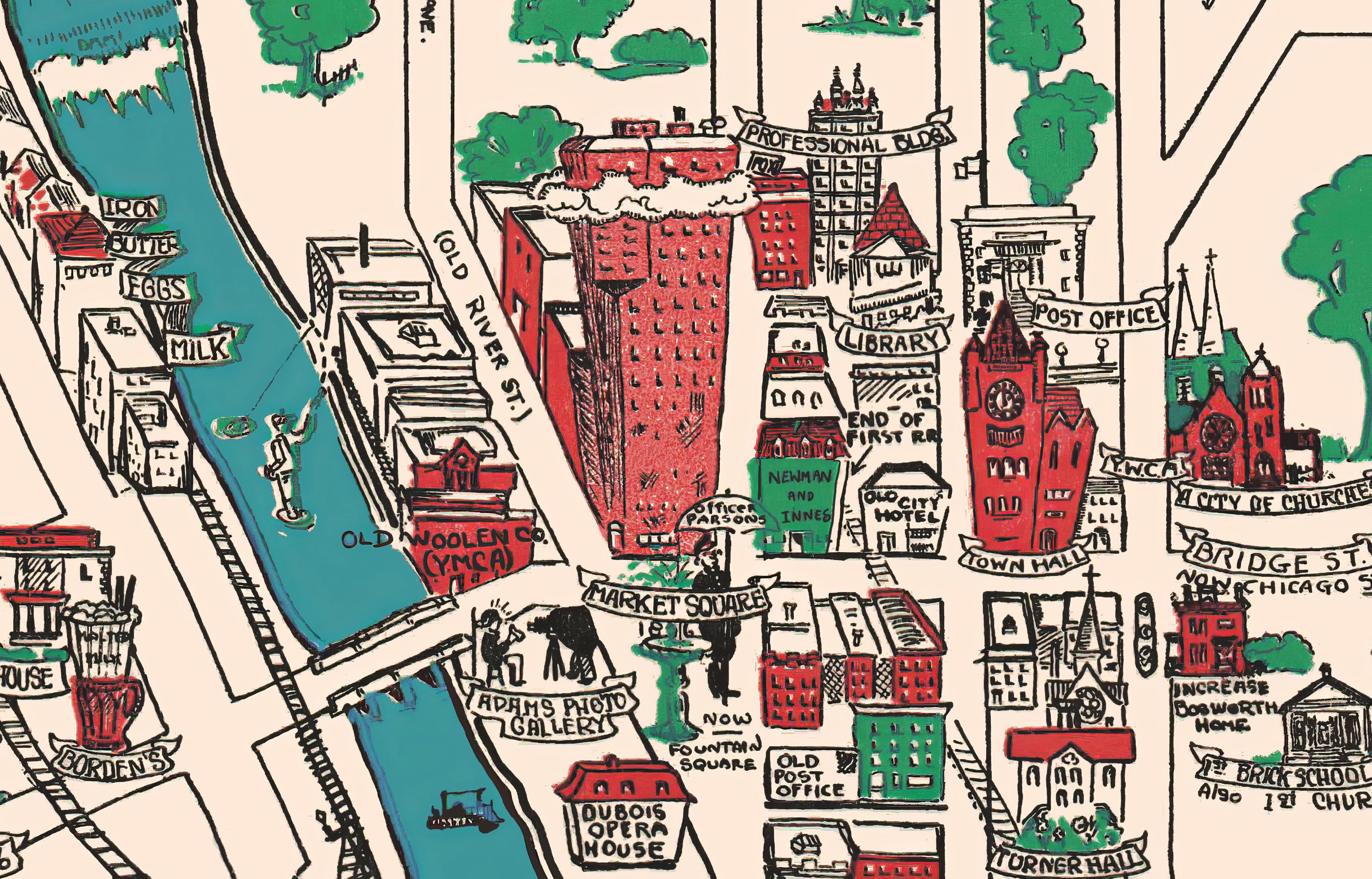
Restored Vintage Map of Elgin, Illinois from 1930
This vintage map is titled "Elgin Past and Present, and was produced in 1930 by the Elgin Branch of the American Association of Women. This animated historical map was created ninety five years after the town was formed, and highlights historical sights and landmarks.
 New Mexico
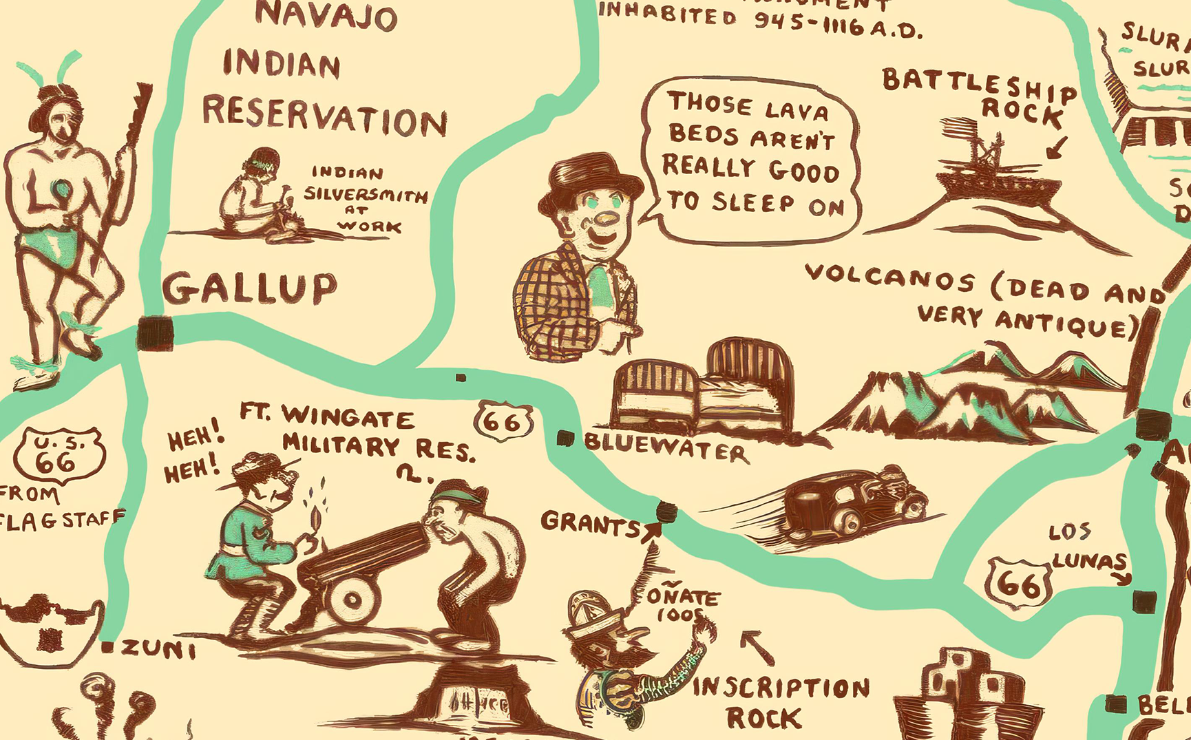
New Mexico Like Never Before: 1939 Map Brings History to Life with a Laugh
Rediscover the charm of the Southwest with this playful 1939 Cartoon Map of New Mexico. Perfect for locals who love a side of humor with their history!
 Texas
Texas
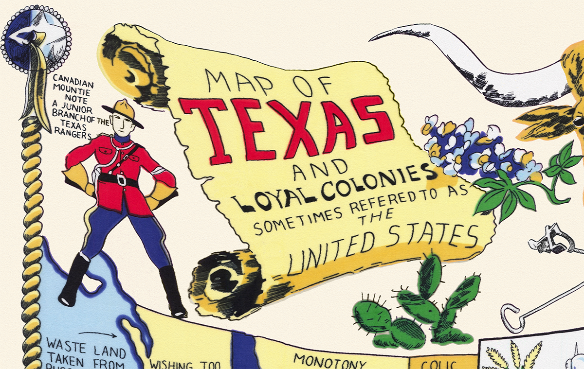
Map of Texas and Loyal Colonies, AKA the United States, 1960s
The historic map of Texas is a nostalgic and humorous representation of the state created in the 1960's. The map depicts Texas as the…
 Connecticut
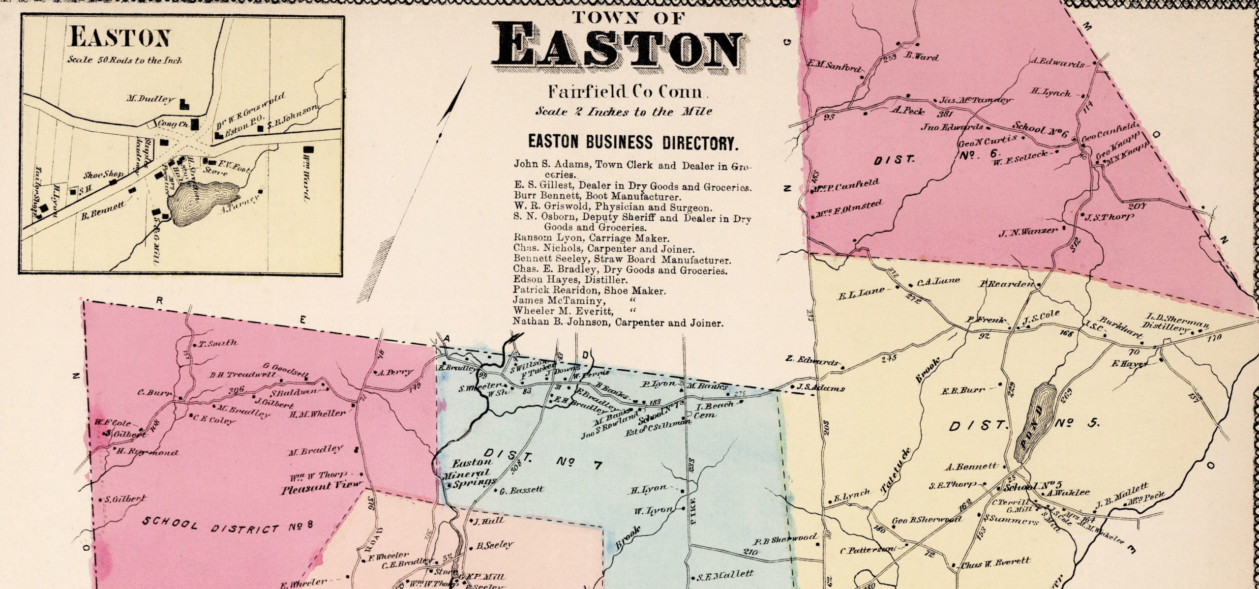
Vintage Property Map of Easton, Connecticut from 1867
This vintage landowners map of Easton, Connecticut was created in 1867 by Frederick W. Beers. a prominent 19th century map maker. Beers was a prominent American map maker and publisher during the 19th century. He began his career as a civil engineer and surveyor, and later established the firm of F.W. Beers, A.D. Ellis & Co. in 1866.
 Minnesota
Vintage Map of Rochester, Minnesota from 1869
Historic Rochester landmarks on the map include Bear Creek, Lumbro River, Rochester Railroad Depot, Public School, Court House, and Baptist, Congregational, Episcopal, Methodist, German Methodist, Presbyteria, Universalist, and Roman Catholic Churches.
 Massachusetts
Vintage Map of Beverly, Massachusetts from 1886
Vintage Map of Beverly, Massachusetts from 1886
 Illinois
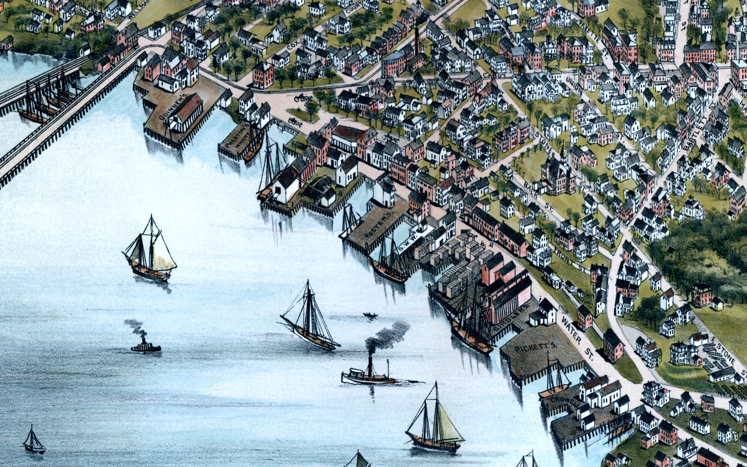
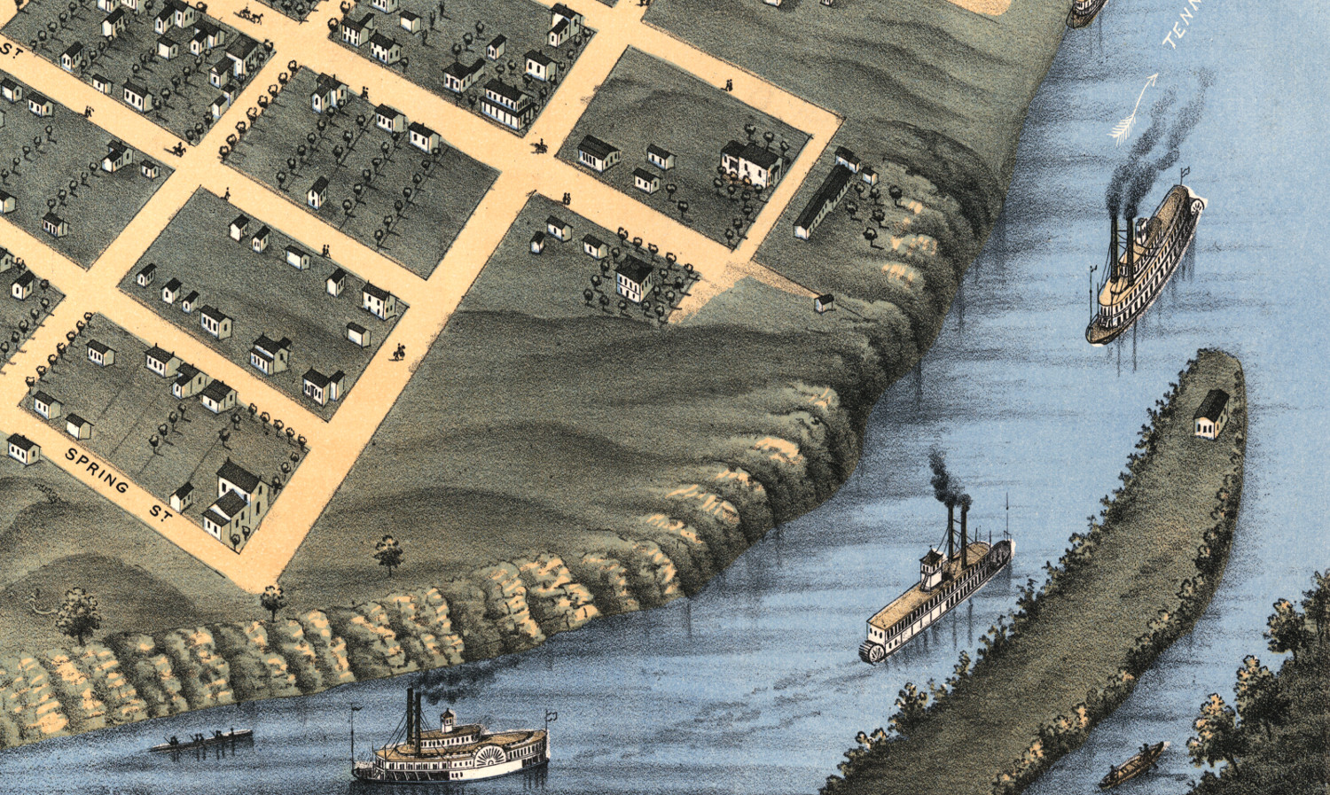
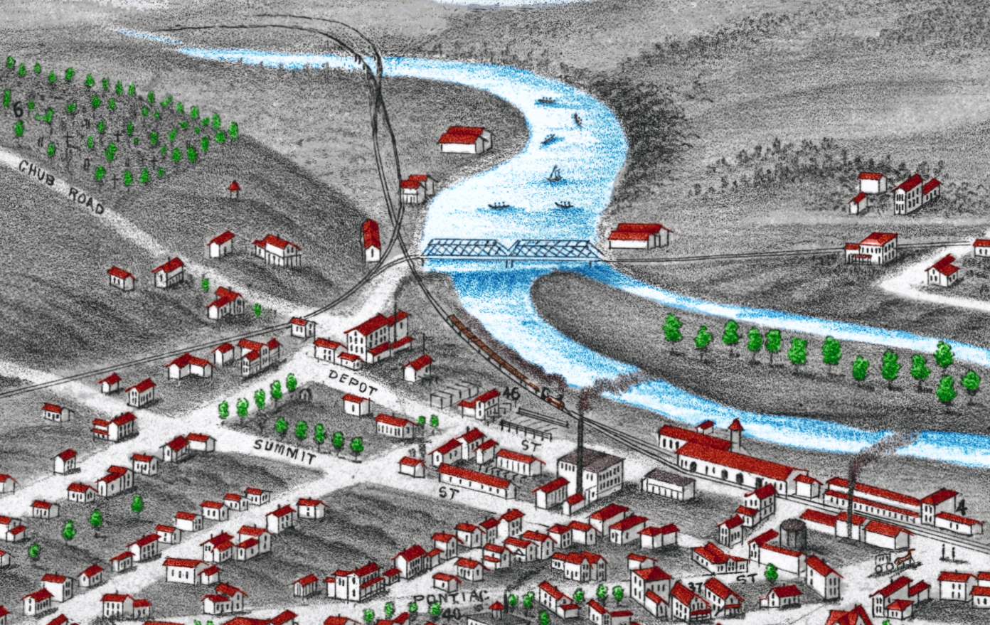
Historic bird’s eye view of Belleville, Illinois in 1867
Historic bird's eye view of Belleville, Illinois from 1867
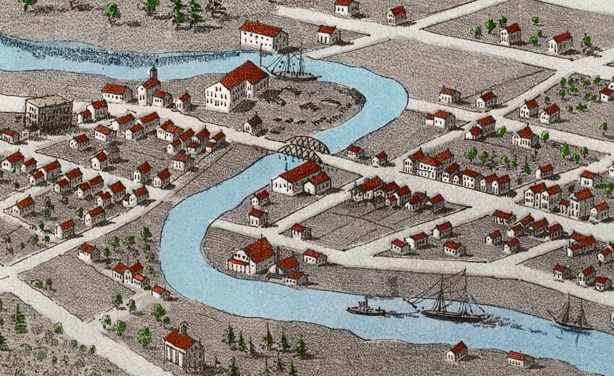
 Michigan
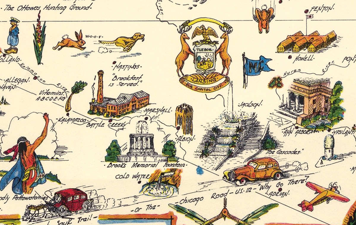
Map of Historic Michigan, a one page history dedicated to the Old Timers, 1935
Dive into the historic grandeur of the Great Lake State with this Pictorial Map of Michigan from 1935. Created by Hy Richardson, this map…
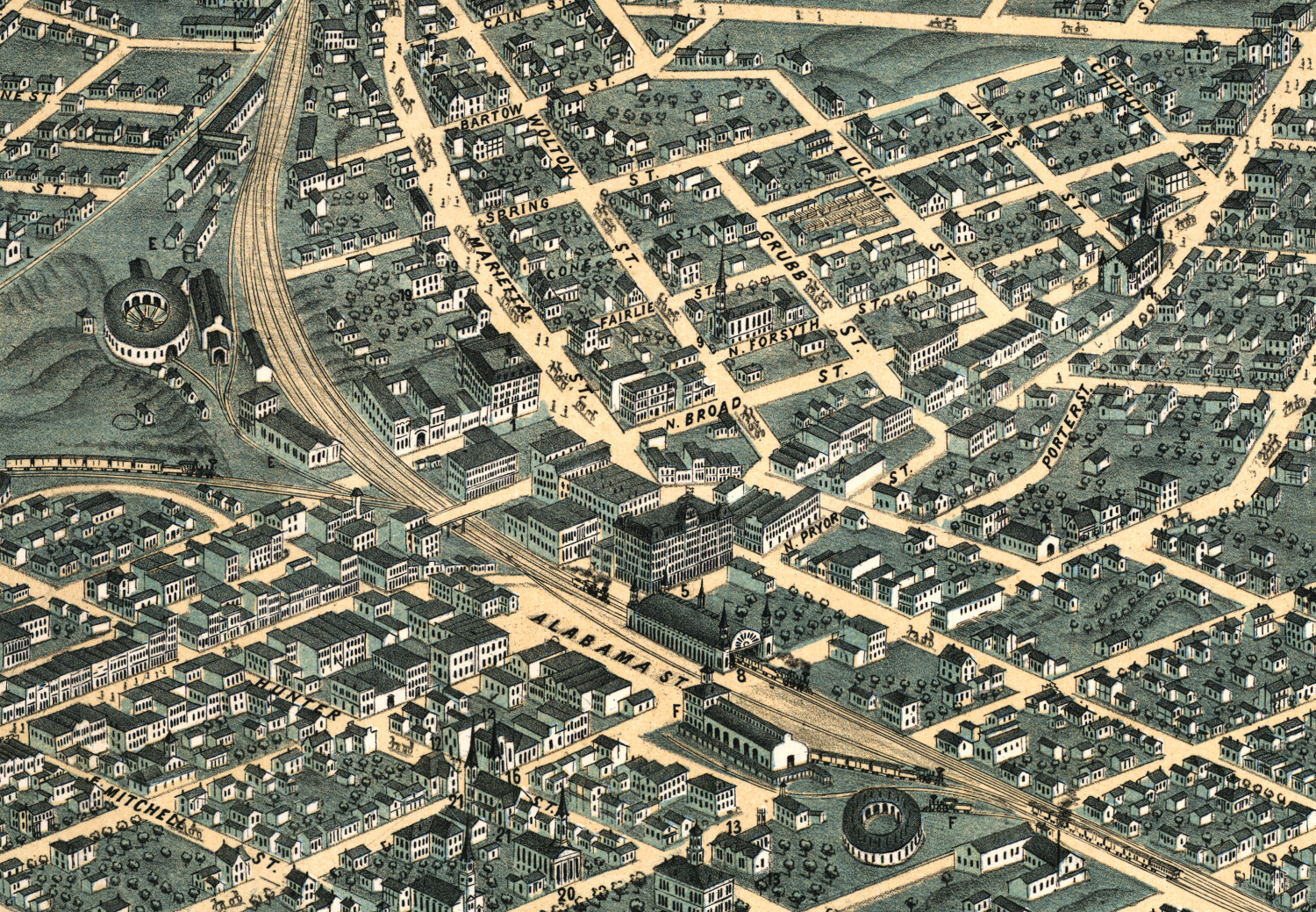
 Georgia
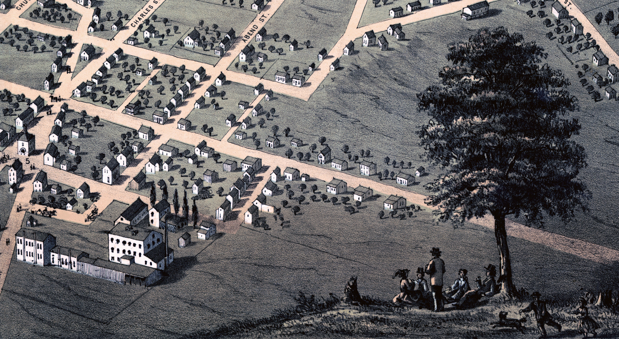
Beautifully restored map of Columbus, Georgia from 1886
Historic old map of Columbus, Georgia from 1886
 Tennessee
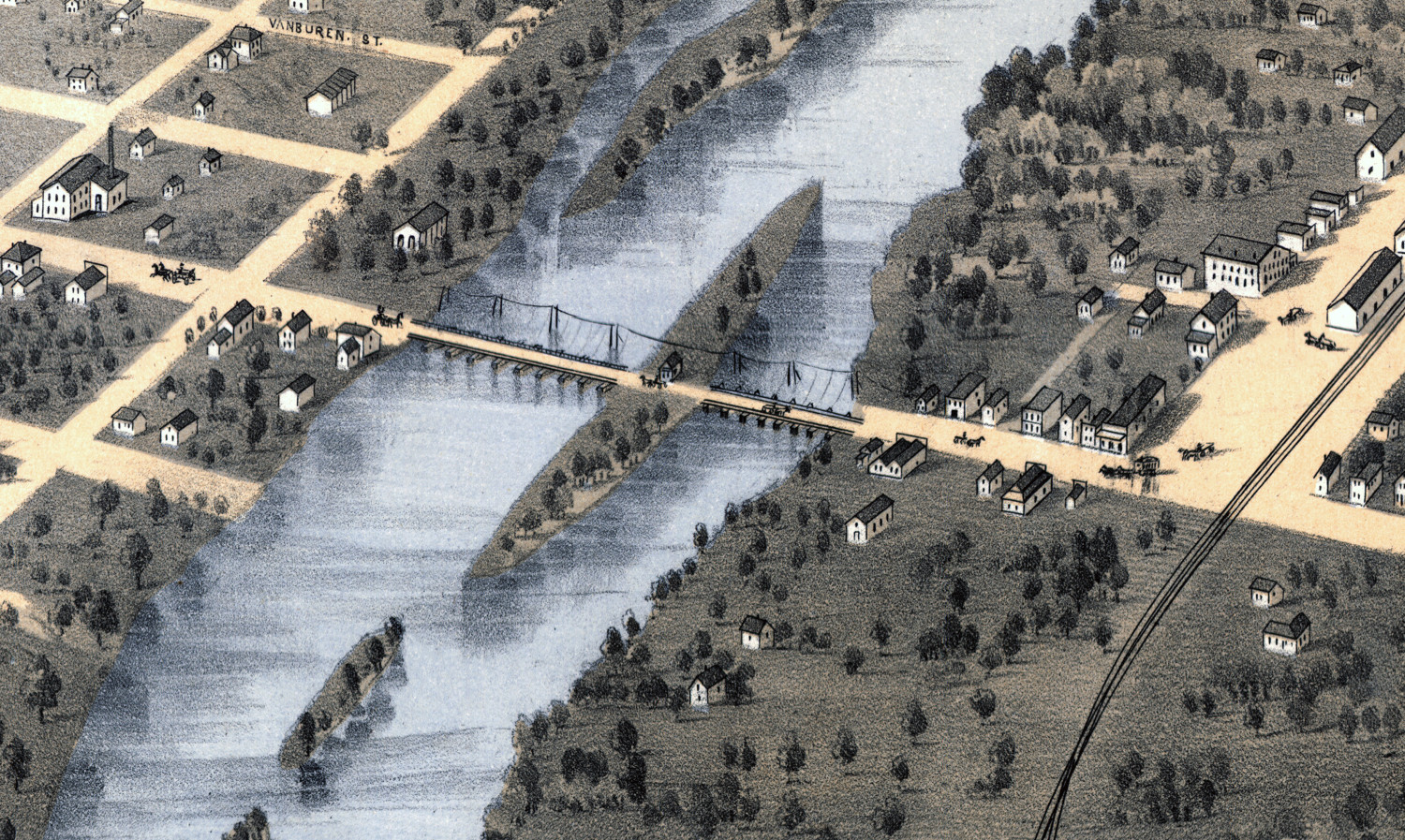
Historic map of Chattanooga, Tennessee from 1871
Historic old map shows bird's eye view of Chattanooga, Tennessee in 1871
 Kansas
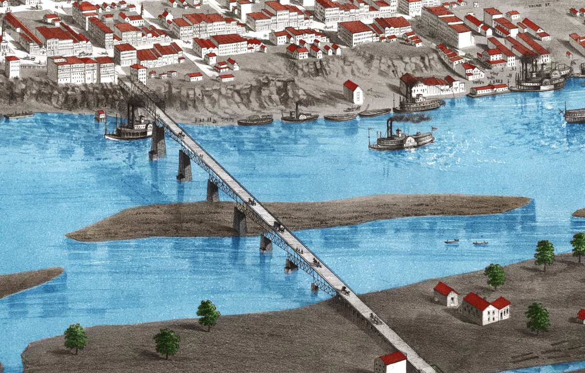
Beautifully restored map of Topeka, Kansas from 1869
Historic bird's eye view of Topeka, Kansas from 1869
 Minnesota
Detailed map of Saint Paul, Minnesota from 1867
Historic old map of Saint Paul, Minnesota from 1867
 Wisconsin
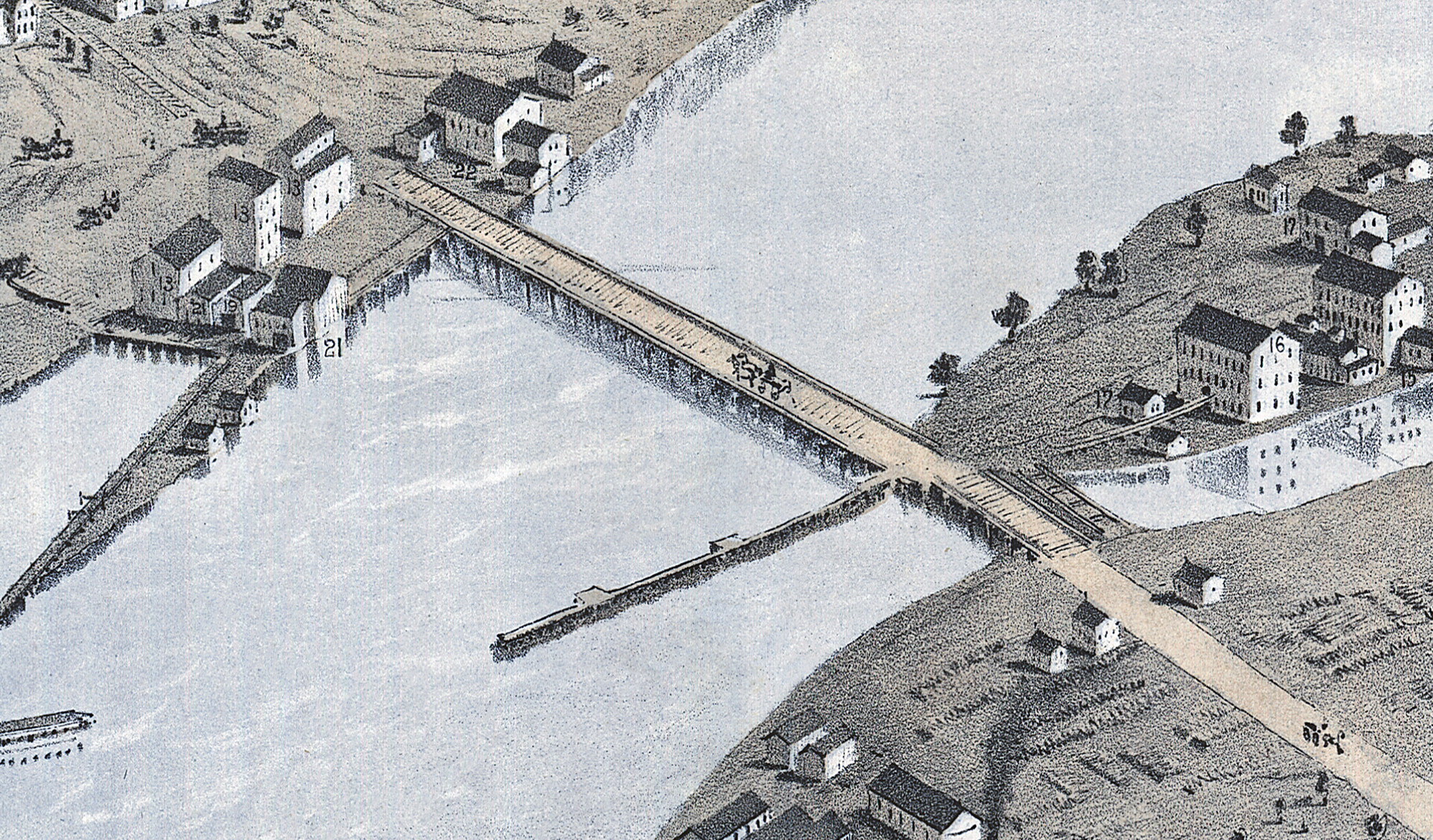
Historic old map of Appleton, Wisconsin from 1867
Historic bird's eye view of Appleton, Wisconsin from 1867
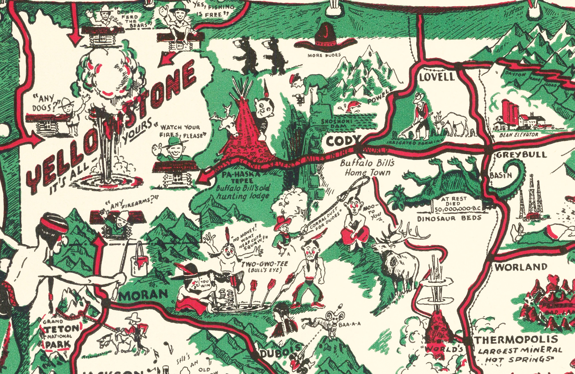 Wyoming
Whimsical Paint-Brush Map of Wyoming from 1938
Historic Wyoming landmarks on the map include Kaycee, Gillette, Big Horn Mountains, Dinosaur Beds, Cody, Jackson, Yellowstone, and more.
 Georgia
Vintage Map of Atlanta, Georgia from 1871
Vintage bird's eye view map of Atlanta, Georgia from 1871
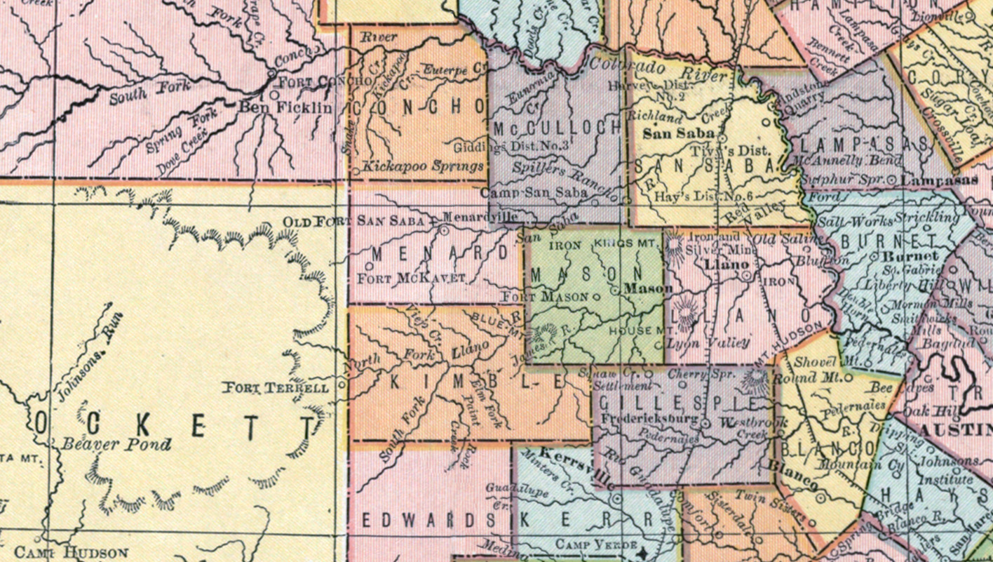 Texas
Texas
Beautifully detailed map of Texas Railroads from 1876
Compiled from Actual Surveys, and containing all changes in Lines of Counties up to Sept. 1st, 1876.
 Wisconsin
Historic old map of Green Bay, Wisconsin from 1867
Historic bird's eye view of Green Bay, Wisconsin from 1867
 Michigan
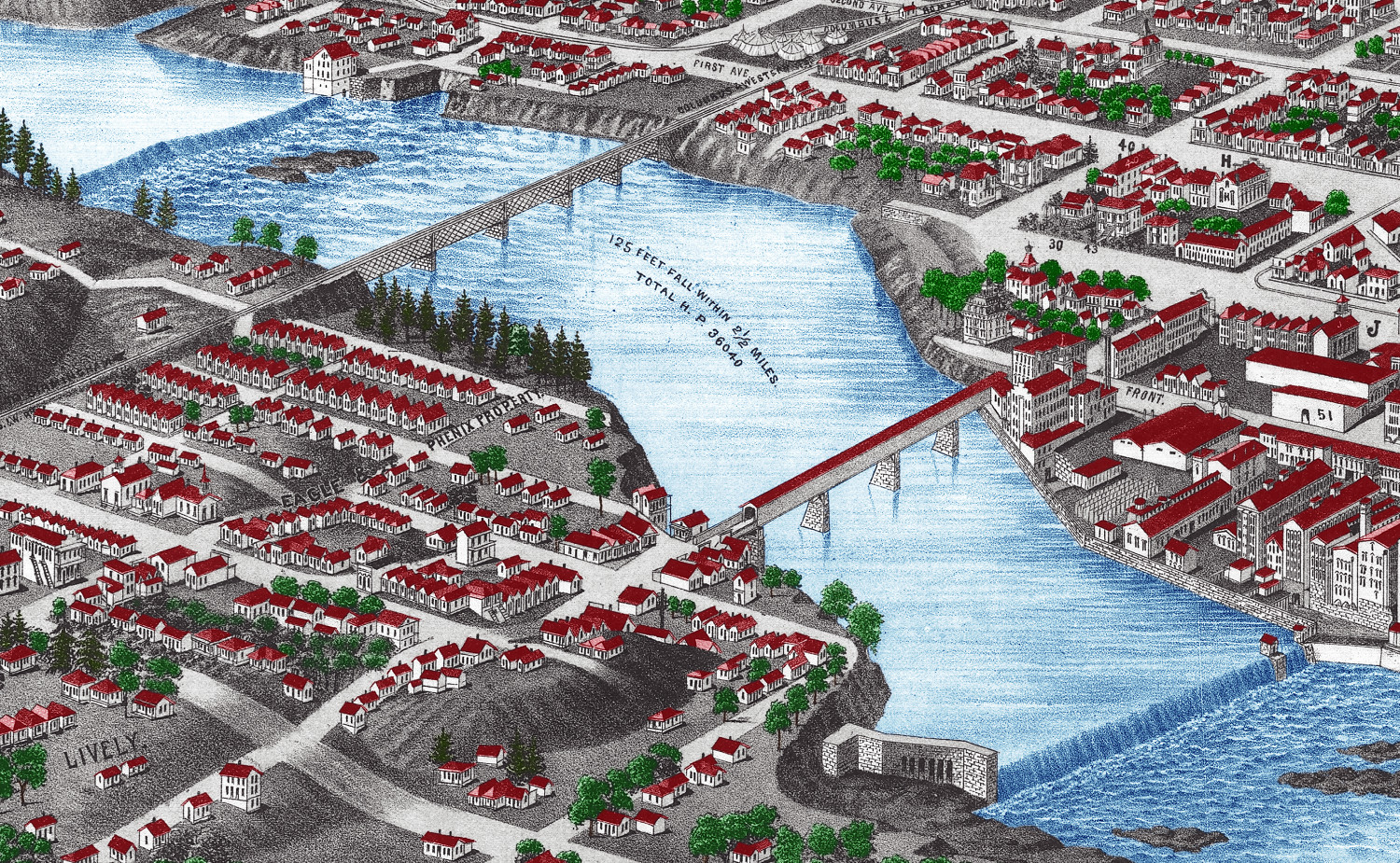
Colorized and Restored Map of Ann Arbor, Michigan from 1880
Historic bird's eye view of Ann Arbor, Michigan from 1880
 Montana
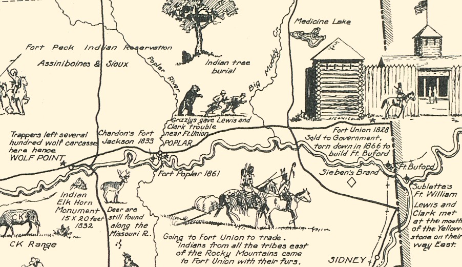
Map of Frontier Montana, a one page history dedicated to the Old Timers
Historic map of Frontier & Pioneer Montana from 1936
 Virginia
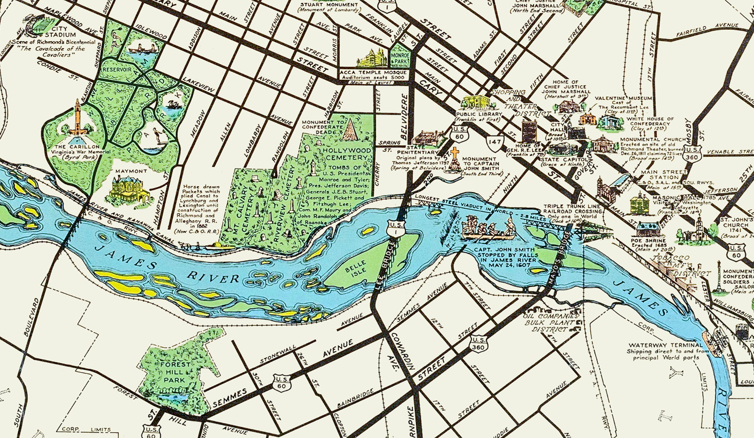
Beautifully Illustrated Pictorial Map of Richmond, VA from 1937
[et_pb_section fb_built="1" _builder_version="3.22"][et_pb_row _builder_version="3.25" background_size="initial" background_position="top_left" background_repeat="repeat"][et_pb_column type="4_4" _builder_version="3.0.47" custom_padding="|||" custom_padding__hover="|||"][et_pb_text _builder_version="3.27.4" z_index_tablet="500" text_text_shadow_horizontal_length_tablet="0px" text_text_shadow_vertical_length_tablet="0px" text_text_shadow_blur_strength_tablet="1px" link_text_shadow_horizontal_length_tablet="0px" link_text_shadow_vertical_length_tablet="0px" link_text_shadow_blur_strength_tablet="1px" ul_text_shadow_horizontal_length_tablet="0px" ul_text_shadow_vertical_length_tablet="0px" ul_text_shadow_blur_strength_tablet="1px" ol_text_shadow_horizontal_length_tablet="0px" ol_text_shadow_vertical_length_tablet="0px"…