Stunning old map of New Bedford, MA from 1876
Bird’s eye view of New Bedford, MA in 1876
Read More
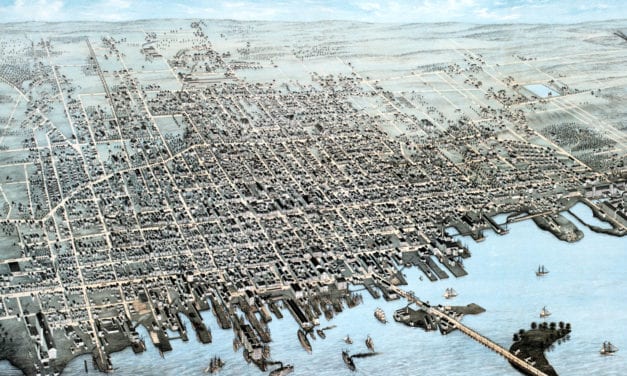
Bird’s eye view of New Bedford, MA in 1876
Read More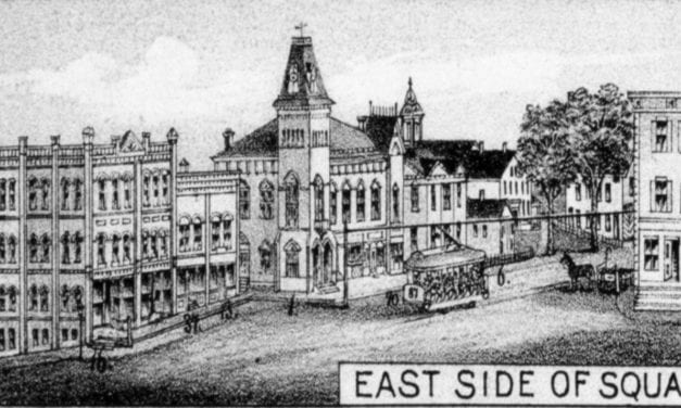
Historic bird’s eye view of Merrimac, Massachusetts in 1889
Read More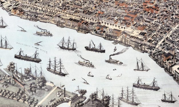
Historic bird’s eye view of Savannah, Georgia in 1891
Read More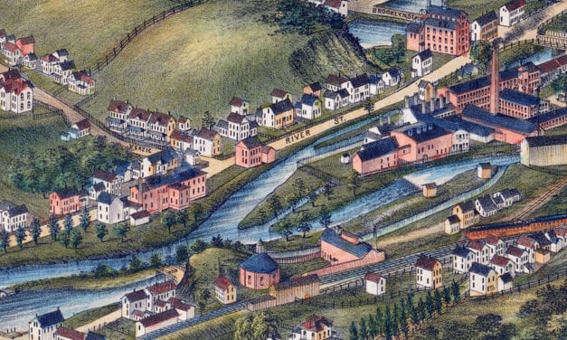
Historic bird’s eye view of North Adams, Massachusetts from 1881
Read More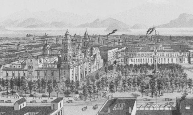
Historic bird’s eye view of Mexico City, Mexico in 1890
Read More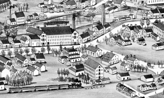
Historic bird’s eye view of Washington, Rhode Island from 1888
Read More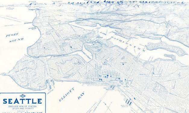
Historic bird’s eye view of Seattle in the early 20th century
Read More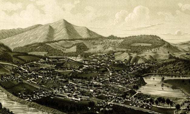
Bird’s eye view of Windsor, Vermont in 1886
Read More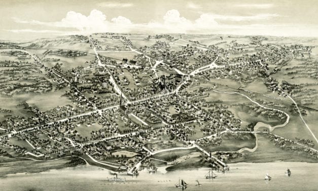
Historic bird’s eye view of Stratford, Connecticut from 1882
Read More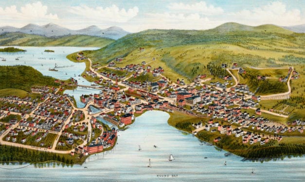
Bird’s eye view of Lake Village, NH in 1883. The town is now known as Lakeport, in Laconia New Hampshire.
Read More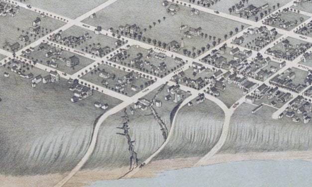
Historic bird’s eye view of Bastrop, Texas in 1887
Read More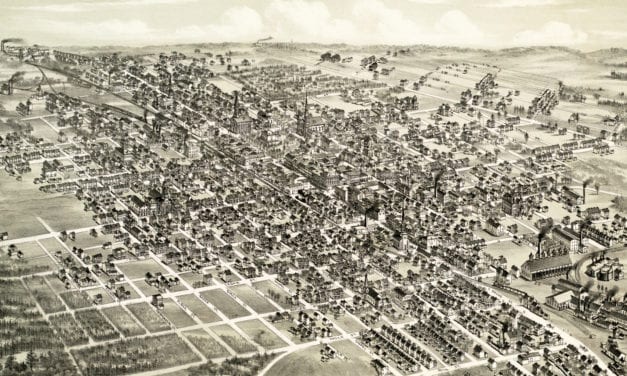
Historic bird’s eye view of Hazleton, Pennsylvania from 1886
Read More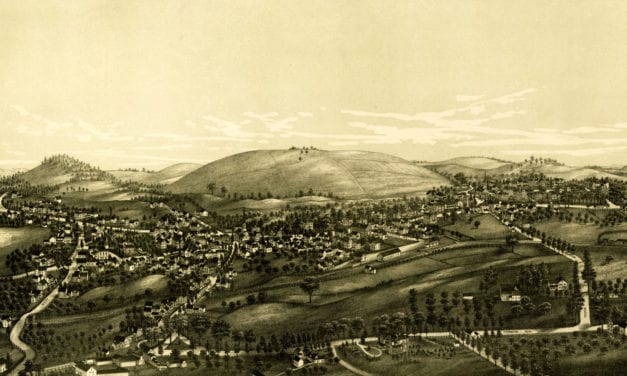
Bird’s eye view of Groton, Massachusetts in 1886
Read More
Historic bird’s eye view of Nazareth, Pennsylvania from 1885
Read More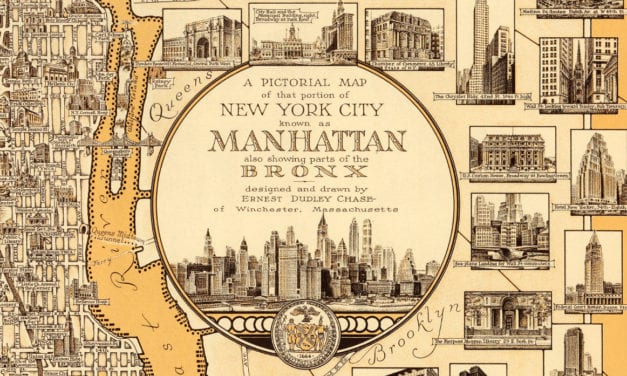
Love NYC? Then you’ll love this old map of Manhattan
Read More
Historic bird’s eye view of Housatonic, Massachusetts from 1890
Read More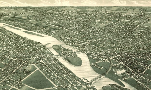
Bird’s eye view of Aurora, IL in 1882
Read More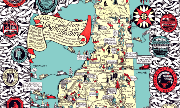
Granite State legend, history, and anecdotes, mixing past and present with skill and humor.
Read More
Bird’s eye view of Cuero, TX in 1881
Read More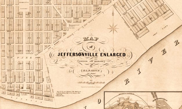
The historic map of Jeffersonville, Indiana was created in 1837 by H.L. Barnum, a civil engineer. Landmarks on the map include the Jeffersonville Ship Yard, Commercial Square, Washington Square, Jefferson Square, Franklin Square, Market Square, and more.
Read More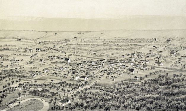
Restoration of an old map of Alvord, TX from 1890
Read More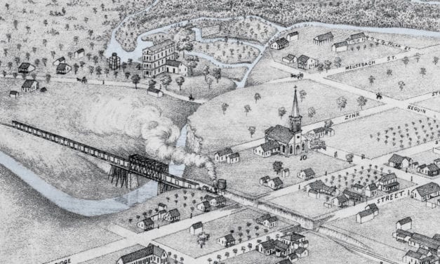
Historic bird’s eye view of New Braunfels, Texas in 1881
Read More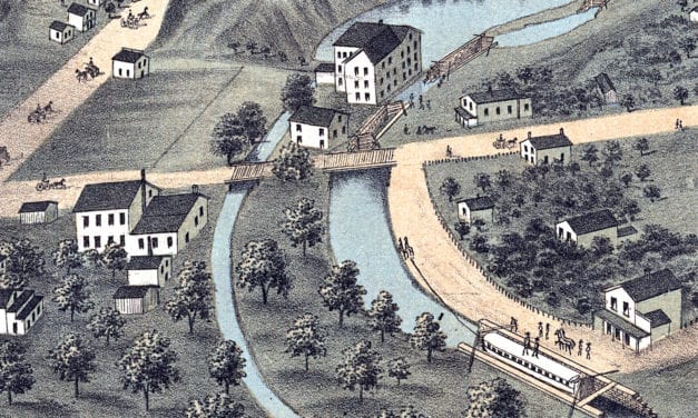
This historic map of Akron, Ohio was created in 1870 by Albert Ruger, a prominent 19th century map...
Read More
Historic bird’s eye view of Clarksville, Tennessee from 1870
Read More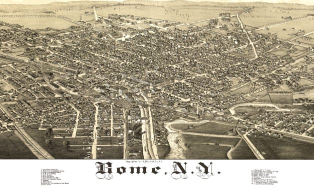
This map shows Rome, New York as it looked in 1886
Read More
Historic bird’s eye view of North Billerica, Massachusetts from 1887
Read More
This map shows Boston and surrounding cities in 1905
Read More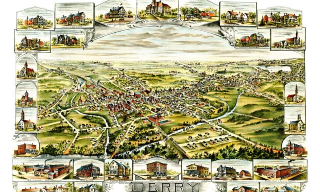
This old map shows Derry, New Hampshire in the late 19th century.
Read More
Historic map showing Abraham Lincoln’s route through Massachusetts in 1848
Read More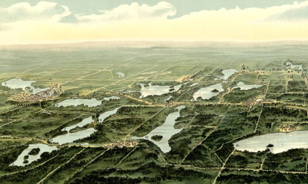
This map from 1890 shows Oconomowoc, Waukesha and Waukesha County, Wisconsin.
Read More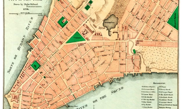
This old map shows New York City in the late 18th century.
Read More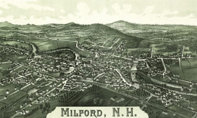
This map shows Milford, New Hampshire as it looked in 1886.
Read More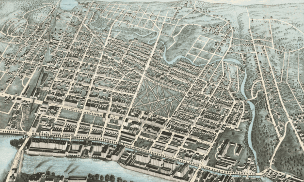
Detailed bird’s eye view of Lawrence, Massachusetts from 1876
Read More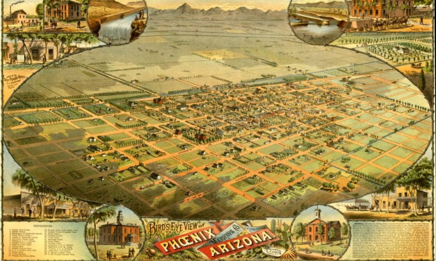
This vintage map shows Phoenix, Arizona as it looked in 1885.
Read More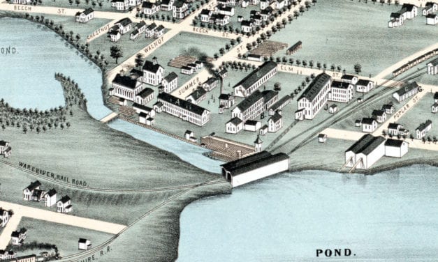
Historic bird’s eye view of Winchendon, Massachusetts from 1878
Read More
Historic bird’s eye view of Providence, Rhode Island in 1894
Read More
Historic bird’s eye view of Monticello, Florida from 1885
Read More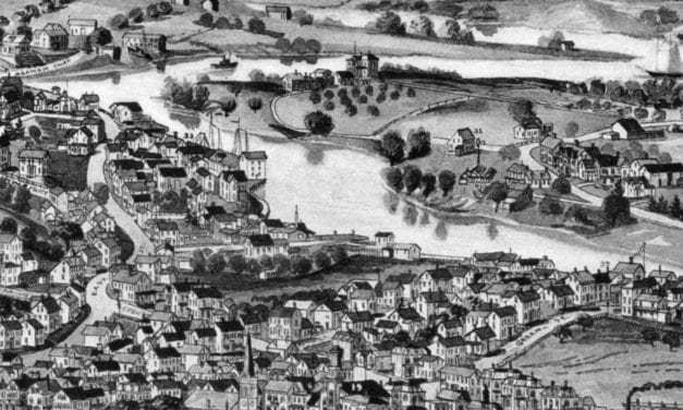
Historic bird’s eye view of Ipswich, Massachusetts from 1893
Read More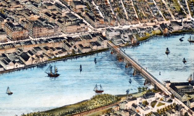
Historic bird’s eye view of Haverhill, Massachusetts from 1893
Read More
Historic bird’s eye view of Milford, MA from 1888
Read More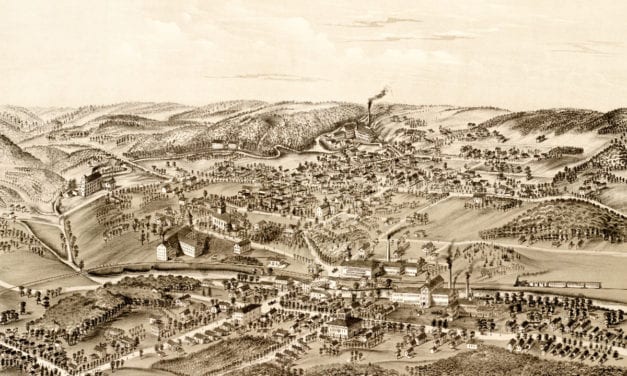
This old map shows the Forestville section of what is now known as Bristol, Connecticut.
Read More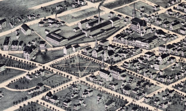
Historic bird’s eye view of Clinton, Massachusetts from 1876
Read More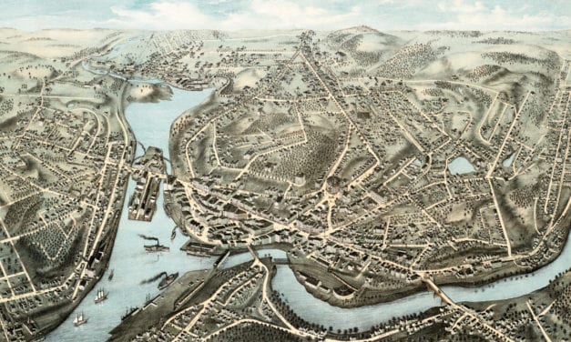
This old map shows Norwich, Connecticut as it looked in 1876.
Read More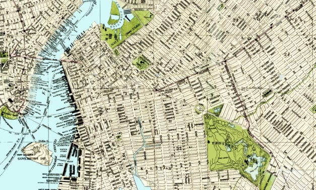
In 1883, Brooklynite S.D.L. Taunton created this beautifully detailed map of his hometown in New...
Read More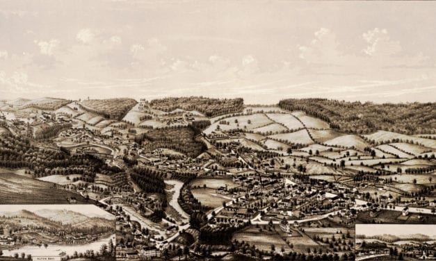
This vintage map shows Alton, New Hampshire as it looked in 1888.
Read More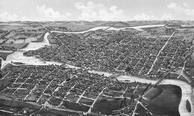
Historic bird’s eye view of Watertown, Wisconsin from 1885
Read More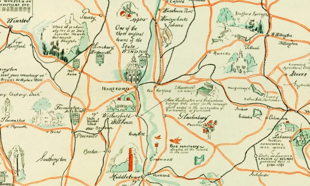
Beautiful old map of the Nutmeg State illustrated with unique vintage drawings.
Read More
Historic bird’s eye view of Corpus Christi, Texas in 1887
Read More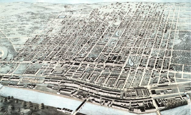
This map shows Manchester, New Hampshire as it looked in 1876. It was created by J.C. Hazen, and...
Read More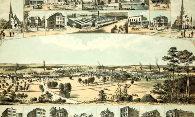
This old map shows Willimantic, Connecticut in the late 19th century.
Read More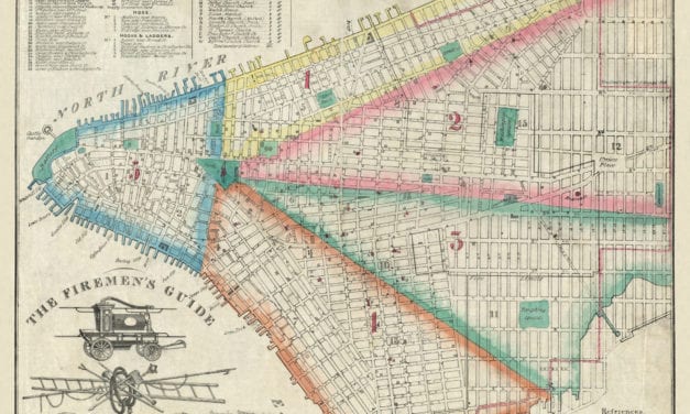
This map was created for the New York City Fire Department in 1834. Officially known as “The...
Read More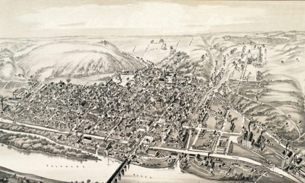
This old map shows Lambertville, New Jersey in the late 19th century.
Read More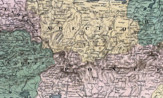
Mapa Topografico De La Isla De Puerto Rico
Read More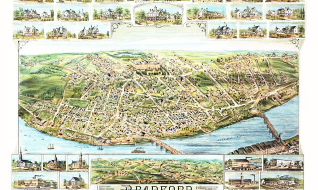
This map shows Bradford, Massachusetts in 1892, five years before it was annexed to the city of Haverhill.
Read More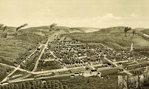
This old map shows Ironwood, Michigan in the late 19th century.
Read More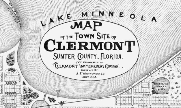
This historic map of Clermont, Florida was issued by the Clermont Improvement Company in 1884, the...
Read More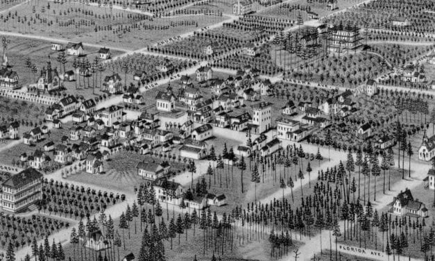
Historic bird’s eye view of DeLand, Florida from 1884
Read More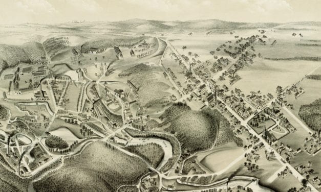
This old map shows Hazardville, Connecticut in the late 19th century.
Read More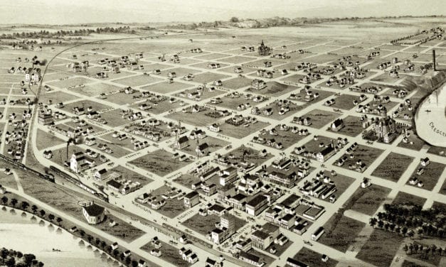
This old map shows Wichita Falls, Texas in the late 19th century.
Read More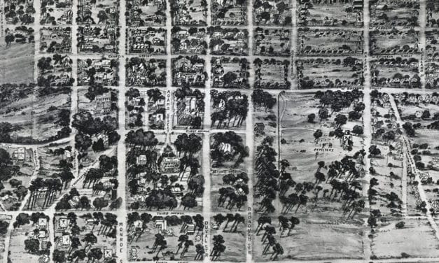
Historic bird’s eye view of Tallahassee, Florida from 1926
Read More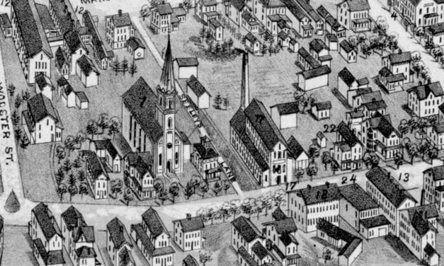
Historic bird’s eye view of Bethel, Connecticut in 1879
Read More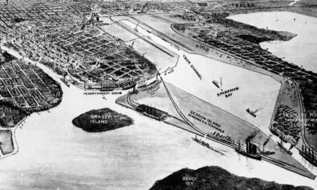
Historic bird’s eye view of Tampa, Florida from 1912
Read More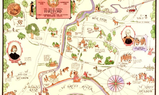
This vintage map of Hartford, CT shows the city as it looked in the 1600’s.
Read More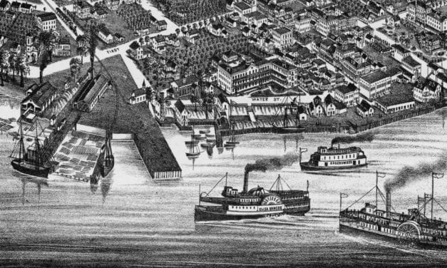
Historic bird’s eye view of Palatka, Florida from 1884
Read More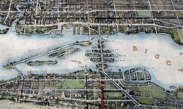
Historic bird’s eye view of Miami, Florida from 1934
Read More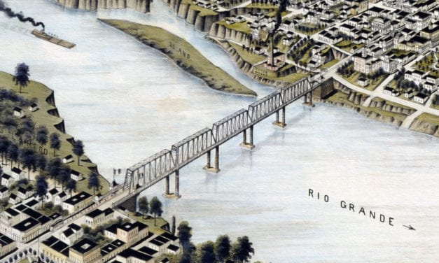
Historic bird’s eye view of Laredo, Texas in 1892
Read More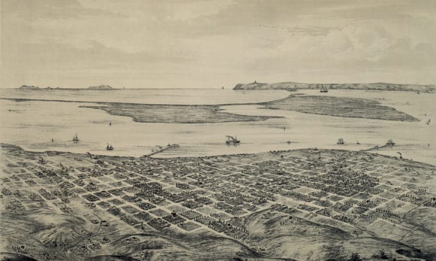
This old map shows San Diego, California in the late 19th century.
Read More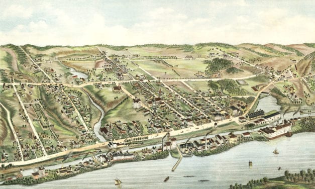
This map shows Windsor Locks, Connecticut as it looked in 1877
Read More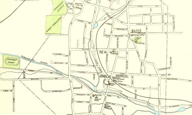
Click here to see what Bristol looked like more than 100 years ago!
Read More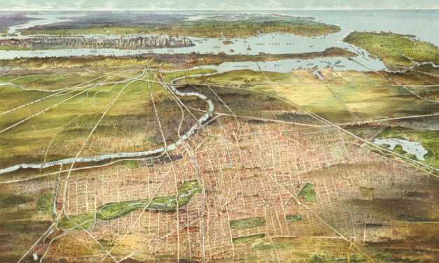
This amazing old map shows Newark, New Jersey as it looked in 1916.
Read More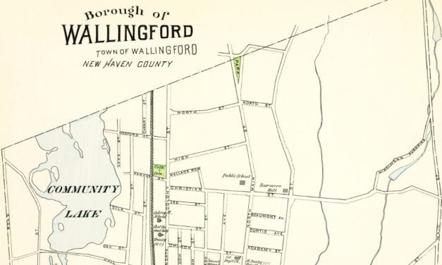
This old map of Wallingford, CT is a hand colored lithograph from 1893. The map was created by...
Read More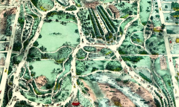
Beautifully designed map of Central Park from the 1800’s
Read More
This old map shows Ossining, New York in the late 19th century.
Read More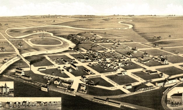
This old map shows Redfield, South Dakota in the late 19th century.
Read More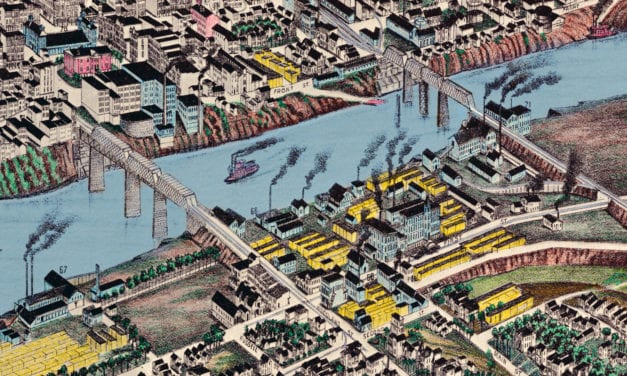
Historic bird’s eye view of Nashville, Tennessee from 1888
Read More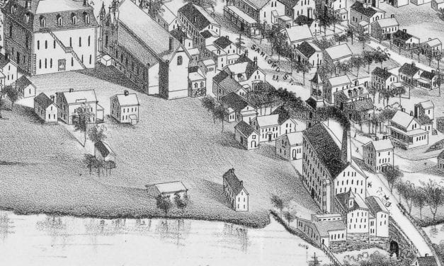
Bird’s eye view of Medway, Massachusetts from 1887
Read More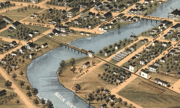
Bird’s eye view of Fort Atkinson, Wisconsin from 1870
Read More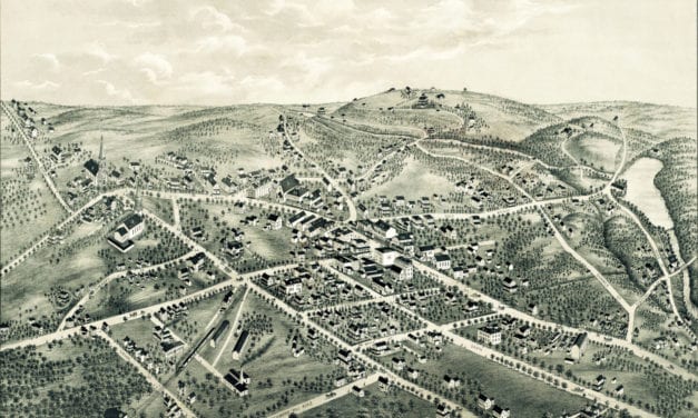
This old map shows New Canaan, Connecticut in the late 19th century.
Read More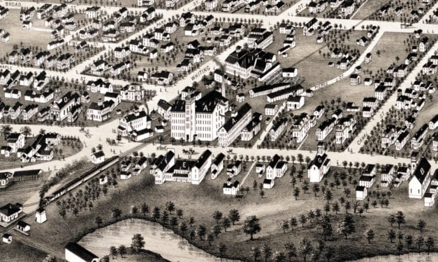
Historic bird’s eye view of Plainville, Connecticut in 1878
Read More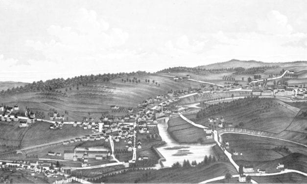
This map shows Moosup, Connecticut as it looked in 1889.
Read More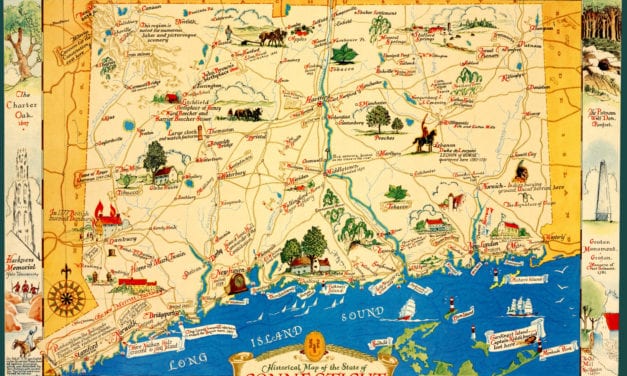
This old map features historical Connecticut trivia from the 17th – 20th century.
Read More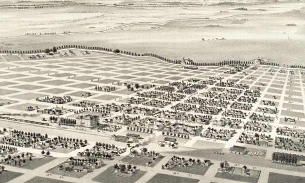
This old map shows Merced, California in the late 19th century.
Read More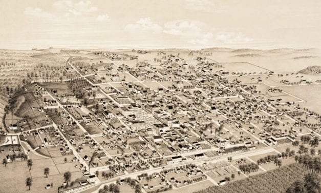
This old map shows Honey Grove, TX in the late 19th century.
Read More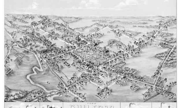
This map of Guilford, CT shows the town as it looked in 1881.
Read More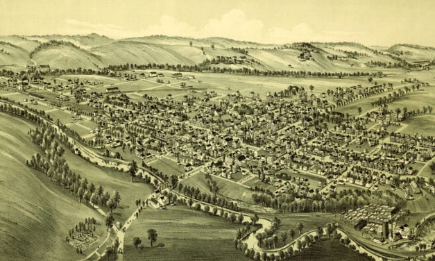
Historical map showing Ligonier, Pennsylvania at the beginning of the 20th century.
Read More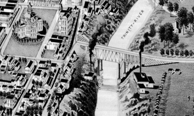
Historic bird’s eye view of Fort Worth, Texas from 1891
Read More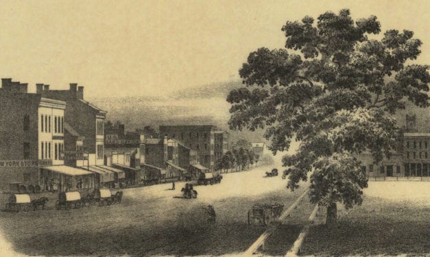
It has a high, beautiful and very healthy location upon the Iowa River, which is a bold deep stream of clear water, navigable with Steamboats during several months of each year, and commands the growing trade of a large scope of exceedingly fertile country, well timbered and watered.
Read More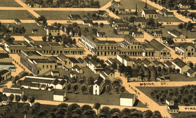
Bird’s eye view of Jacksonville, Oregon in 1883
Read More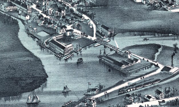
Historic bird’s eye view of Hackensack, New Jersey in 1896
Read More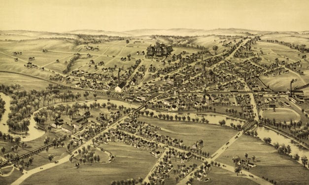
This old map shows Cambridgeboro, Pennsylvania in the late 19th century.
Read More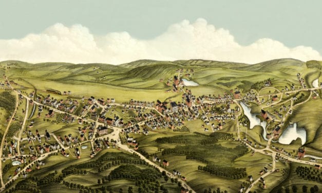
This old map shows Monson, Massachusetts in the late 19th century.
Read More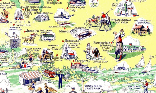
This map of Long Island was originally published in 1938
Read More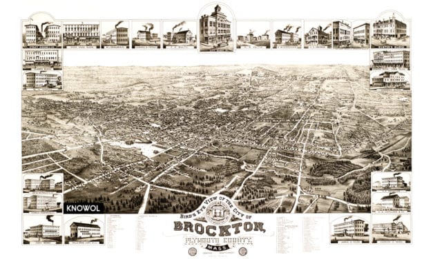
This map shows Brockton, Massachusetts in 1882
Read More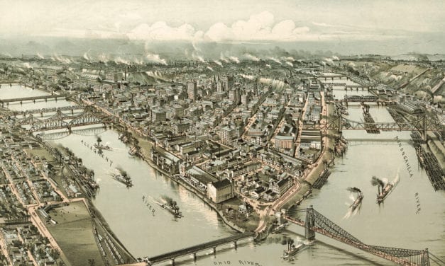
This old map shows Pittsburgh, Pennsylvania in the late 19th century.
Read More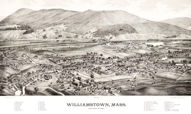
Click here to see Williamstown, MA in 1889
Read More
This old map shows Waco, Texas in the late 19th century.
Read More
Historic bird’s eye view of Northborough, Massachusetts from 1887
Read More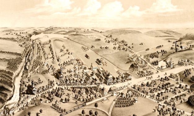
This map shows Manchester, Connecticut as it looked in 1880, including the NY and New England Railroad Station
Read More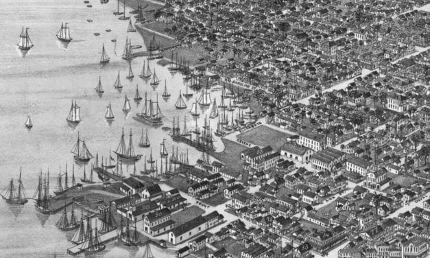
Historic bird’s eye view of Key West, Florida in 1884
Read More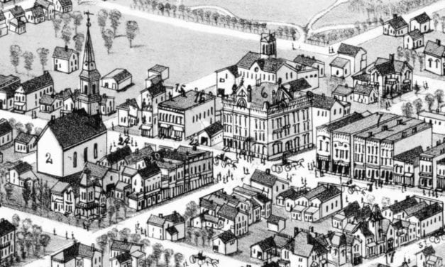
Historic bird’s eye view of Alma, Michigan in 1885
Read More


