Beautifully restored map of Norfolk & Portsmouth, Virginia from 1873
Click here to see what Portsmouth and Norfolk looked like in the 19th century.
Read More
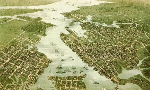
Click here to see what Portsmouth and Norfolk looked like in the 19th century.
Read More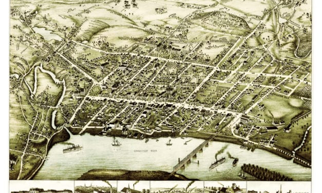
This beautiful vintage map shows Middletown, Connecticut as it looked in 1877. At the time...
Read More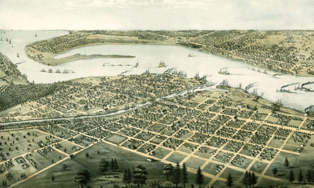
Detailed bird’s eye view of Port Huron, Michigan from 1867
Read More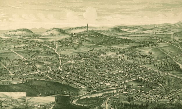
Click here to see what Bennington, Vermont looked like 130+ years ago
Read More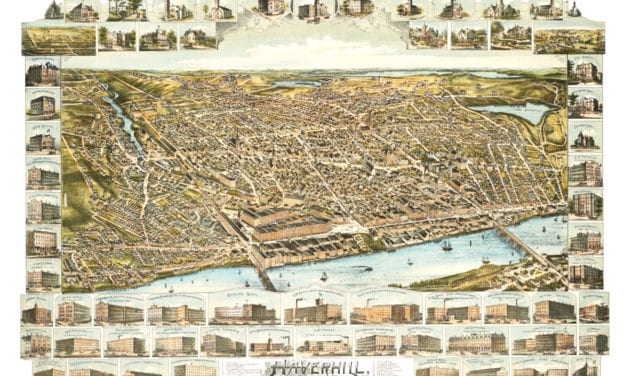
This is what Haverhill looked like when only 30,000 people lived here
Read More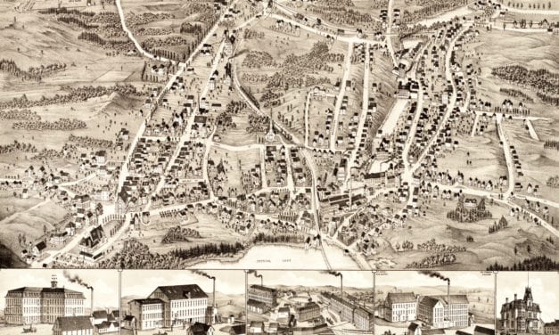
This map of Gardner, Massachusetts was created in 1880 by Beck & Paul Lithographers and the...
Read More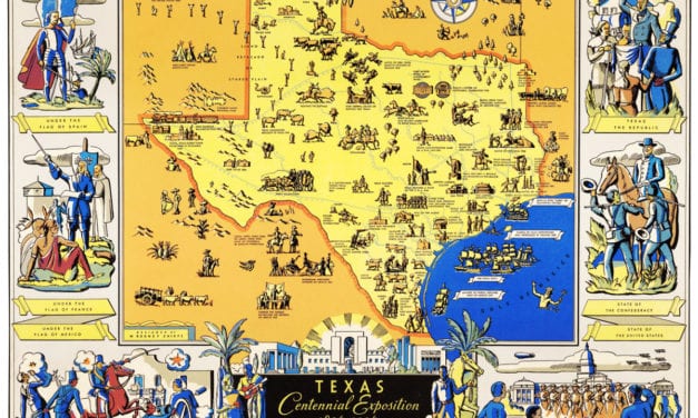
The Centennial Exposition celebrated the 100th anniversary of Texas’s independence from Mexico in 1836.
Read More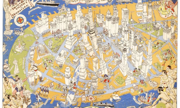
Amazing stories and images from the early years of Manhattan!
Read More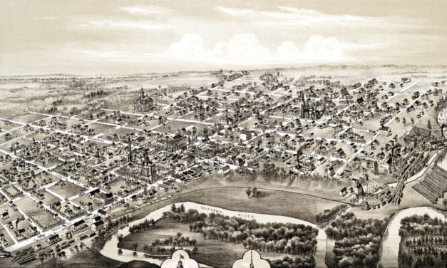
This historic old map of Mount Pleasant, Michigan was created in 1884 by O.H. Bailey, a prominent...
Read More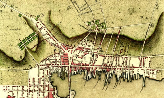
Click here to see Newport, Rhode Island in 1777
Read More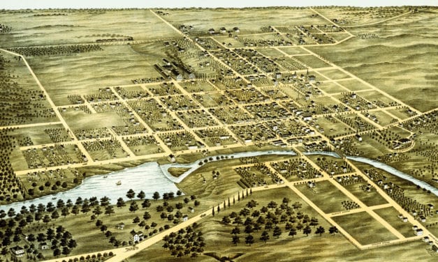
Detailed bird’s eye view of Naperville, Illinois in 1869
Read More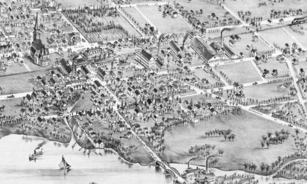
Historic bird’s eye view of Wallingford, Connecticut
Read More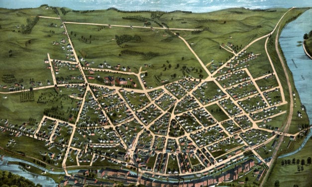
Historic bird’s eye view of Chicopee, Massachusetts in 1878
Read More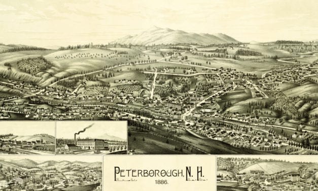
Click here to see what Peterborough looked like 100+ years ago!
Read More
Historic bird’s eye view of Webster, Massachusetts
Read More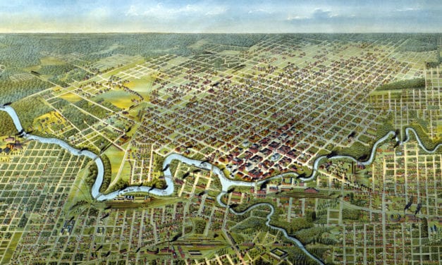
Historic bird’s eye view of Houston, Texas from 1891
Read More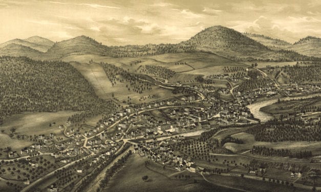
Detailed bird’s eye view of Hinsdale, New Hampshire in 1886
Read More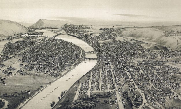
Detailed bird’s eye view of Pittston, Pennsylvania in 1892
Read More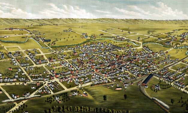
Detailed bird’s eye view of Somerville, New Jersey in 1882
Read More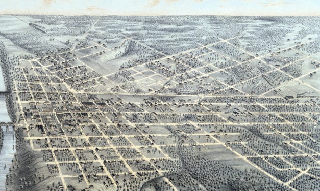
Historic bird’s eye view of Dallas, Texas as it used to be
Read More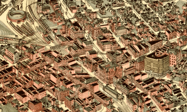
Historic bird’s eye view of Atlanta, Georgia in 1892
Read More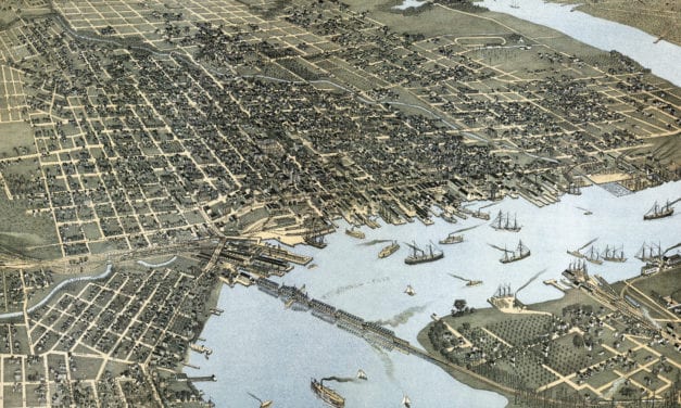
This old map shows a bird’s eye view of Jacksonville, Florida in 1893.
Read More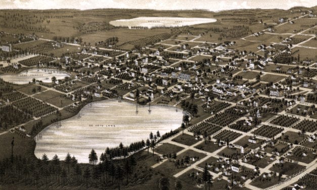
Detailed bird’s eye view of Lake City, Florida in 1885.
Read More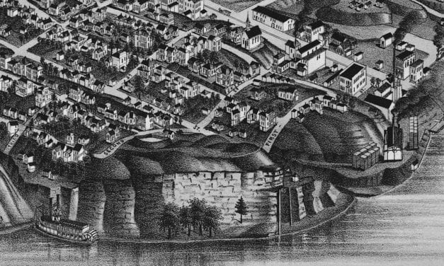
Historic bird’s eye view of Chattanooga, Tennessee from 1886
Read More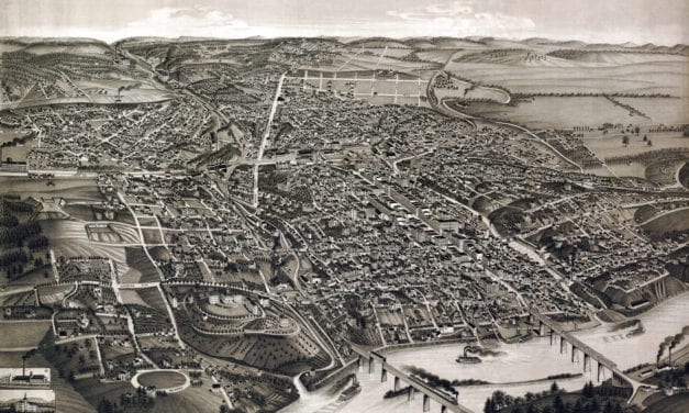
Detailed bird’s eye view of Knoxville, Tennessee in 1886
Read More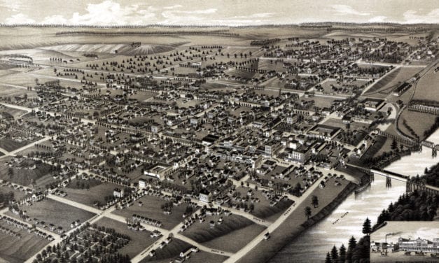
Historic bird’s eye view of Albany, Georgia in the late 19th century
Read More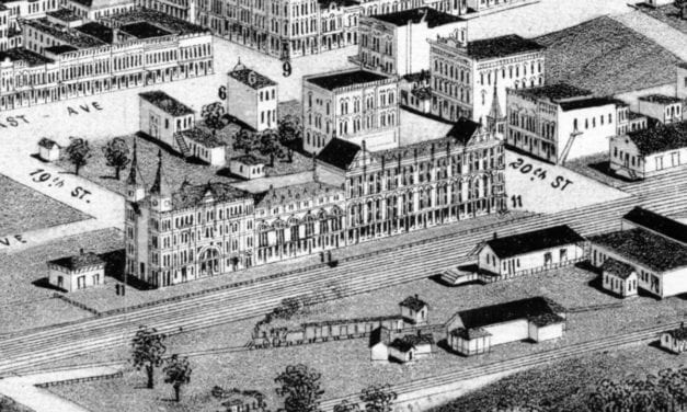
Historic bird’s eye view of Birmingham, Alabama in 1885
Read More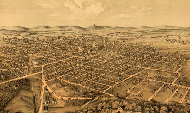
Detailed bird’s eye view of Kalamazoo, Michigan as it used to be.
Read More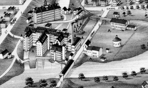
Historic old map of Blackstone, Massachusetts from 1879
Read More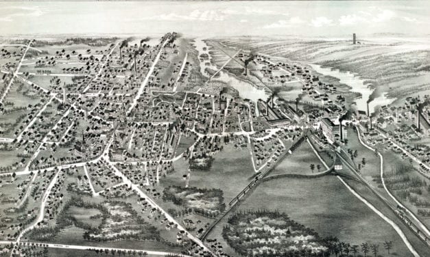
Historic old map of Whitman, Massachusetts from 1889
Read More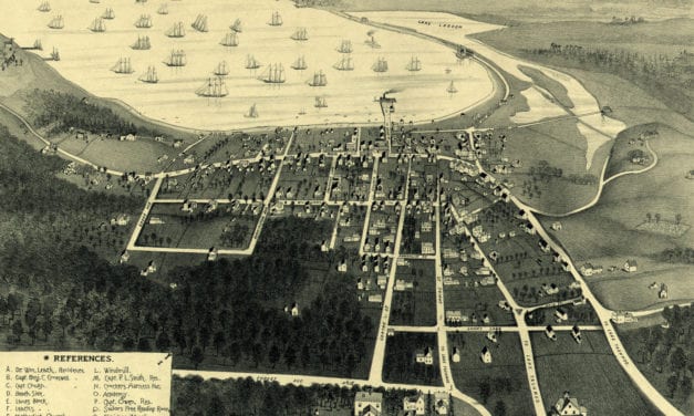
Detailed bird’s eye view of Vineyard Haven, MA in 1893
Read More
Detailed bird’s eye view of Westport, Connecticut in 1878
Read More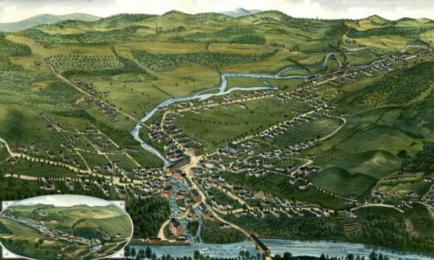
Detailed bird’s eye view of Bristol, New Hampshire in 1884
Read More
Detailed bird’s eye view of Denver, Colorado in 1882
Read More
Historic bird’s eye view of Stamford, Connecticut in 1875
Read More
Detailed bird’s eye view of Stoneham, Massachusetts in 1878
Read More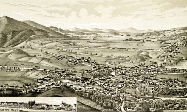
Detailed bird’s eye view of Colebrook, New Hampshire in 1887
Read More
Detailed bird’s eye view of Charlton, Massachusetts in 1887
Read More
Detailed bird’s eye view of Orange, Massachusetts in 1883
Read More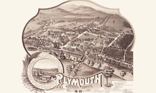
Historic bird’s eye view of Plymouth, New Hampshire from 1883
Read More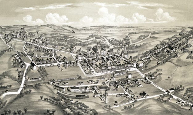
Detailed bird’s eye view of East Stroudsburg, Pennsylvania from 1884
Read More
Detailed bird’s eye view of Blairstown, NJ from 1883
Read More
Detailed bird’s eye view of Coleman, Michigan in the late 19th century
Read More
Detailed bird’s eye view of Clare, Michigan in 1884
Read More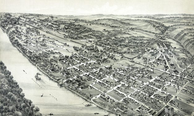
Detailed bird’s eye view of New Kensington, PA in 1896
Read More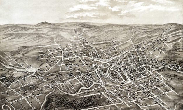
Historic bird’s eye view of Hyde Park, Massachusetts in 1879
Read More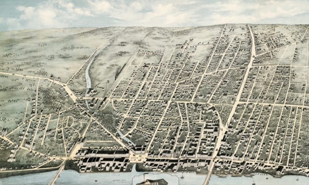
Historic old map shows a bird’s eye view of Haverhill, Massachusetts in 1876
Read More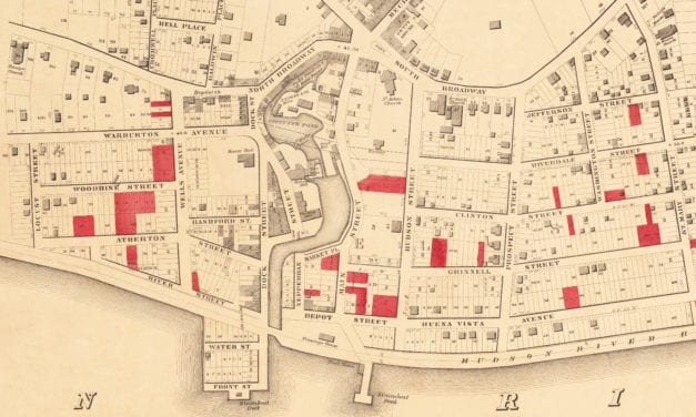
Historic map of Yonkers from 1859
Read More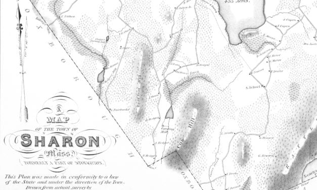
Detailed map of Sharon, MA from 1831
Read More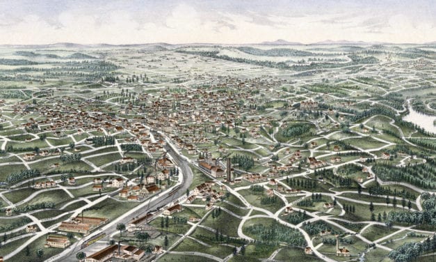
Detailed bird’s eye view of Tallapoosa, Georgia from 1892
Read More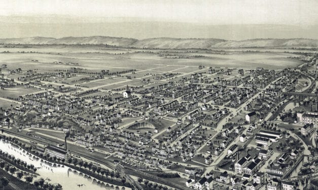
Detailed bird’s eye view of West Bethlehem, PA in 1894
Read More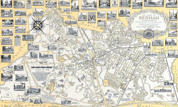
This beautifully detailed map of Dedham, Massachusetts features historical facts and trivia from around the state. It was created by renowned illustrator Ernest Dudley Chase in 1954.
Read More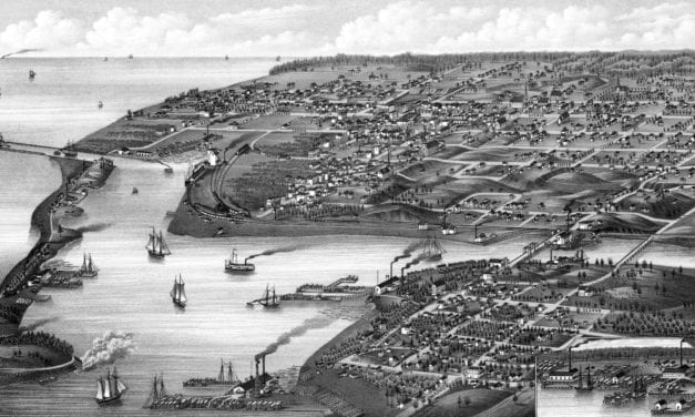
Detailed bird’s eye view of Ludington, Michigan in 1880
Read More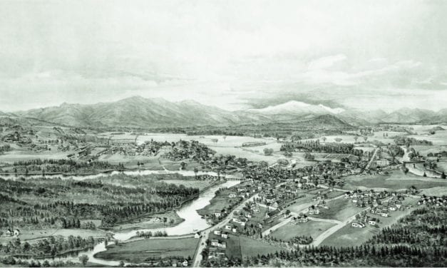
Detailed bird’s eye view of Conway, New Hampshire in 1896
Read More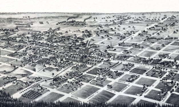
Detailed bird’s eye view of Quitman, Georgia in 1885
Read More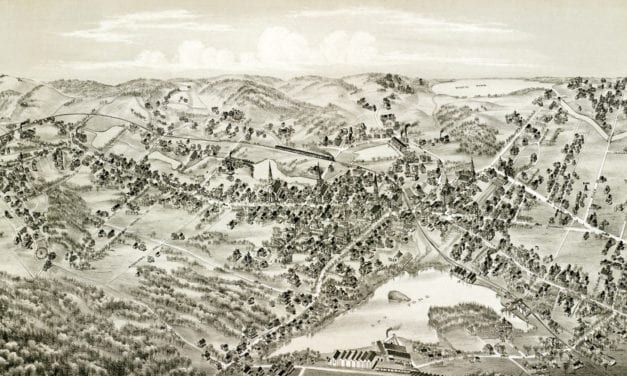
Bird’s eye view of Arlington, MA in 1884
Read More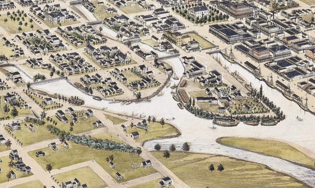
Historic bird’s eye view of Stockton, California from 1870
Read More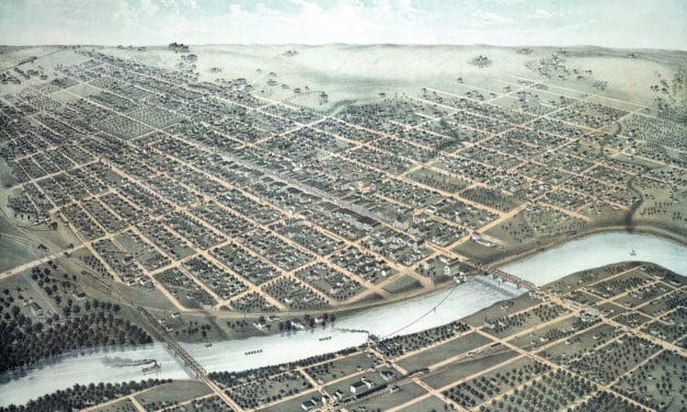
Vintage bird’s eye view of Lawrence, Kansas in 1880
Read More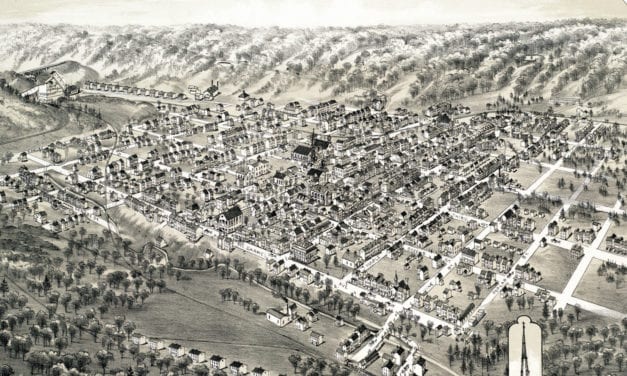
Historic old map of Mount Carmel, Pennsylvania from 1884
Read More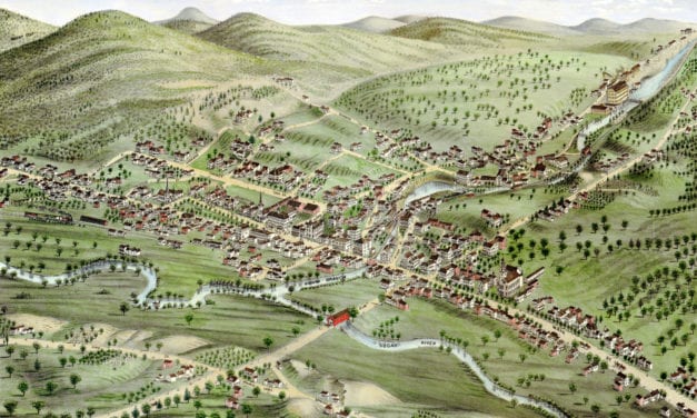
Historic old map of Newport, New Hampshire from 1877
Read More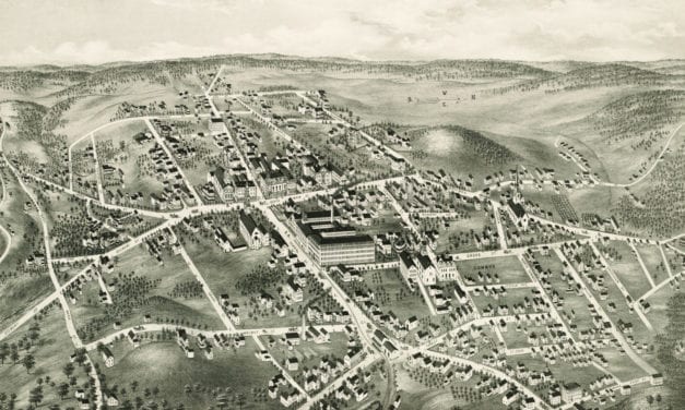
Historic bird’s eye view of North Brookfield, Massachusetts in the late 19th century.
Read More
Historic bird’s eye view of Fort Worth, Texas from 1876
Read More
Historic bird’s eye view of Plano, Texas from 1891
Read More
Bird’s Eye View of California, Pennsylvania in 1902
Read More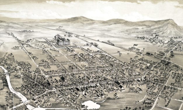
Bird’s eye view of Hackettstown, New Jersey in the late 19th century.
Read More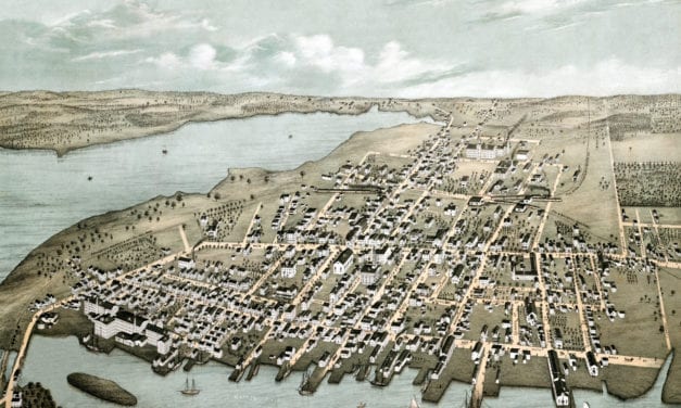
This map of Warren, Rhode Island was created in 1877 by O.H. Bailey and J.C. Hazen, prominent 19th...
Read More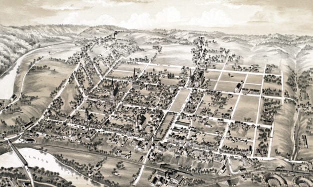
Bird’s eye view of Lehighton, PA in the late 19th century
Read More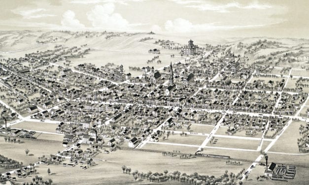
Bird’s eye view of Mifflinburg, PA in the late 19th century.
Read More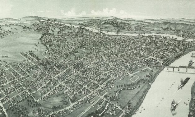
Parkersburg, West Virginia in the late 19th century.
Read More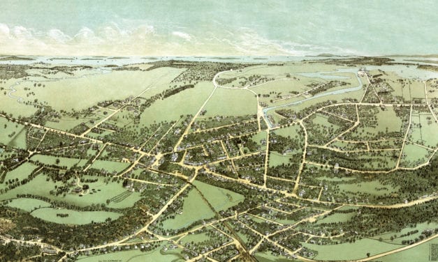
Historic bird’s eye view of Quincy, Massachusetts
Read More
Bird’s eye view of Canastota, NY in 1885
Read More
This map shows Ashland, New Hampshire as it looked in 1883.
Read More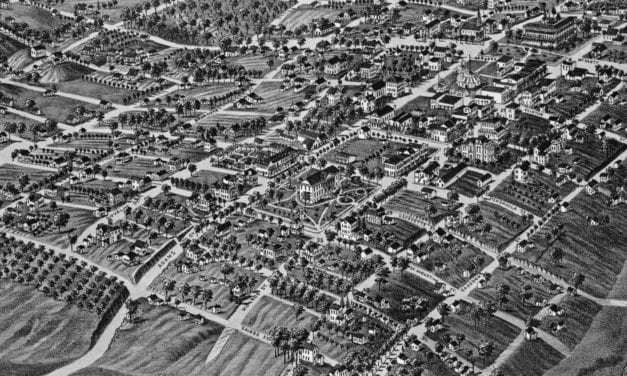
Click here to see what Tallahassee, FL looked like in the late 19th century.
Read More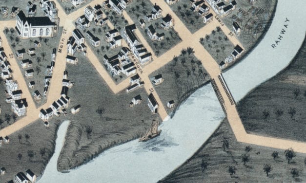
Historic bird’s eye view of Rahway, New Jersey in 1874
Read More
Historic bird’s eye view of Newburyport, Massachusetts from 1894
Read More
Historic bird’s eye view of Texarkana, Texas & Arkansas in 1888
Read More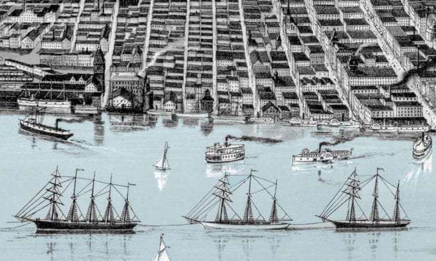
Historic bird’s eye view of Detroit, Michigan in 1889
Read More
Historic bird’s eye view of Ottawa, Illinois in 1875
Read More
Historic bird’s eye view of North Berwick, Maine from 1877
Read More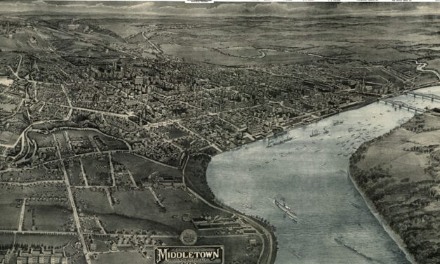
This old map shows Middletown, Connectiicut in the early 20th century.
Read More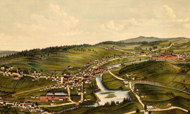
This old map shows Moosup, Connecticut in the late 19th century.
Read More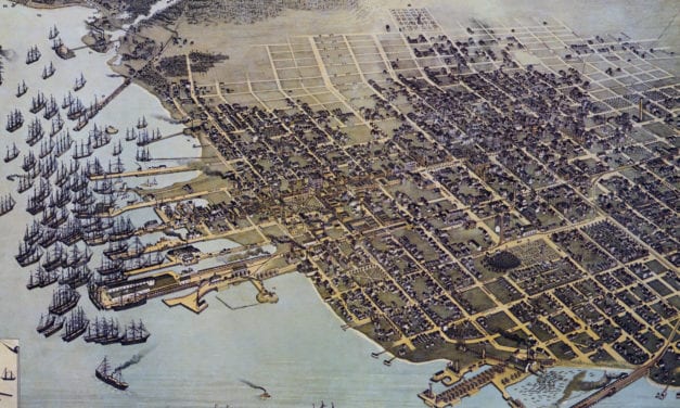
Historic bird’s eye view of Pensacola, Florida from 1896
Read More
Historic bird’s eye view of Longwood, Florida from 1885
Read More
Historic bird’s eye view of Orlando, Florida in 1884
Read More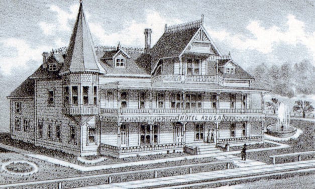
This old map shows Azusa, California in the late 19th century.
Read More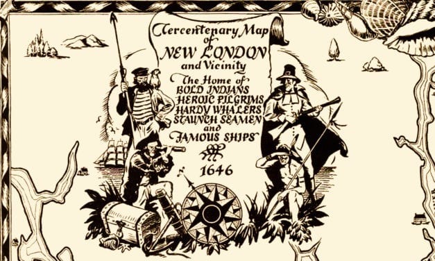
This historical map was created to celebrate New London’s 300th anniversary in 1946.
Read More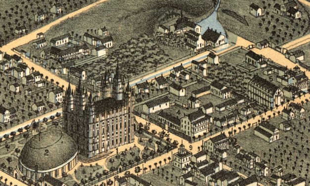
Historic bird’s eye view of Salt Lake City in 1870
Read More
Bird’s eye view of Santa Fe, New Mexico in 1882
Read More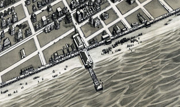
Historic bird’s eye view of Ocean City, New Jersey in 1903
Read More
This old map shows Higganum, Connecticut in the late 19th century.
Read More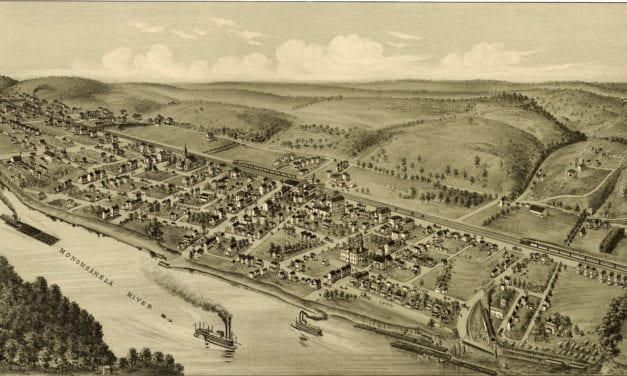
This old map shows Roscoe, Pennsylvania in the early 20th century.
Read More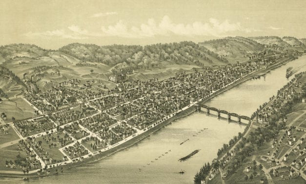
This old map shows Kittanning, Pennsylvania in the late 19th century.
Read More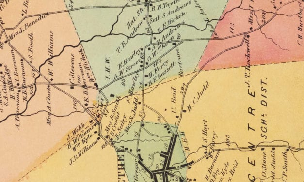
Vintage landowners map of Bethel, Connecticut as it used to be
Read More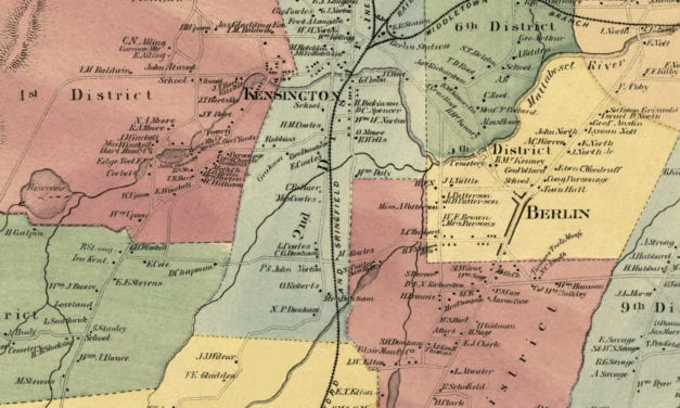
Vintage landowners map shows Berlin, Connecticut as it used to be
Read More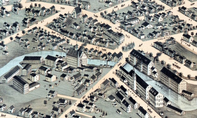
Rare bird’s eye view of Ware, MA in the late 19th century.
Read More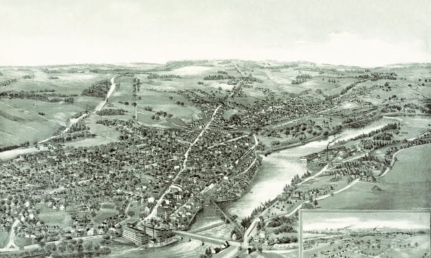
Bird’s eye view of Waterville, ME in the late 19th century
Read More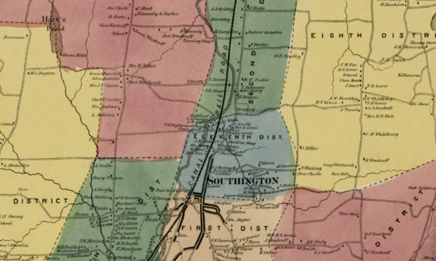
Vintage landowners map of Southington, Connecticut as it used to be
Read More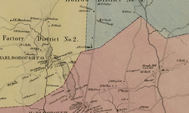
Vintage landowners map of Marlborough, Connecticut from 1869
Read More
Bird’s eye view of Geneva, Illinois in 1869
Read More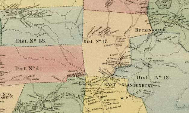
Vintage landowners map of Glastonbury, Connecticut as it used to be
Read More


