Pictorial Bird’s Eye View of Charleston, South Carolina in 1872
Bird’s eye view of Charleston, South Carolina in 1872
Read More
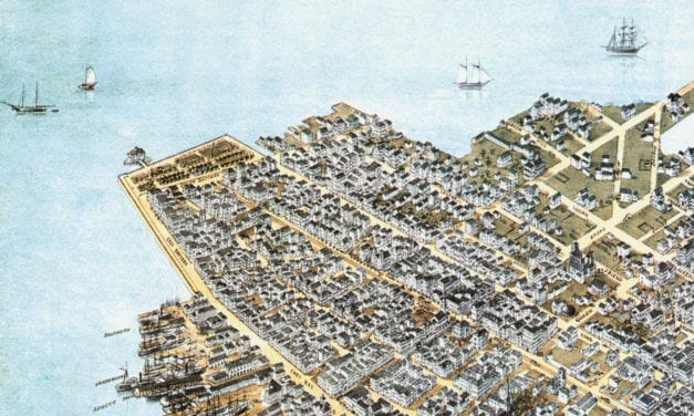
Bird’s eye view of Charleston, South Carolina in 1872
Read More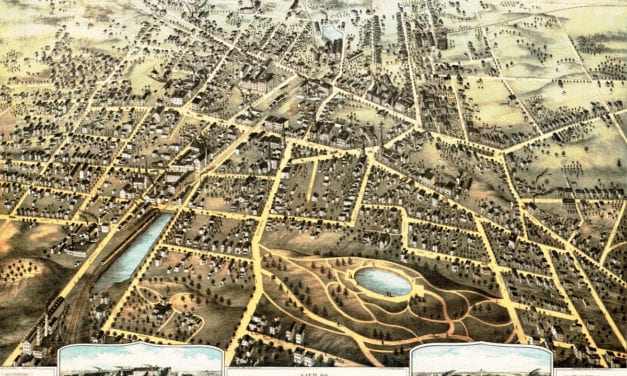
This map shows New Britain, Connecticut in 1875.
Read More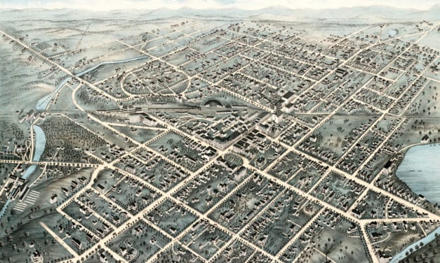
This old map shows Pittsfield, Massachusetts in the late 19th century.
Read More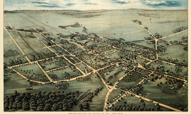
This map shows Hempstead, New York as it looked in 1876. It was created by Fowler & Bulger in 1876.
Read More
This old map shows Henniker, New Hampshire in the late 19th century.
Read More
Click here to see the full map.
Read More
This old map shows Terryville, Connecticut in the late 19th century.
Read More
This old map shows New Hartford, Connecticut in the late 19th century.
Read More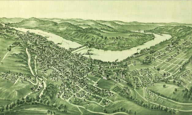
Detailed bird’s eye view of Morgantown, West Virginia in the late 19th century
Read More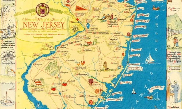
This map from the 1930’s is filled with wonderful scenes from NJ history!
Read More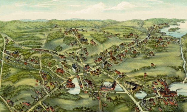
This old map shows East Hampton, Connecticut in the late 19th century.
Read More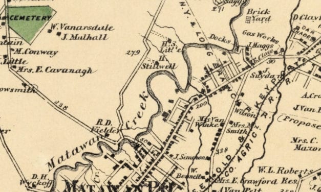
Historic landowners map of Matavan, New Jersey from 1873
Read More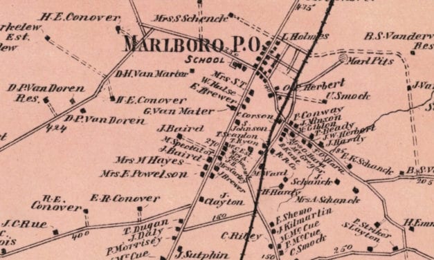
Vintage landowners map of Marlboro, New Jersey as it used to be
Read More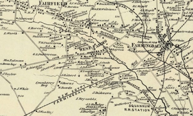
Vintage landowners map of Howell, New Jersey as it used to be
Read More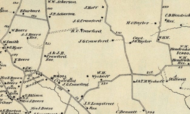
Vintage landowners map of Holmdel, New Jersey as it used to be
Read More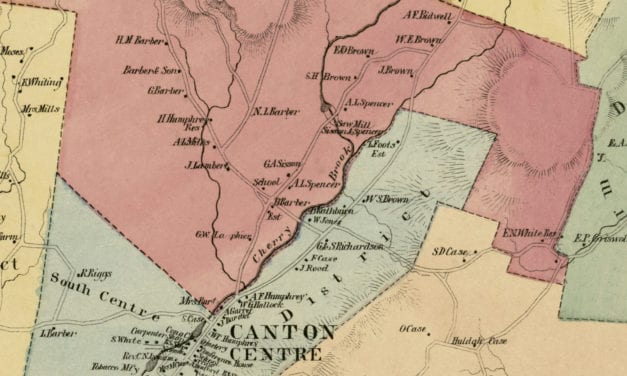
Vintage landowners map of Canton, Connecticut as it used to be
Read More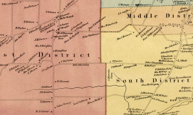
Vintage landowners map of Rocky Hill, Connecticut as it used to be
Read More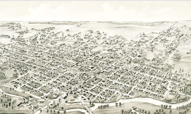
Detailed bird’s eye view of Muncie, Indiana in 1884
Read More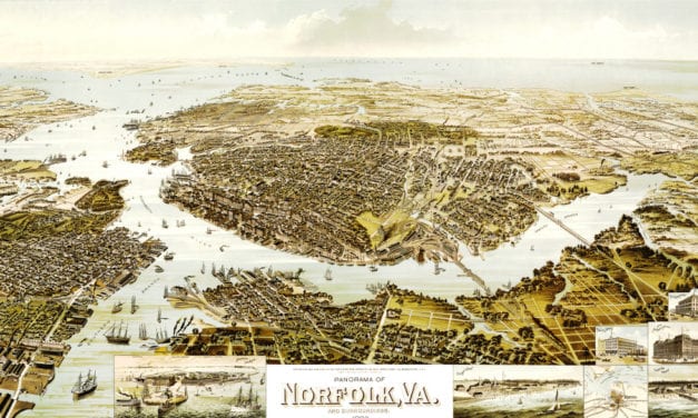
This map from 1892 shows Norfolk, Virginia and the surrounding areas.
Read More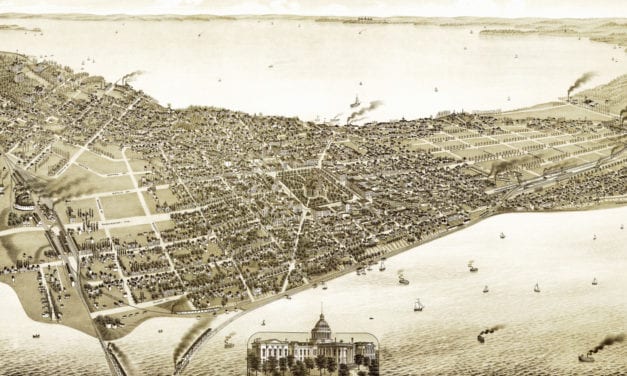
This old map shows Madison, Wisconsin in the late 19th century.
Read More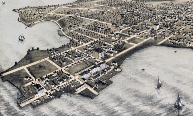
Historic bird’s eye view of College Point, Queens in 1876
Read More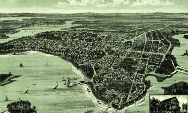
Click here to see what Wareham, Massachusetts looked like in the late 19th century.
Read More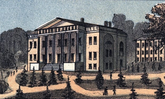
Historic bird’s eye view of Lexington, Kentucky in 1871
Read More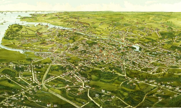
Click here to see what Stamford looked like 100+ years ago.
Read More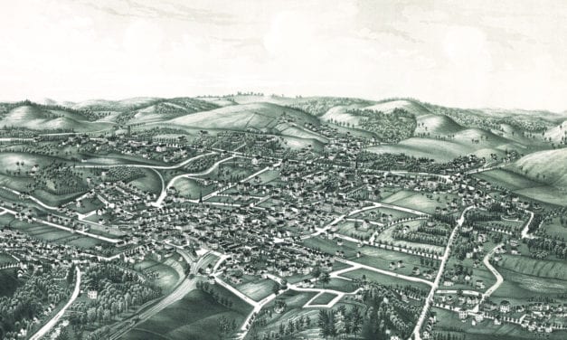
Historic bird’s eye view of White Plains, New York from 1887
Read More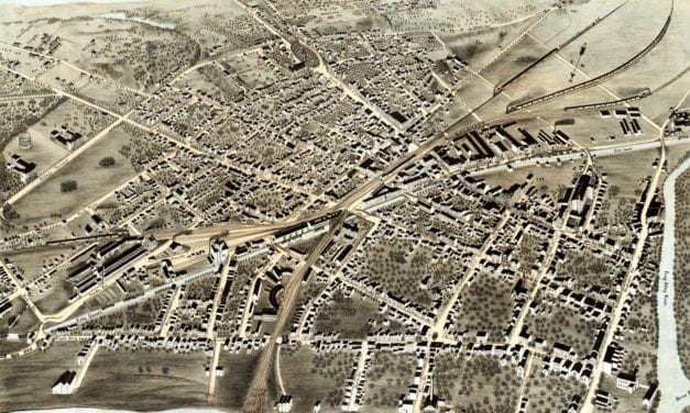
Click here to see Schenectady, New York in 1875
Read More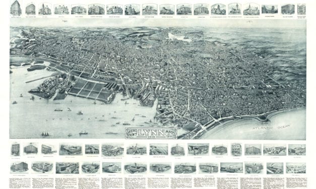
See what Lynn looked like more than 100 years ago!
Read More
Historic bird’s eye view of Stonington, Connecticut as it used to be
Read More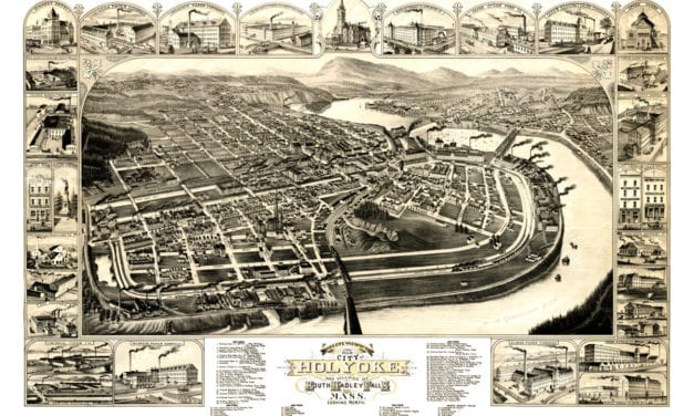
This map shows Holyoke, Massachusetts as it looked in 1881. At the time only 22,000 people lived in Holyoke.
Read More
This historic old map of Oshkosh, Wisconsin was created in 1919 by the Wright Directory Company of...
Read More
Vintage map of East Boston, Massachusetts from the late 19th century.
Read More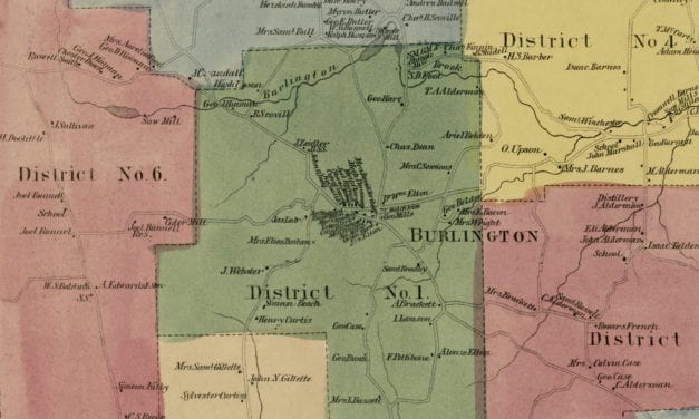
Vintage landowners map of Burlington, Connecticut as it used to be
Read More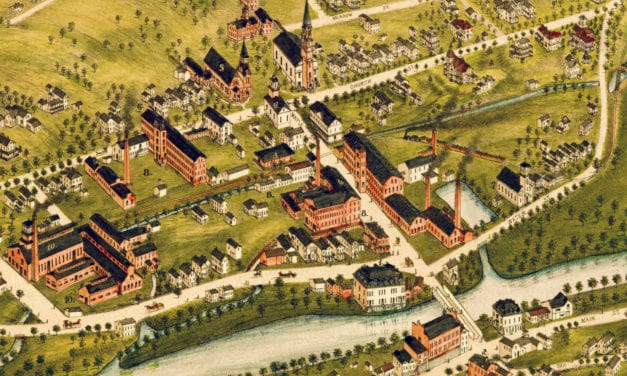
Historic bird’s eye view of Naugatuck, Connecticut from 1877
Read More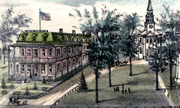
Detailed bird’s eye view of Cheshire, Connecticut as it used to be
Read More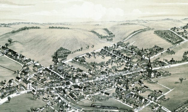
This bird’s eye view of Bath, Pennsylvania was created more than 130 years ago.
Read More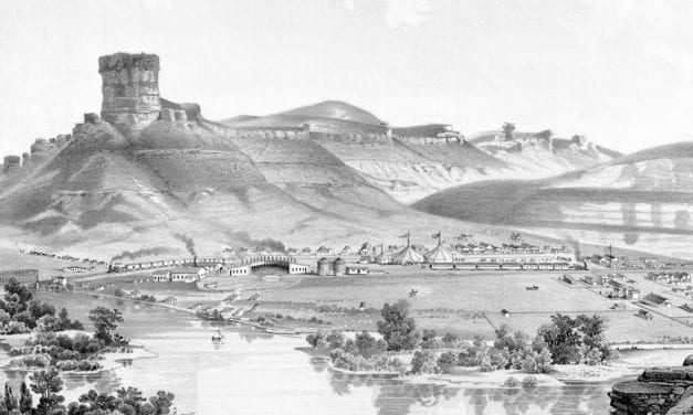
Historic bird’s eye view of Green River, Wyoming from 1875
Read More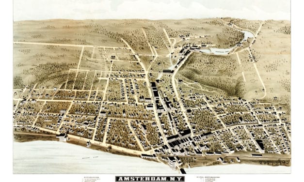
Old map showing Amsterdam, New York as it looked when only 5,500 people lived there
Read More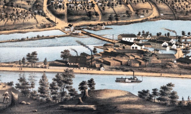
Historic bird’s eye view of Appleton, Wisconsin from 1874
Read More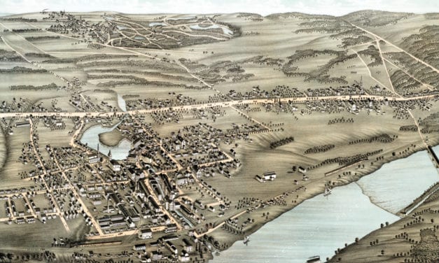
This old map shows Thompsonville, Connecticut as it looked in 1878.
Read More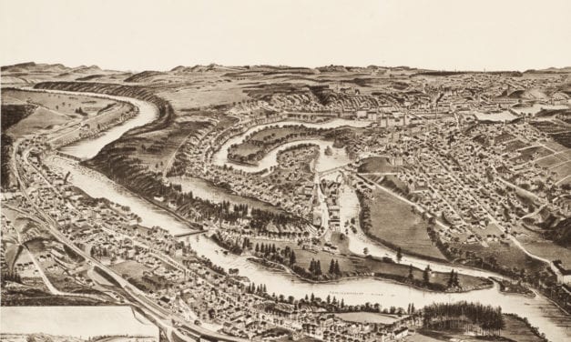
This map shows Franklin NH as it looked in 1884
Read More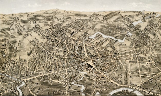
This map shows Taunton, Mass as it looked in 1875
Read More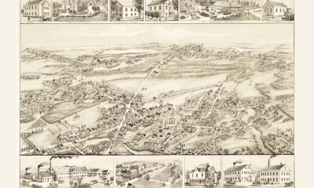
This map shows East Bridgewater, Massachusetts as it looked in 1887.
Read More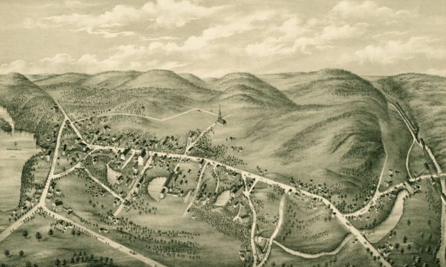
This vintage map shows South Coventry, CT as it looked in 1878.
Read More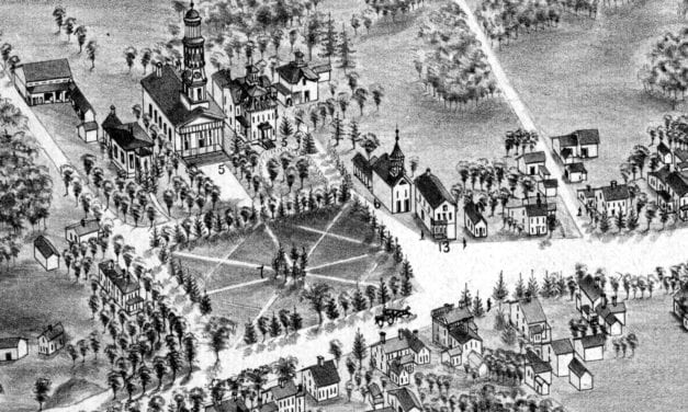
Bird’s eye view of Madison, Connecticut as it used to be
Read More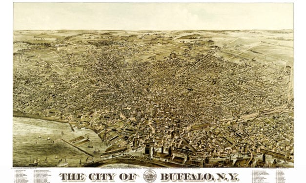
This map shows Buffalo, NY as it looked in 1880.
Read More
Historic bird’s eye view of Milford, Connecticut in the late 19th century.
Read More
Click here to see what Greenville looked like 100+ years ago
Read More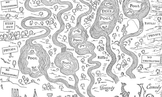
This map by the satirical artist John Held shows the perfect “estate” for the fly fisherman.
Read More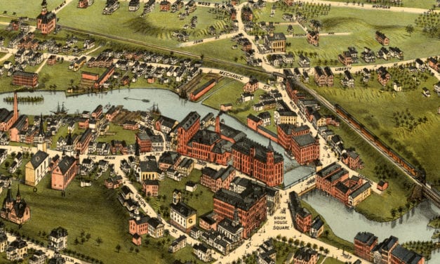
This map shows Westerly, Rhode Island as it looked in 1877
Read More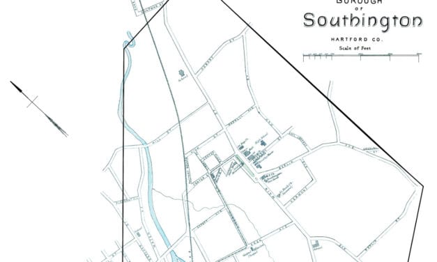
This beautiful map of Southington, Connecticut was created using government surveys in 1893.
Read More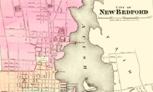
This amazing map of New Bedford, Massachusetts shows the town as it looked in 1871
Read More
Click here to see what Commack was like in the early 20th century.
Read More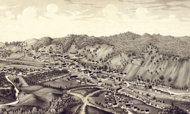
Click here to see the full map of Bethel, VT from 1886
Read More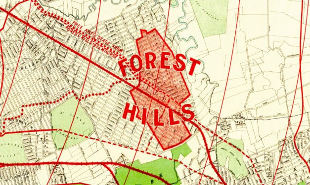
Historic old map of Forest Hills used to promote the neighborhoods development.
Read More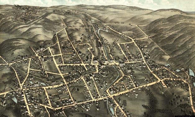
This old map shows Bristol, Connecticut as it looked in 1878.
Read More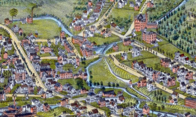
Historic bird’s eye view of Danbury, Connecticut from 1884
Read More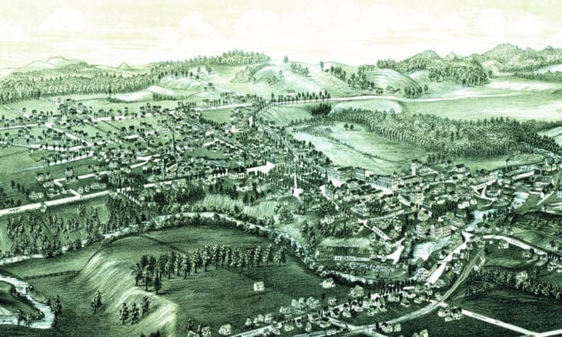
Click here to see Fair Haven, Vermont in 1886
Read More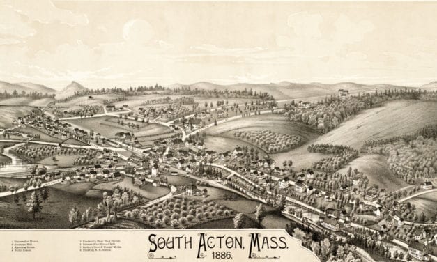
This map of South Acton, Massachusetts was created in 1886 by Lucien R. Burleigh, an artist and...
Read More
Historic bird’s eye view of Leominster, Massachusetts from 1886
Read More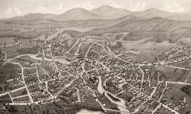
This map of Laconia, New Hampshire was created in 1883 by Lucien R. Burleigh, an artist who spent...
Read More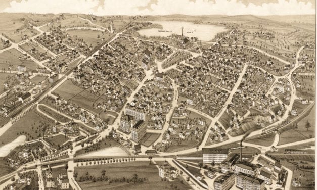
This old map shows Wakefield, Massachusetts as it looked in 1882.
Read More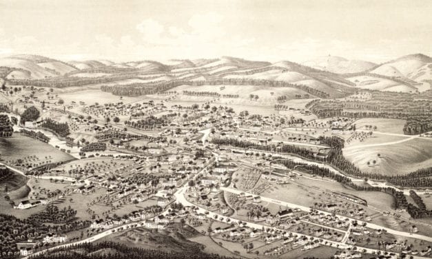
Click here to see what Goffstown, NH looked like in 1887.
Read More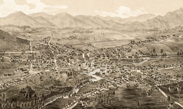
Click here to see the full map.
Read More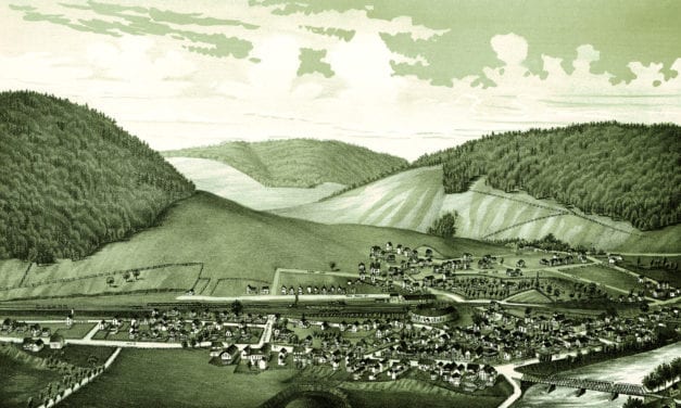
Click here to see what Hallstead, Pennsylvania looked like 100+ years ago.
Read More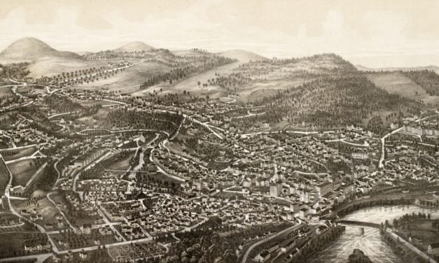
Click here to see what Brattleboro, VT looked like 100+ years ago.
Read More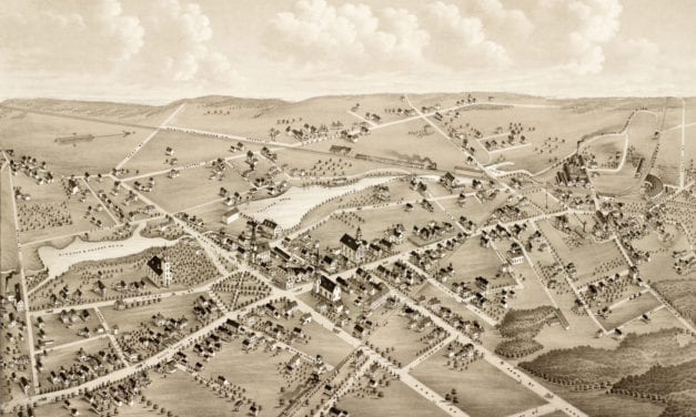
This old map shows Mansfield, Massachusetts when only 2,700 people lived there.
Read More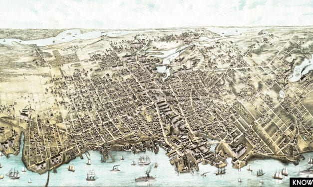
This map shows Fall River, Massachusetts as it looked in 1877.
Read More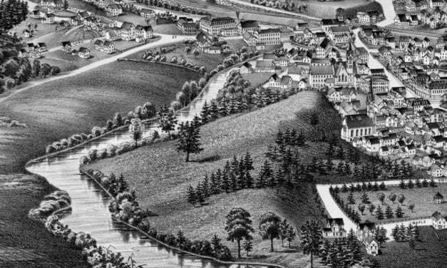
Historic bird’s eye view of Athol, Massachusetts from 1887
Read More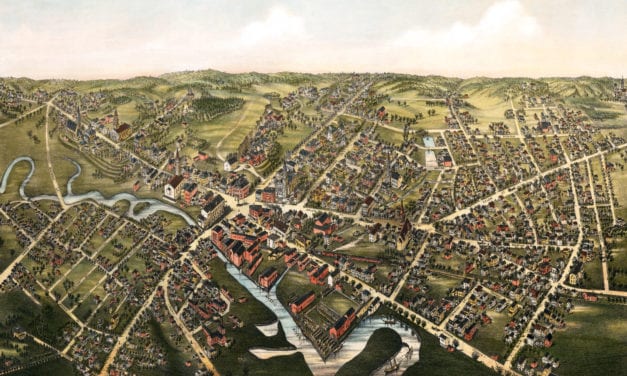
This old map shows Medford, Massachusetts as it looked in 1880.
Read More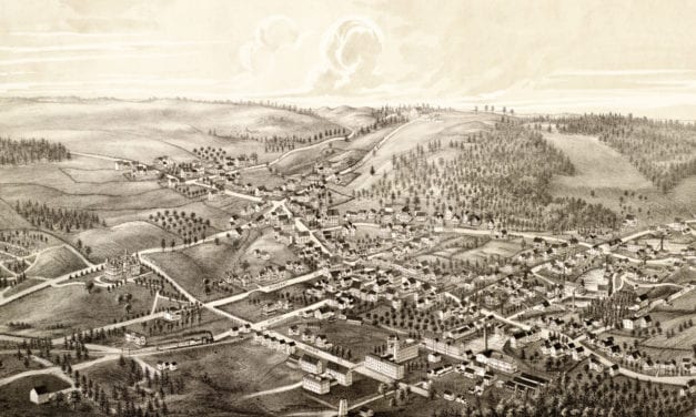
Click here to see what Ashburnham looked like in 1886
Read More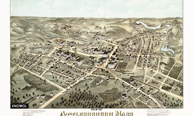
This old map shows Attleboro, Massachusetts as it looked in 1878. The map was created by O.H....
Read More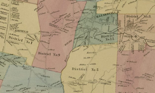
Vintage landowners map shows Enfield, Connecticut as it used to be
Read More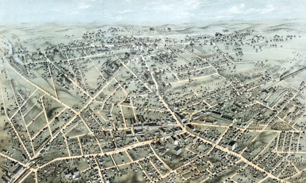
Detailed bird’s eye view of Meriden, Connecticut in 1875
Read More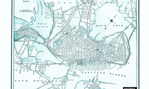
The map shows the layout of Portland, Maine as it looked in the 18th century
Read More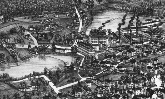
Historic bird’s eye view of Sanford, Maine from 1889
Read More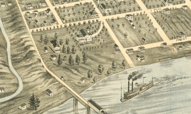
Bird’s eye view of Knoxville, Tennessee in 1871
Read More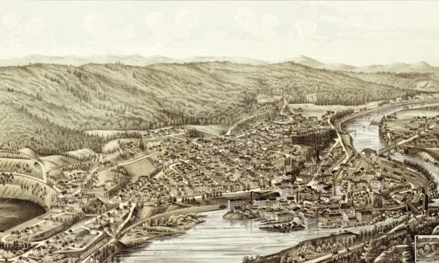
Click here to see what Bellows Falls looked like more than 130 years ago.
Read More
Bird’s eye view of Newton, New Jersey from 1883
Read More
Historic bird’s eye view of Woburn, Massachusetts in 1883
Read More
Historic bird’s eye view of Helena, Montana from 1875
Read More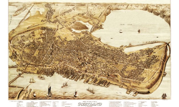
Beautiful vintage map of Portland Maine showing old landmarks and streets
Read More
Detailed bird’s eye view of Springvale, Maine in 1888
Read More
Click here to see how Oakland, Maryland looked more than 100+ years ago.
Read More
Click here to see what Plainville, MA looked like in 1887.
Read More
Historic bird’s eye view of Ayer, Massachusetts in 1886
Read More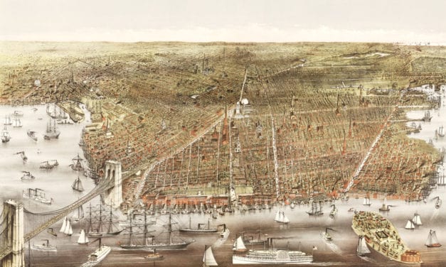
This old map shows Brooklyn, New York as it looked in 1879
Read More
Click here to see Wilmerding, Pennsylvania at the end of the 19th century.
Read More
Click here to see what Asbury Park looked like 100+ years ago
Read More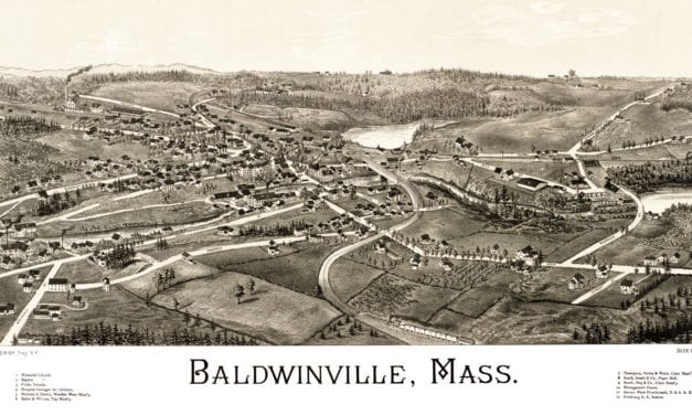
Click here to see the full map.
Read More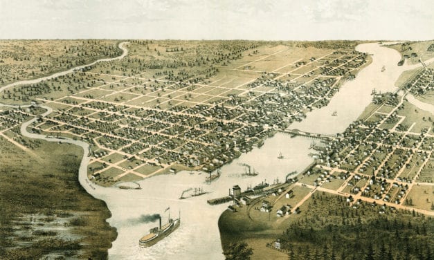
Historic bird’s eye view of Green Bay and Fort Howard in 1867
Read More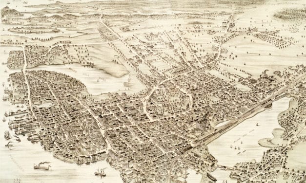
This map shows Portsmouth, New Hampshire as it looked in 1877.
Read More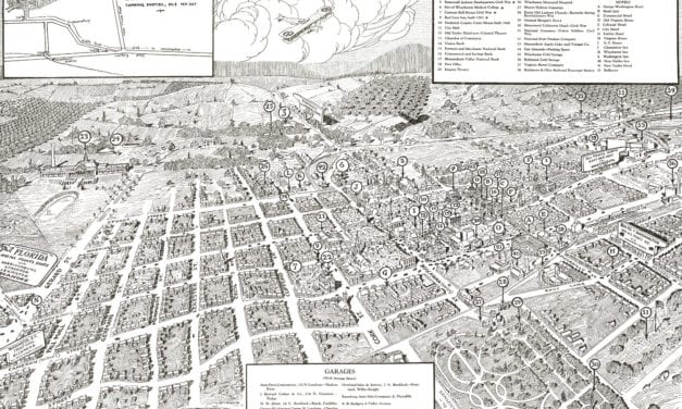
Historic bird’s eye view of Winchester, Virginia from 1926
Read More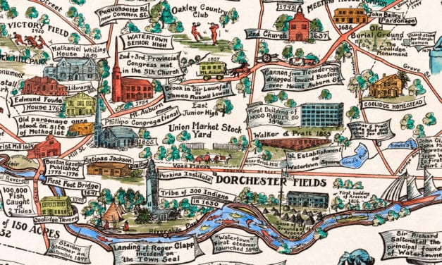
This amazing map of Watertown, Massachusetts was created to celebrate the town’s 300th anniversary in 1930.
Read More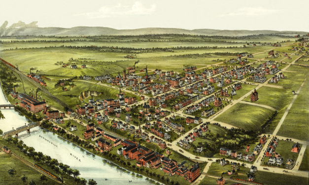
Click here to see Royersford, Pennsylvania in the 19th century.
Read More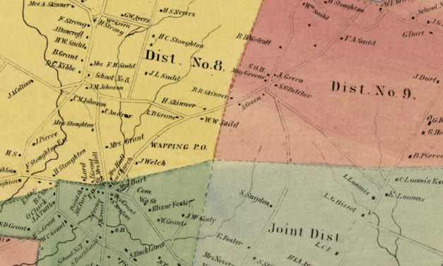
Vintage landowners map shows South Windsor, Connecticut as it used to be
Read More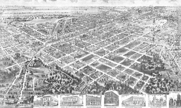
Click here to see how Rocky Mount looked in the early 20th century.
Read More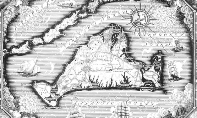
Historic map of Martha’s Vineyard from 1954
Read More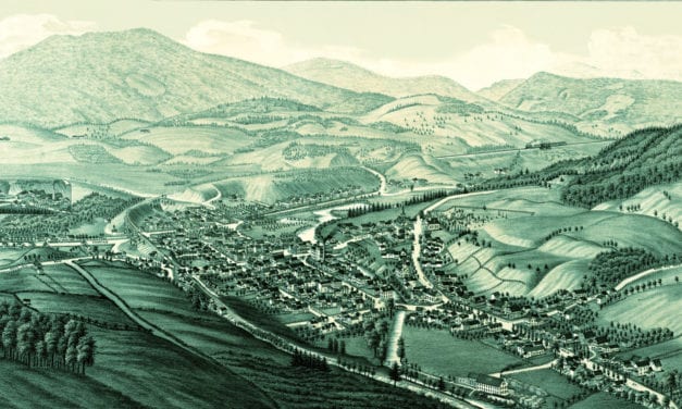
Click here to see what Ludlow looked like 100+ years ago!
Read More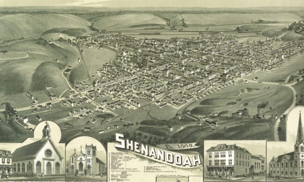
Click here to see Shenandoah toward the end of the 19th century
Read More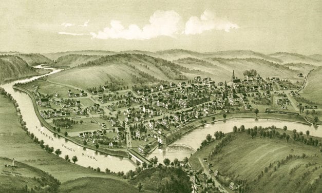
Click here to find out what Philippi, WV looked like in the 19th century
Read More


