
Old Maps
Explore the archive through editorial features, geography, and historical collections.
 New Jersey
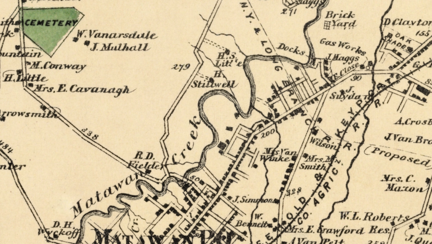
Beautifully restored map of Matavan, NJ from 1873
Historic landowners map of Matavan, New Jersey from 1873
 New Jersey
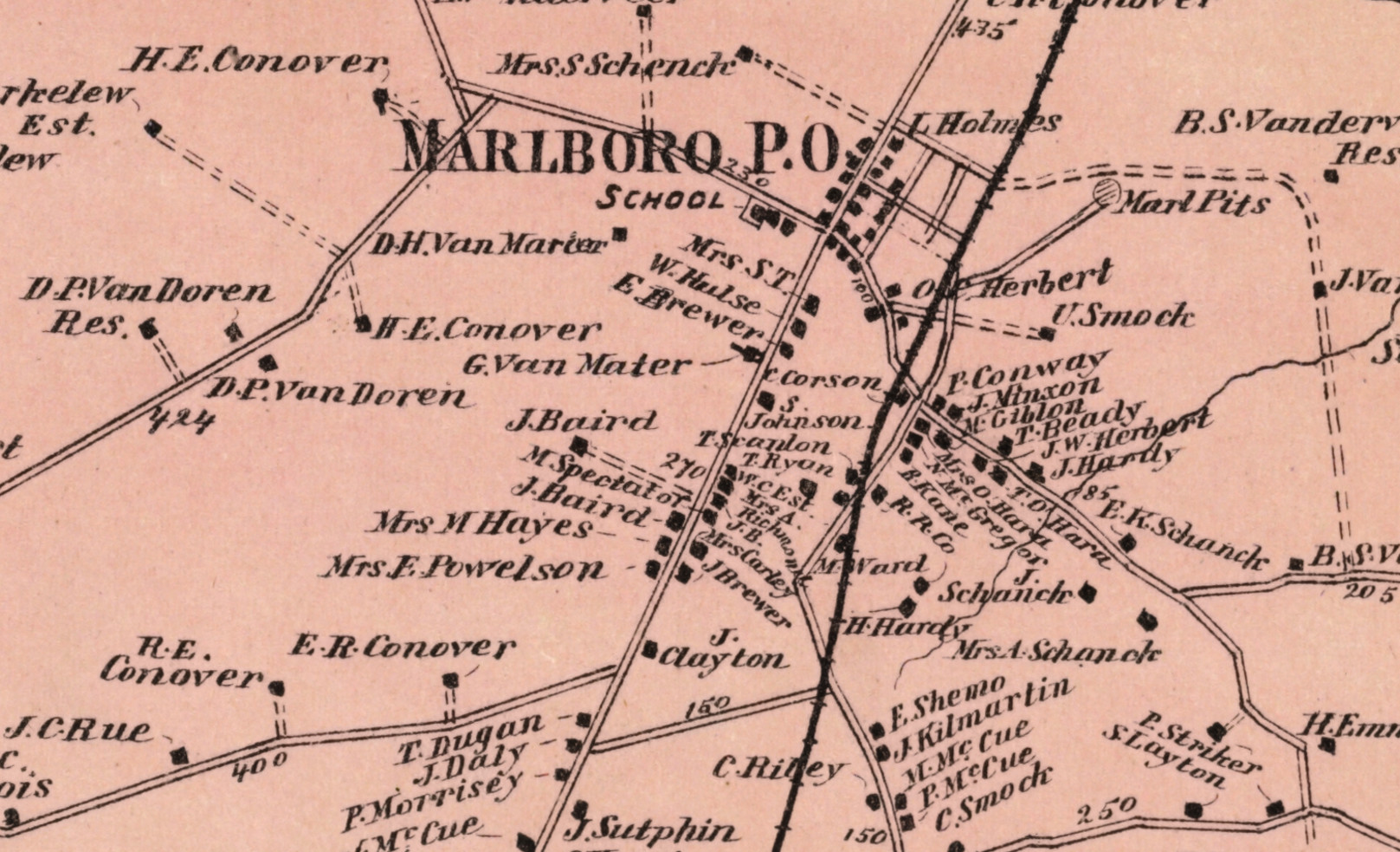
Beautifully restored map of Marlboro, NJ from 1873
Vintage landowners map of Marlboro, New Jersey as it used to be
 New Jersey
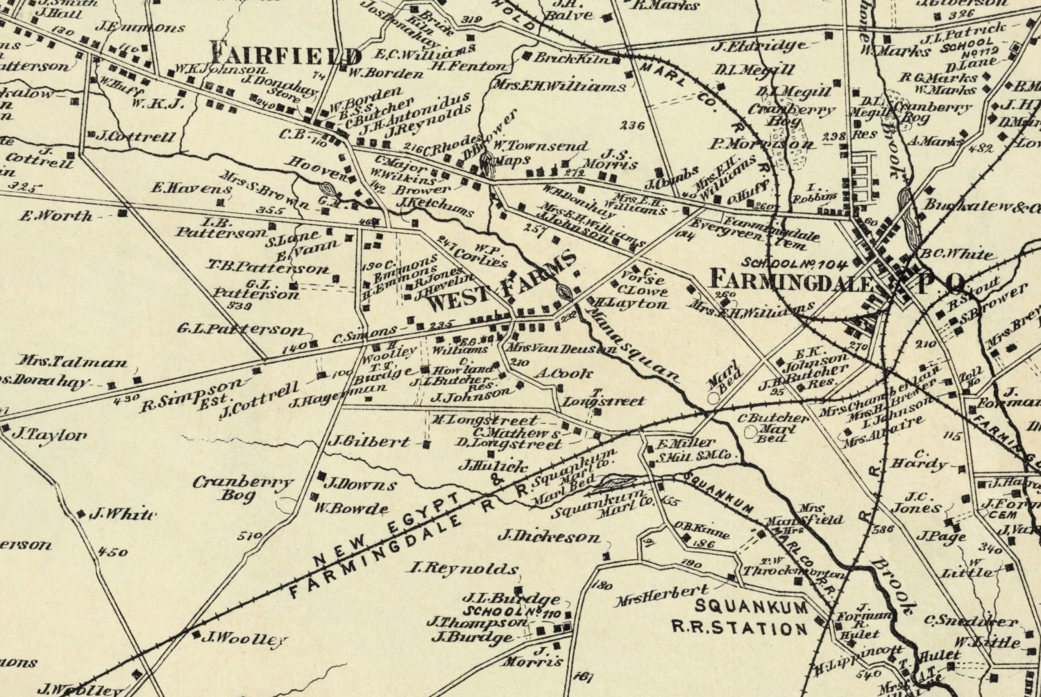
Beautifully restored map of Howell, NJ from 1873
Vintage landowners map of Howell, New Jersey as it used to be
 New Jersey
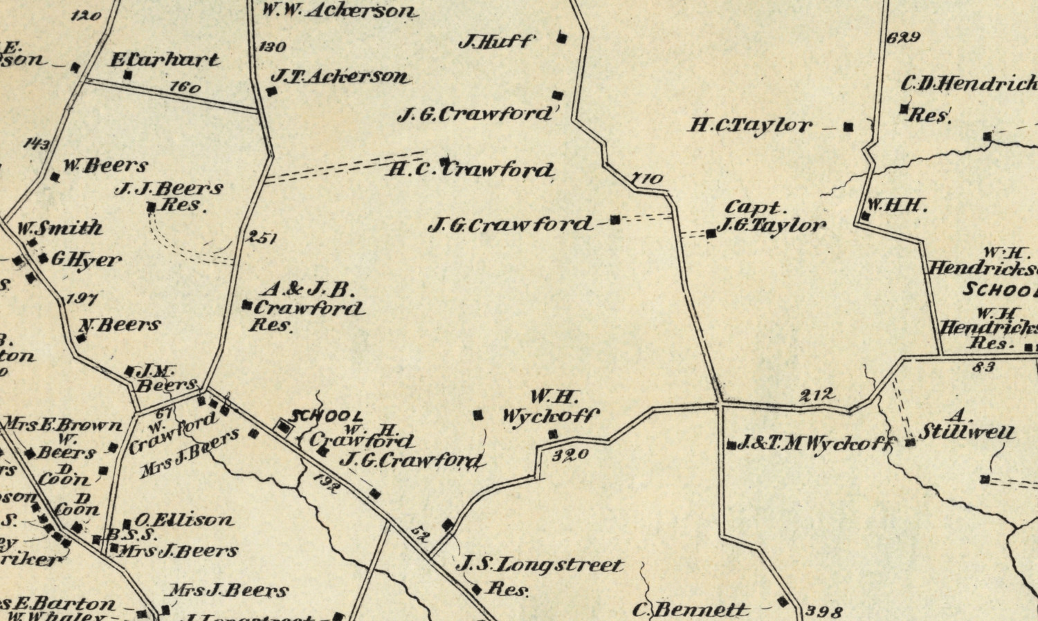
Beautifully restored map of Holmdel, NJ from 1873
Vintage landowners map of Holmdel, New Jersey as it used to be
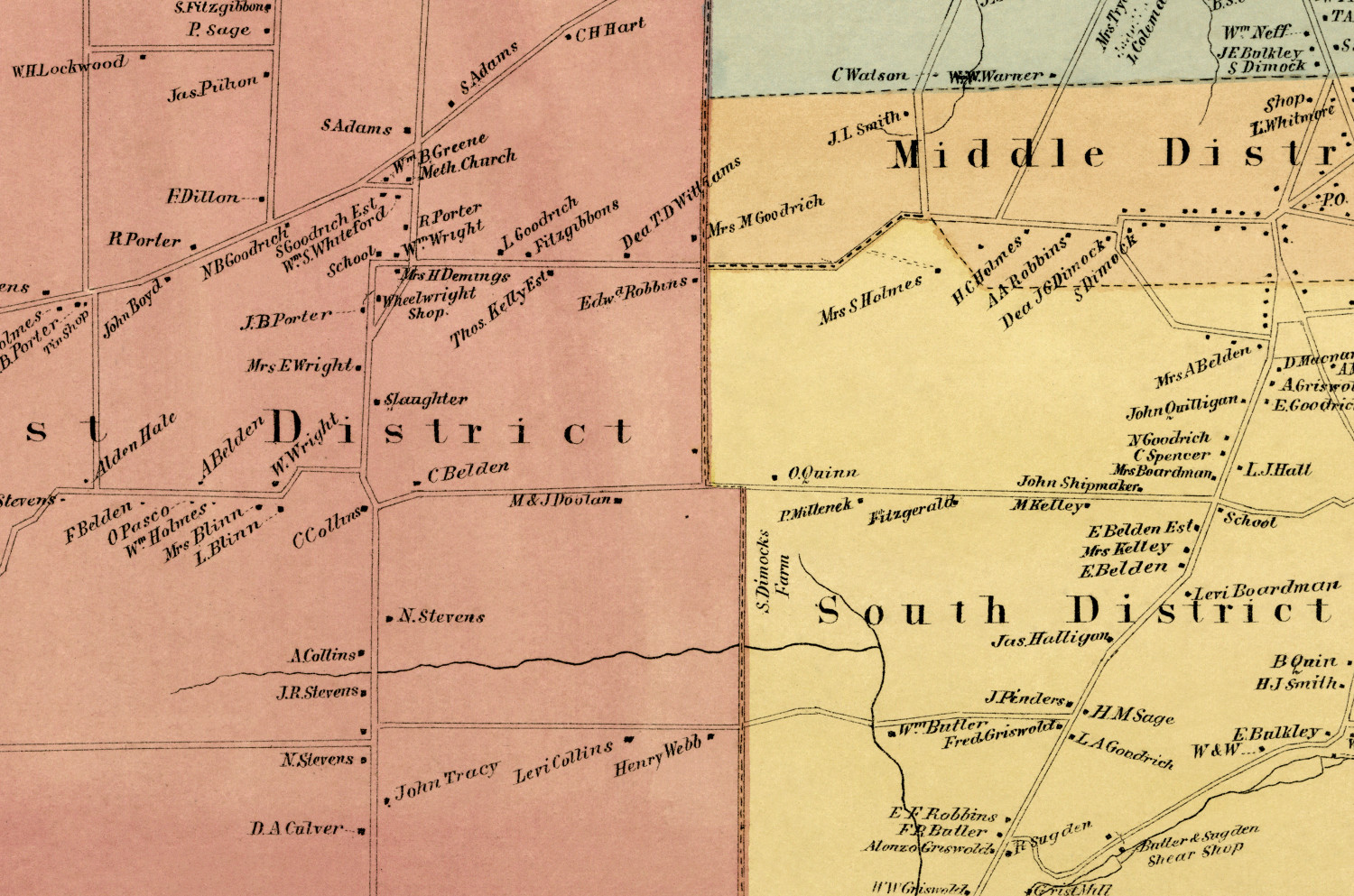
 Connecticut
Beautifully restored map of Canton, CT from 1869
Vintage landowners map of Canton, Connecticut as it used to be
 Connecticut
Beautifully restored map of Rocky Hill, CT from 1869
Vintage landowners map of Rocky Hill, Connecticut as it used to be
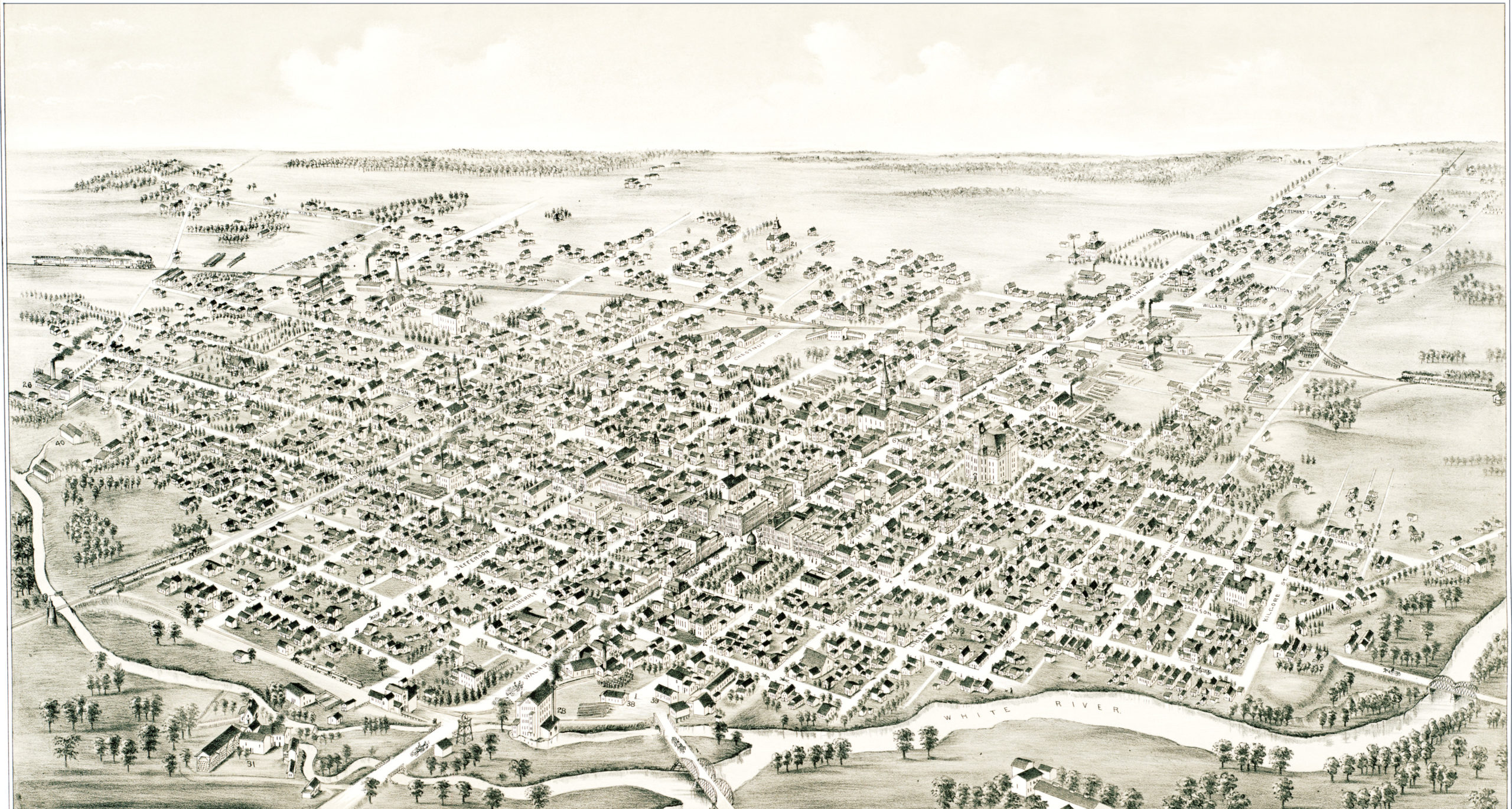 Indiana
Beautifully detailed map of Muncie, Indiana from 1884
Detailed bird's eye view of Muncie, Indiana in 1884
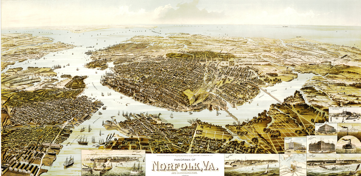 Virginia
Beautiful old map shows Norfolk, VA as it looked in 1892
This map from 1892 shows Norfolk, Virginia and the surrounding areas.
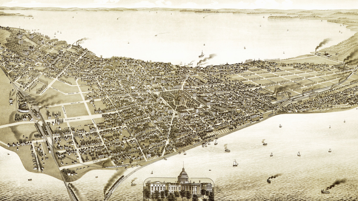 Wisconsin
Amazing vintage map of Madison, Wisconsin in 1885
This old map shows Madison, Wisconsin in the late 19th century.
 New York
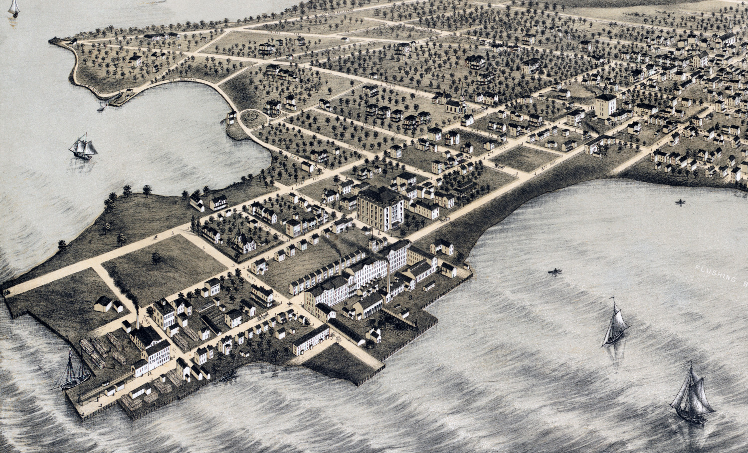
Beautifully restored map of College Point, Queens from 1876
Historic bird's eye view of College Point, Queens in 1876
 Massachusetts
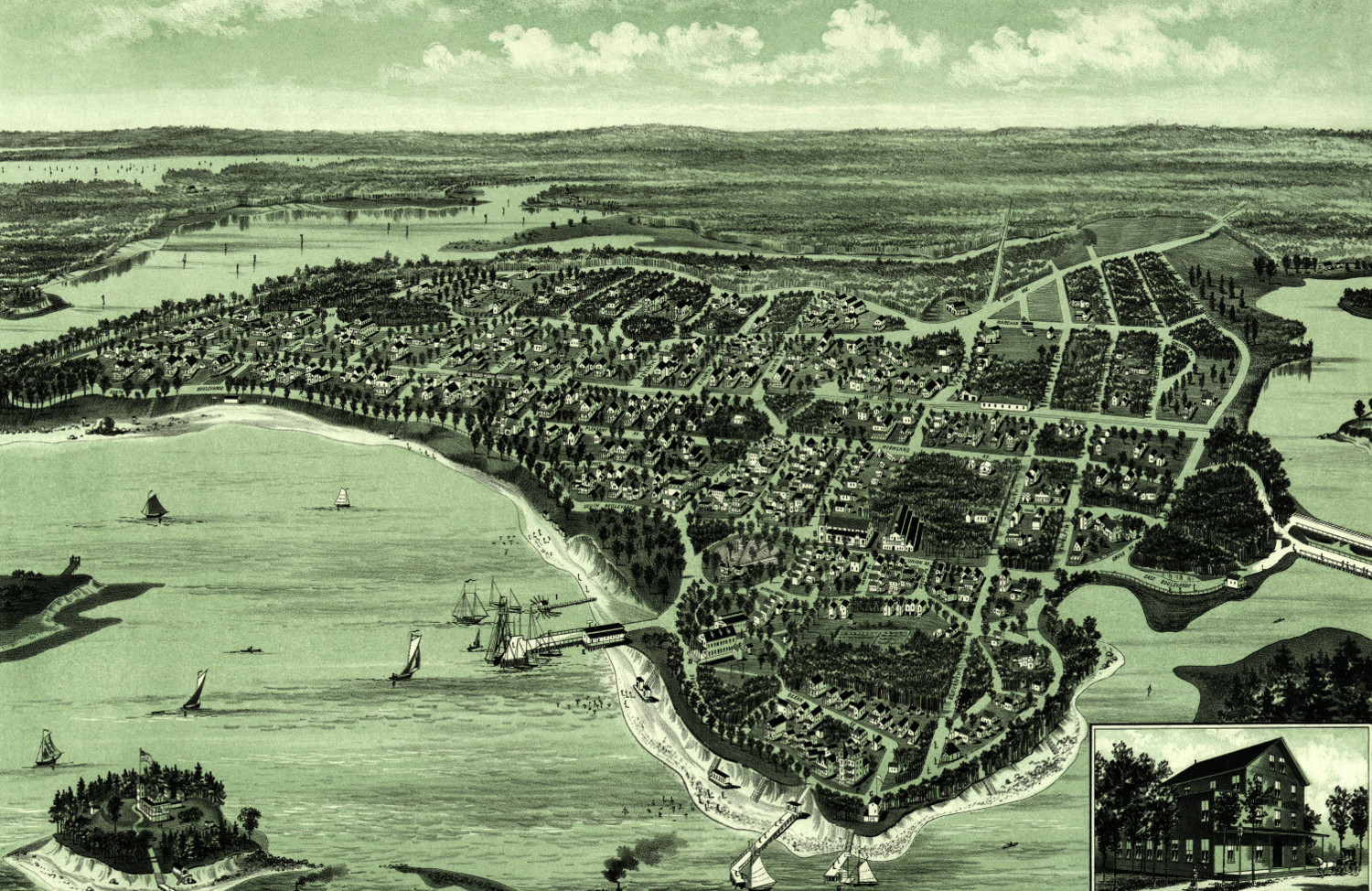
Beautiful map of Onset Bay Grove in Wareham, MA from 1885
Click here to see what Wareham, Massachusetts looked like in the late 19th century.
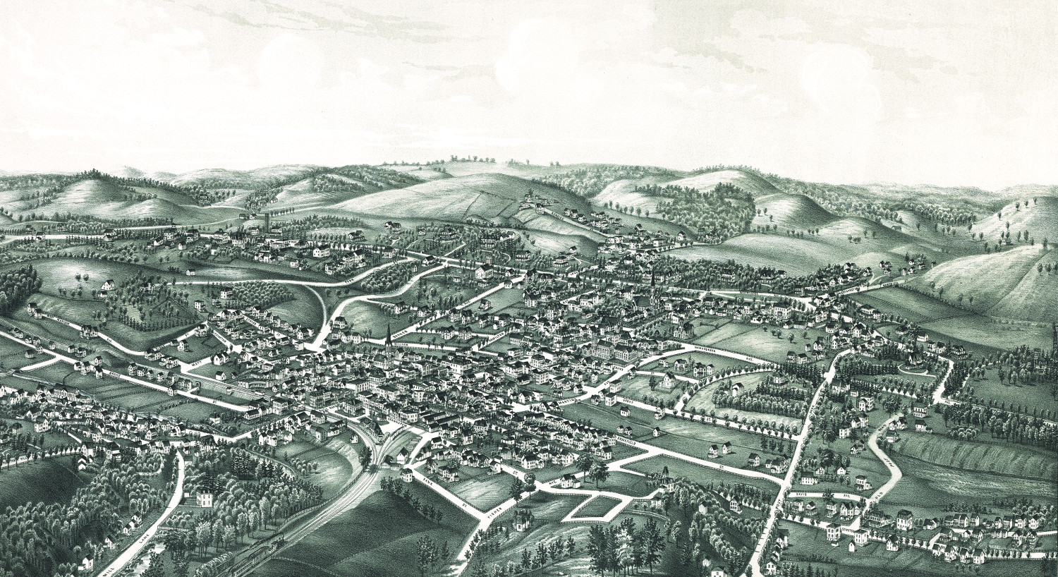
 Kentucky
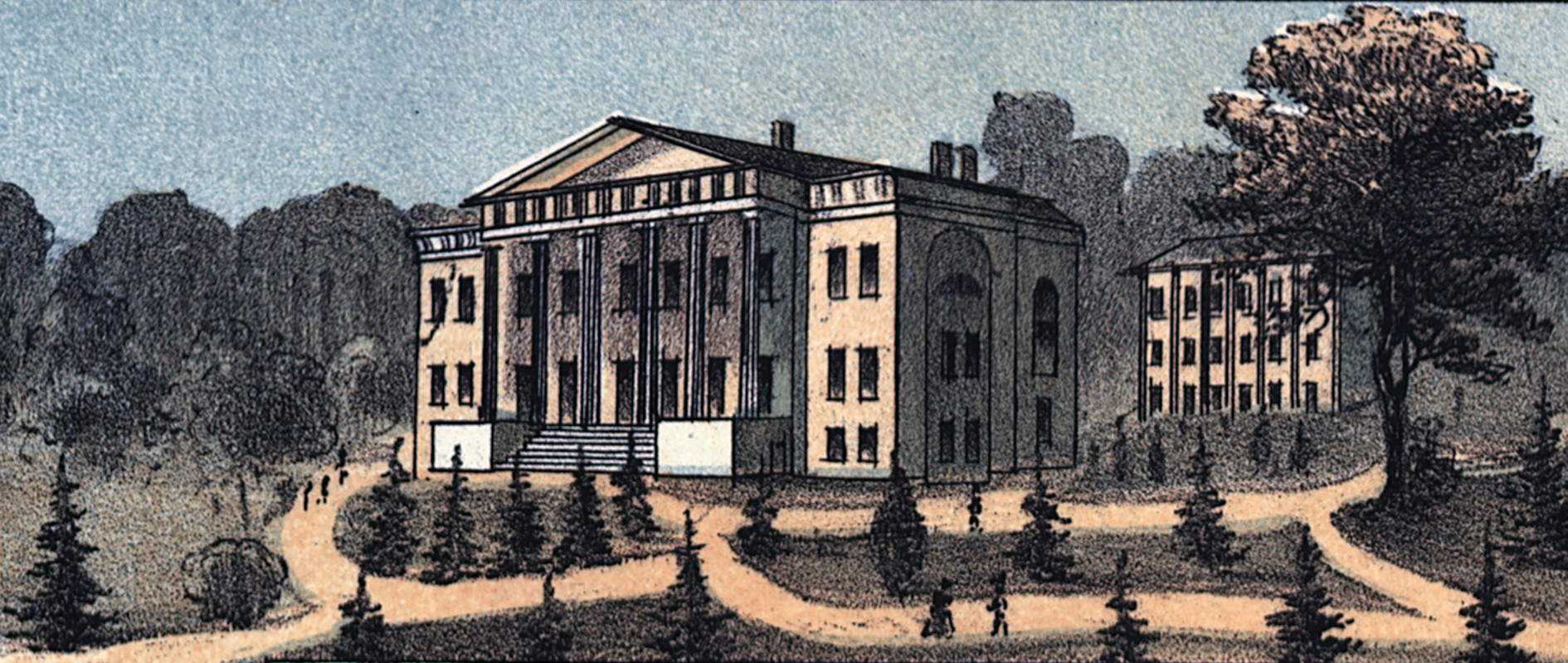
Beautifully restored map of Lexington, Kentucky from 1871
Historic bird's eye view of Lexington, Kentucky in 1871
 Connecticut
Beautiful hand drawn map of Stamford, Connecticut in 1883
Click here to see what Stamford looked like 100+ years ago.
 New York
Historic old map of White Plains, New York from 1887
Historic bird's eye view of White Plains, New York from 1887
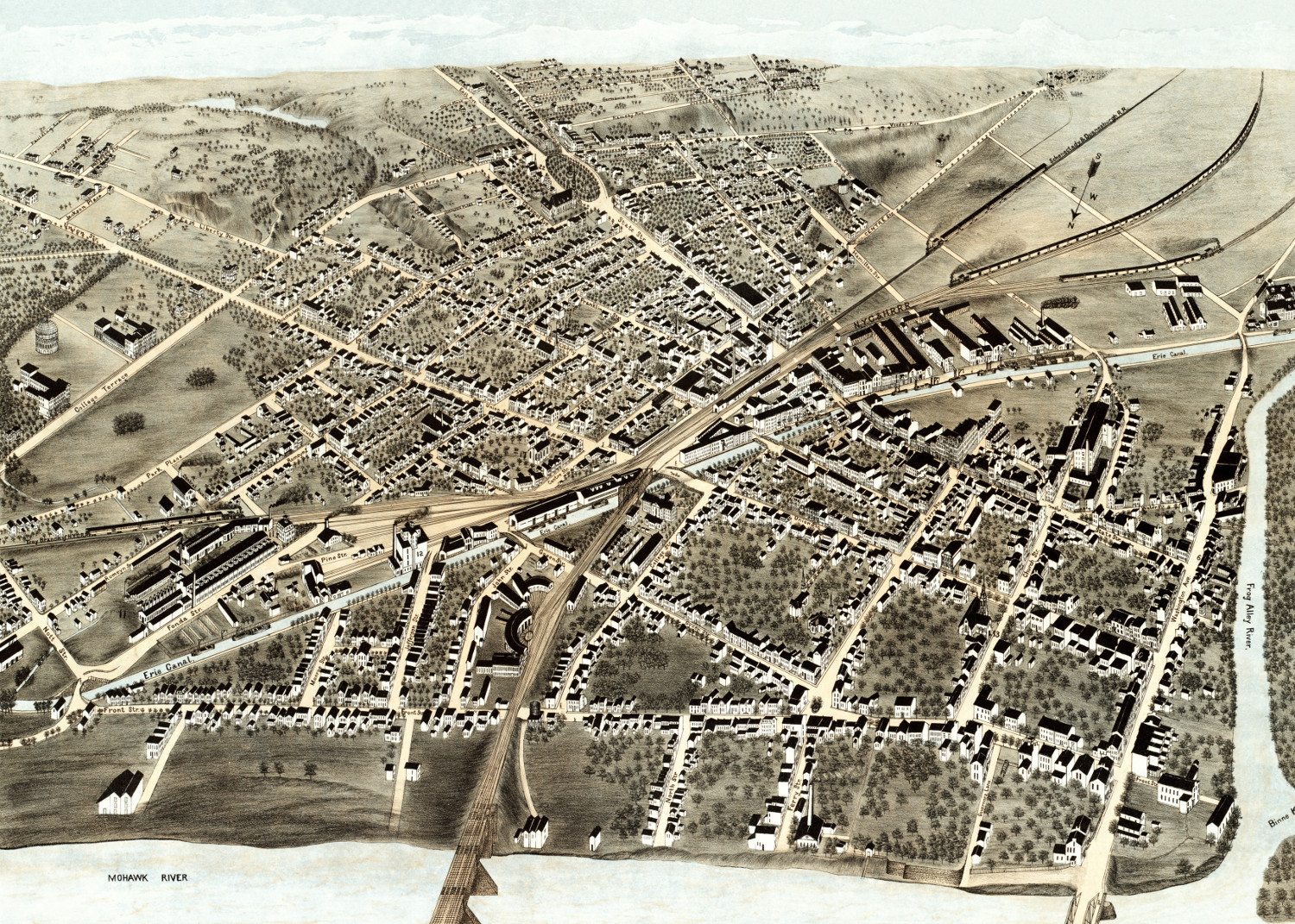 New York
Beautiful bird’s eye view of Schenectady, NY in 1875
Click here to see Schenectady, New York in 1875
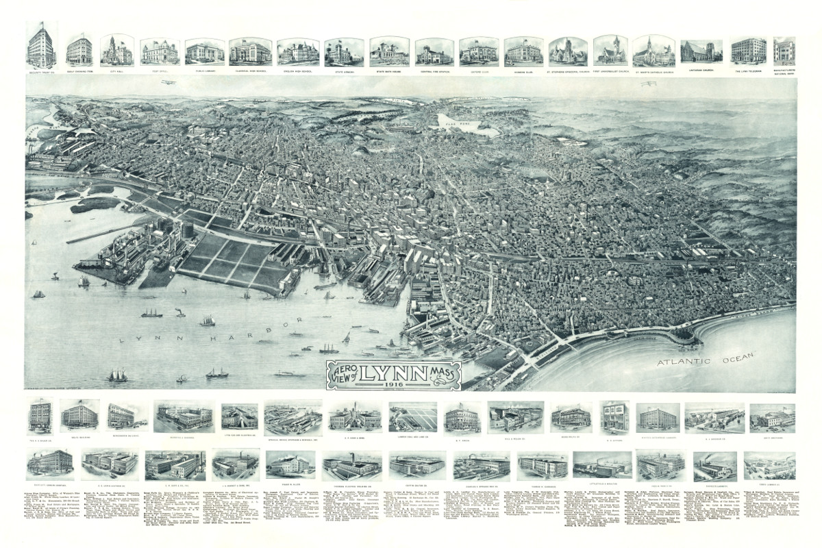 Massachusetts
This is how Lynn, Massachusetts looked in 1916
See what Lynn looked like more than 100 years ago!
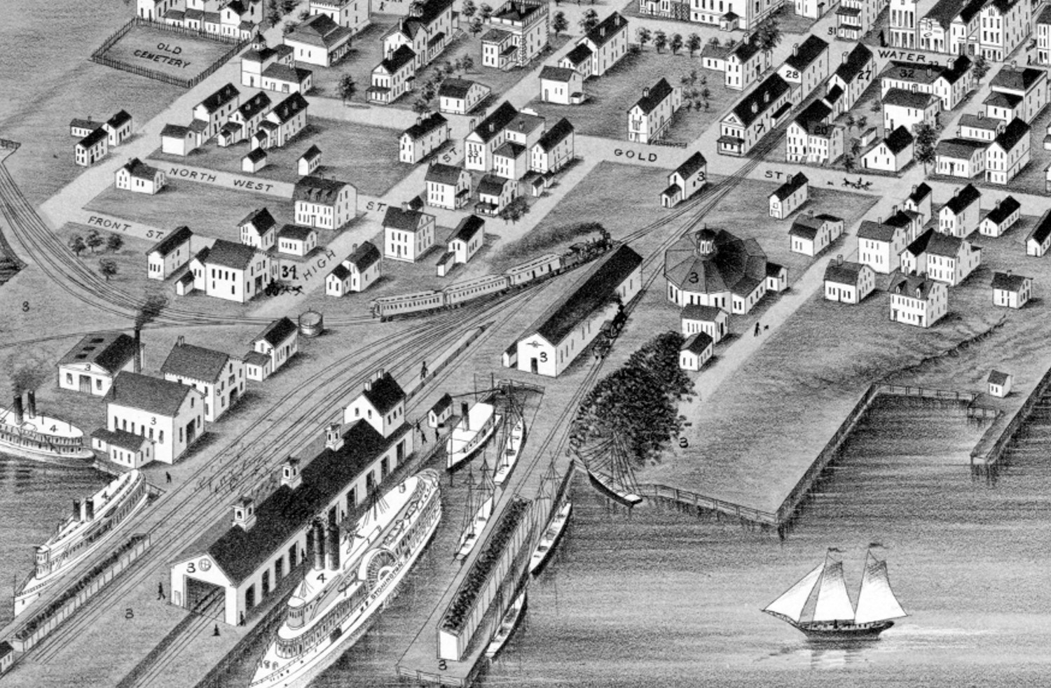 Connecticut
Beautifully restored map of Stonington, Connecticut from 1879
Historic bird's eye view of Stonington, Connecticut as it used to be
 Massachusetts
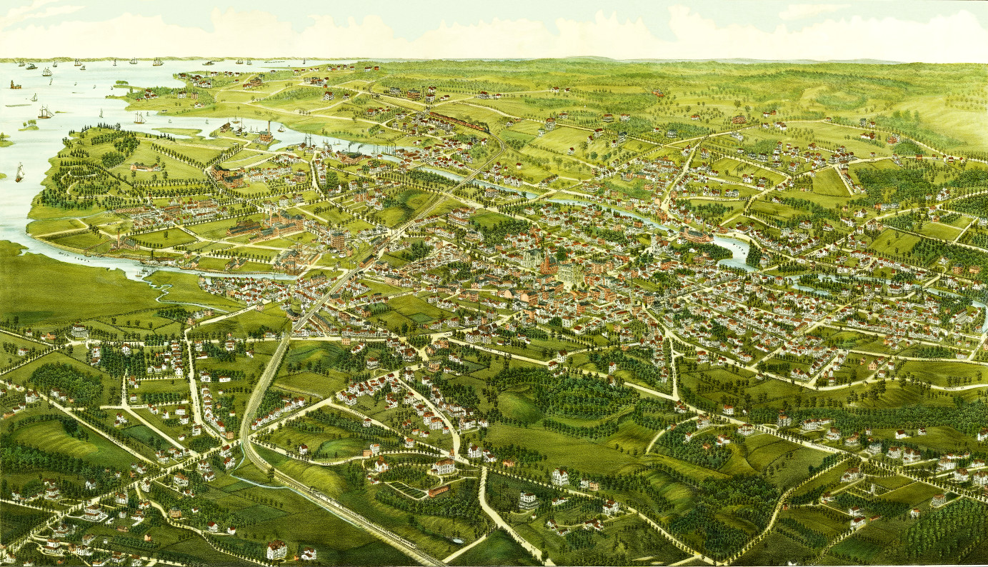
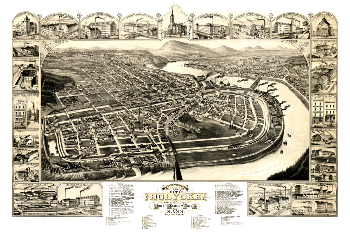
Old map showing Holyoke, Massachusetts in 1881
This map shows Holyoke, Massachusetts as it looked in 1881. At the time only 22,000 people lived in Holyoke.
 Wisconsin
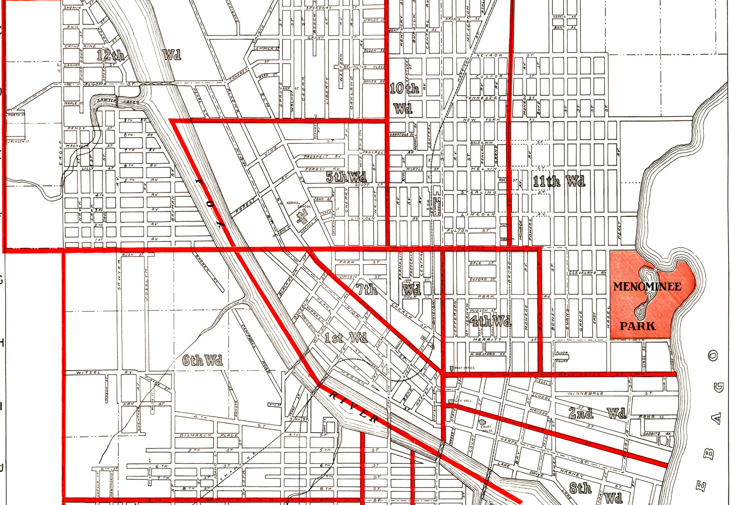
Historic old map of Oshkosh, Wisconsin from 1919
This historic old map of Oshkosh, Wisconsin was created in 1919 by the Wright Directory Company of Milwaukee. The map shows an aerial outline of…
 Massachusetts
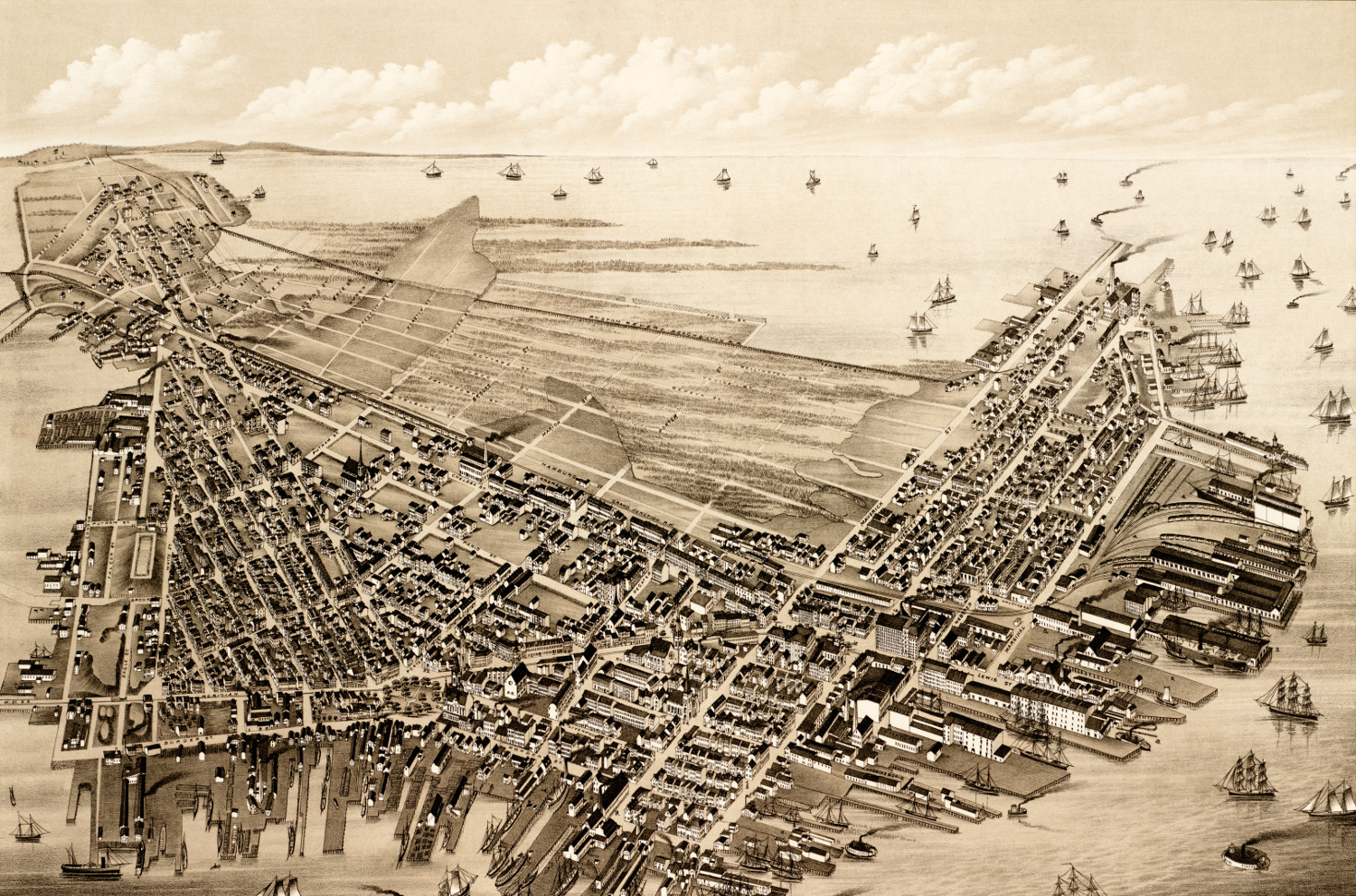
Beautifully restored map of East Boston, Massachusetts from 1879
Vintage map of East Boston, Massachusetts from the late 19th century.
 Connecticut
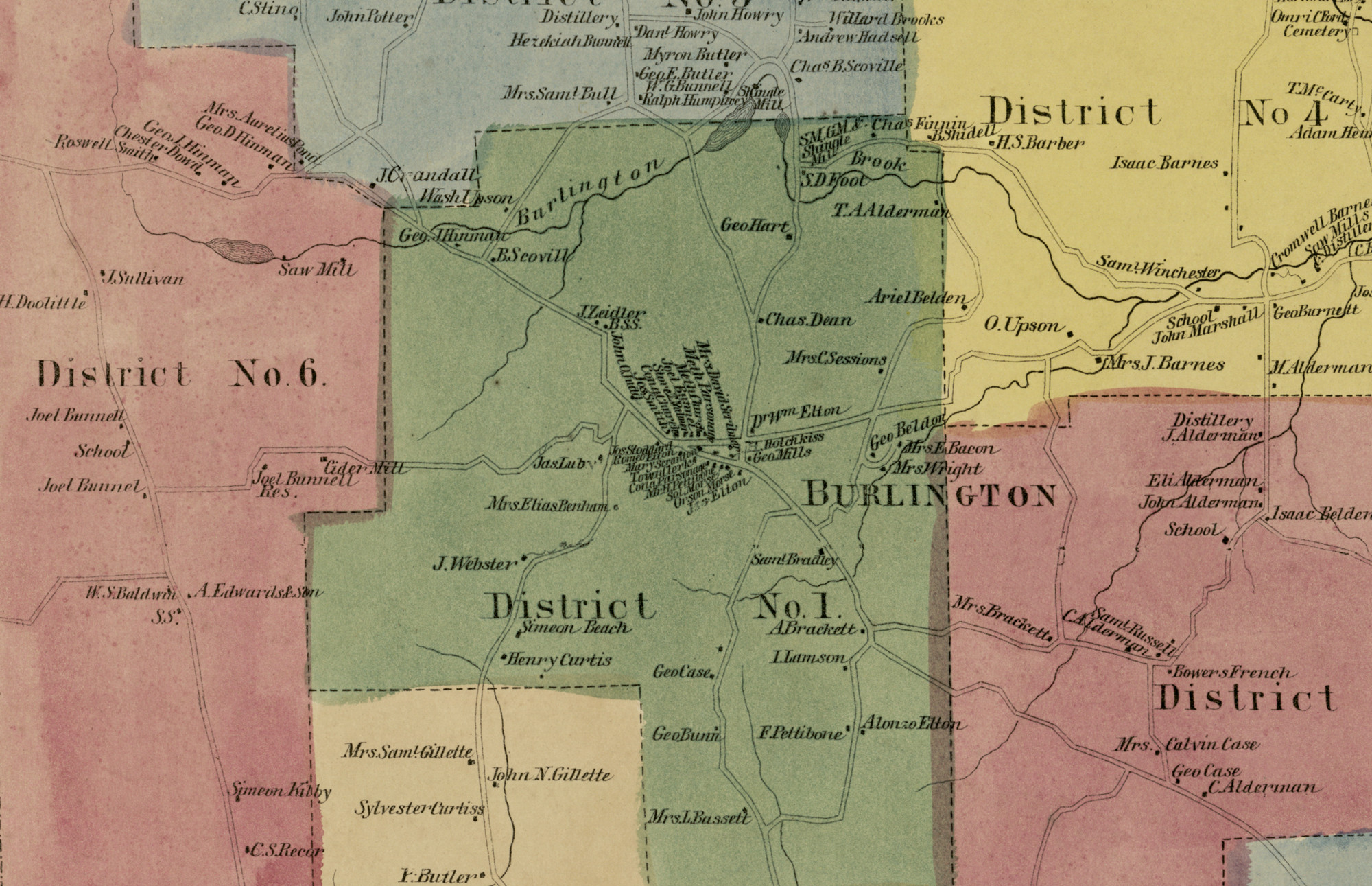
Historic landowners map of Burlington, CT from 1869
Vintage landowners map of Burlington, Connecticut as it used to be