
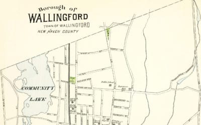
Historical map of Wallingford, Connecticut created in 1893
This old map of Wallingford, CT is a hand colored lithograph from 1893. The map was created by D.H. Hurd & Company and printed in Boston, Massachusetts as part of an atlas book depicting each town in the state. The mapmaker used government surveys, county records...
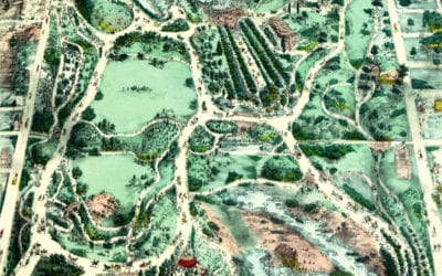
Beautifully designed map shows Central Park in the 1800’s
Beautifully designed map of Central Park from the 1800’s
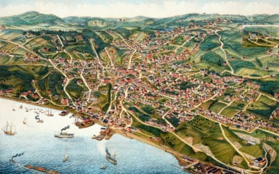
Beautifully restored map of Ossining, “Sing Sing” NY from 1884
This old map shows Ossining, New York in the late 19th century.
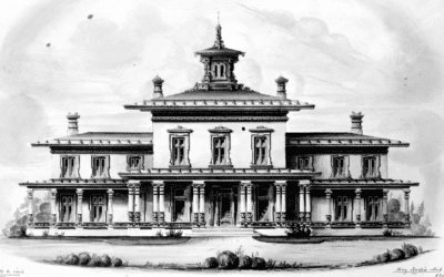
The most luxurious house ever built in Wallingford, Connecticut
Moses Yale Beach was an American inventor and publisher born in Wallingford…
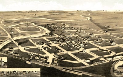
Old historical map of Redfield, South Dakota from 1883
This old map shows Redfield, South Dakota in the late 19th century.
Beautifully restored map of Nashville, Tennessee from 1888
Historic bird’s eye view of Nashville, Tennessee from 1888
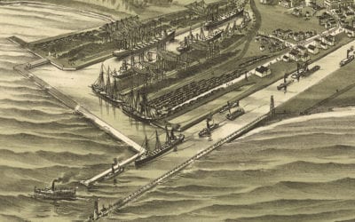
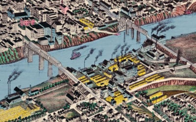
Beautifully detailed map of Ashtabula, OH from 1896
Bird’s eye view of Ashtabula Harbor, Ohio in 1896
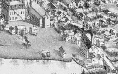
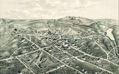
Beautifully detailed map of Medway, Massachusetts from 1887
Bird’s eye view of Medway, Massachusetts from 1887
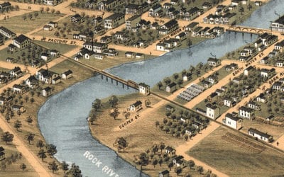
Beautifully restored map of Fort Atkinson, WI from 1870
Bird’s eye view of Fort Atkinson, Wisconsin from 1870
Beautifully restored map of New Canaan, Connecticut from 1878
This old map shows New Canaan, Connecticut in the late 19th century.


