
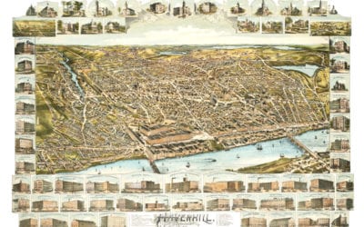
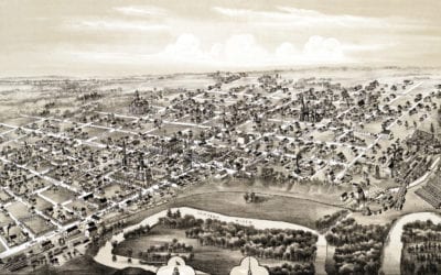
Bird’s eye view of Haverhill, Massachusetts in 1893
This is what Haverhill looked like when only 30,000 people lived here
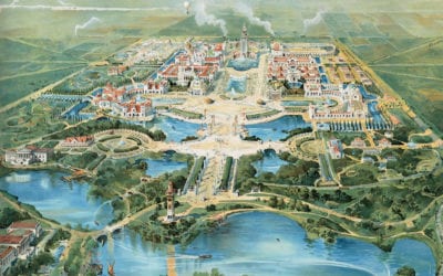
Bird’s eye view of Buffalo’s Pan-American Exposition of 1901
Bird’s eye view of the 1091 Pan-American Expo in Buffalo, New York
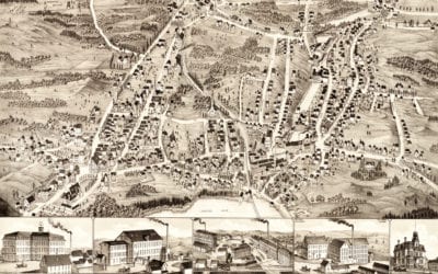
Bird’s eye view of Gardner, Massachusetts in 1880
This map of Gardner, Massachusetts was created in 1880 by Beck & Paul Lithographers and the E.H. Bigelow Publishing Company of Framingham, Mass. The company sent artists across America to create beautifully detailed maps of small towns and their landmarks. The map...
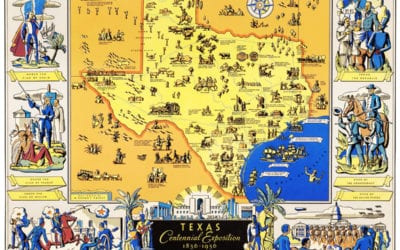
Amazing map of Texas from the Centennial Exposition in 1936
The Centennial Exposition celebrated the 100th anniversary of Texas’s independence from Mexico in 1836.
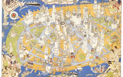
Long lost map of NYC shows locations of historical events
Amazing stories and images from the early years of Manhattan!
Beautifully restored map of Mt. Pleasant, Michigan from 1884
This historic old map of Mount Pleasant, Michigan was created in 1884 by O.H. Bailey, a prominent 19th century map maker. The map shows a bird's eye view of the city as it used to be, including street names and old landmarks. Landmarks on the map include the Chippewa...
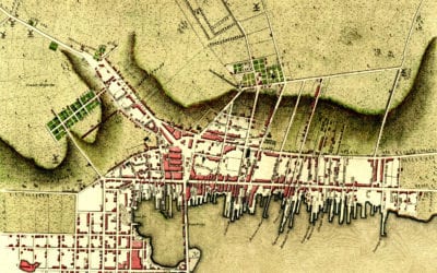
Plan of Newport, Rhode Island created in 1777 by the invading British Army
Click here to see Newport, Rhode Island in 1777

The church thought the Earth was flat
Magellan planned the first circumnavigation of the Earth, proving that the planet was round.

Young men, life is before you
Young men, life is before you. Two voices are calling you – one coming out from…

Mark Twain’s thoughts on Satan
This missive on Satan was written by Mark Twain and published by Elbert Hubbard…


