
Old Maps
Explore the archive through editorial features, geography, and historical collections.
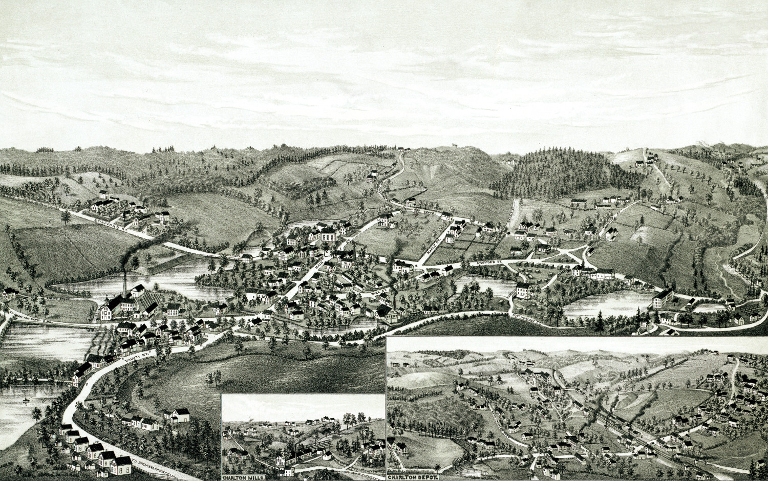 Massachusetts
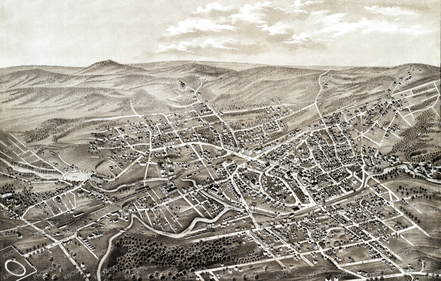
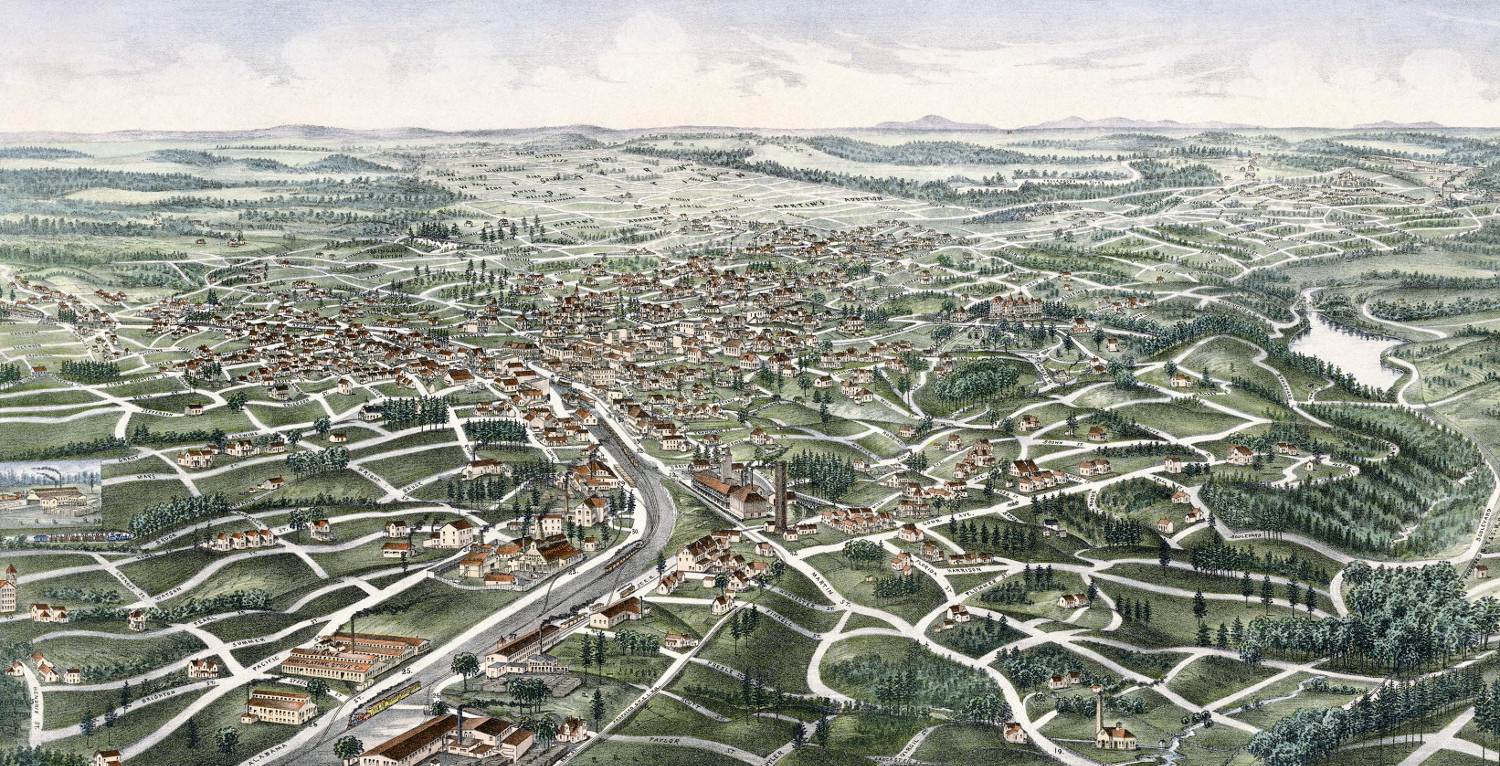
Beautifully restored map of Charlton, MA in 1887
Detailed bird's eye view of Charlton, Massachusetts in 1887
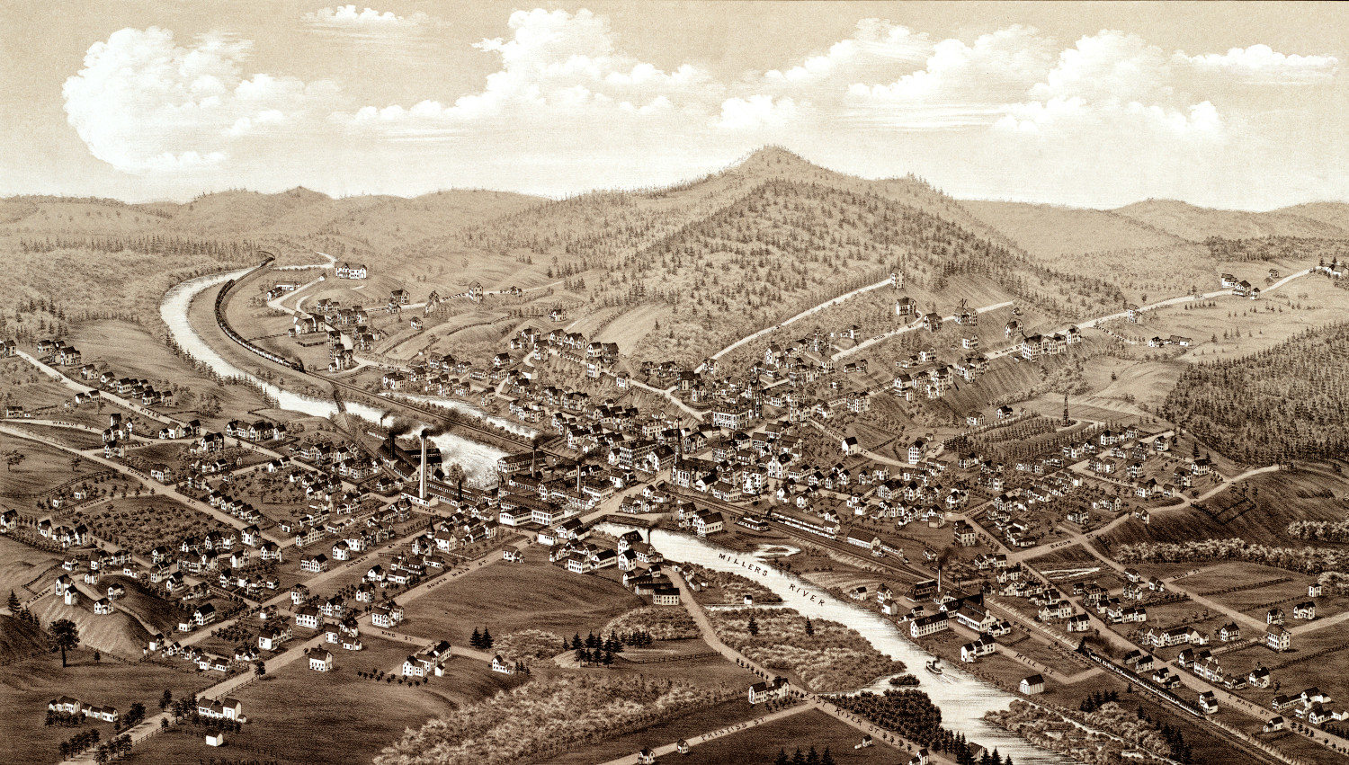 Massachusetts
Beautifully detailed map of Orange, MA from 1883
Detailed bird's eye view of Orange, Massachusetts in 1883
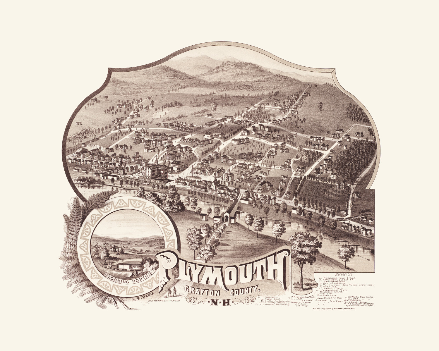 New Hampshire
Beautifully detailed map of Plymouth, NH from 1883
Historic bird's eye view of Plymouth, New Hampshire from 1883
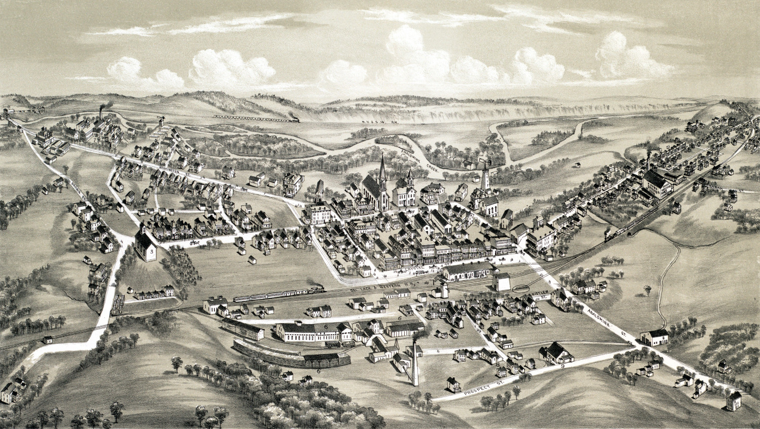 Pennsylvania
Historic old map of East Stroudsburg, PA from 1884
Detailed bird's eye view of East Stroudsburg, Pennsylvania from 1884
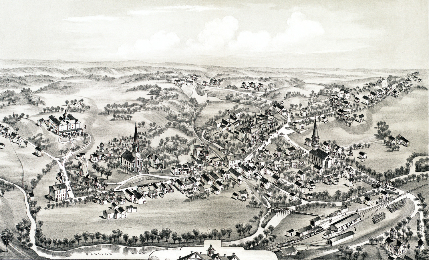 New Jersey
Beautifully detailed map of Blairstown, NJ from 1883
Detailed bird's eye view of Blairstown, NJ from 1883
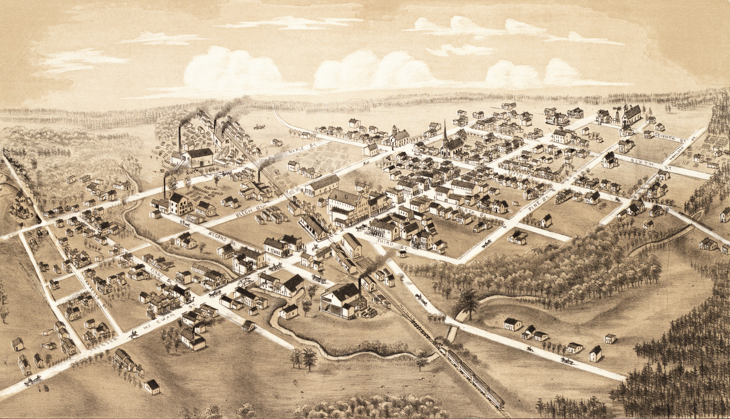
 Michigan
Beautiful old map of Coleman, Michigan from 1884
Detailed bird's eye view of Coleman, Michigan in the late 19th century
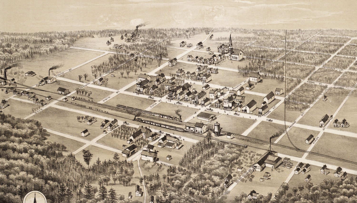
 Michigan
Beautifully detailed map of Clare, Michigan from 1884
Detailed bird's eye view of Clare, Michigan in 1884
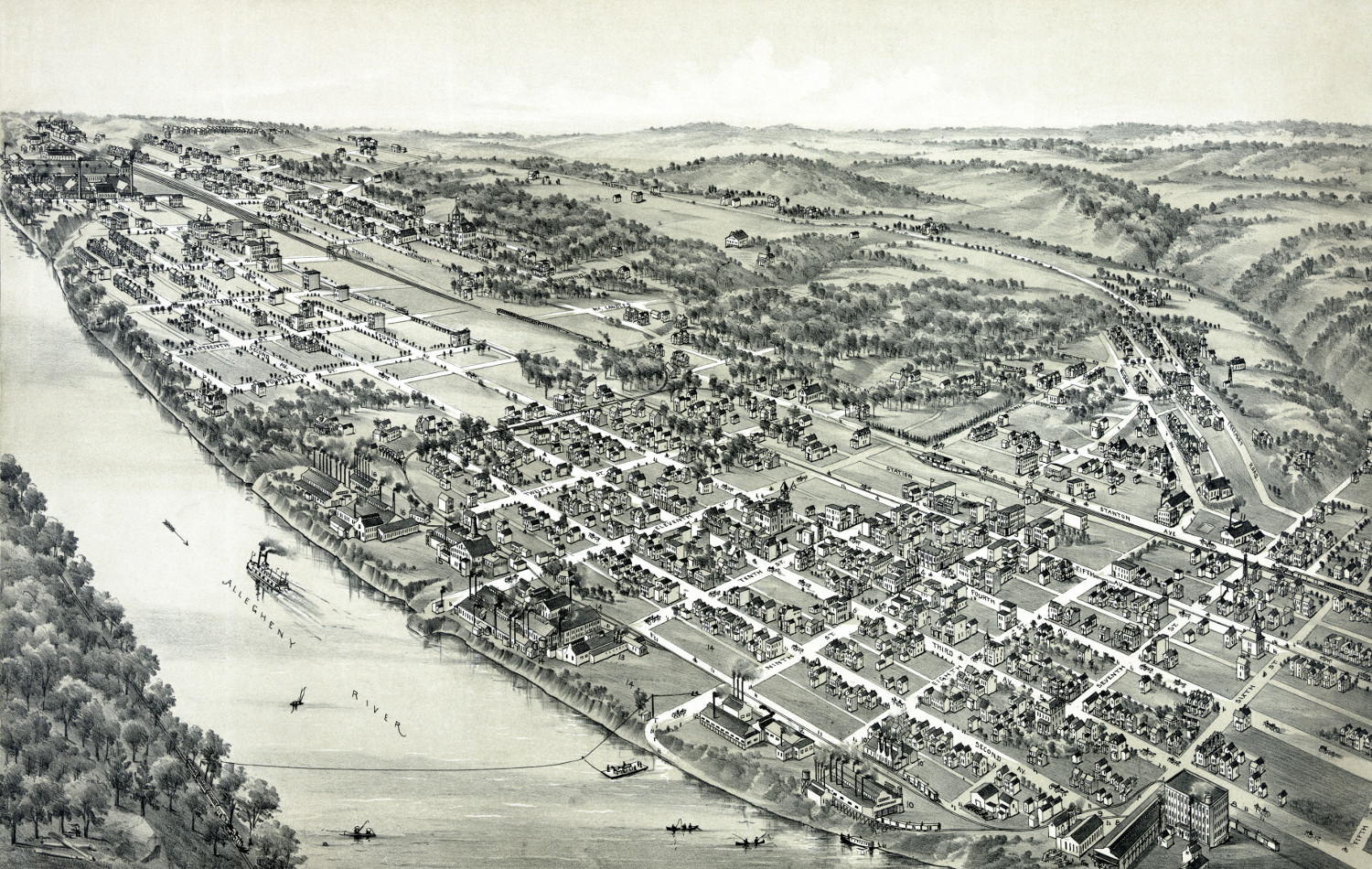 Pennsylvania
Beautifully detailed map of New Kensington, PA 1896
Detailed bird's eye view of New Kensington, PA in 1896
 Massachusetts
Beautifully detailed map of Hyde Park, Massachusetts from 1879
Historic bird's eye view of Hyde Park, Massachusetts in 1879
 Information
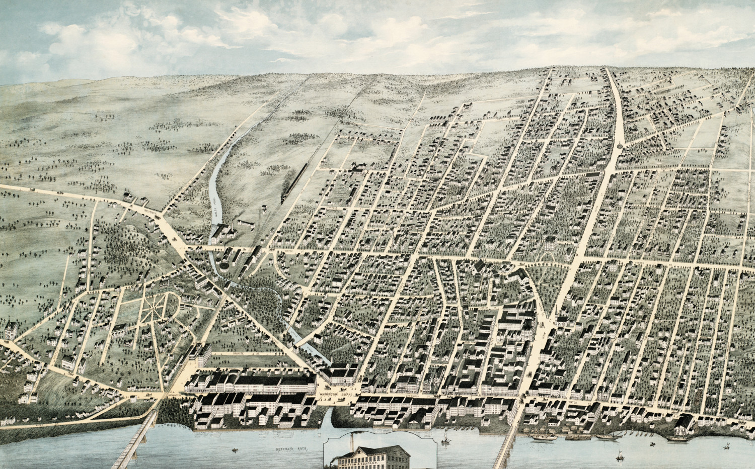
Beautifully restored map of Haverhill, MA from 1876
Historic old map shows a bird's eye view of Haverhill, Massachusetts in 1876
 New York
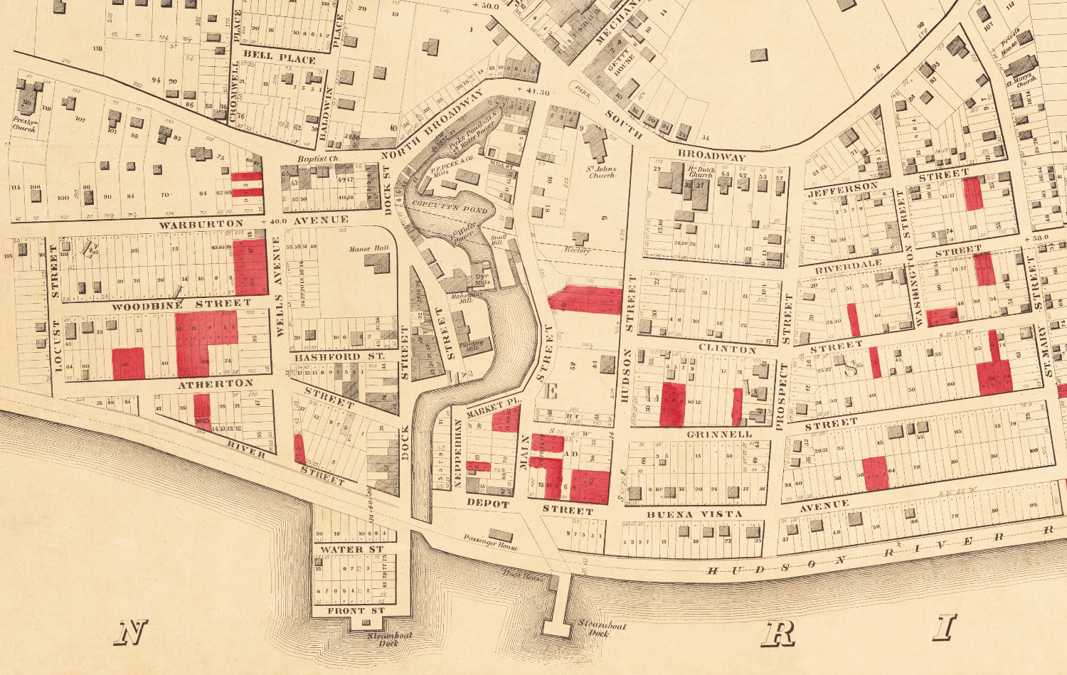
Historic old map of Yonkers, New York from 1859
Historic map of Yonkers from 1859
 Massachusetts
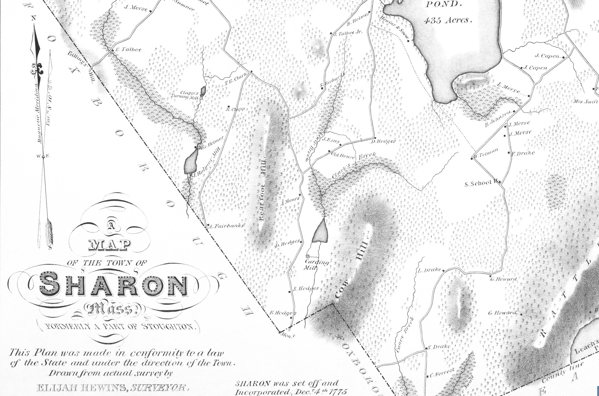
Historic map of Sharon, Massachusetts from 1831
Detailed map of Sharon, MA from 1831
 Georgia
Beautiful bird’s eye view map of Tallapoosa, Georgia from 1892
Detailed bird's eye view of Tallapoosa, Georgia from 1892
 Pennsylvania
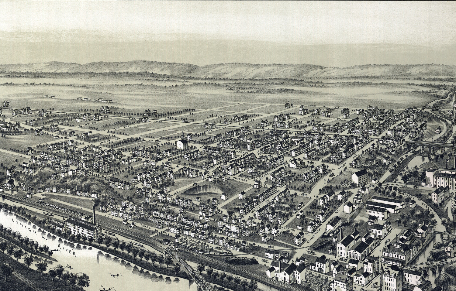
Beautifully restored map of West Bethlehem, PA from 1894
Detailed bird's eye view of West Bethlehem, PA in 1894
 Massachusetts
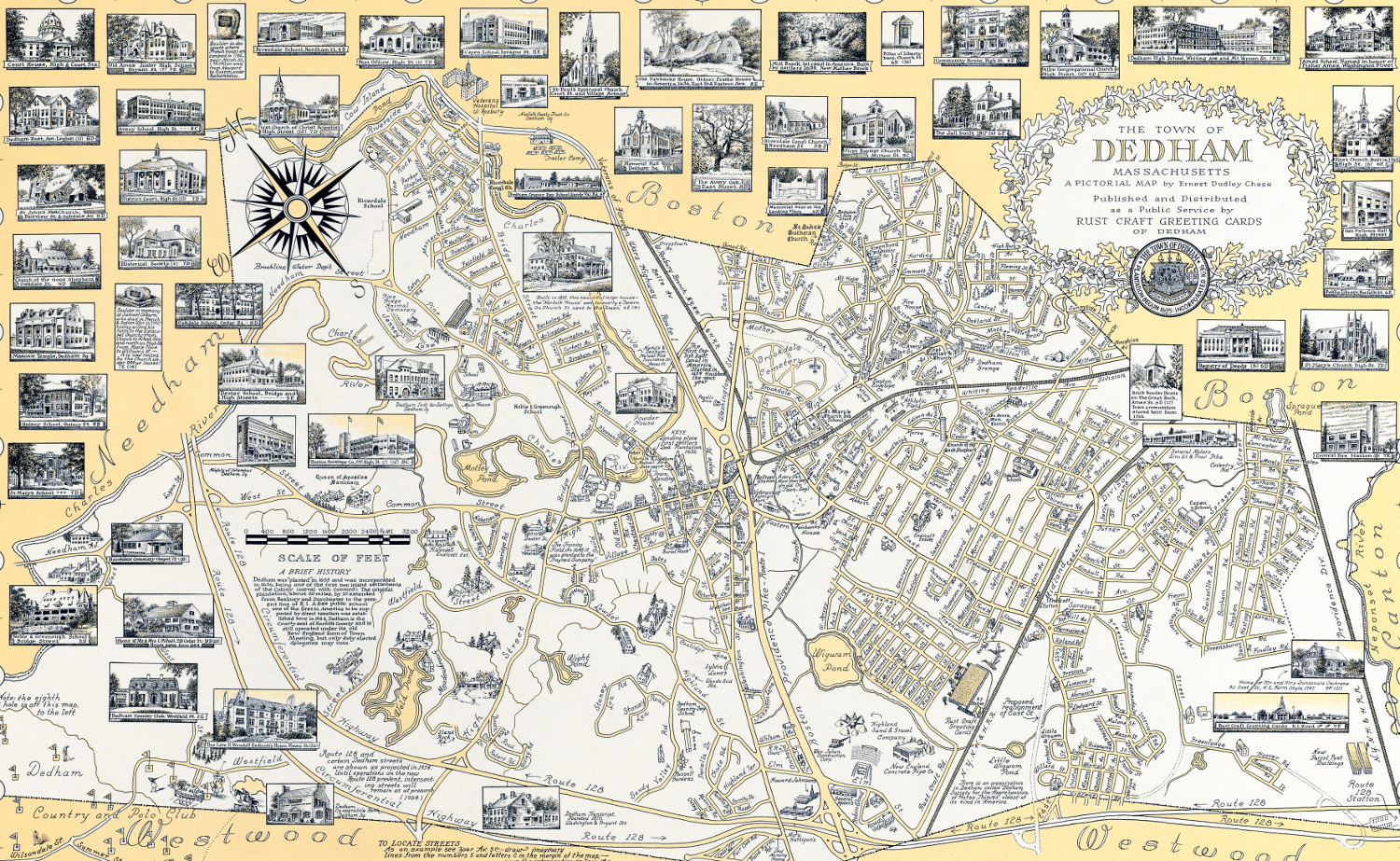
The History of Dedham, MA: beautifully detailed map from 1954
This beautifully detailed map of Dedham, Massachusetts features historical facts and trivia from around the state. It was created by renowned illustrator Ernest Dudley Chase in 1954.
 Michigan
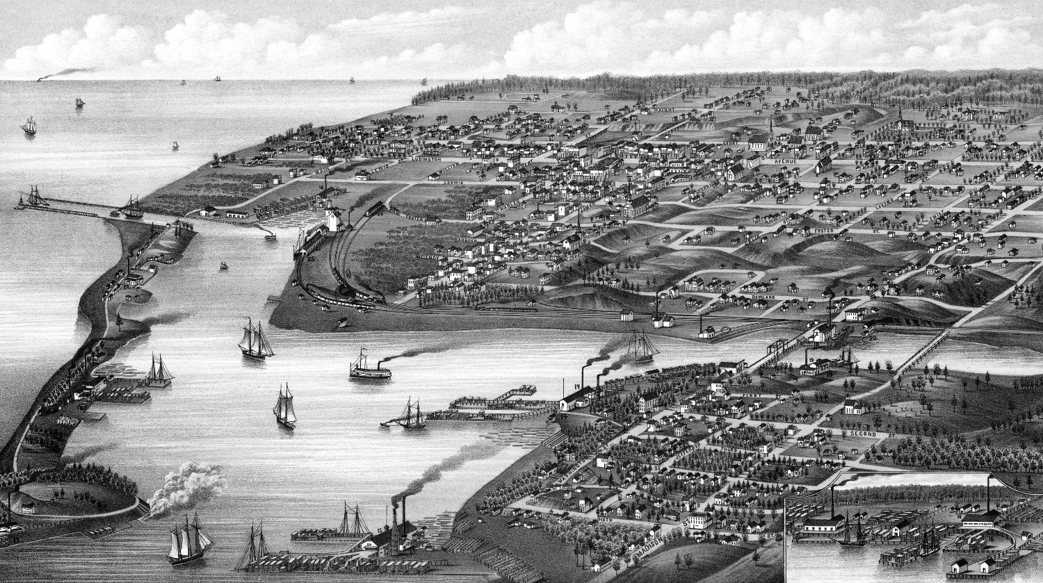
Historic bird’s eye view map of Ludington, Michigan in 1880
Detailed bird's eye view of Ludington, Michigan in 1880
 New Hampshire
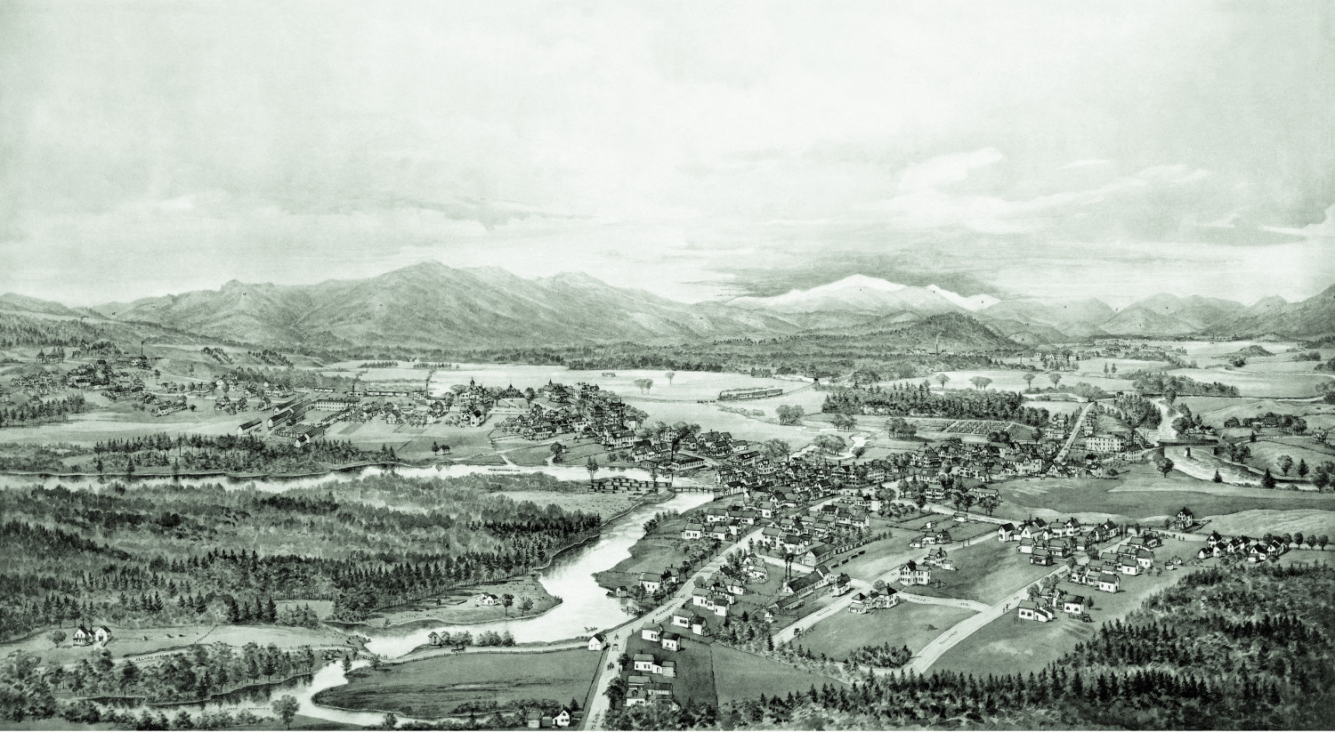
Beautifully restored map of Conway, New Hampshire from 1896
Detailed bird's eye view of Conway, New Hampshire in 1896
 Georgia
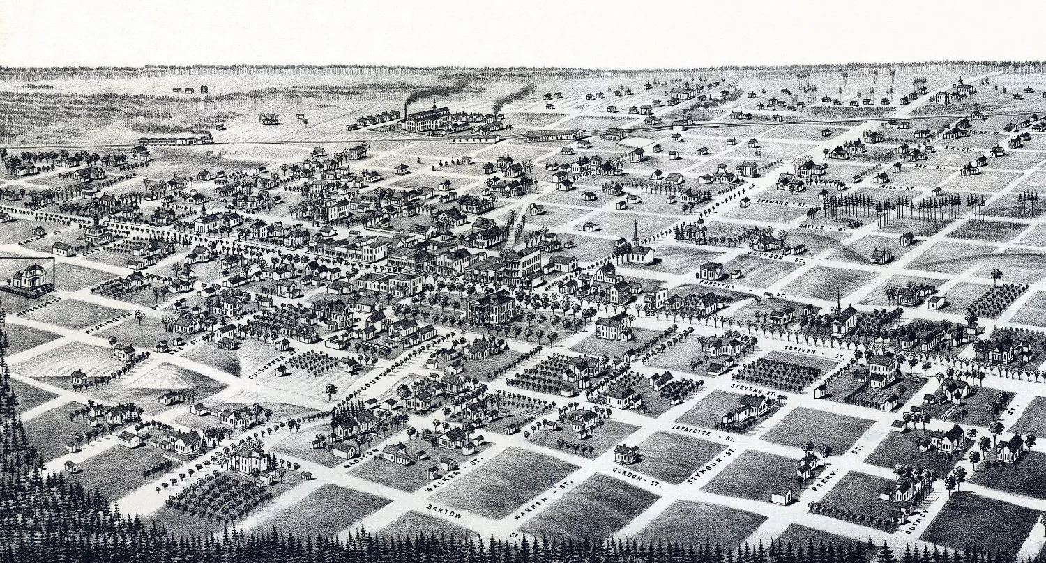
Beautifully restored map of Quitman, GA from 1885
Detailed bird's eye view of Quitman, Georgia in 1885
 Massachusetts
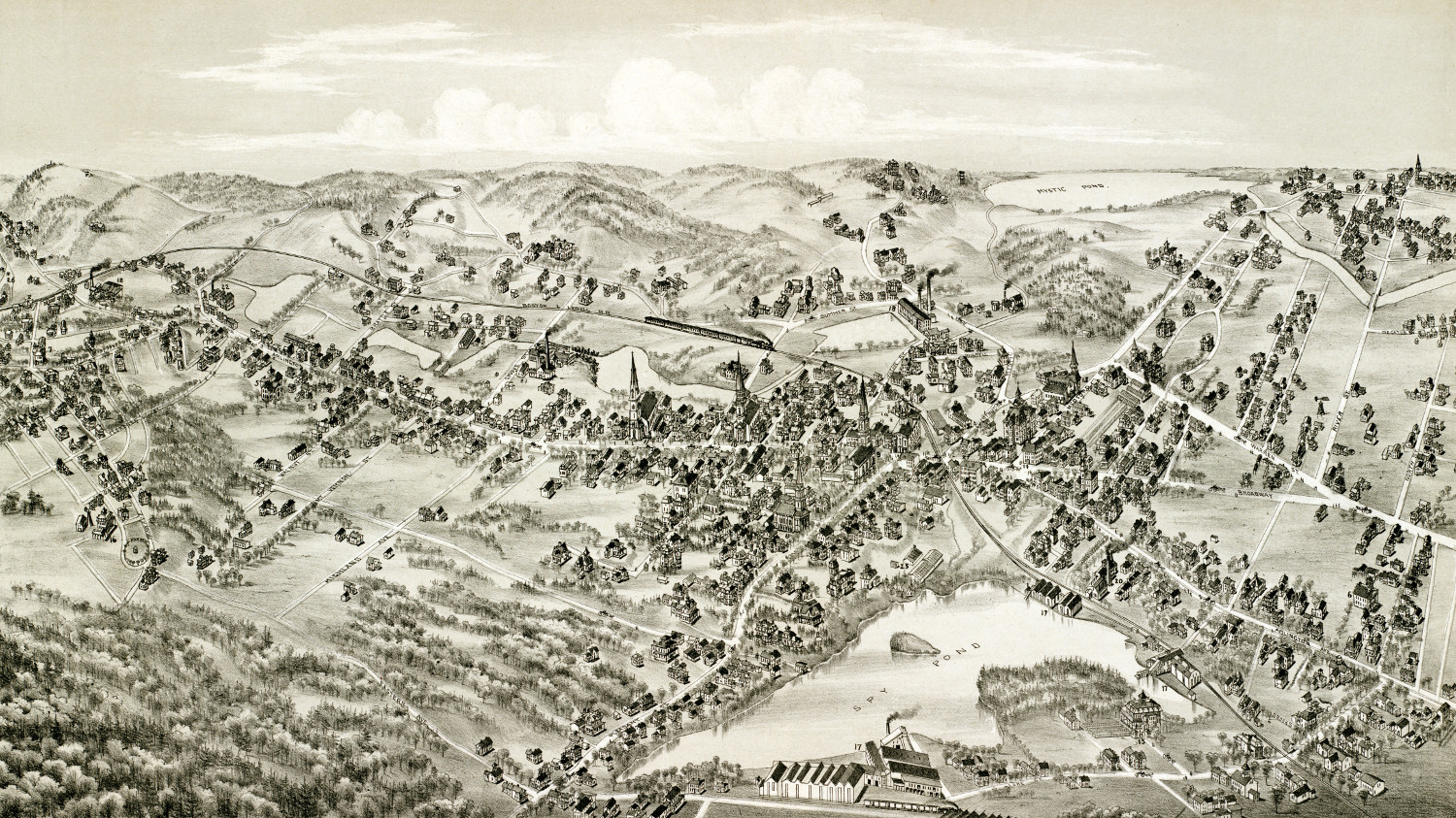
Beautifully restored map of Arlington, Massachusetts from 1884
Bird's eye view of Arlington, MA in 1884
 California
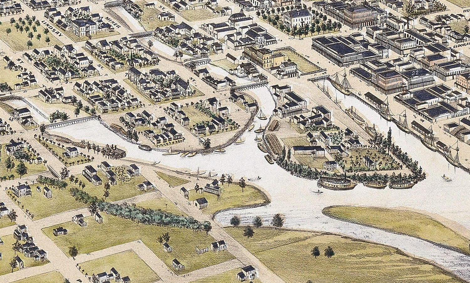
Historic Map of Stockton, California shows the city in 1870
Historic bird's eye view of Stockton, California from 1870
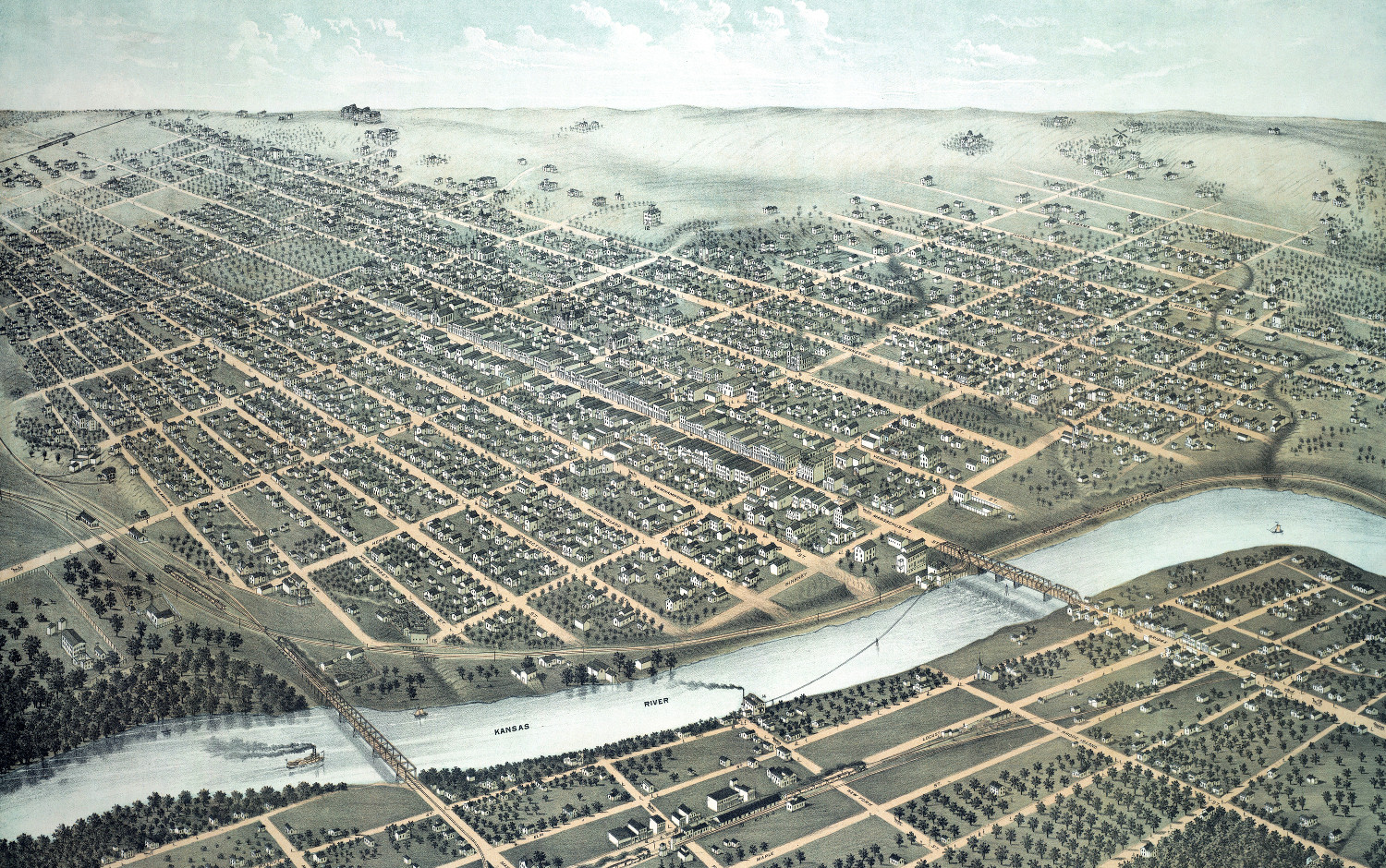 Kansas
Beautifully restored map of Lawrence, Kansas in 1880
Vintage bird's eye view of Lawrence, Kansas in 1880