
TheKnowOwl
Explore the archive through editorial features, geography, and historical collections.
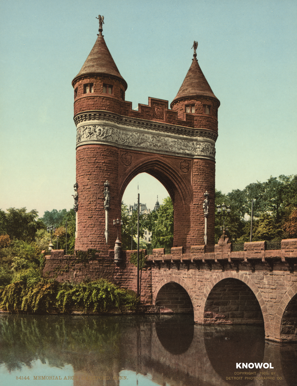 Connecticut
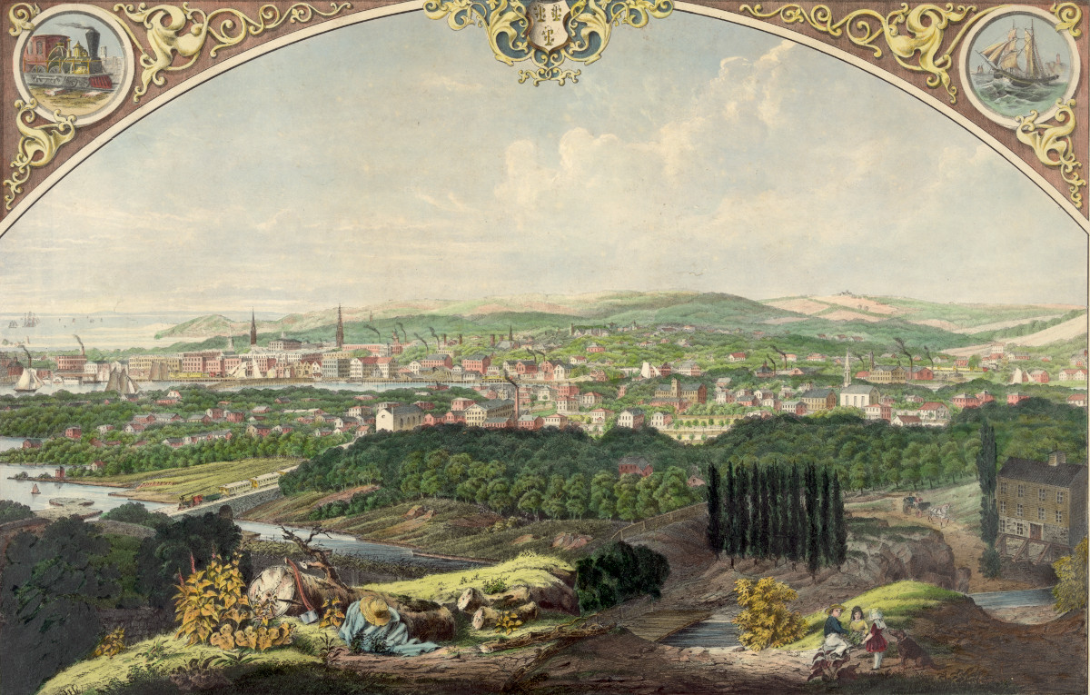
Hartford’s State Capital, Memorial Arch, and Bushnell Park
These pictures of Hartford, Connecticut were taken over the span of 20 years, from 1900 -1920.
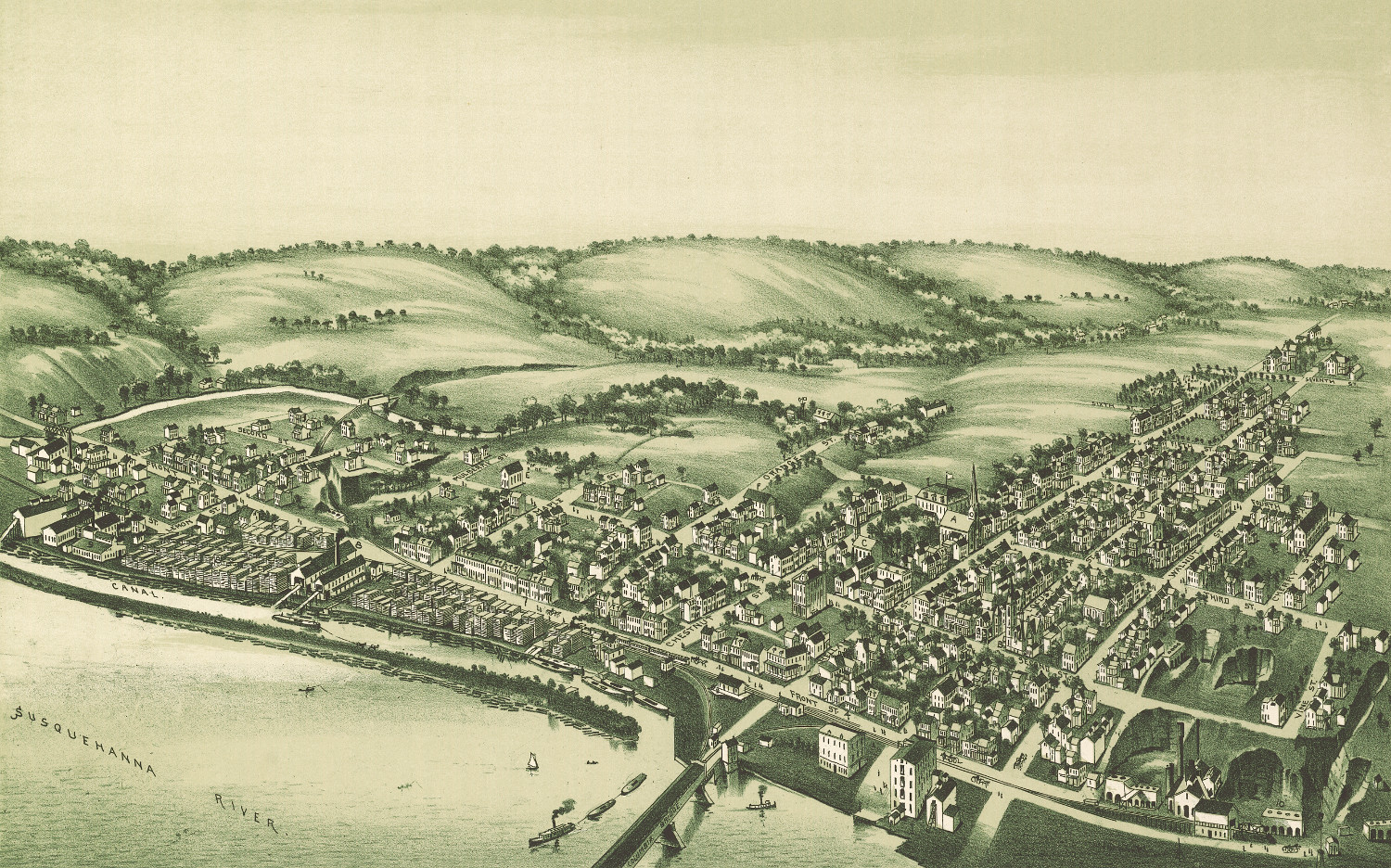 Pennsylvania
Bird’s eye view of Wrightsville, Pennsylvania in 1894
Click here to see what Wrightsville, Pennsylvania looked like in the 19th century.
 New Jersey
Beautifully restored map of Asbury Park, New Jersey in 1881
Click here to see what Asbury Park looked like 100+ years ago
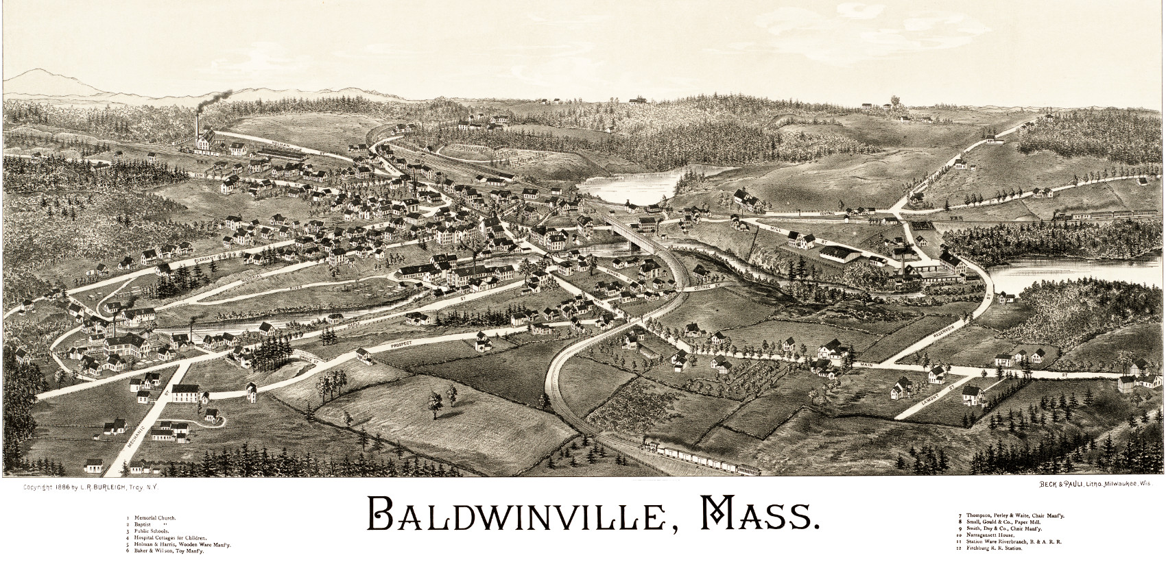 Massachusetts
Hand Drawn Map of Baldwinville, Massachusetts from 1886
Click here to see the full map.
 Wisconsin
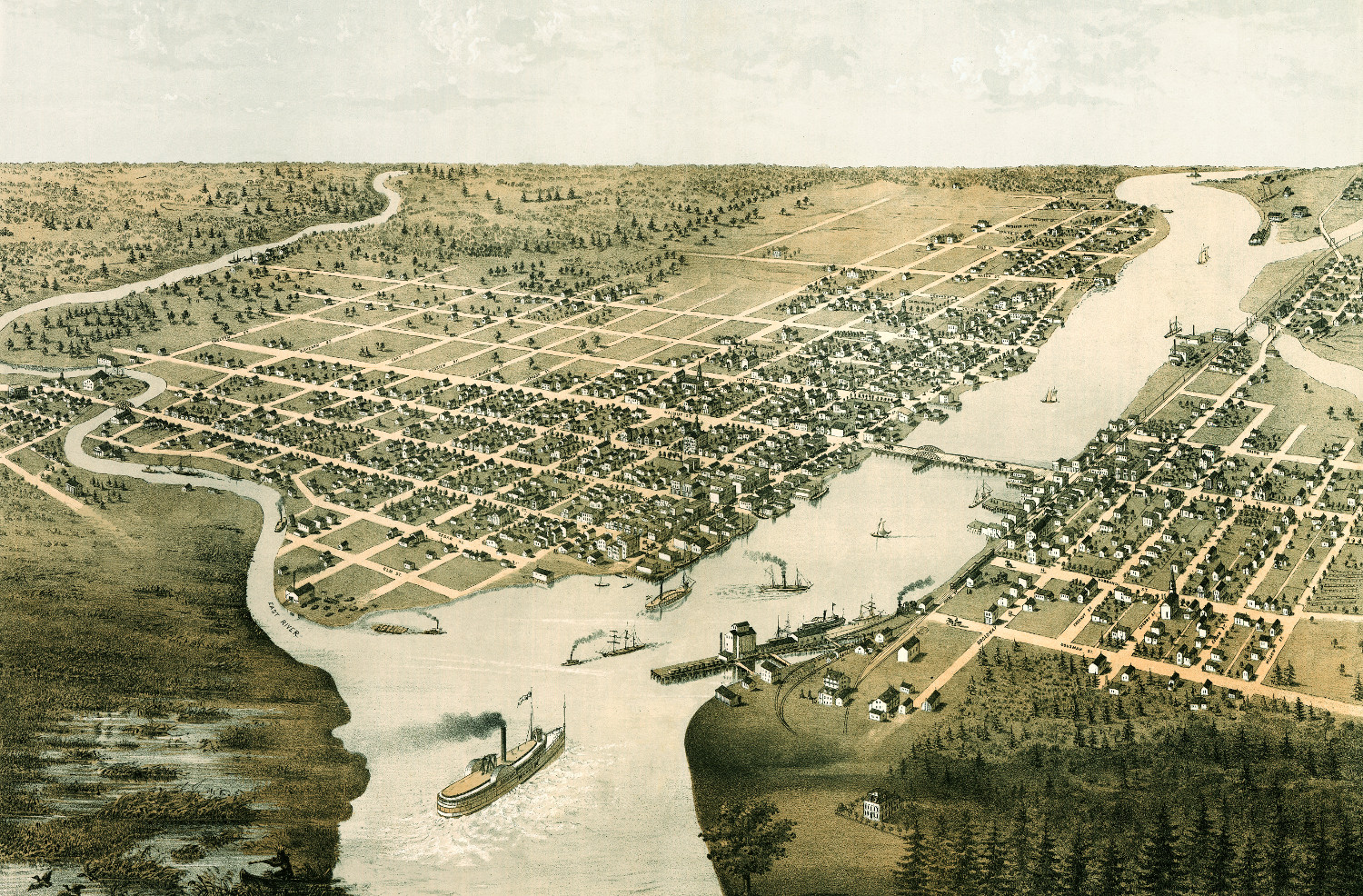
Beautifully restored map of Green Bay, Wisconsin from 1867
Historic bird's eye view of Green Bay and Fort Howard in 1867
 New Hampshire
Vintage map of Portsmouth, New Hampshire from 1877
This map shows Portsmouth, New Hampshire as it looked in 1877.
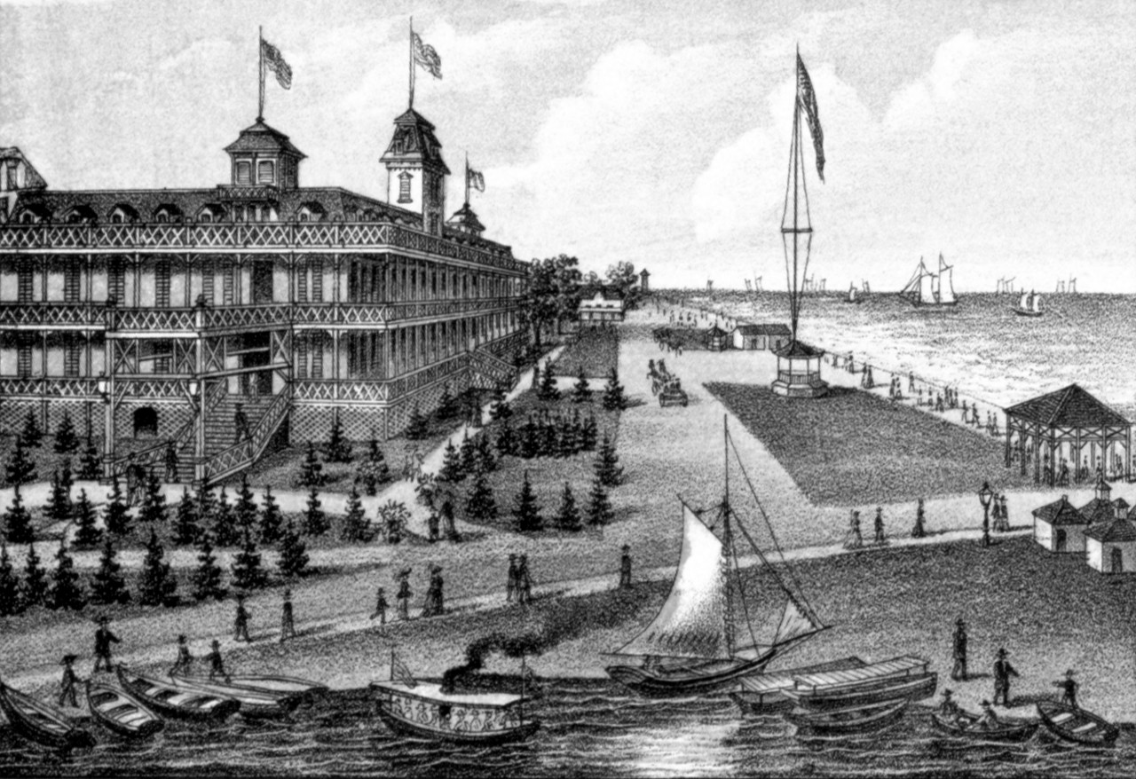
 New Jersey
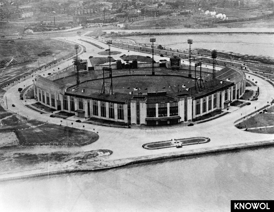
9 vintage pictures reveal the glory of Roosevelt Stadium
Roosevelt Stadium in Jersey City was a significant structure in the history of New Jersey and the racial integration of baseball. The stadium is…
 Connecticut
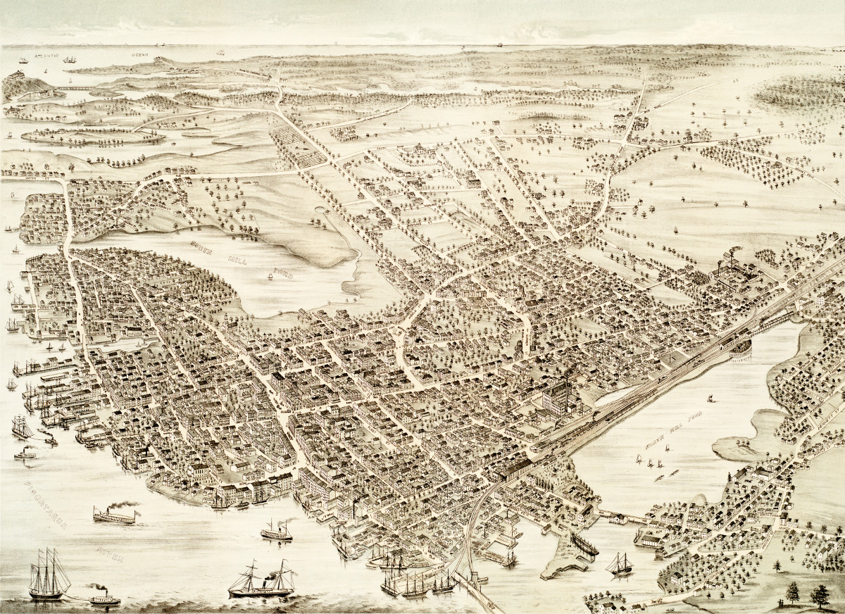
Cityscape view of Bridgeport, Connecticut from a nearby hill in 1857
This beautiful vintage print shows Bridgeport, Connecticut as it looked in 1857. The artist, Walter Staengel, sat atop what was then known as "Old…
 Massachusetts
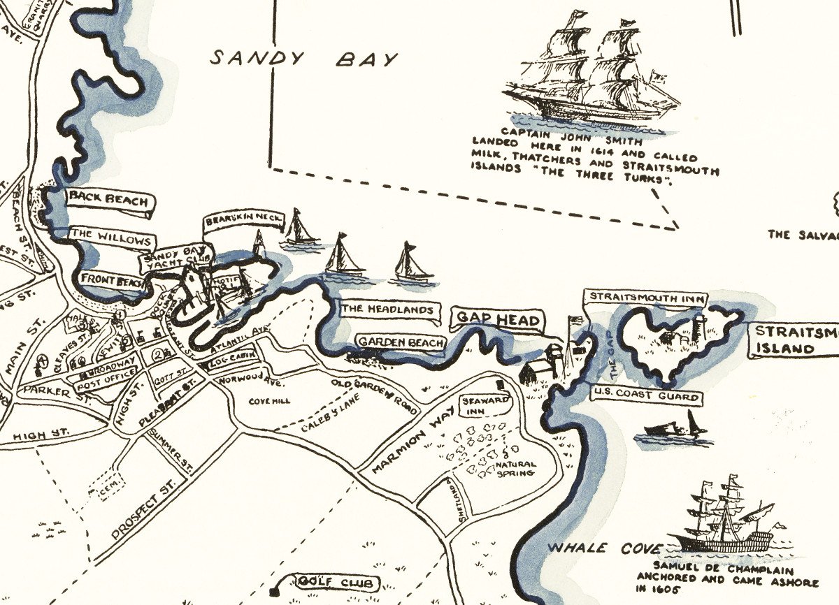
Beautiful map of Rockport, Massachusetts from 1940
This amazing vintage map of Rockport, Massachusetts was created by Jacqueline Hudson in 1940
 Virginia
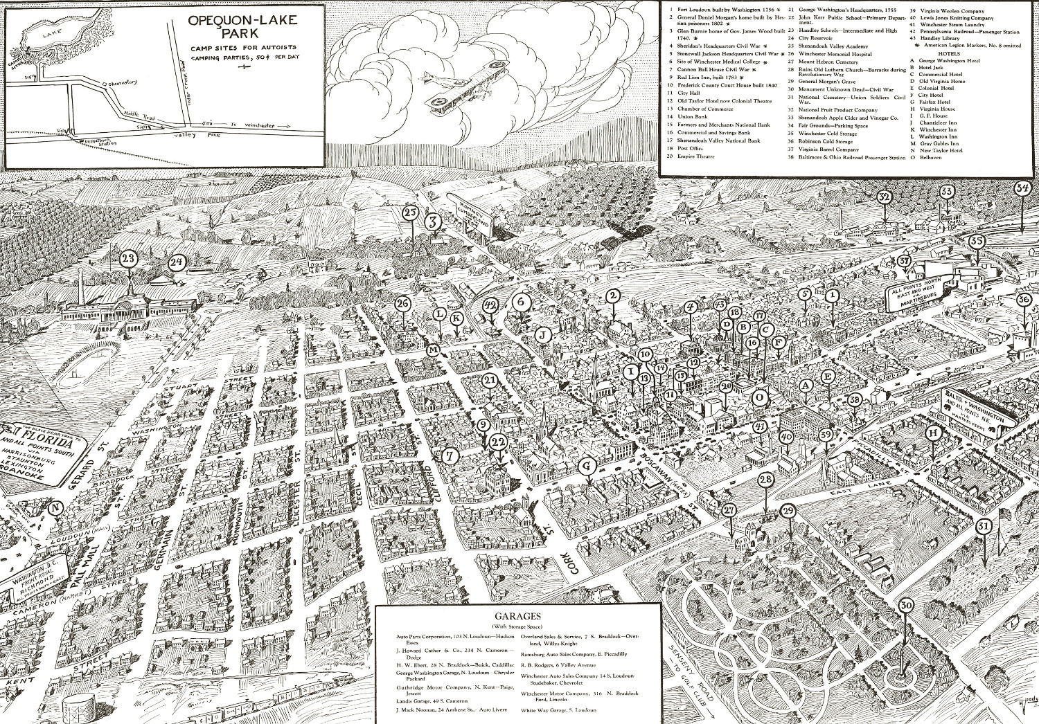
Beautifully detailed map of Winchester, Virginia from 1926
Historic bird's eye view of Winchester, Virginia from 1926
 Massachusetts
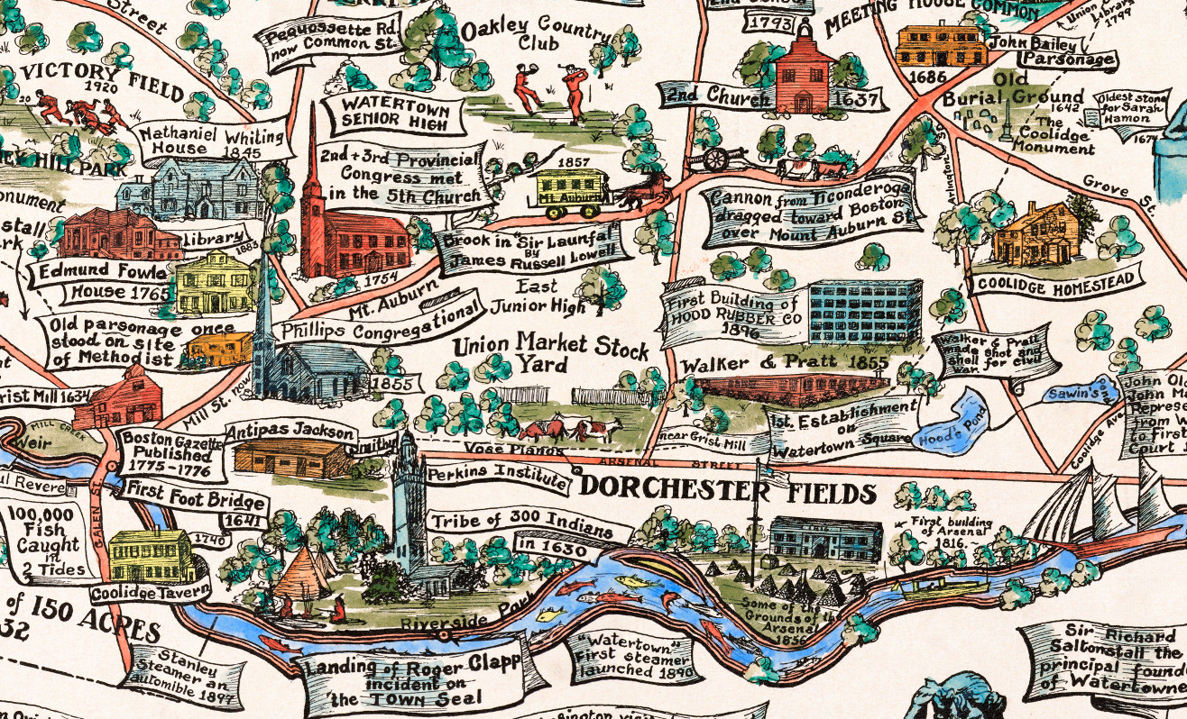
Beautifully restored map of Watertown, MA from 1930
This amazing map of Watertown, Massachusetts was created to celebrate the town's 300th anniversary in 1930.
 Pennsylvania
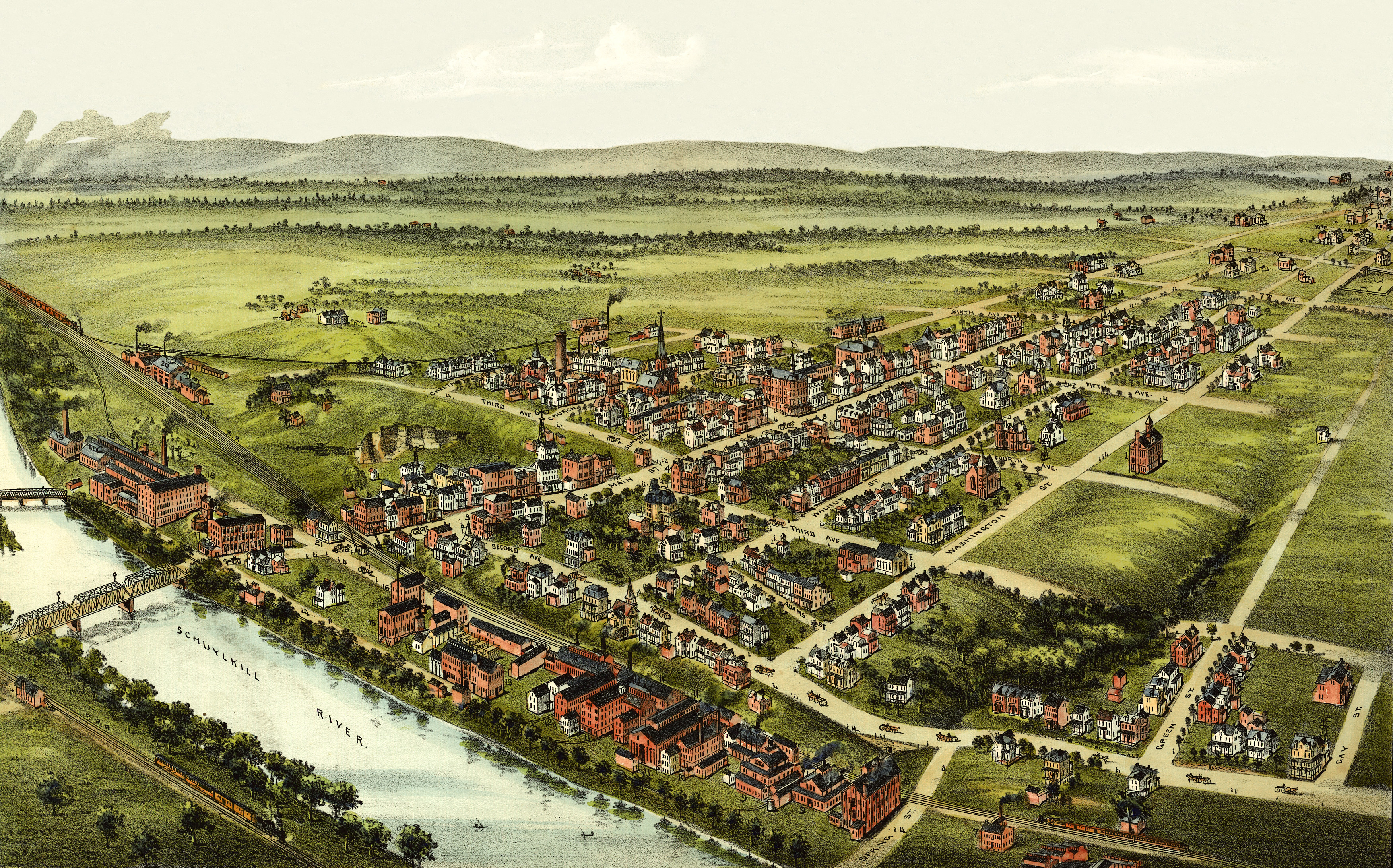
Beautifully detailed map of Royersford, PA from 1893
Click here to see Royersford, Pennsylvania in the 19th century.
 Connecticut
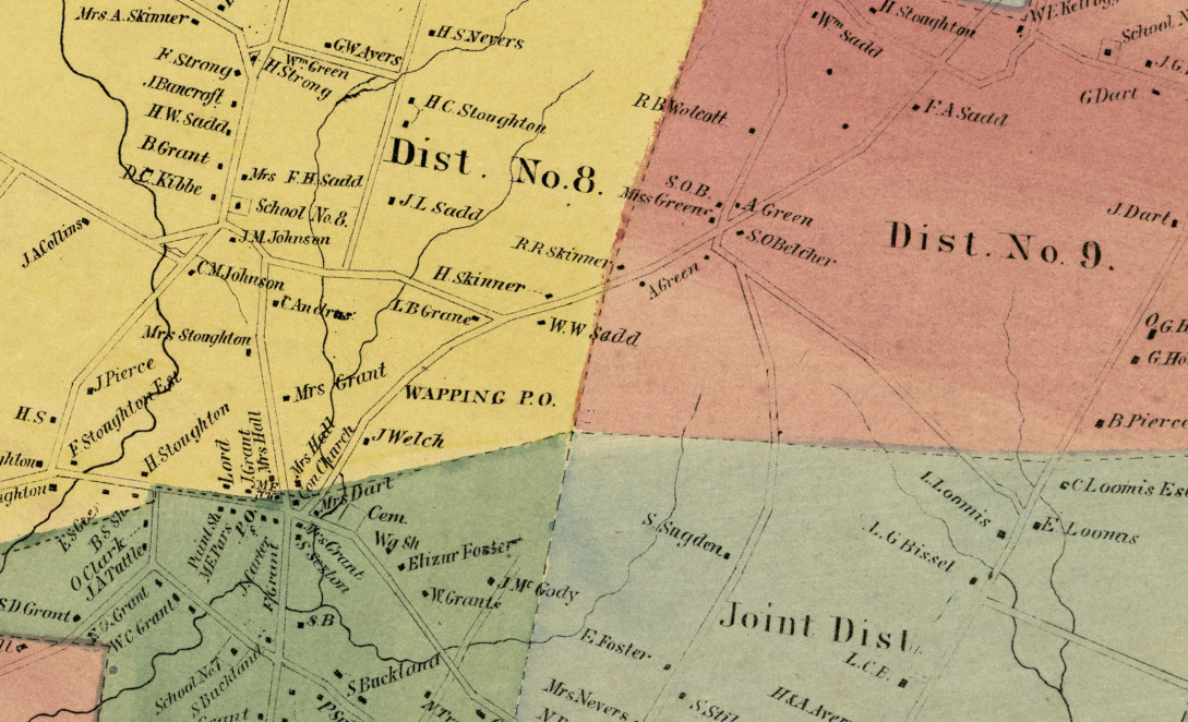
Historic landowners map of South Windsor, CT from 1869
Vintage landowners map shows South Windsor, Connecticut as it used to be
 North Carolina
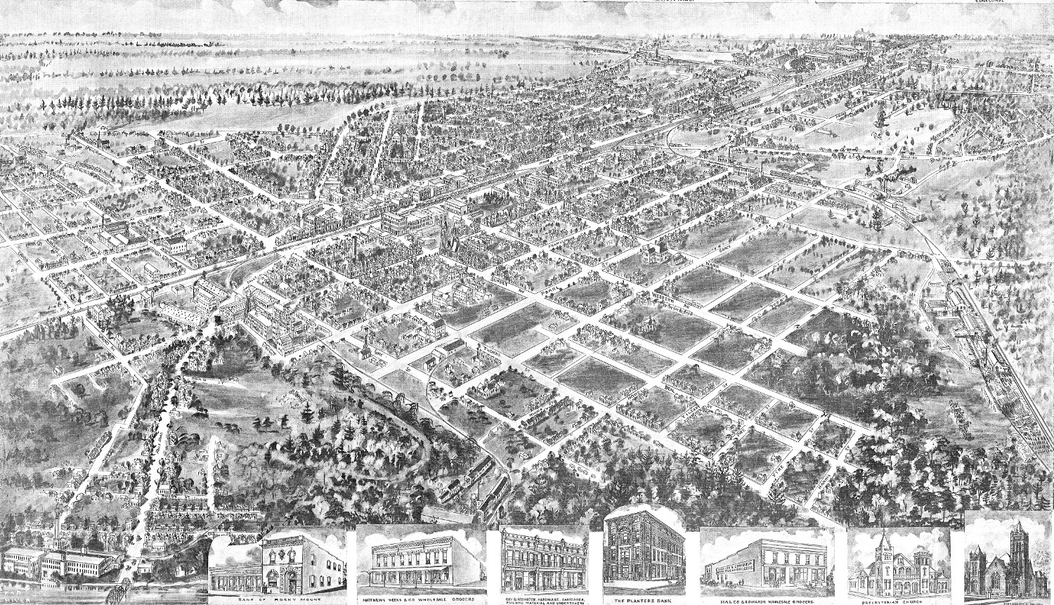
Bird’s eye view of Rocky Mount, North Carolina in 1907
Click here to see how Rocky Mount looked in the early 20th century.
 Wisconsin
Beautifully restored map of Geneva, Wisconsin from 1871
Historic bird's eye view of Geneva, Wisconsin from 1871
 Massachusetts
Beautifully detailed map of Martha’s Vineyard from 1954
Historic map of Martha's Vineyard from 1954
 Vermont
Historic old map of Ludlow, Vermont from 1885
Click here to see what Ludlow looked like 100+ years ago!
 Pennsylvania
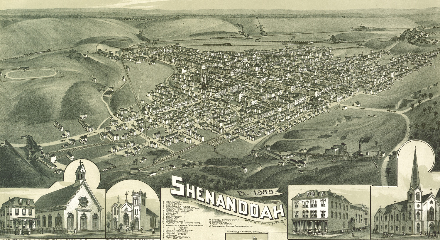
Beautiful bird’s eye view of Shenandoah, PA from 1889
Click here to see Shenandoah toward the end of the 19th century
 West Virginia
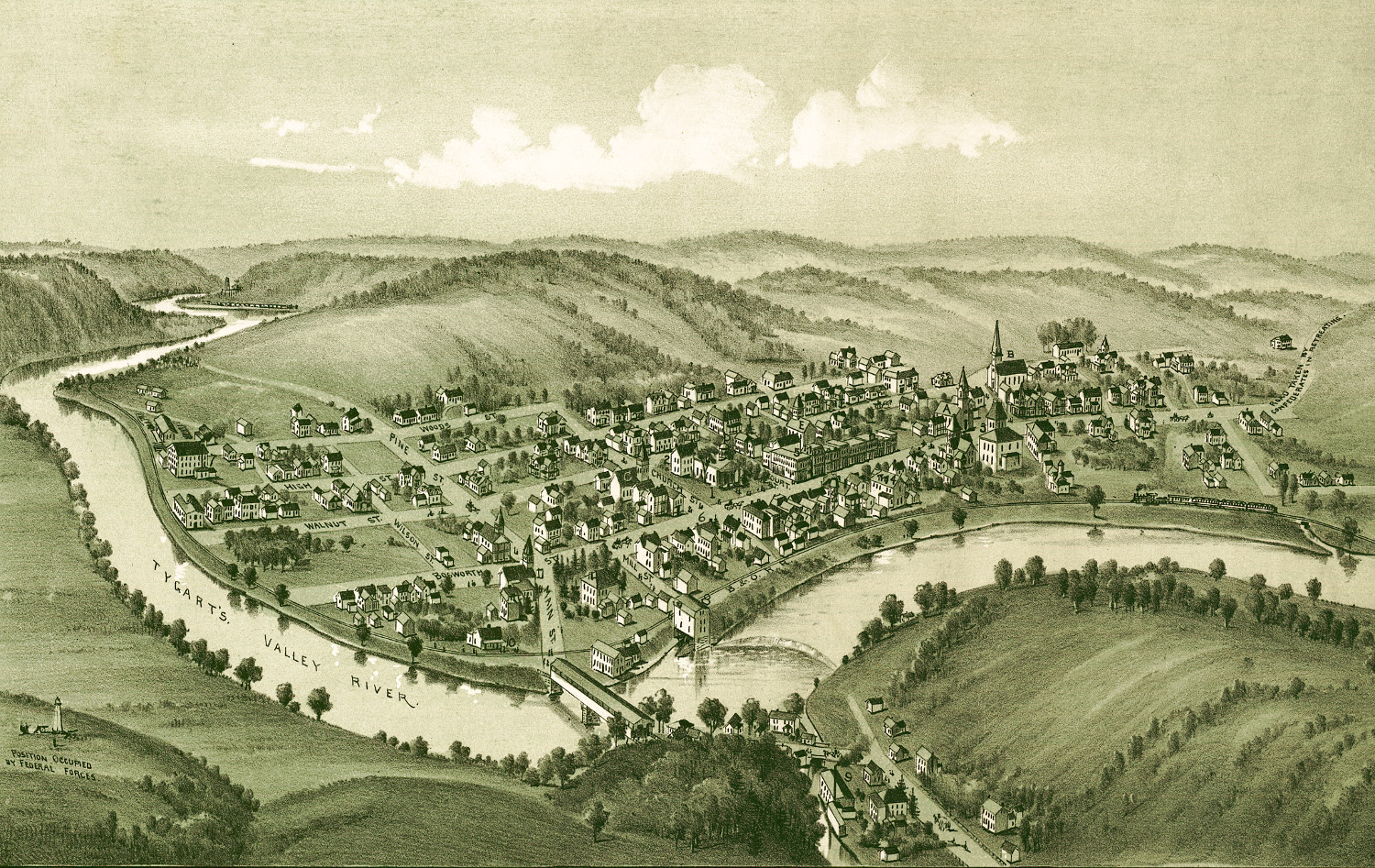
Historic old map of Philippi, West Virginia in 1897
Click here to find out what Philippi, WV looked like in the 19th century
 Virginia
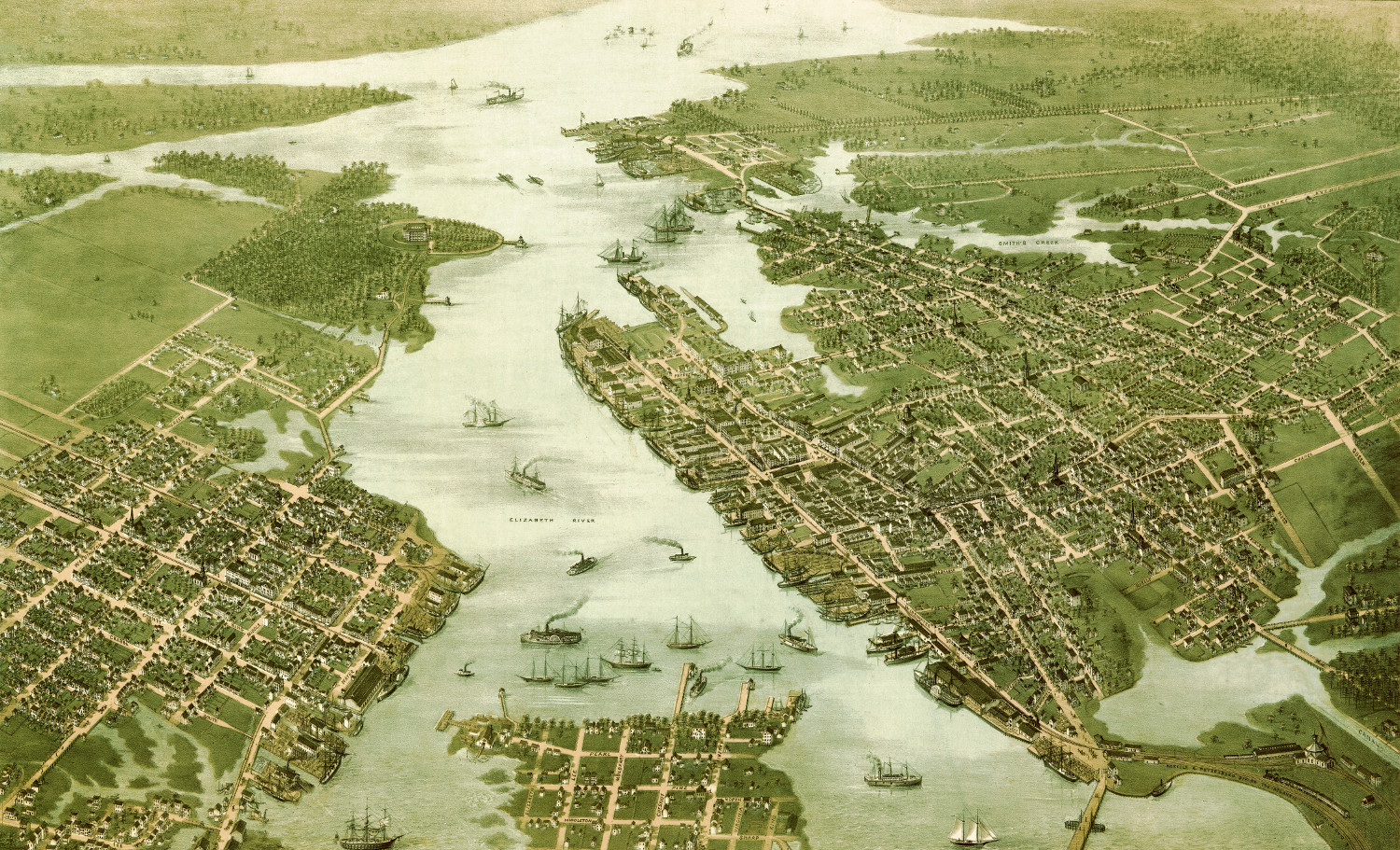
Beautifully restored map of Norfolk & Portsmouth, Virginia from 1873
Click here to see what Portsmouth and Norfolk looked like in the 19th century.
 Connecticut
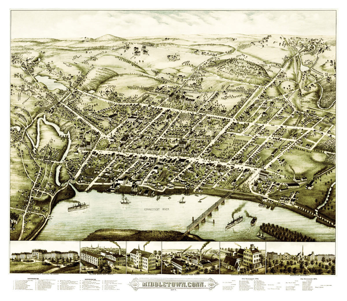
Bird’s eye view of Middletown, Connecticut in 1877
This beautiful vintage map shows Middletown, Connecticut as it looked in 1877. At the time approximately 7,000 people lived in Middletown and manufacturing was the…