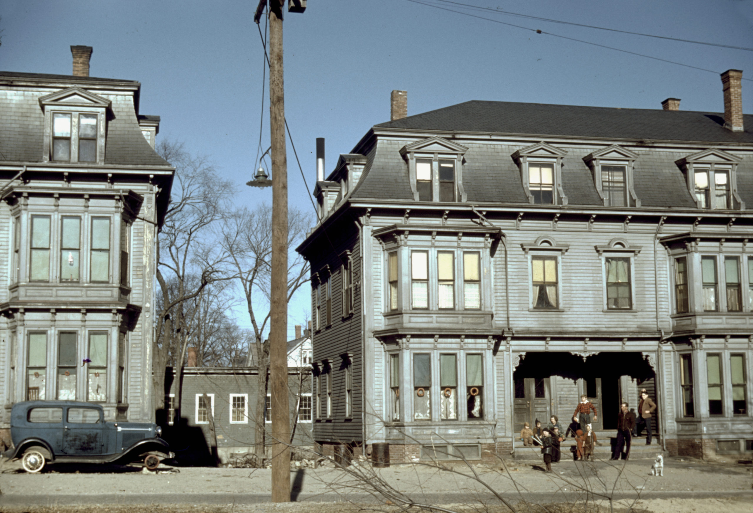
This photo showing children in the tenement district of Brockton, MA was taken by Jack Delano in December, 1940. The building on the left is 14-20 Rosseter St and the one on the right is 22-28 Rosseter St.
More Pictures of Massachusetts
Beautifully detailed map of Woburn, Massachusetts in 1883
Historic bird’s eye view of Woburn, Massachusetts in 1883
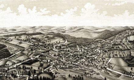
Beautifully restored map of Townsend Center, MA from 1889
Detailed bird’s eye view of Townsend Center, MA in 1889
Beautifully restored map of Fitchburg, MA from 1875
Historic old map of Fitchburg, Massachusetts from 1875
Bird’s eye view of Haverhill, Massachusetts in 1893
This is what Haverhill looked like when only 30,000 people lived here
Beautifully restored map of Marblehead, MA from 1882
Detailed bird’s eye view of Marblehead, Massachusetts in 1882
Beautifully restored map of East Boston, Massachusetts from 1879
Vintage map of East Boston, Massachusetts from the late 19th century.
Beautifully restored map of North Billerica, MA from 1887
Historic bird’s eye view of North Billerica, Massachusetts from 1887
Beautifully detailed map of Housatonic, MA from 1890
Historic bird’s eye view of Housatonic, Massachusetts from 1890
Beautifully detailed map of Chicopee, Massachusetts in 1878
Historic bird’s eye view of Chicopee, Massachusetts in 1878
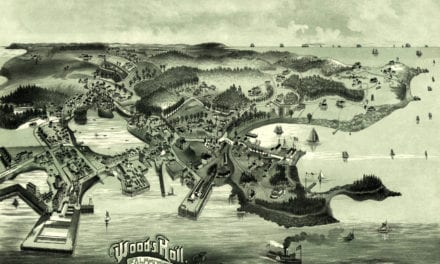
Vintage travel poster for Martha’s Vineyard, the Enchanted Isle
Martha’s Vineyard, the Enchanted Isle was an advertising poster created in 1934.
Beautifully detailed map of Winchendon, MA from 1878
Historic bird’s eye view of Winchendon, Massachusetts from 1878
Beautifully restored map of Southbridge, MA from 1878
Bird’s eye view of Southbridge, Massachusetts in the 19th century.
Beautifully restored map shows bird’s eye view of Monson, MA in 1879
This old map shows Monson, Massachusetts in the late 19th century.
Beautifully restored map of Ipswich, Massachusetts from 1893
Historic bird’s eye view of Ipswich, Massachusetts from 1893
Beautifully restored view of Lawrence, MA from 1854
Detailed bird’s eye view of Lawrence, Massachusetts from 1855
Beautifully restored map of Newburyport, MA from 1894
Historic bird’s eye view of Newburyport, Massachusetts from 1894
Beautifully detailed map of Athol, Massachusetts in 1887
Historic bird’s eye view of Athol, Massachusetts from 1887
Bird’s eye view of Huntington, Massachusetts from 1886
This beautiful hand drawn map of Huntington, Massachusetts was created by Hughes & Bailey Publishers in 1886. The map shows a bird’s eye view of Huntington, MA surrounded by hand drawn pictures of historic Huntington landmarks.
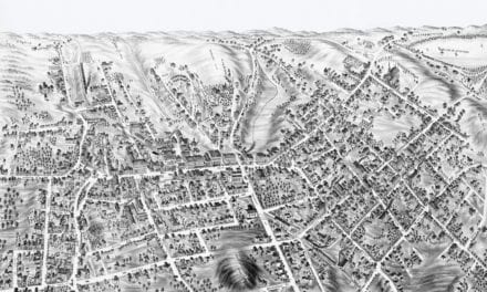
Beautifully restored map of Haverhill, Massachusetts in 1893
Historic bird’s eye view of Haverhill, Massachusetts from 1893