
New Hampshire Town Map Prints

Every town in New Hampshire, from the Seacoast to the North Country, drawn as a map you can hang on the wall. Type yours, or find it on the map.

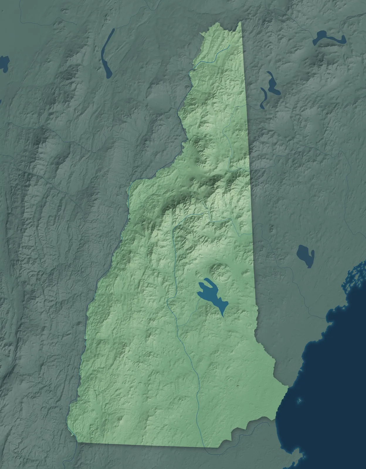
Relief map of New Hampshire with each town map as a dot

A town, city, neighborhood or landmark. Pick one to see its map.

New Hampshire Town Maps A to Z

All 263 town maps, from Acworth to Woodsville. Each one opens its own page with the whole map.

A

  1. Acworth
  2. Albany
  3. Alexandria
  4. Allenstown
  5. Allenstown Elementary School
  6. Alstead
  7. Alton
  8. Amherst
  9. Andover
  10. Antrim
  11. Ashland
  12. Atkinson
  13. Auburn

B

  1. Barnstead
  2. Barrington
  3. Bartlett
  4. Bath
  5. Bedford
  6. Belmont
  7. Bennington
  8. Benton
  9. Berlin
  10. Bethlehem
  11. Blodgett Landing
  12. Boscawen
  13. Bow
  14. Bradford
  15. Brentwood
  16. Bridgewater
  17. Bristol
  18. Brookfield
  19. Brookline

C

  1. Campton
  2. Canaan
  3. Candia
  4. Canterbury
  5. Carroll
  6. Center Harbor
  7. Center Ossipee
  8. Center Sandwich
  9. Charlestown
  10. Chatham
  11. Chester
  12. Chesterfield
  13. Chichester
  14. Claremont
  15. Clarksville
  16. Colebrook
  17. Columbia
  18. Concord
  19. Contoocook
  20. Conway
  21. Cornish
  22. Croydon

D

  1. Dalton
  2. Danbury
  3. Danville
  4. Deerfield
  5. Deering
  6. Derry
  7. Dorchester
  8. Dover
  9. Dublin
  10. Dummer
  11. Dunbarton
  12. Durham

E

  1. East Kingston
  2. East Merrimack
  3. Easton
  4. Eaton
  5. Effingham
  6. Ellsworth
  7. Enfield
  8. Epping
  9. Epsom
  10. Errol
  11. Exeter

F

  1. Farmington
  2. Fitzwilliam
  3. Francestown
  4. Franconia
  5. Franklin
  6. Freedom
  7. Fremont

G

  1. Gilford
  2. Gilmanton
  3. Gilsum
  4. Goffstown
  5. Gorham
  6. Goshen
  7. Grafton
  8. Grantham
  9. Greenfield
  10. Greenland
  11. Greenville
  12. Groton
  13. Groveton

H

  1. Hampstead
  2. Hampton
  3. Hampton Beach
  4. Hampton Falls
  5. Hancock
  6. Hanover
  7. Harrisville
  8. Hart's Location
  9. Haverhill
  10. Hebron
  11. Henniker
  12. Hill
  13. Hillsborough
  14. Hinsdale
  15. Holderness
  16. Hollis
  17. Hooksett
  18. Hopkinton
  19. Hudson

J

  1. Jackson
  2. Jaffrey
  3. Jefferson

K

  1. Keene
  2. Kensington
  3. Kingston
  4. Klondike Corner

L

  1. Laconia
  2. Lancaster
  3. Landaff
  4. Langdon
  5. Lebanon
  6. Lee
  7. Lempster
  8. Lincoln
  9. Lisbon
  10. Litchfield
  11. Littleton
  12. Londonderry
  13. Loudon
  14. Lyman
  15. Lyme
  16. Lyndeborough

M

  1. Madbury
  2. Madison
  3. Manchester
  4. Marlborough
  5. Marlow
  6. Mason
  7. Melvin Village
  8. Meredith
  9. Merrimack
  10. Middleton
  11. Milan
  12. Milford
  13. Milton
  14. Milton Mills
  15. Monroe
  16. Mont Vernon
  17. Moultonborough
  18. Mountain Lakes

N

  1. Nashua
  2. Nelson
  3. New Boston
  4. New Castle
  5. New Durham
  6. New Hampton
  7. New Ipswich
  8. New London
  9. Newbury
  10. Newfields
  11. Newington
  12. Newmarket
  13. Newport
  14. Newton
  15. North Conway
  16. North Hampton
  17. North Haverhill
  18. North Londonderry
  19. North Salem
  20. North Walpole
  21. North Woodstock
  22. Northfield
  23. Northumberland
  24. Northwood
  25. Nottingham

O

  1. Orange
  2. Orford
  3. Ossipee

P

  1. Pelham
  2. Pembroke
  3. Peterborough
  4. Piermont
  5. Pinardville
  6. Pittsburg
  7. Pittsfield
  8. Plainfield
  9. Plaistow
  10. Plymouth
  11. Portsmouth

R

  1. Randolph
  2. Raymond
  3. Richmond
  4. Rindge
  5. Rochester
  6. Rollinsford
  7. Roxbury
  8. Rumney
  9. Rye

S

  1. Salem
  2. Salisbury
  3. Sanbornton
  4. Sanbornville
  5. Sandown
  6. Sandwich
  7. Seabrook
  8. Seabrook Beach
  9. Sharon
  10. Shelburne
  11. Somersworth
  12. South Hampton
  13. South Hooksett
  14. Springfield
  15. Stark
  16. Stewartstown
  17. Stoddard
  18. Strafford
  19. Stratford
  20. Stratham
  21. Sugar Hill
  22. Suissevale
  23. Sullivan
  24. Sunapee
  25. Suncook
  26. Surry
  27. Sutton
  28. Swanzey

T

  1. Tamworth
  2. Temple
  3. Thornton
  4. Tilton
  5. Tilton Northfield
  6. Troy
  7. Tuftonboro

U

  1. Union
  2. Unity

W

  1. Wakefield
  2. Walpole
  3. Warner
  4. Warren
  5. Washington
  6. Waterville Valley
  7. Weare
  8. Webster
  9. Wentworth
  10. West Stewartstown
  11. West Swanzey
  12. Westmoreland
  13. Whitefield
  14. Wilmot
  15. Wilton
  16. Winchester
  17. Windham
  18. Windsor
  19. Wolfeboro
  20. Woodstock
  21. Woodsville

Don’t see your town? Ask us to draw it.

About New Hampshire

New Hampshire has just 18 miles of ocean coast, the shortest of any coastal state. From the beaches it climbs north through lakes and hills to the White Mountains and the Great North Woods at the Canadian border. In June 1788, it became the ninth state to ratify the Constitution, and its vote put the Constitution into effect.

More than half of all Granite Staters live in Hillsborough and Rockingham counties, along the Merrimack River and the Seacoast. Many towns there grew up around textile and shoe mills, while farther north they began as farm villages, logging and paper towns, and summer resorts. With 400 members, New Hampshire's House of Representatives is by far the largest of any state.

Statehood
June 21, 1788
Capital
Concord
Population
1,415,3422025 Census estimate
Highest point
Mount Washington, 6,288 feet
Lowest point
Atlantic Ocean, sea level
Size
9,349 square miles, the 46th largest state

Portsmouth and the Seacoast

Portsmouth, Rye and Hampton are on the ocean, Exeter, Dover and Durham sit on tidal rivers just inland, and Salem and Derry are down near the Massachusetts line. Dover, settled in 1623, is the oldest permanent settlement in the state. In Portsmouth, a whole old neighborhood with houses from the 1600s to the 1800s is now the Strawbery Banke Museum. Robert Frost wrote many of his early poems on his farm in Derry.

Manchester, Nashua and Concord

The state's three biggest cities, Manchester, Nashua and Concord, sit along the Merrimack River, with towns like Milford and Peterborough in the hills around them. Manchester's Amoskeag Mills grew into the largest cotton textile plant in the world, and their brick buildings still line the river. Concord, the capital, gave its name to the Concord coach, once the most popular stagecoach in North America. Thornton Wilder wrote Our Town at Peterborough's MacDowell artists' colony, and the town was a model for the play.

Monadnock and Lake Sunapee

This is the state's southwest corner, along the Vermont line, with Keene in the south and Claremont, Newport and Lake Sunapee to the north. Mount Monadnock, in Jaffrey, is often called one of the most climbed mountains in the world. Harrisville's brick mills from the 1800s are so well kept that the village is a National Historic Landmark. In Cornish, the home and studio of sculptor Augustus Saint-Gaudens is now a national park.

Lakes Region and Mount Washington Valley

Lake Winnipesaukee, the largest lake in the state, is ringed by Laconia, Gilford, Meredith, Alton and Wolfeboro. Wolfeboro calls itself the oldest summer resort in America, because the colonial governor, John Wentworth, built a summer estate there in 1771. Motorcycle Week began at Laconia's Weirs Beach in 1916. To the north, Conway and North Conway sit in the Mount Washington Valley, where landscape painters gathered by the 1850s.

White Mountains and the North Country

Hanover and Lebanon sit on the Connecticut River, and north of Plymouth the White Mountains rise around Lincoln, Franconia, Littleton and Gorham, with the paper mill city of Berlin beyond. Dartmouth College was founded in Hanover in 1769. The Mount Washington Cog Railway, the world's first mountain-climbing cog railway, reached the summit in 1869. In Pittsburg, settlers caught in a border dispute ran their own Republic of Indian Stream from 1832 to 1835.

  • 12 × 18 inPrint $39.99Framed $89.99
  • 18 × 24 inPrint $49.99Framed $129.99
  • 24 × 36 inPrint $89.99Framed $199.99
The three sizes, drawn to scale

Sizes and Prices

Every map comes in three sizes on archival matte paper. Framed prints come in black or white wood.

How each map is made

  1. It starts with the real place

    Streets, buildings, terrain and water form the map, drawn the way New Hampshire looks today.

  2. Then the details

    Local research and an old atlas style give each town its character.

  3. Then it's yours

    Look around the map, then pick a print to keep or give.

Find your town