Beautifully detailed map of the White Mountains from 1890
Historic bird’s eye view of New Hampshire’s White Mountains from 1890
Read More
Historic bird’s eye view of New Hampshire’s White Mountains from 1890
Read More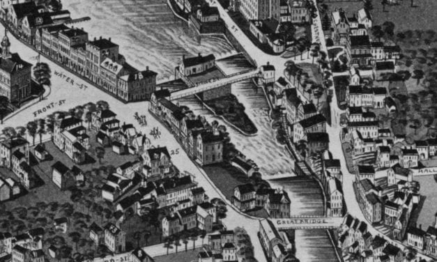
Historic bird’s eye view of Exeter, New Hampshire from 1884
Read More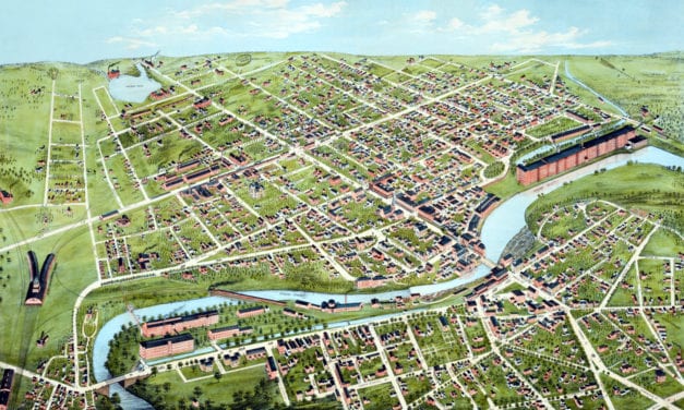
Detailed bird’s eye view of Nashua, New Hampshire from 1875
Read More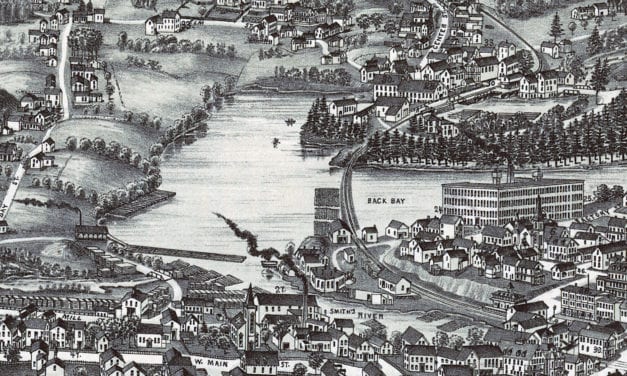
Historic bird’s eye view of Wolfeboro, New Hampshire from 1889
Read More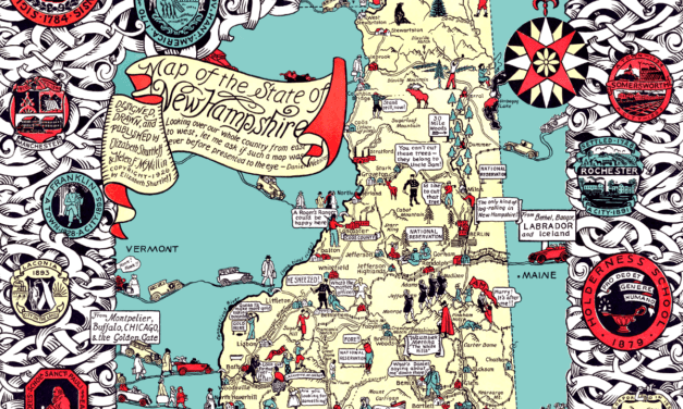
Granite State legend, history, and anecdotes, mixing past and present with skill and humor.
Read More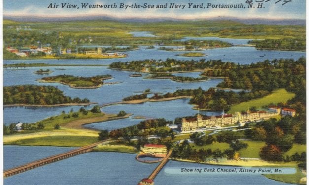
The following images of Portsmouth, New Hampshire are from postcards dated…
Read More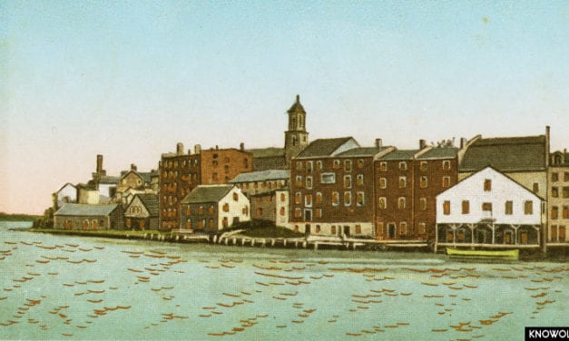
This series of old pictures shows Portsmouth New Hampshire and the surrounding areas…
Read More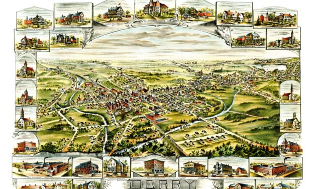
This old map shows Derry, New Hampshire in the late 19th century.
Read More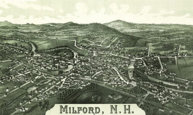
This map shows Milford, New Hampshire as it looked in 1886.
Read More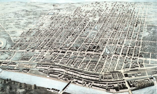
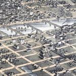
This map shows Manchester, New Hampshire as it looked in 1876. It was created by J.C. Hazen, and...
Read More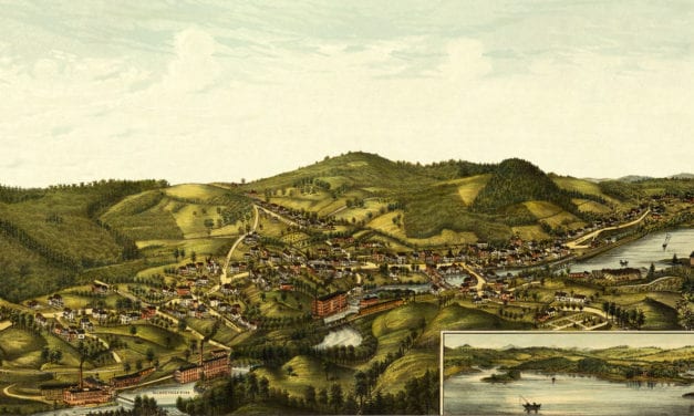
This old map shows Milton, New Hampshire in the late 19th century.
Read More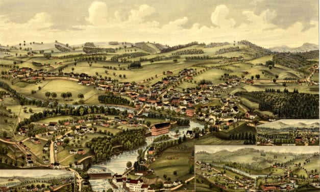
This old map shows Henniker, New Hampshire in the late 19th century.
Read More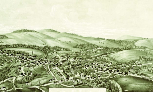
Click here to see what Greenville looked like 100+ years ago
Read More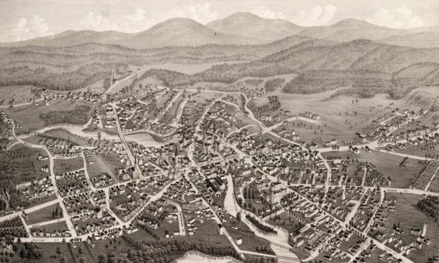
This map of Laconia, New Hampshire was created in 1883 by Lucien R. Burleigh, an artist who spent...
Read More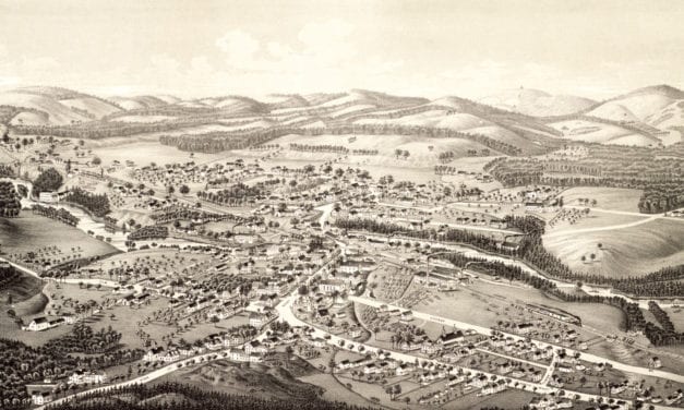
Click here to see what Goffstown, NH looked like in 1887.
Read More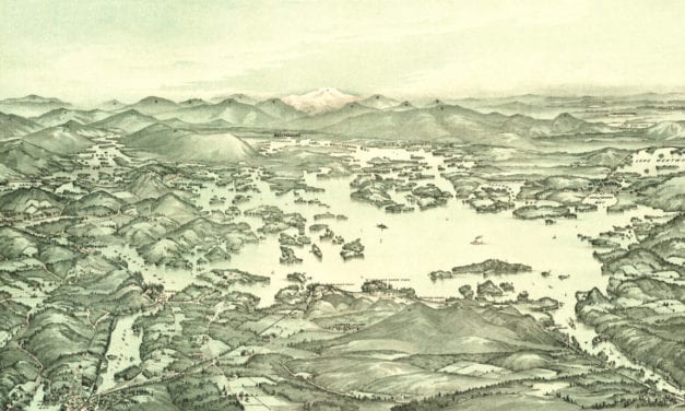
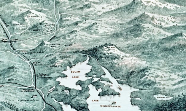
Historic bird’s eye view of Lake Winnipesaukee from 1903
Read More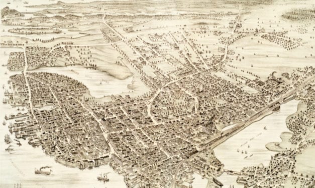
This map shows Portsmouth, New Hampshire as it looked in 1877.
Read More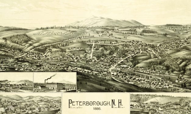
Click here to see what Peterborough looked like 100+ years ago!
Read More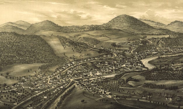
Detailed bird’s eye view of Hinsdale, New Hampshire in 1886
Read More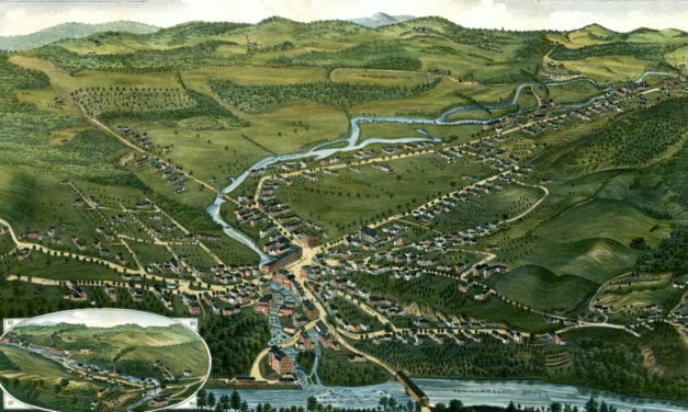
Detailed bird’s eye view of Bristol, New Hampshire in 1884
Read More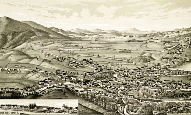
Detailed bird’s eye view of Colebrook, New Hampshire in 1887
Read More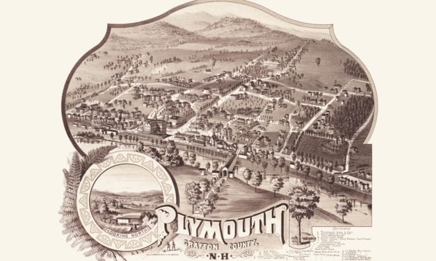
Historic bird’s eye view of Plymouth, New Hampshire from 1883
Read More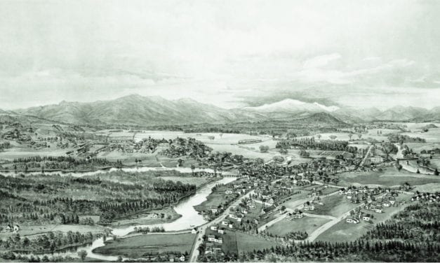
Detailed bird’s eye view of Conway, New Hampshire in 1896
Read More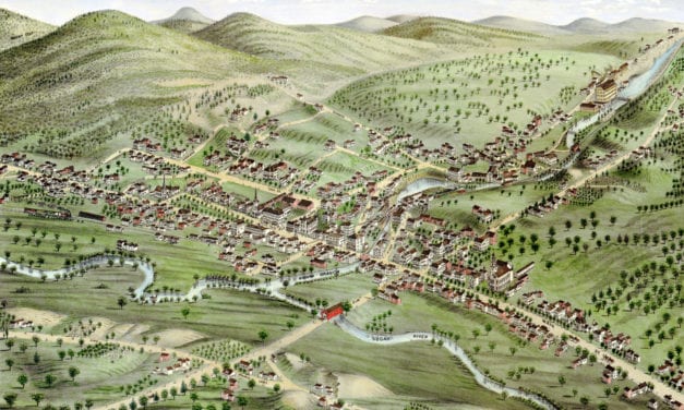
Historic old map of Newport, New Hampshire from 1877
Read More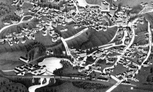
This map shows Ashland, New Hampshire as it looked in 1883.
Read More