


West Virginia Town Maps A to Z
All 514 town maps, from Accoville to Zela. Each one opens its own page with the whole map.
A
B
- Baileysville
- Bancroft
- Barboursville
- Barrackville
- Bartley
- Bartow
- Baxter
- Bayard
- Beards Fork
- Beaver
- Beckley
- Bedington
- Beech Bottom
- Belington
- Belle
- Belmont
- Belva
- Benwood
- Bergoo
- Berkeley
- Berkeley Springs
- Berwind
- Bethany
- Bethlehem
- Beverly
- Big Chimney
- Big Creek
- Big Otter
- Big Sandy
- Birch River
- Blacksville
- Blennerhassett
- Bluefield
- Bluestone Lake
- Bluewell
- Boaz
- Bolivar
- Bolt
- Boomer
- Booth
- Bowden
- Bradley
- Bradshaw
- Bramwell
- Brandonville
- Brandywine
- Brenton
- Bridgeport
- Brookhaven
- Bruceton Mills
- Bruno
- Brush Fork
- Buckhannon
- Bud
- Buffalo
- Bunker Hill
- Burlington
- Burnsville
C
- Cairo
- Camden-on-Gauley
- Cameron
- Capon Bridge
- Carolina
- Carpendale
- Cass
- Cassville
- Cedar Grove
- Century
- Ceredo
- Chapmanville
- Charles Town
- Charleston
- Charlton Heights
- Chattaroy
- Chauncey
- Cheat Lake
- Chelyan
- Chesapeake
- Chester
- Clarksburg
- Clay
- Clearview
- Clendenin
- Clifton
- Coal City
- Coal Fork
- Coalton
- Colcord
- Colliers
- Comfort
- Confidence
- Corinne
- Cottageville
- Covel
- Cowen
- Crab Orchard
- Craigsville
- Crichton
- Crooked Creek
- Cross Lanes
- Crum
- Crumpler
- Cucumber
- Culloden
- Cunard
D
E
F
G
H
I
J
K
L
M
- Mabscott
- MacArthur
- Madison
- Malden
- Mallory
- Man
- Mannington
- Marlinton
- Marlowe
- Marmet
- Martha
- Martinsburg
- Mason
- Masontown
- Matewan
- Matheny
- Matoaka
- Maybeury
- Maysville
- McConnell
- McMechen
- Meadow Bridge
- Melrose
- Middlebourne
- Middleway
- Midland
- Mill Creek
- Milton
- Mineral Wells
- Mineralwells
- Mitchell Heights
- Monaville
- Monongah
- Montcalm
- Montgomery
- Montrose
- Moorefield
- Morgantown
- Moundsville
- Mount Carbon
- Mount Gay-Shamrock
- Mount Hope
- Mount Storm Lake
- Mullens
N
O
P
Q
R
S
- Salem
- Salt Rock
- Sand Fork
- Sand Hill
- Sarah Ann
- Scarbro
- Shady Spring
- Shannondale
- Sharon
- Shenandoah Junction
- Shepherdstown
- Sherrard
- Shinnston
- Shrewsbury
- Sissonville
- Sistersville
- Slanesville
- Smithers
- Smithfield
- Smithville
- Smoot
- Sophia
- South Charleston
- Spanishburg
- Spelter
- Spencer
- Sprague
- Spring Mills
- Spring Valley
- Springfield
- St. Albans
- St. George
- St. Marys
- Stanaford
- Star City
- Stollings
- Stonewood
- Summersville
- Summersville Lake
- Sutton
- Switzer
- Sylvester
T
U
V
W
- Wallace
- Walton
- War
- Wardensville
- Washington
- Waverly
- Wayne
- Webster Springs
- Weirton
- Welch
- Wellsburg
- West Dunbar
- West Hamlin
- West Liberty
- West Logan
- West Milford
- West Union
- Westmoreland
- Weston
- Westover
- Wheeling
- White Hall
- White Sulphur Springs
- Whitesville
- Whitmer
- Wiley Ford
- Williamson
- Williamstown
- Windsor Heights
- Winfield
- Wolf Summit
- Worthington
- Wyoming
Z
Don’t see your town? Ask us to draw it.
About West Virginia
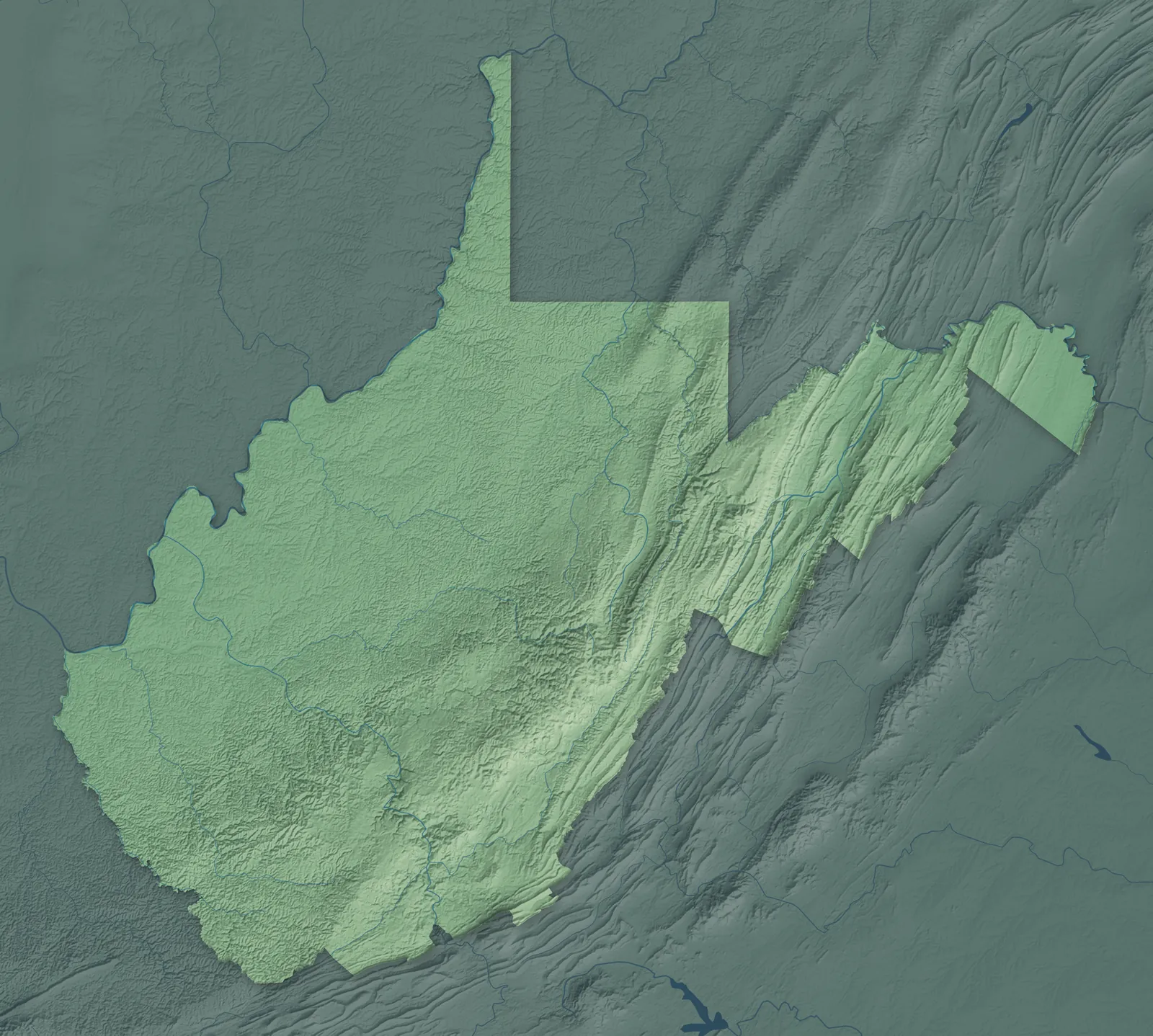
West Virginia is mountain country almost from edge to edge, and it's the only state that lies entirely inside Appalachia. The Ohio River runs along its western side. Two panhandles reach out, one north between Ohio and Pennsylvania and one east between Maryland and Virginia. It split from Virginia during the Civil War, the only state formed by breaking away from a Confederate state.
More than half of West Virginians live in rural areas, a bigger share than in any state but Vermont and Maine. The largest cities, Charleston, Huntington, Morgantown, Parkersburg and Wheeling, all grew up on rivers. Many small towns began as coal camps, railroad towns or river landings. In the early 1900s, immigrants of about 25 nationalities came to mine coal, along with many African Americans from Virginia and the Deep South.
- Statehood
- June 20, 1863
- Capital
- Charleston
- Population
- 1,766,1472025 Census estimate
- Highest point
- Spruce Knob, 4,862 feet
- Lowest point
- Potomac River at the Virginia border, 240 feet
- Size
- 24,230 square miles, the 41st largest state
Wheeling and the Northern Panhandle
Wheeling, Weirton, Moundsville and New Martinsville grew up as steel and glass towns on the Ohio River, along a narrow strip between Ohio and Pennsylvania. Wheeling was the first state capital, and its suspension bridge was the longest in the world when it opened in 1849. The Adena people built Grave Creek Mound in Moundsville more than 2,000 years ago. The pottery in Newell first made its colorful Fiesta dinnerware in 1936, and it's still made there.


Martinsburg and the Eastern Panhandle
Martinsburg, Charles Town and Shepherdstown sit at the north end of the Shenandoah Valley, and Berkeley Springs lies in the ridges to the west. Thomas Jefferson wrote that the view at Harpers Ferry, where the Shenandoah meets the Potomac, was "worth a voyage across the Atlantic," after he saw it in 1783. Shepherdstown, chartered in 1762, is one of the state's two oldest towns. George Washington first visited the warm springs at Berkeley Springs in 1748, as a 16-year-old surveyor.


Elkins and the Potomac Highlands
Elkins, Keyser, Romney, Moorefield and Davis sit among long ridges, high plateaus and the valleys of the upper Potomac, and much of the land is national forest. Elkins is named for Stephen B. Elkins, who brought the railroad there in 1889 with Henry Gassaway Davis. Cass was built in 1901 as a logging company town, and old geared steam engines still push trains up Back Allegheny Mountain. Nearby Green Bank is home to the largest fully steerable radio telescope in the world.


Morgantown, Fairmont and Clarksburg
Morgantown, Fairmont, Clarksburg, Bridgeport and Grafton sit in rolling hills along the Monongahela River and its branches. West Virginia University opened in Morgantown in 1867. Around 1927, Italian baker Giuseppe Argiro began selling pepperoni rolls in Fairmont as an easy lunch for coal miners. Anna Jarvis started Mother's Day, and the first official Mother's Day service was held at a Grafton church in 1908.


Parkersburg and the Mid-Ohio Valley
Parkersburg, Vienna, St. Marys and Ravenswood line the Ohio River, with Ripley, Spencer and Harrisville in the hills inland. Parkersburg grew where the Little Kanawha meets the Ohio, and it became an oil refining center in the late 1800s. At Burning Springs, named for gas that bubbled up through a spring and burned when lit, an oil boom drew 10,000 people in 1861. A sternwheeler carries visitors from Parkersburg to Blennerhassett Island, where a copy of Harman and Margaret Blennerhassett's mansion stands.


Weston, Buckhannon and Summersville
Weston, Buckhannon, Summersville, Sutton and Glenville sit in the hills at the center of the state, in the travel region called Mountain Lakes. Summersville Lake is the largest lake in West Virginia, and each fall its dam lets out water for rafters on the Gauley River. The first Golden Delicious apple tree grew on the Mullins family farm in Clay County, and it's now the state fruit. Buckhannon holds the West Virginia Strawberry Festival every May.


Charleston and Huntington
Charleston, Huntington, South Charleston, St. Albans and Point Pleasant sit along the Kanawha and Ohio rivers, with Hurricane, Madison and Hamlin in the hills nearby. Charleston has been the capital since 1885, and Cass Gilbert's gold-domed Capitol was dedicated there in 1932. The Chesapeake and Ohio Railway founded Huntington in 1871 at the western end of its line. Booker T. Washington grew up in Malden, where he packed salt as a boy before leaving for school in Virginia at 16.


Beckley and Southern West Virginia
Beckley, Bluefield, Welch, Logan and Williamson grew with the coal mines and railroads of the southern mountains, and Lewisburg sits in the Greenbrier Valley. The New River Gorge Bridge opened near Fayetteville in 1977, 876 feet above the river, and the gorge became a national park in 2020. In Beckley, retired coal miners guide visitors on a small train deep into the Exhibition Coal Mine. Bluefield, Nature's Air-Conditioned City, hands out free lemonade whenever it hits 90 degrees.


- 12 × 18 inPrint $39.99Framed $89.99
- 18 × 24 inPrint $49.99Framed $129.99
- 24 × 36 inPrint $89.99Framed $199.99

Sizes and Prices
Every map comes in three sizes on archival matte paper. Framed prints come in black or white wood.
How each map is made
It starts with the real place
Streets, buildings, terrain and water form the map, drawn the way West Virginia looks today.
Then the details
Local research and an old atlas style give each town its character.
Then it's yours
Look around the map, then pick a print to keep or give.
















