Montana Town Maps A to Z
All 526 town maps, from Absarokee to Zurich. Each one opens its own page with the whole map.
A
B
- Babb
- Bainville
- Baker
- Ballantine
- Basin
- Batavia
- Bear Dance
- Bearcreek
- Beaver Creek
- Belfry
- Belgrade
- Belknap
- Belt
- Biddle
- Big Arm
- Big Sandy
- Big Sky
- Big Sky Colony
- Big Stone Colony
- Big Timber
- Bigfork
- Billings
- Birch Creek Colony
- Birney
- Black Eagle
- Blackfoot
- Bloomfield
- Boneau
- Bonner-West Riverside
- Boulder
- Box Elder
- Boyd
- Bozeman
- Brady
- Brandon
- Bridger
- Broadus
- Broadview
- Brockton
- Brockway
- Brooks
- Browning
- Bull Lake
- Busby
- Butte-Silver Bow
- Bynum
C
- Camas
- Camp Three
- Camrose Colony
- Canyon Creek
- Canyon Ferry Lake
- Cardwell
- Carlton
- Carter
- Cascade
- Cascade Colony
- Centerville
- Charlo
- Charlos Heights
- Chester
- Chinook
- Choteau
- Churchill
- Circle
- Clancy
- Cleveland
- Clinton
- Clyde Park
- Coffee Creek
- Cohagen
- Colstrip
- Columbia Falls
- Columbus
- Condon
- Conner
- Conrad
- Cooke City
- Coram
- Corvallis
- Corwin Springs
- Craig
- Crane
- Creston
- Crow Agency
- Culbertson
- Custer
- Cut Bank
- Cyr
D
E
F
G
H
- Hall
- Hamilton
- Hammond
- Happys Inn
- Hardin
- Hardy
- Harlem
- Harlowton
- Harrison
- Hartland Colony
- Haugan
- Hauser Lake
- Havre
- Havre North
- Hays
- Heart Butte
- Hebgen Lake
- Hebgen Lake Estates
- Helena
- Helena Flats
- Helena Valley Northeast
- Helena Valley Northwest
- Helena Valley Southeast
- Helena Valley West Central
- Helena West Side
- Helmville
- Heron
- Herron
- Hidden Lake Colony
- Highwood
- Hilger
- Hilldale Colony
- Hillside Colony
- Hingham
- Hinsdale
- Hobson
- Hogeland
- Holter Lake
- Homestead
- Horizon Colony
- Hot Springs
- Hungry Horse
- Hungry Horse Reservoir
- Huntley
- Huson
- Hysham
I
J
K
L
M
N
O
P
R
S
- Saco
- Saddle Butte
- Sage Creek Colony
- Saint Mary Lake
- Salmon Prairie
- Saltese
- Sand Coulee
- Sand Springs
- Sangrey
- Santa Rita
- Sapphire Ridge
- Savage
- Sčilíp
- Scobey
- Sedan
- Seeley Lake
- Seville Colony
- Shawmut
- Shelby
- Shepherd
- Sheridan
- Shields
- Sidney
- Silesia
- Silver Gate
- Silver Star
- Simms
- Sleeping Buffalo
- Snowslip
- Somers
- South Browning
- South Glastonbury
- South Hills
- Spokane Creek
- Spring Creek Colony
- Springdale
- Springdale Colony
- Springhill
- Springwater Colony
- Square Butte
- St. Ignatius
- St. Marie
- St. Mary
- St. Pierre
- St. Regis
- St. Xavier
- Stacey
- Stanford
- Starr School
- Stevensville
- Stockett
- Stryker
- Sula
- Sun Prairie
- Sun River
- Sunburst
- Sunnybrook Colony
- Sunset
- Superior
- Surprise Creek Colony
- Swan Lake
- Sweet Grass
- Sylvanite
T
U
V
W
- Walkerville
- Warm Spring Creek
- Weeksville
- West Glacier
- West Glendive
- West Havre
- West Kootenai
- West Yellowstone
- Westby
- Wheatland
- White Haven
- White Sulphur Springs
- Whitefish
- Whitefish Lake
- Whitehall
- Whitetail
- Whitewater
- Whitlash
- Wibaux
- Willow Creek
- Wilsall
- Windham
- Wineglass
- Winifred
- Winnett
- Winston
- Wisdom
- Wise River
- Wolf Creek
- Wolf Point
- Woods Bay
- Worden
- Wye
- Wyola
Y
Z
Don’t see your town? Ask us to draw it.
About Montana
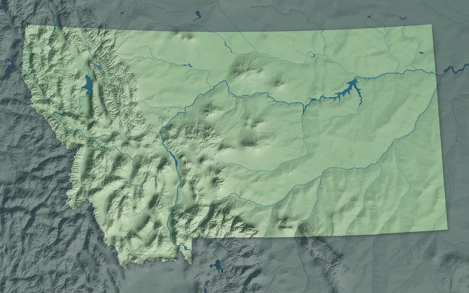
The Rocky Mountains rise across western Montana, from Glacier National Park down to the edge of Yellowstone. To the east, the Great Plains roll out to the Dakotas, crossed by the Missouri and Yellowstone rivers. Montana became the 41st state in 1889, in the same month as North Dakota, South Dakota and Washington.
About three in five Montanans live in the six counties around Billings, Bozeman, Missoula, Kalispell, Great Falls and Helena. Many towns began as mining camps or railroad stops, and a homestead boom after 1909 brought new farm towns to the plains. Twelve tribal nations make their homes in Montana, and seven reservations lie within its borders.
- Statehood
- November 8, 1889
- Capital
- Helena
- Population
- 1,144,6942025 Census estimate
- Highest point
- Granite Peak, 12,807 feet
- Lowest point
- Kootenai River at the Idaho border, 1,800 feet
- Size
- 147,040 square miles, the 4th largest state
The Flathead and Northwest Montana
Kalispell, Whitefish, Polson and Libby sit among lakes, forests and mountains, with Glacier National Park to the northeast. Flathead Lake is the largest natural freshwater lake west of the Mississippi in the lower 48. Kalispell, a Salish word for flat land above the lake, was laid out in 1891 as the Great Northern Railway arrived. The Salish, Pend d'Oreille and Kootenai govern the Flathead Reservation together, and in 2022 the National Bison Range was returned to them.


Missoula and the Bitterroot Valley
Missoula, Hamilton, Stevensville, Superior and Philipsburg sit in the mountain valleys of the Clark Fork River and its branches. Jesuit priests founded St. Mary's Mission at Stevensville in 1841, after the Bitterroot Salish asked them to come. Travelers' Rest in Lolo is the only Lewis and Clark campsite that archaeologists have confirmed. Hamilton began in 1890 as a company town of copper king Marcus Daly.


Butte, Helena and Southwest Montana
Butte, Helena, Anaconda, Dillon and Virginia City sit in mountain valleys along the Continental Divide. Gold found at Bannack in 1862 set off Montana's first rush, and Bannack, Virginia City and Helena each took a turn as the territorial capital. Helena's main street follows Last Chance Gulch, where four prospectors struck gold in 1864. Butte's copper mines made it famous as the Richest Hill on Earth, and Anaconda's 585-foot smelter stack still stands above the town.


Bozeman and Yellowstone Country
Bozeman, Livingston, Big Timber, Red Lodge and West Yellowstone sit in the mountain valleys north and west of Yellowstone National Park. Lewis and Clark named the Jefferson, Madison and Gallatin rivers at Three Forks in 1805, where they join to form the Missouri. Livingston began as a Northern Pacific town in 1882, and its branch line carried visitors south to Yellowstone. In 1903, Theodore Roosevelt laid the cornerstone of the stone arch at the park's north entrance in Gardiner.


Great Falls and Central Montana
Great Falls, Lewistown, Choteau and Fort Benton sit in wheat and cattle country between the Rocky Mountain Front and the island ranges of the plains. Lewis and Clark spent about a month carrying their boats around the Great Falls of the Missouri in 1805. Fort Benton, known as the birthplace of Montana, was as far up the Missouri as steamboats from St. Louis could go. Near Choteau, scientists found nests of Maiasaura, a duck-billed dinosaur that cared for its young.


Havre and the Hi-Line
The Hi-Line follows Highway 2 and the railroad across northern Montana, through Cut Bank, Shelby, Havre, Malta, Glasgow and Wolf Point. Many of its towns began as Great Northern stops, and Amtrak's Empire Builder still runs the line. The Blackfeet Nation, the Chippewa Cree of Rocky Boy's, the Aaniiih and Nakoda of Fort Belknap, and the Assiniboine and Sioux of Fort Peck all have reservations here. Fort Peck Dam, still being built, was on the cover of the first Life magazine in 1936.


Billings and Eastern Montana
Billings, Hardin, Miles City, Glendive and Sidney sit along the Yellowstone River and its branches, among ranches and badlands. Billings began as a Northern Pacific town in 1882 and grew so fast that people called it the Magic City. On his way home in 1806, William Clark carved his name on Pompeys Pillar, and it's still there. The Apsáalooke, or Crow, set up more than a thousand tipis at Crow Fair in August, and the Northern Cheyenne make their home at Lame Deer.


- 12 × 18 inPrint $39.99Framed $89.99
- 18 × 24 inPrint $49.99Framed $129.99
- 24 × 36 inPrint $89.99Framed $199.99

Sizes and Prices
Every map comes in three sizes on archival matte paper. Framed prints come in black or white wood.
How each map is made
It starts with the real place
Streets, buildings, terrain and water form the map, drawn the way Montana looks today.
Then the details
Local research and an old atlas style give each town its character.
Then it's yours
Look around the map, then pick a print to keep or give.