


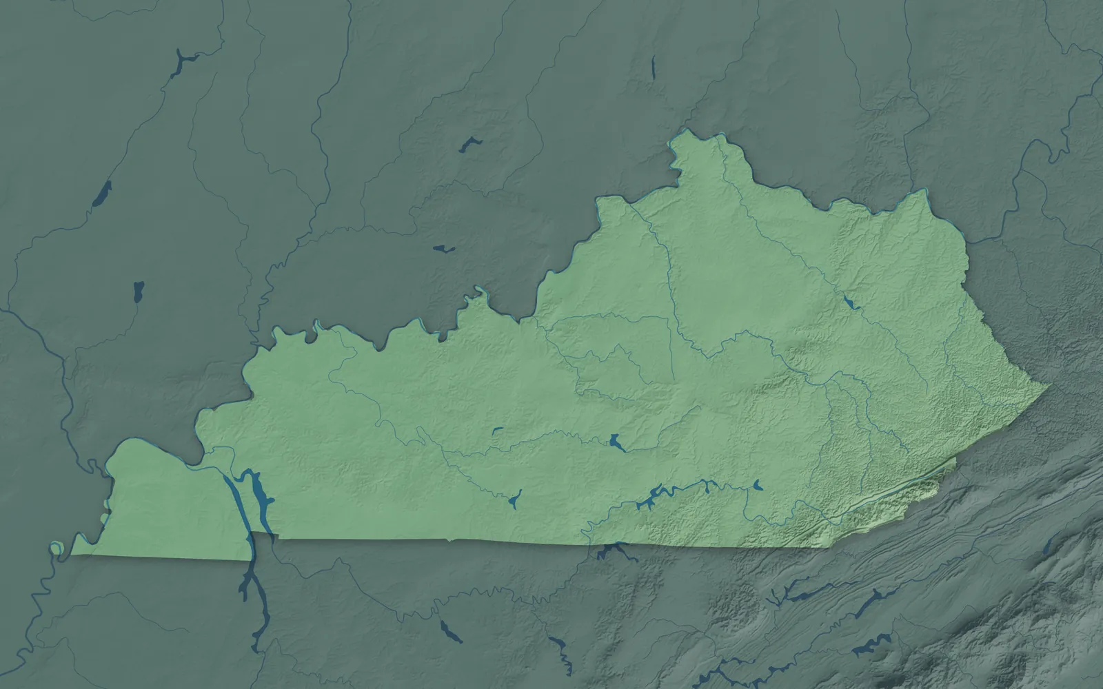
Kentucky Town Maps A to Z
All 659 town maps, from Adairville to Yelvington. Each one opens its own page with the whole map.
A
B
- Bancroft
- Bandana
- Barbourmeade
- Barbourville
- Bardstown
- Bardwell
- Barlow
- Barren River Lake
- Beattyville
- Beaver Dam
- Bedford
- Beech Grove
- Beechmont
- Beechwood Village
- Belfry
- Bellefonte
- Bellemeade
- Belleview
- Bellevue
- Bellewood
- Benham
- Benton
- Berea
- Berry
- Betsy Layne
- Big Clifty
- Big Creek
- Black Mountain
- Blackey
- Blaine
- Blandville
- Bloomfield
- Blue Ridge Manor
- Bonnieville
- Boonesborough
- Booneville
- Boston
- Bowen
- Bowling Green
- Bradfordsville
- Brandenburg
- Breckinridge Center
- Bremen
- Briarwood
- Bridgeport
- Brigadoon
- Bristow
- Brodhead
- Broeck Pointe
- Bromley
- Brooks
- Brooksville
- Brownsboro Farm
- Brownsboro Village
- Brownsville
- Buckhorn
- Buckner
- Buffalo
- Burgin
- Burkesville
- Burlington
- Burna
- Burning Springs
- Burnside
- Butler
C
- Cadiz
- Cairo
- Calhoun
- California
- Calumet
- Calvary
- Calvert City
- Camargo
- Cambridge
- Campbellsburg
- Campbellsville
- Campton
- Caneyville
- Cannonsburg
- Cardinal Valley
- Carlisle
- Carr Creek
- Carrollton
- Carrsville
- Carter
- Catlettsburg
- Cave City
- Cave Run Lake
- Cawood
- Cayce
- Cecilia
- Cedar Creek Lake
- Cedar Grove
- Centerfield
- Centertown
- Central City
- Cerulean
- Chaplin
- Clarkson
- Claryville
- Clay
- Clay City
- Clearfield
- Cleaton
- Clinton
- Cloverport
- Coal Run Village
- Cold Spring
- Coldiron
- Coldstream
- Columbia
- Columbus
- Combs
- Concord
- Corbin
- Cordia
- Corinth
- Corydon
- Covington
- Coxs Creek
- Coxton
- Crab Orchard
- Crayne
- Creekside
- Crescent Springs
- Crestview
- Crestview Hills
- Crestwood
- Crittenden
- Crofton
- Crossgate
- Cub Run
- Cumberland
- Cunningham
- Curdsville
- Custer
- Cynthiana
D
E
F
- Fairfield
- Fairview
- Fallsburg
- Falmouth
- Fancy Farm
- Farley
- Farmers
- Farmington
- Farristown
- Ferguson
- Fincastle
- Flaherty
- Flat Lick
- Flatwoods
- Fleming-Neon
- Flemingsburg
- Florence
- Fordsville
- Forest Hills
- Fort Campbell North
- Fort Knox
- Fort Mitchell
- Fort Thomas
- Fort Wright
- Fountain Run
- Fox Chase
- Frakes
- Francisville
- Frankfort
- Franklin
- Fredonia
- Freeburn
- Frenchburg
- Fulton
G
H
- Hanson
- Hardin
- Hardinsburg
- Hardyville
- Harlan
- Harrodsburg
- Hartford
- Hawesville
- Hazard
- Hazel
- Hazel Green
- Heath
- Hebron
- Hebron Estates
- Henderson
- Hendron
- Heritage Creek
- Herrington Lake
- Hickman
- Hickory
- Hickory Hill
- High Bridge
- Highland
- Highland Heights
- Hill 'n Dale
- Hillcrest
- Hills and Dales
- Hillsboro
- Hillview
- Hindman
- Hiseville
- Hodgenville
- Hollow Creek
- Hollyvilla
- Hopkinsville
- Horse Branch
- Horse Cave
- Houston Acres
- Hunters Hollow
- Hurstbourne
- Hurstbourne Acres
- Hustonville
- Hyden
I
J
K
L
- La Center
- La Grange
- LaFayette
- Lake Barkley
- Lake Cumberland
- Lakeside Park
- Lakeview Heights
- Lancaster
- Langdon Place
- Lansdowne
- Laurel River Lake
- Lawrenceburg
- Lebanon
- Lebanon Junction
- Ledbetter
- LeGrande
- Leitchfield
- Letcher
- Lewisburg
- Lewisport
- Lexington-Fayette
- Liberty
- Lincolnshire
- Livermore
- Livingston
- London
- Loretto
- Louisa
- Louisville
- Lovelaceville
- Lowes
- Loyall
- Ludlow
- Lynch
- Lyndon
- Lynnview
M
- Maceo
- Mackville
- Madisonville
- Magnolia
- Mammoth Cave National Park
- Manchester
- Manitou
- Manor Creek
- Marion
- Marrowbone
- Martin
- Maryhill Estates
- Mason
- Masonville
- Massac
- Mayfield
- Mayking
- Mays Lick
- Maysville
- Maytown
- McCarr
- McDowell
- McHenry
- McKee
- McKinney
- McRoberts
- Meadow Vale
- Meadowbrook Farm
- Meadowview Estates
- Melbourne
- Mentor
- Middlesborough
- Middletown
- Midway
- Millard
- Millersburg
- Millstone
- Milton
- Mockingbird Valley
- Monterey
- Monticello
- Moorland
- Morehead
- Morganfield
- Morgantown
- Mortons Gap
- Moseleyville
- Mount Olivet
- Mount Sterling
- Mount Vernon
- Mount Washington
- Muldraugh
- Munfordville
- Murray
- Murray Hill
N
O
P
- Paducah
- Paint Lick
- Paintsville
- Panther
- Paris
- Park City
- Park Hills
- Parkway Village
- Pathfork
- Payne Gap
- Payneville
- Pembroke
- Perryville
- Petersburg
- Pewee Valley
- Phelps
- Philpot
- Pikeville
- Pine Grove
- Pine Knot
- Piner
- Pineville
- Pioneer Village
- Pippa Passes
- Plano
- Plantation
- Pleasant Ridge
- Pleasant View
- Pleasureville
- Plum Springs
- Poole
- Poplar Hills
- Powderly
- Prestonsburg
- Prestonville
- Princeton
- Prospect
- Providence
- Pryorsburg
R
S
- Sacramento
- Sadieville
- Salem
- Salem, Russell County
- Salt Lick
- Salvisa
- Salyersville
- Sanders
- Sandy Hook
- Sardis
- Science Hill
- Scottsville
- Sebree
- Sedalia
- Seneca Gardens
- Sharpe
- Sharpsburg
- Shelbyville
- Shepherdsville
- Sherman
- Shively
- Shopville
- Silver Grove
- Simpsonville
- Sinking Fork
- Slaughters
- Smithfield
- Smithland
- Smiths Grove
- Somerset
- Sonora
- Sorgho
- South Carrollton
- South Irvine
- South Marshall
- South Park View
- South Shore
- South Wallins
- South Williamson
- Southern Heights
- Southgate
- Sparta
- Spottsville
- Spring Mill
- Spring Valley
- Springfield
- St. Charles
- St. Joseph
- St. Mary
- St. Matthews
- St. Regis Park
- Stamping Ground
- Stanford
- Stanley
- Stanton
- Stearns
- Stinnett
- Strathmoor Manor
- Strathmoor Village
- Sturgis
- Summer Shade
- Summersville
- Summit
- Sunshine
- Sycamore
- Symsonia
T
U
V
W
- Waco
- Wallins Creek
- Walton
- Warfield
- Warsaw
- Water Valley
- Watterson Park
- Waverly
- Wayland
- Waynesburg
- Wellington
- West Buechel
- West Gardenside
- West Irvine
- West Liberty
- West Louisville
- West Point
- West Van Lear
- Westport
- Westwood
- Wheatcroft
- Wheelwright
- White Plains
- Whitesburg
- Whitesville
- Whitley City
- Wickliffe
- Wilder
- Wildwood
- Williamsburg
- Williamstown
- Willisburg
- Wilmore
- Winchester
- Windy Hills
- Wingo
- Woodburn
- Woodbury
- Woodland Hills
- Woodlawn
- Woodlawn Park
- Woodsbend
- Worthington
- Worthington Hills
- Worthville
- Wrigley
- Wurtland
Y
Don’t see your town? Ask us to draw it.
About Kentucky
Rivers run along three sides of Kentucky: the Ohio on the north, the Mississippi on the west, and the Big Sandy and Tug Fork on the east. Mountains and coalfields fill the eastern end, horse farms spread over the rolling hills of the Bluegrass in the middle, and caves, lakes and farmland lie to the west. Kentucky became the 15th state in 1792, the first one west of the Appalachian Mountains.
Louisville, Lexington, Bowling Green, Owensboro and Covington are the biggest cities. Smaller towns grew from pioneer forts, river landings, county seats, railroad stops, coal camps and farm crossroads. Many pioneer families came into Kentucky through the Cumberland Gap, on the Wilderness Road that Daniel Boone blazed in 1775.
- Statehood
- June 1, 1792
- Capital
- Frankfort
- Population
- 4,606,8642025 Census estimate
- Highest point
- Black Mountain, 4,139 feet
- Lowest point
- Mississippi River at Kentucky Bend, 257 feet
- Size
- 40,408 square miles, the 37th largest state
Louisville, Bardstown and Elizabethtown
Louisville grew up at the Falls of the Ohio, where George Rogers Clark brought settlers in 1778. Around it, in farm country and wooded knobs, are Shelbyville, La Grange, Shepherdsville, Elizabethtown, Radcliff and Bardstown, which calls itself the Bourbon Capital of the World. The Kentucky Derby has been run at Churchill Downs every year since 1875. Abraham Lincoln was born in 1809 in a log cabin near Hodgenville.


Northern Kentucky and Maysville
Covington and Newport face Cincinnati across the Ohio River, with Florence, Independence and Fort Thomas close by. Carrollton, Augusta, Maysville and Vanceburg are old river towns farther along the shore. The Roebling Suspension Bridge was the longest suspension bridge in the world when it opened in 1866, and it was a model for the Brooklyn Bridge. Rabbit Hash, a tiny river town in Boone County, has elected a dog as its unofficial mayor since 1998.


Lexington and the Bluegrass
Lexington, Frankfort, Georgetown, Richmond, Nicholasville, Danville and Versailles sit in the rolling Bluegrass. Lexington calls itself the Horse Capital of the World, and horse farms cover the hills around it. Harrodsburg, founded in 1774, is the oldest permanent American settlement west of the Appalachians. Berea College opened in 1855 as the first college in the South to teach Black and white students, men and women, together.


The Mountains of Eastern Kentucky
Eastern Kentucky is mountain and coal country. Ashland and Morehead are in the north, Pikeville, Prestonsburg and Hazard are deep in the hills, and London, Corbin, Harlan and Middlesboro are in the south. Middlesboro was built inside an ancient meteor crater. Harland Sanders first sold his fried chicken to travelers in North Corbin in the 1930s, and Loretta Lynn grew up in Butcher Hollow near Van Lear. The Red River Gorge has more than 100 natural stone arches.


Bowling Green and Lake Cumberland
South Central Kentucky runs from Bowling Green, Glasgow, Franklin and Russellville east to Somerset, Campbellsville, Columbia and Monticello. Under the hills near Cave City and Brownsville lies Mammoth Cave, the longest known cave system in the world. Every Corvette since 1981 has been built in Bowling Green. Lake Cumberland, behind Wolf Creek Dam, winds through the hills with more than 1,200 miles of shoreline.


Owensboro, Henderson and the Green River
Owensboro and Henderson sit on the Ohio River, with Morganfield, Hartford, Beaver Dam, Hawesville and Providence in the farm and coal country around them. Bill Monroe was born near Rosine in 1911, and his band, the Blue Grass Boys, gave bluegrass music its name. John James Audubon ran a store in Henderson in the 1810s, and many birds in his Birds of America came from the woods there. Owensboro is known for its barbecued mutton.


Hopkinsville and the Pennyrile
Hopkinsville, Madisonville, Princeton, Central City, Greenville and Cadiz are in the western Pennyrile, named for the pennyroyal mint that grows wild here. Kentucky Lake and Lake Barkley run side by side, with the woods of Land Between the Lakes on the long strip of land that divides them. Robert Penn Warren, the first Poet Laureate of the United States, was born in Guthrie in 1905.


Paducah and the Jackson Purchase
The Jackson Purchase is the low farm country between the Tennessee and Mississippi rivers, with Paducah, Murray, Mayfield, Benton, Fulton and Hickman. It's named for Andrew Jackson, who with Isaac Shelby bought it from the Chickasaw Nation in 1818. Paducah, home of the National Quilt Museum, became a UNESCO City of Crafts and Folk Art in 2013. The Kentucky Bend, a piece of the state inside a loop of the Mississippi, can be reached by road only through Tennessee.


- 12 × 18 inPrint $39.99Framed $89.99
- 18 × 24 inPrint $49.99Framed $129.99
- 24 × 36 inPrint $89.99Framed $199.99

Sizes and Prices
Every map comes in three sizes on archival matte paper. Framed prints come in black or white wood.
How each map is made
It starts with the real place
Streets, buildings, terrain and water form the map, drawn the way Kentucky looks today.
Then the details
Local research and an old atlas style give each town its character.
Then it's yours
Look around the map, then pick a print to keep or give.
















