Colorado Town Maps A to Z
All 550 town maps, from Acres Green to Yuma. Each one opens its own page with the whole map.
A
B
- Baker
- Bark Ranch
- Barnum
- Basalt
- Battlement Mesa
- Bayfield
- Bennett
- Berkeley
- Berkley
- Berthoud
- Bessemer
- Bethune
- Beulah Valley
- Black Forest
- Black Hawk
- Blanca
- Blende
- Blue Mesa Reservoir
- Blue River
- Blue Sky
- Blue Valley
- Bonanza
- Bonanza Mountain Estates
- Boone
- Boulder
- Bow Mar
- Brandon
- Branson
- Breckenridge
- Brick Center
- Briggsdale
- Brighton
- Brook Forest
- Brookside
- Broomfield
- Brush
- Buena Vista
- Burlington
- Byers
C
- Calhan
- Campo
- Cañon City
- Capitol Hill
- Capulin
- Carbonate
- Carbondale
- Cascade-Chipita Park
- Castle Pines
- Castle Pines Village
- Castle Rock
- Cathedral
- Catherine
- Cattle Creek
- Cedaredge
- Centennial
- Center
- Central City
- Chacra
- Chaffee Park
- Chatfield Reservoir
- Cheesman Reservoir
- Cheraw
- Cherry Creek
- Cherry Creek Reservoir
- Cherry Hills Village
- Cheyenne Wells
- Cimarron Hills
- City Park
- City Park West
- Clayton
- Clifton
- Coal Creek
- Coaldale
- Cokedale
- Cole
- Collbran
- Colona
- Colorado City
- Colorado Springs
- Columbine
- Columbine Valley
- Comanche Creek
- Commerce City
- Conejos
- Conifer
- Cope
- Copper Mountain
- Cortez
- Cotopaxi
- Cottonwood
- Craig
- Crawford
- Creede
- Crested Butte
- Crestone
- Cripple Creek
- Crisman
- Crook
- Crowley
D
E
F
G
- Galeton
- Garden City
- Gardner
- Garfield
- Gateway
- Genesee
- Genoa
- Georgetown
- Gerrard
- Gilcrest
- Gilpin
- Glendale
- Gleneagle
- Glenwood Springs
- Globeville
- Gold Hill
- Golden
- Goldfield
- Goodnight
- Granada
- Granby
- Grand Junction
- Grand Lake
- Grand View Estates
- Greeley
- Green Mountain Falls
- Green Mountain Reservoir
- Greenwood Village
- Gross Reservoir
- Grover
- Guadalupe
- Guffey
- Gunbarrel
- Gunnison
- Gypsum
H
I
J
K
L
- La Jara
- La Junta
- La Junta Gardens
- La Salle
- La Veta
- Lafayette
- Laird
- Lake City
- Lake George
- Lake Granby
- Lake San Cristobal
- Lakeside
- Lakewood
- Lamar
- Laporte
- Larkspur
- Las Animas
- Lazear
- Lazy Acres
- Leadville
- Leadville North
- Lewis
- Leyner
- Limon
- Lincoln Park
- Littleton
- Lochbuie
- Log Lane Village
- Loghill Village
- Loma
- Lone Star
- Lone Tree
- Longmont
- Louisville
- Louviers
- Loveland
- Lynn
- Lyons
M
- Manassa
- Mancos
- Manitou Springs
- Manzanola
- Marble
- Marshdale
- Marvel
- Matheson
- Maybell
- Maysville
- McClave
- McCoy
- McPhee Reservoir
- Mead
- Meeker
- Meridian
- Meridian Village
- Merino
- Mesa Verde National Park
- Midland
- Milliken
- Minturn
- Moffat
- Montbello
- Monte Vista
- Montezuma
- Montrose
- Monument
- Morgan Heights
- Morrison
- Mount Crested Butte
- Mountain Meadows
- Mountain View
- Mountain Village
- Mulford
N
O
P
R
S
- Saddle Ridge
- Saguache
- Salida
- Salt Creek
- San Acacio
- San Luis
- Sanford
- Sawpit
- Security-Widefield
- Sedalia
- Sedgwick
- Segundo
- Seibert
- Seven Hills
- Severance
- Shadow Mountain Lake
- Shaw Heights
- Sheridan
- Sheridan Lake
- Sherrelwood
- Sierra Ridge
- Silt
- Silver Cliff
- Silver Plume
- Silverthorne
- Silverton
- Simla
- Smeltertown
- Snowmass Village
- Snyder
- Somerset
- South Fork
- Southern Ute
- Springfield
- St. Ann Highlands
- St. Mary's
- Standley Lake
- Starkville
- Steamboat Springs
- Stepping Stone
- Sterling
- Sterling Ranch
- Stonegate
- Stonewall Gap
- Strasburg
- Stratmoor
- Stratton
- Sugar City
- Sugarloaf
- Sunnyside
- Sunshine
- Superior
- Swink
T
U
V
W
Y
Don’t see your town? Ask us to draw it.
About Colorado
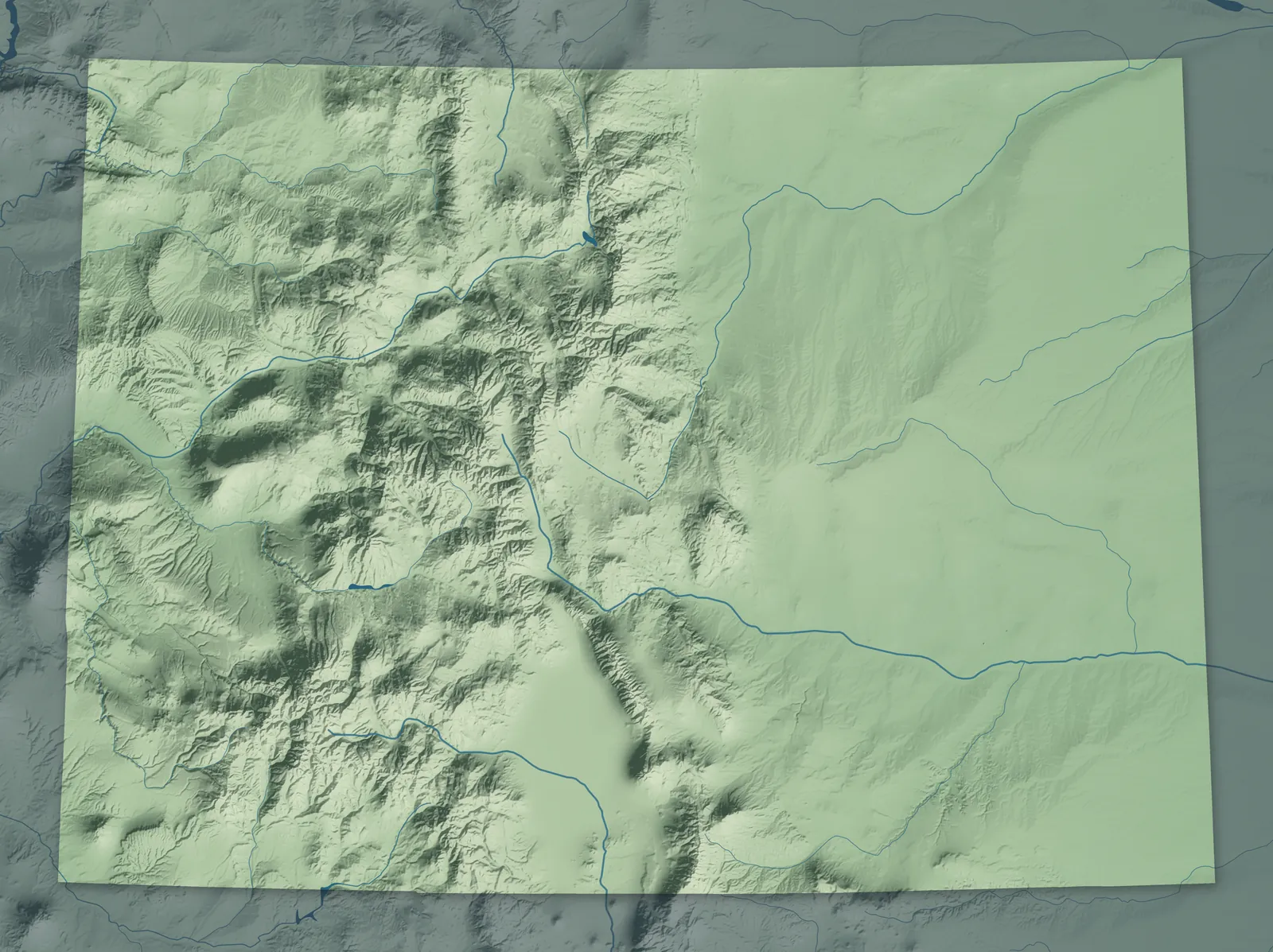
Colorado sits higher than any other state, about 6,800 feet above sea level on average. The Eastern Plains climb west to the Rocky Mountains, where more than 50 peaks top 14,000 feet. Past the Continental Divide, the land drops to the canyons and mesas of the Western Slope. Colorado became the 38th state on August 1, 1876, less than a month after the country's 100th birthday, so it's called the Centennial State.
Most Coloradans live along the Front Range, where the plains meet the mountains, in cities from Fort Collins through Denver to Pueblo. Many towns began as mining camps, in the gold rush that started in 1858 or the silver booms that followed. Others grew up as railroad stops, farm colonies or coal camps. In 1893, Colorado became the first state where the voters themselves gave women the right to vote.
- Statehood
- August 1, 1876
- Capital
- Denver
- Population
- 6,012,5612025 Census estimate
- Highest point
- Mount Elbert, 14,440 feet
- Lowest point
- Arikaree River at the Kansas border, 3,317 feet
- Size
- 104,094 square miles, the 8th largest state
Denver, Boulder and the Metro Area
Denver, Aurora, Lakewood, Arvada, Boulder and Castle Rock spread across the plains below the foothills. Denver, the Mile High City, was founded during the gold rush of 1858, where Cherry Creek meets the South Platte River. Golden was the capital of Colorado Territory from 1862 to 1867, and Boulder's Chautauqua, founded in 1898, still holds summer lectures and concerts. Near Morrison, Red Rocks Amphitheatre opened in 1941 between two giant sandstone rocks.


Fort Collins and Northern Colorado
In NoCo, as locals call Northern Colorado, Fort Collins, Loveland, Greeley and Windsor spread from the foothills east into farm country. Fort Collins began as an Army post on the Cache la Poudre River in 1864. Greeley started as the Union Colony, a farm colony later named for the New York newspaper editor who backed it, Horace Greeley. In Estes Park, at the east entrance to Rocky Mountain National Park, steam car maker F. O. Stanley opened the Stanley Hotel in 1909.


Colorado Springs and Southern Colorado
Colorado Springs, Pueblo, Cañon City, Walsenburg and Trinidad sit along the mountains from Pikes Peak south to the New Mexico line. Katharine Lee Bates wrote the poem that became "America the Beautiful" after a trip up Pikes Peak in 1893. Cripple Creek and Victor boomed after a cowboy named Bob Womack found gold nearby in 1890. Pueblo calls itself the Home of Heroes, because four Medal of Honor recipients came from there.


The Eastern Plains
Sterling, Fort Morgan, Burlington, La Junta and Lamar are farm and ranch towns on the high plains, and most towns out here have a grain elevator and a water tower. Near La Junta, the Bent brothers built an adobe trading post on the Santa Fe Trail in 1833, and Bent's Old Fort was rebuilt for Colorado's 100th birthday in 1976. Bandleader Glenn Miller went to high school in Fort Morgan. In Burlington, a carousel built in 1905 still turns with its original paint.


Aspen, Vail and the High Country
Breckenridge, Vail, Aspen, Steamboat Springs, Salida and Crested Butte sit in high valleys on both sides of the Continental Divide. Central City and Black Hawk grew up after John Gregory found gold nearby in 1859, and Leadville, at more than 10,000 feet, boomed with silver in the late 1870s. During World War II, soldiers of the 10th Mountain Division trained on skis at Camp Hale. One of them, Pete Seibert, came back to start Vail, which opened in 1962.


Grand Junction and the Western Slope
Grand Junction, Fruita, Montrose, Delta, Glenwood Springs and Craig sit among the river valleys and mesas of western Colorado. The Colorado River here was called the Grand River until 1921, and Grand Junction is named for the spot where it meets the Gunnison. John Otto built trails by hand in the canyons nearby, and after they became Colorado National Monument in 1911, he ran it for $1 a month. Palisade grows peaches, and Glenwood Springs opened its hot springs pool in 1888.


Durango and Southwest Colorado
Durango, Cortez, Telluride, Ouray, Silverton and Pagosa Springs sit among the San Juan Mountains and the mesas of the Four Corners. The Southern Ute Indian Tribe is based in Ignacio, and the Ute Mountain Ute Tribe in Towaoc. Ancestral Pueblo people built Mesa Verde's cliff dwellings more than 700 years ago, and in 1906 it became the first national park made to protect the work of people. Steam trains still run from Durango to Silverton on tracks finished in 1882.


Alamosa and the San Luis Valley
Farms around Alamosa, Monte Vista and Center grow potatoes and barley in the San Luis Valley, a high valley between the San Juan and Sangre de Cristo mountains. Hispanic settlers from Taos founded San Luis in 1851, and it's the oldest town in Colorado that people have lived in without a break. The tallest sand dunes in North America rise on the valley's east side, in Great Sand Dunes National Park. Heavyweight champion Jack Dempsey, the Manassa Mauler, was born in Manassa in 1895.


- 12 × 18 inPrint $39.99Framed $89.99
- 18 × 24 inPrint $49.99Framed $129.99
- 24 × 36 inPrint $89.99Framed $199.99

Sizes and Prices
Every map comes in three sizes on archival matte paper. Framed prints come in black or white wood.
How each map is made
It starts with the real place
Streets, buildings, terrain and water form the map, drawn the way Colorado looks today.
Then the details
Local research and an old atlas style give each town its character.
Then it's yours
Look around the map, then pick a print to keep or give.