Louisiana Town Maps A to Z
All 594 town maps, from Abbeville to Zwolle. Each one opens its own page with the whole map.
A
B
- Bains
- Baker
- Baldwin
- Ball
- Banks Springs
- Barataria
- Basile
- Baskin
- Bastrop
- Baton Rouge
- Bawcomville
- Bayou Blue
- Bayou Cane
- Bayou Chicot
- Bayou Corne
- Bayou Country Club
- Bayou Gauche
- Bayou Goula
- Bayou L'Ourse
- Bayou St. John
- Bayou Vista
- Beekman
- Belcher
- Bell City
- Belle Chasse
- Belle Place
- Belle Rose
- Belmont
- Benton
- Bernice
- Berwick
- Bienville
- Black Pearl
- Blanchard
- Bogalusa
- Bonita
- Boothville
- Bordelonville
- Bossier City
- Bourg
- Boutte
- Boyce
- Branch
- Breaux Bridge
- Bridge City
- Broadmoor
- Broussard
- Brownfields
- Brownsville
- Brusly
- Bryceland
- Buckeye
- Bunkie
- Buras
- Bywater
C
- Caddo Lake
- Cade
- Calhoun
- Calvin
- Cameron
- Campti
- Cankton
- Carencro
- Carlyss
- Carolyn Park
- Castor
- Catahoula
- Catahoula Lake
- Cecilia
- Center Point
- Centerville
- Central
- Central Business District
- Chackbay
- Chalmette
- Charenton
- Chataignier
- Chatham
- Chauvin
- Cheneyville
- Chesbrough
- Choctaw
- Choudrant
- Church Point
- City Park
- Claiborne
- Clarence
- Clarks
- Clayton
- Clinton
- Colfax
- Collinston
- Columbia
- Convent
- Converse
- Coteau
- Cotton Valley
- Cottonport
- Coushatta
- Covington
- Creola
- Crescent
- Cross Lake
- Crowley
- Crowville
- Cullen
- Cut Off
D
E
F
G
- Galliano
- Garden District
- Gardere
- Garyville
- Gentilly Terrace
- Gentilly Woods
- Georgetown
- Gibsland
- Gibson
- Gilbert
- Gilliam
- Gillis
- Glencoe
- Glenmora
- Gloster
- Golden Meadow
- Goldonna
- Gonzales
- Good Pine
- Grambling
- Gramercy
- Grand Cane
- Grand Coteau
- Grand Isle
- Grand Point
- Grand Prairie
- Gray
- Grayson
- Greensburg
- Greenwood
- Gretna
- Grosse Tete
- Gueydan
H
I
J
K
L
- Labadieville
- Lacassine
- Lacombe
- Lafayette
- Lafitte
- Lafourche Crossing
- Lake Arthur
- Lake Charles
- Lake Claiborne
- Lake D'Arbonne
- Lake Maurepas
- Lake Pontchartrain
- Lake Providence
- Lake St. Catherine
- Lake Verret
- Lakeshore
- Lakeview
- Laplace
- Larose
- Lawtell
- Lebeau
- Lecompte
- Leesville
- Lemannville
- Lenwil
- Leonville
- Lewisburg
- Lillie
- Lisbon
- Livingston
- Livonia
- Lockport
- Lockport Heights
- Logansport
- Longstreet
- Longville
- Loranger
- Loreauville
- Lower Garden District
- Lower Ninth Ward
- Lucky
- Lukeville
- Luling
- Lutcher
- Lydia
M
- Madisonville
- Mamou
- Mandeville
- Mangham
- Mansfield
- Mansura
- Many
- Marigny
- Maringouin
- Marion
- Marksville
- Marrero
- Marthaville
- Martin
- Mathews
- Maurepas
- Maurice
- McNary
- Meaux
- Melville
- Mer Rouge
- Meraux
- Mermentau
- Merrydale
- Merryville
- Metairie
- Mid-City
- Midland
- Midway
- Milton
- Minden
- Minorca
- Mire
- Monroe
- Montegut
- Monterey
- Montgomery
- Monticello
- Montpelier
- Montz
- Moonshine
- Mooringsport
- Moreauville
- Morgan City
- Morganza
- Morrow
- Morse
- Moss Bluff
- Mound
- Mount Lebanon
- Mulberry
N
O
P
- Paincourtville
- Palmetto
- Paradis
- Parks
- Patterson
- Paulina
- Pearl River
- Perry
- Pesson
- Phoenix
- Pickering
- Pierre Part
- Pine
- Pine Prairie
- Pineville
- Pioneer
- Pitkin
- Plain Dealing
- Plaisance
- Plaquemine
- Plaucheville
- Pleasant Hill
- Pleasure Bend
- Point Place
- Pointe a la Hache
- Poland
- Pollock
- Ponchatoula
- Port Allen
- Port Barre
- Port Sulphur
- Port Vincent
- Powhatan
- Poydras
- Prairieville
- Presquille
- Prien
- Princeton
- Prospect
- Provencal
Q
R
S
- Sabine Lake
- Saline
- Sarepta
- Schriever
- Scotlandville
- Scott
- Seventh Ward
- Sharon Hills
- Shenandoah
- Shongaloo
- Shreveport
- Sibley
- Sicily Island
- Sikes
- Simmesport
- Simpson
- Simsboro
- Singer
- Siracusaville
- Sixth Ward – Treme – Lafitte
- Slaughter
- Slidell
- Sorrel
- Sorrento
- South Mansfield
- South Vacherie
- Southdown
- Spearsville
- Spokane
- Spring Creek
- Springfield
- Springhill
- St. Claude
- St. Francisville
- St. Gabriel
- St. George
- St. James
- St. Joseph
- St. Martinville
- St. Maurice
- St. Roch
- St. Rose
- St. Thomas Area – Lower Garden District
- Standard
- Stanley
- Starks
- Start
- Sterlington
- Stonewall
- Sugartown
- Sulphur
- Summerfield
- Sun
- Sunset
- Supreme
- Swartz
T
U
V
W
Y
Z
Don’t see your town? Ask us to draw it.
About Louisiana
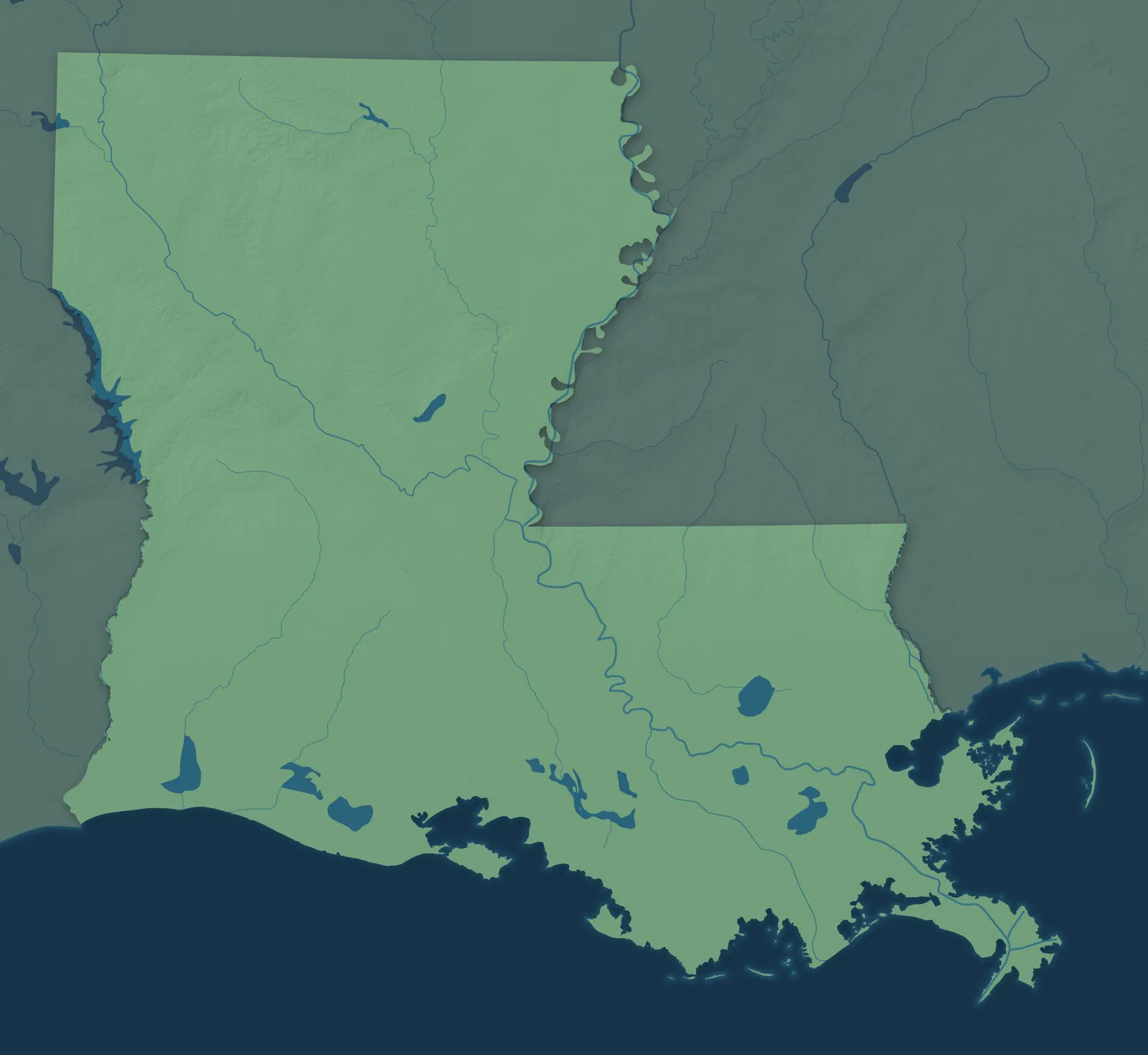
Much of southeastern Louisiana is land the Mississippi River built from the mud it carried down over thousands of years, a low country of bayous, marshes and barrier islands along the Gulf Coast. To the north and west, the land rises into rolling pine hills. Louisiana became the 18th state in 1812, the first carved out of the Louisiana Purchase, and it's still the only state divided into parishes instead of counties.
New Orleans, Baton Rouge, Shreveport and Lafayette are the biggest cities. Smaller towns grew up as river landings, sugar and rice towns, sawmill towns, oil towns and fishing ports. In South Louisiana, many families trace their roots to French settlers from Acadia, in what is now eastern Canada. They began arriving in the 1760s and came to be called Cajuns.
- Statehood
- April 30, 1812
- Capital
- Baton Rouge
- Population
- 4,618,1892025 Census estimate
- Highest point
- Driskill Mountain, 535 feet
- Lowest point
- New Orleans, 8 feet below sea level
- Size
- 52,378 square miles, the 31st largest state
New Orleans and the River Parishes
New Orleans, Metairie, Kenner and Chalmette sit on low ground between the Mississippi River and Lake Pontchartrain, and Plaquemines Parish follows the river down to the Gulf. New Orleans was founded in 1718, and its French Quarter was laid out in 1721. Upriver, German farmers settled St. Charles and St. John the Baptist parishes in the 1720s, and that stretch became known as the German Coast. In St. James Parish, families build bonfires on the levee for Christmas Eve.


The Northshore
Slidell, Mandeville, Covington, Hammond and Ponchatoula sit north of Lake Pontchartrain, on what locals call the Northshore. Bogalusa and Franklinton are farther north in the pine woods. The Causeway bridge, nearly 24 miles long, has carried drivers across the lake from Mandeville since 1956. Abita Springs grew into a resort around springs people believed could heal, and Bogalusa was built in 1906 around one of the world's largest sawmills.


Greater Baton Rouge
Baton Rouge sits on bluffs above the Mississippi, with Denham Springs, Gonzales, Plaquemine, Port Allen and New Roads around it. Its name means red stick in French, after a red pole that French explorers saw on the bluff in 1699. The Capitol, finished in 1932, is the tallest state capitol in the country. In 1810, settlers here rose up against Spain and set up the short-lived Republic of West Florida, with St. Francisville as its capital.


Lafayette and Acadiana
Acadiana, also called Cajun Country, runs from Lafayette, Opelousas, Eunice and New Iberia to Morgan City, Houma and Thibodaux. The swamps of the Atchafalaya Basin lie in between. Acadian families began settling along Bayou Teche in 1765. In 1959 the state named Breaux Bridge the Crawfish Capital of the World, and on Avery Island the McIlhenny family has made Tabasco sauce since 1868.


Lake Charles and Southwest Louisiana
Lake Charles, Sulphur, Jennings, DeRidder and Oakdale sit on flat prairie and pine land that runs south to the marshes and beaches of Cameron Parish. Lake Charles takes its name from Charles Sallier, one of the first Europeans to settle there. Sulphur is named for a mine where, on Christmas Eve 1894, workers first brought up sulfur melted underground with superheated water. DeRidder grew up along a new railroad in the 1890s and is named for Ella de Ridder, a Dutch investor's sister-in-law.


Central Louisiana
Alexandria and Pineville face each other across the Red River in the middle of the state, which locals call Cenla. Around them are Natchitoches, Leesville, Marksville, Jena and the pine hills of Kisatchie, Louisiana's only national forest. Founded in 1714, Natchitoches is the oldest permanent settlement in the Louisiana Purchase, and its brick Front Street faces Cane River Lake. The Tunica-Biloxi Tribe's reservation is just south of Marksville.


North Louisiana
North Louisiana is pine hills, lakes and farmland, with Shreveport and Bossier City in the west, Monroe and West Monroe in the east, and Ruston and Minden between them. Shreveport was founded in 1836 and named for Henry Shreve, whose crews cleared a huge logjam from the Red River. Delta Air Lines began in Monroe in 1928, growing out of a crop-dusting company. Near Epps, the earthworks of Poverty Point, built more than 3,000 years ago, are a World Heritage Site.


- 12 × 18 inPrint $39.99Framed $89.99
- 18 × 24 inPrint $49.99Framed $129.99
- 24 × 36 inPrint $89.99Framed $199.99

Sizes and Prices
Every map comes in three sizes on archival matte paper. Framed prints come in black or white wood.
How each map is made
It starts with the real place
Streets, buildings, terrain and water form the map, drawn the way Louisiana looks today.
Then the details
Local research and an old atlas style give each town its character.
Then it's yours
Look around the map, then pick a print to keep or give.