


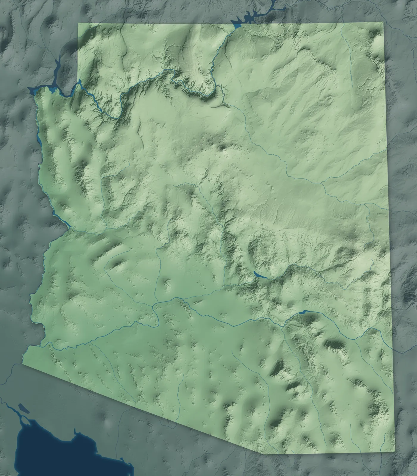
Arizona Town Maps A to Z
All 528 town maps, from Aguila to Yuma Proving Ground. Each one opens its own page with the whole map.
A
B
C
- Cactus Flats
- Cactus Forest
- Camelback East
- Cameron
- Camp Verde
- Campo Bonito
- Cane Beds
- Canyon Day
- Canyon Lake
- Carefree
- Carrizo
- Casa Blanca
- Casa Grande
- Casas Adobes
- Catalina
- Catalina Foothills
- Cave Creek
- Cedar Creek
- Centennial Park
- Central
- Central City
- Central Heights-Midland City
- Chandler
- Charco
- Chiawuli Tak
- Chilchinbito
- Chinle
- Chino Valley
- Chloride
- Christopher Creek
- Chuichu
- Cibecue
- Cibola
- Cienega Springs
- Circle City
- Citrus Park
- Clacks Canyon
- Clarkdale
- Clay Springs
- Claypool
- Clifton
- Cochise
- Cocopah Indian Tribe
- Colorado City
- Colorado River Indian Tribes
- Comobabi
- Concho
- Congress
- Coolidge
- Copper Hill
- Cordes Lakes
- Cornfields
- Cornville
- Corona de Tucson
- Cottonwood
- Cove
- Cowlic
- Crown King
- Crozier
- Crystal Beach
- Cutter
D
E
F
G
H
I
J
K
L
M
- Maish Vaya
- Mammoth
- Many Farms
- Marana
- Maricopa
- Maricopa Colony
- Martinez Lake
- Maryvale
- Mayer
- McConnico
- McNary
- McNeal
- Mead Ranch
- Meadview
- Mesa
- Mesa del Caballo
- Mescal
- Mesquite Creek
- Miami
- Miracle Valley
- Moccasin
- Moenkopi
- Mohave Valley
- Mojave Ranch Estates
- Moon Valley
- Morenci
- Mormon Lake
- Morristown
- Mountain View Ranches
- Mountainaire
- Munds Park
N
O
P
- Padre Ranchitos
- Page
- Palo Verde
- Palominas
- Paradise Valley
- Parker
- Parker Strip
- Parks
- Pascua Yaqui Tribe
- Patagonia
- Paulden
- Payson
- Peach Springs
- Pearce
- Peeples Valley
- Peoria
- Peridot
- Phoenix
- Picacho
- Picture Rocks
- Pima
- Pinal
- Pine
- Pine Lake
- Pine Springs
- Pinedale
- Pinetop Country Club
- Pinetop-Lakeside
- Pinion Pines
- Pinon
- Pirtleville
- Pisinemo
- Pomerene
- Poston
- Prescott
- Prescott Valley
Q
R
S
- Sacate Village
- Sacaton
- Sacaton Flats Village
- Saddlebrooke
- Safford
- Saguaro Lake
- Sahuarita
- Salome
- Salt River
- Salt River Pima-Maricopa Indian Community
- San Carlos
- San Carlos Apache Tribe
- San Carlos Lake
- San Jose
- San Luis
- San Manuel
- San Miguel
- San Simon
- San Tan Valley
- Sanders
- Santa Cruz
- Santa Rosa
- Santan
- Sawmill
- Scenic
- Scottsdale
- Seba Dalkai
- Second Mesa
- Sedona
- Sehili
- Seligman
- Sells
- Sentinel
- Seven Mile
- Shongopovi
- Shonto
- Show Low
- Shumway
- Sierra Vista
- Sierra Vista Southeast
- Six Shooter Canyon
- Skull Valley
- Snowflake
- So-Hi
- Solomon
- Somerton
- Sonoita
- South Komelik
- South Tucson
- Spring Valley
- Springerville
- St. David
- St Johns
- St. Michaels
- Stanfield
- Star Valley
- Steamboat
- Stotonic Village
- Strawberry
- Summerhaven
- Summit
- Sun City
- Sun City West
- Sun Lakes
- Sun Valley
- Sunizona
- Sunsites
- Sunwest
- Supai
- Superior
- Surprise
- Sweet Water Village
- Swift Trail Junction
T
- Tacna
- Tanque Verde
- Tat Momoli
- Taylor
- Teec Nos Pos
- Tees Toh
- Tempe
- Thatcher
- Theba
- Theodore Roosevelt Lake
- Three Points
- Timberline-Fernwood
- Tohono O'odham Nation
- Tolani Lake
- Tolleson
- Tombstone
- Tonalea
- Tonopah
- Tonto Apache Tribe
- Tonto Basin
- Tonto Village
- Top-of-the-World
- Topawa
- Topock
- Tortolita
- Toyei
- Truxton
- Tsaile
- Tuba City
- Tubac
- Tucson
- Tucson Estates
- Tucson Mountains
- Tumacacori-Carmen
- Turkey Creek
- Tusayan
U
V
W
- Wagon Wheel
- Wahak Hotrontk
- Wall Lane
- Walnut Creek
- Washington Park
- Wellton
- Wellton Hills
- Wenden
- Wet Camp Village
- Wheatfields
- Whetstone
- Whispering Pines
- White Hills
- White Mountain Apache Tribe
- White Mountain Lake
- Whitecone
- Whiteriver
- Why
- Wickenburg
- Wide Ruins
- Wikieup
- Wilhoit
- Willcox
- Williams
- Williamson
- Willow Canyon
- Willow Valley
- Window Rock
- Winkelman
- Winslow
- Winslow West
- Wintersburg
- Wittmann
- Woodruff
Y
Don’t see your town? Ask us to draw it.
About Arizona
Arizona runs from the pine forests and canyons of the Colorado Plateau down to the Sonoran Desert. It became the 48th state on February 14, 1912, the last of the lower 48 to join.
Most Arizonans live around Phoenix and Tucson, but a lot of the state's towns started as something smaller: a mining camp, a railroad stop, a ranch town or an Army fort. Arizona is also home to 22 federally recognized tribes, whose lands cover more than a quarter of the state.
- Statehood
- February 14, 1912
- Capital
- Phoenix
- Population
- 7,582,3842024 Census estimate
- Highest point
- Humphreys Peak, 12,633 feet
- Lowest point
- The Colorado River near San Luis, about 70 feet
- Size
- 113,990 square miles, the 6th largest state
Phoenix and the Valley
Phoenix, Mesa, Chandler, Scottsdale, Tempe and their neighbors fill the Salt River Valley, which most people here just call the Valley. The Hohokam people dug hundreds of miles of canals in this valley centuries ago, and settlers in the late 1860s cleared some of the old routes to farm the desert again. To the southeast, Florence was laid out along the Gila River in 1866, which makes it one of the oldest towns in the state.


Tucson and Southern Arizona
Tucson grew up around a Spanish fort built in 1775, and the mission church of San Xavier del Bac still stands just south of the city. Down toward the border are Nogales, Douglas and Sierra Vista. Southeast of Tucson, Tombstone and Bisbee drew thousands of people during the silver and copper booms of the late 1800s.


Northern Arizona
This is the high country: Flagstaff, Sedona, Prescott and the Grand Canyon. Flagstaff sits at nearly 7,000 feet in one of the largest ponderosa pine forests in North America. Prescott served as the capital of Arizona Territory twice, and Jerome, a copper town built on the side of Cleopatra Hill, nearly emptied out after its last mine closed in 1953.


Eastern Arizona
Eastern Arizona climbs from the copper towns of Globe, Miami and Morenci up to the Mogollon Rim and the White Mountains, where Payson, Show Low and Pinetop-Lakeside sit in cool pine country. Winslow and Holbrook grew up as railroad towns, Safford farms the Gila Valley, and farther north Window Rock, Chinle and Kayenta are on the Navajo Nation.


Western Arizona
The Colorado River forms most of Arizona's western border. Yuma grew up at a river crossing and held the territorial prison from 1876 to 1909. Lake Havasu City is where the London Bridge was rebuilt in 1971, and Kingman sits on one of the longest stretches of old Route 66 still left.


Tribal Nations
Arizona has 22 federally recognized tribes. The Navajo Nation, the largest reservation in the United States, covers much of the northeast and reaches into New Mexico and Utah. The Hopi villages on their three mesas are among the oldest communities in North America that people have lived in without a break, and the Tohono O'odham Nation stretches along the border with Mexico.


- 12 × 18 inPrint $39.99Framed $89.99
- 18 × 24 inPrint $49.99Framed $129.99
- 24 × 36 inPrint $89.99Framed $199.99

Sizes and Prices
Every map comes in three sizes on archival matte paper. Framed prints come in black or white wood.
How each map is made
It starts with the real place
Streets, buildings, terrain and water form the map, drawn the way Arizona looks today.
Then the details
Local research and an old atlas style give each town its character.
Then it's yours
Look around the map, then pick a print to keep or give.