New Mexico Town Maps A to Z
All 544 town maps, from Abeytas to Zuni Pueblo. Each one opens its own page with the whole map.
A
B
C
- Caballo
- Cañada de los Alamos
- Candy Kitchen
- Canjilon
- Cannon AFB
- Cañon
- Cañoncito
- Cañones
- Canova
- Capitan
- Capulin
- Carlsbad
- Carnuel
- Carrizozo
- Casa Colorada
- Casas Adobes
- Catalpa Canyon
- Causey
- Cedar Crest
- Cedar Grove
- Cedar Hill
- Cedro
- Center Point
- Chama
- Chamberino
- Chamisal
- Chamita
- Chamizal
- Chaparral
- Chical
- Chili
- Chilili
- Chimayo
- Chupadero
- Church Rock
- Cimarron
- City of the Sun
- Clayton
- Cliff
- Cloudcroft
- Clovis
- Cobre
- Cochiti
- Cochiti Lake
- Columbus
- Conchas Dam
- Conchas Lake
- Conejo
- Continental Divide
- Cordova
- Corona
- Corrales
- Costilla
- Cotton City
- Coyote
- Crestview
- Crouch Mesa
- Crownpoint
- Cruzville
- Crystal
- Cuartelez
- Cuba
- Cubero
- Cundiyo
- Cuyamungue
- Cuyamungue Grant
D
E
F
G
H
I
J
K
L
- La Bajada
- La Boca
- La Cienega
- La Cueva, Sandoval County
- La Cueva, Santa Fe County
- La Hacienda
- La Huerta
- La Jara
- La Joya
- La Luz
- La Madera, Rio Arriba County
- La Madera, Sandoval County
- La Mesa
- La Mesilla
- La Plata
- La Puebla
- La Tierra
- La Union
- La Villita
- Laguna
- Lake Arthur
- Lake Roberts
- Lake Roberts Heights
- Lake Sumner
- Lake Valley
- Lamy
- Las Campanas
- Las Cruces
- Las Maravillas
- Las Nutrias
- Las Palomas
- Las Tusas
- Las Vegas
- Lee Acres
- Lemitar
- Lindrith
- Little Walnut Village
- Livingston Wheeler
- Llano del Medio
- Lobo Canyon
- Loco Hills
- Logan
- Lordsburg
- Los Alamos
- Los Cerrillos
- Los Chaves
- Los Luceros
- Los Lunas
- Los Ojos
- Los Ranchos de Albuquerque
- Loving
- Lovington
- Lower Frisco
- Luis Lopez
- Lumberton
- Luna
- Lybrook
- Lyden
M
- Madrid
- Madrone
- Magdalena
- Malaga
- Manuelito
- Manzano
- Manzano Springs
- Mariano Lake
- Maxwell
- Mayhill
- McCartys Village
- McGaffey
- McIntosh
- Meadow Lake
- Medanales
- Melrose
- Mesa del Sol
- Mescalero
- Mesilla
- Mesita
- Mesquite
- Middle Frisco
- Middle Mesa
- Midway
- Milan
- Mimbres
- Mogollon
- Monterey Park
- Monument
- Moquino
- Mora
- Moriarty
- Morningside
- Mosquero
- Mount Taylor
- Mountain View, Chaves County
- Mountain View, Cibola County
- Mountain View, Luna County
- Mountainair
N
O
P
- Paa-Ko
- Paguate
- Pajarito Mesa
- Paradise Hills
- Paraje
- Pastura
- Peak Place
- Pecan Park
- Pecos
- Peña Blanca
- Peñasco
- Peralta
- Picacho
- Picacho Hills
- Picuris Pueblo
- Pie Town
- Pinedale
- Pinehaven
- Pinehill
- Pinon
- Pinos Altos
- Placitas, Doña Ana County
- Placitas, Sandoval County
- Playas
- Pleasanton
- Pojoaque
- Polvadera
- Ponderosa
- Ponderosa Pine
- Portales
- Prewitt
- Pueblito
- Pueblitos
- Pueblo
- Pueblo of Sandia Village
- Pueblo Pintado
- Puerto de Luna
- Pulpotio Bareas
- Punta de Agua
- Purty Rock
Q
R
S
- Sacramento
- Sagar
- Salem
- San Acacia
- San Antonio
- San Antonito, Bernalillo County
- San Antonito, Socorro County
- San Cristobal
- San Felipe Pueblo
- San Fidel
- San Ildefonso Pueblo
- San Jon
- San Jose, Rio Arriba County
- San Jose, San Miguel County
- San Lorenzo
- San Luis
- San Mateo
- San Miguel
- San Pablo
- San Pedro
- San Rafael
- San Ysidro
- Sandia Heights
- Sandia Knolls
- Sandia Park
- Sanostee
- Santa Ana Pueblo
- Santa Clara
- Santa Clara Pueblo
- Santa Cruz
- Santa Fe
- Santa Fe Foothills
- Santa Rosa
- Santa Teresa
- Santo Domingo Pueblo
- Sausal
- Seama
- Seboyeta
- Sedillo
- Sena
- Seton Village
- Sheep Springs
- Shiprock
- Sierra Vista
- Silver City
- Skyline-Ganipa
- Socorro
- Soham
- Sombrillo
- South Acomita Village
- South River
- South Valley
- Spencerville
- Springer
- Stanley
- Stoneridge
- Sullivan
- Sundance
- Sunland Park
- Sunlit Hills
- Sunshine
T
- Tajique
- Talpa
- Tano Road
- Taos
- Taos Pueblo
- Taos Ski Valley
- Tatum
- Tecolote
- Tecolotito
- Tesuque
- Tesuque Pueblo
- Texico
- Thoreau
- Thunder Mountain
- Tierra Amarilla
- Tijeras
- Timberlake
- Timberon
- Tohatchi
- Tome
- Torreon, Sandoval County
- Torreon, Torrance County
- Tortugas
- Totah Vista
- Tres Arroyos
- Trout Valley
- Truchas
- Truth or Consequences
- Tse Bonito
- Tucumcari
- Tularosa
- Turley
- Twin Forks
- Twin Lakes
- Tyrone
U
V
W
Y
Z
Don’t see your town? Ask us to draw it.
About New Mexico
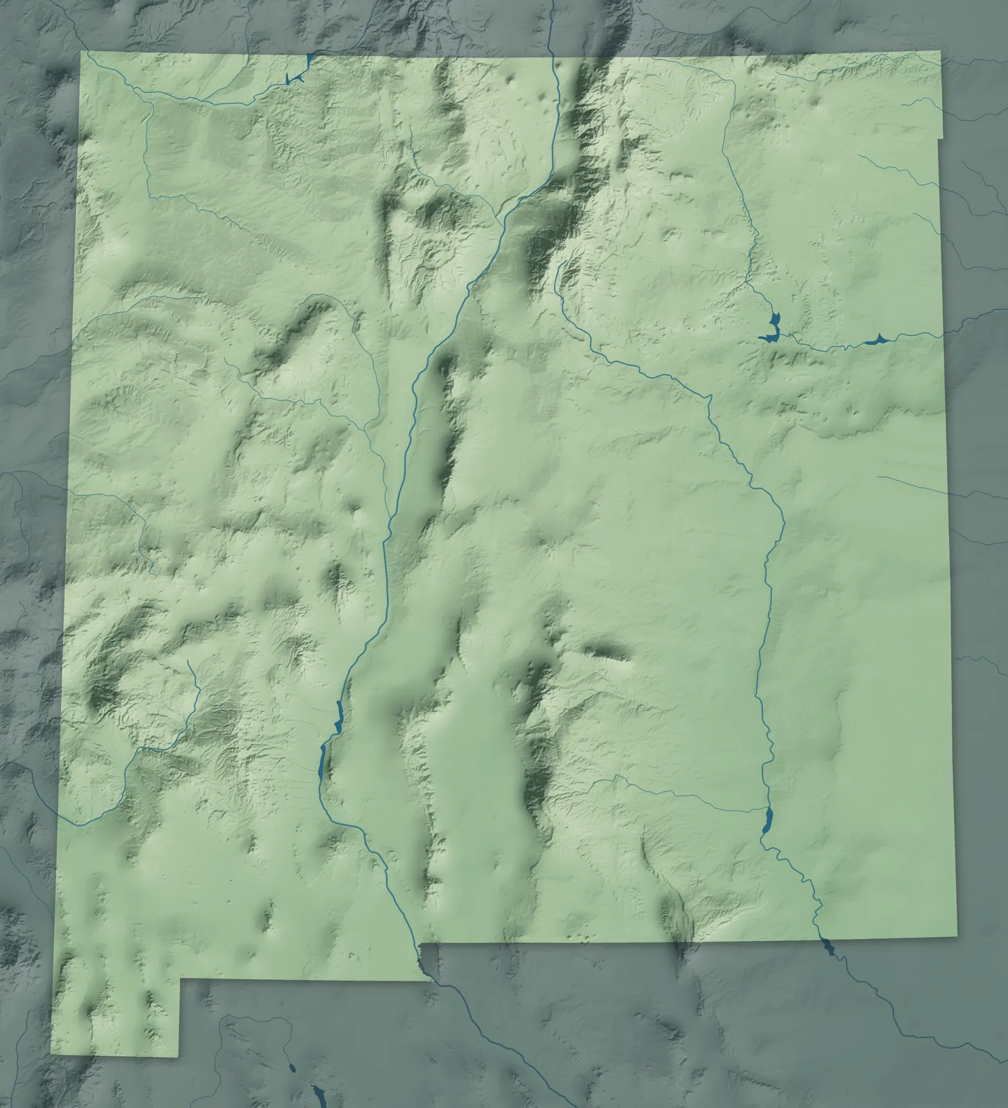
The Rio Grande runs down the middle of New Mexico, from the Colorado line south to El Paso. East of the river, mountain ranges give way to high plains. To the west are mesas, lava flows and the red rock of the Colorado Plateau. New Mexico spent more than 60 years as a territory before it became the 47th state in 1912.
About two of every three New Mexicans live in the counties along the Rio Grande, from Taos down through Albuquerque to Las Cruces. Many towns began as Spanish farm villages, railroad stops, mining camps or ranch towns. New Mexico is also home to 23 tribes: 19 pueblos, three Apache tribes and the Navajo Nation.
- Statehood
- January 6, 1912
- Capital
- Santa Fe
- Population
- 2,125,4982025 Census estimate
- Highest point
- Wheeler Peak, 13,167 feet
- Lowest point
- Red Bluff Reservoir on the Texas border, 2,842 feet
- Size
- 121,590 square miles, the 5th largest state
Albuquerque and Central New Mexico
Albuquerque, Rio Rancho, Los Lunas and Belen line the Rio Grande valley, with the Sandia and Manzano Mountains to the east. Albuquerque was founded in 1706 and named for a Spanish duke, so people call it the Duke City. Its Balloon Fiesta began in 1972 with 13 balloons in a mall parking lot. Isleta, Sandia, Santa Ana, San Felipe, Kewa (Santo Domingo), Cochiti, Zia and Jemez pueblos are here too.


Santa Fe and Northern New Mexico
Santa Fe, the oldest and highest state capital, sits at about 7,000 feet below the Sangre de Cristo Mountains, with Española, Los Alamos and Taos to the north. The Jicarilla Apache Nation is here, along with eight pueblos: Taos, Picuris, Ohkay Owingeh, Santa Clara, San Ildefonso, Nambé, Pojoaque and Tesuque. Taos Pueblo's adobe homes, stacked several stories high, were built between about 1000 and 1450. Los Alamos was built in secret in 1943 for a wartime lab that's still there.


Gallup, Farmington and the Northwest
Farmington sits where the San Juan, Animas and La Plata rivers meet, and Gallup and Grants grew up along the railroad and later Route 66. Much of this mesa country is the Navajo Nation, home of the Diné, along with the Zuni, Acoma and Laguna pueblos. Acoma's Sky City, high on a mesa, is one of the oldest communities in the country that people have lived in without a break. Gallup has held its Inter-Tribal Indian Ceremonial since 1922.


Las Vegas, Raton and the Northeast
Las Vegas and Raton sit where the mountains meet the plains, and Tucumcari, Santa Rosa and Clayton are out on the grassland. Las Vegas grew rich on the Santa Fe Trail and the railroad, and it has nine historic districts on the National Register of Historic Places. Near Folsom in 1908, cowboy George McJunkin found the bones of an extinct kind of bison. Spear points found among those bones in 1927 proved people hunted here more than 10,000 years ago.


Las Cruces and the Southwest
Las Cruces and Mesilla sit among the chile and pecan farms of the Mesilla Valley, with Socorro, Truth or Consequences, Deming and Silver City farther out. Hot Springs renamed itself Truth or Consequences in 1950 after a radio quiz show, which broadcast from the town the next night. Deming grew up in 1881 where two railroads met to finish the second line across the country. North of Silver City, the Gila Wilderness became the world's first designated wilderness in 1924.


Roswell, Carlsbad and the Southeast
Roswell, Artesia and Carlsbad grew up in the Pecos Valley, and Hobbs, Clovis and Portales sit on the eastern plains, in farm, ranch and oil country. To the west, Ruidoso and Cloudcroft are cool mountain towns near the Mescalero Apache Reservation, and White Sands, in the basin below, is the world's largest gypsum dunefield. Buddy Holly recorded "That'll Be the Day" in Clovis in 1957. The cub who became the living Smokey Bear was found near Capitan in 1950, and he's buried there.


- 12 × 18 inPrint $39.99Framed $89.99
- 18 × 24 inPrint $49.99Framed $129.99
- 24 × 36 inPrint $89.99Framed $199.99

Sizes and Prices
Every map comes in three sizes on archival matte paper. Framed prints come in black or white wood.
How each map is made
It starts with the real place
Streets, buildings, terrain and water form the map, drawn the way New Mexico looks today.
Then the details
Local research and an old atlas style give each town its character.
Then it's yours
Look around the map, then pick a print to keep or give.