Alabama Town Maps A to Z
All 675 town maps, from Abanda to York. Each one opens its own page with the whole map.
A
B
- Babbie
- Bagley
- Baileyton
- Bakerhill
- Ballplay
- Banks
- Bay Minette
- Bayou La Batre
- Bear Creek
- Beatrice
- Beauregard
- Beaverton
- Belgreen
- Belk
- Bellamy
- Belle Fontaine
- Benton
- Berlin
- Berry
- Bessemer
- Beulah
- Big Creek Lake
- Billingsley
- Birmingham
- Black
- Blountsville
- Blue Ridge
- Blue Springs
- Boaz
- Boligee
- Bon Air
- Bon Secour
- Boykin
- Brantley
- Brantley, Dallas County
- Brantleyville
- Brent
- Brewton
- Bridgeport
- Brighton
- Brilliant
- Bristow Cove
- Brook Highland
- Brookside
- Brookwood
- Broomtown
- Brundidge
- Bryant
- Buckhorn
- Bucks
- Buhl
- Butler
C
- Calera
- Calhoun
- Calvert
- Camden
- Camp Hill
- Carbon Hill
- Cardiff
- Carlisle-Rockledge
- Carlton
- Carolina
- Carrollton
- Castleberry
- Catherine
- Catoma
- Cedar Bluff
- Cedar Hill
- Center Point
- Centre
- Centreville
- Chatom
- Chelsea
- Cherokee
- Cherokee Ridge
- Chickasaw
- Childersburg
- Choccolocco
- Chunchula
- Citronelle
- Clanton
- Clay
- Clayhatchee
- Claysville
- Clayton
- Cleburne
- Cleveland
- Clio
- Coaling
- Coats Bend
- Coffee Springs
- Coffeeville
- Coker
- Colbert Heights
- Cold Springs
- Collinsville
- Colony
- Columbia
- Columbiana
- Concord
- Coosada
- Cordova
- Corner
- Cottondale
- Cottonwood
- County Line
- Courtland
- Cowarts
- Creola
- Crossville
- Cuba
- Cullman
- Cullomburg
- Curry
- Cusseta
D
E
F
G
- Gadsden
- Gainesville
- Gallant
- Gantt
- Garden City
- Gardendale
- Gaylesville
- Geiger
- Geneva
- Georgiana
- Geraldine
- Gilbertown
- Glen Allen
- Glencoe
- Glenwood
- Goldville
- Good Hope
- Goodwater
- Gordo
- Gordon
- Gordonville
- Goshen
- Graham
- Grand Bay
- Grant
- Grayson Valley
- Graysville
- Greensboro
- Greenville
- Grimes
- Grove Hill
- Gu-Win
- Guin
- Gulf Shores
- Gulfcrest
- Guntersville
- Guntersville Lake
- Gurley
H
- Hackleburg
- Hackneyville
- Haleburg
- Haleyville
- Hamilton
- Hammondville
- Hampton Cove
- Hanceville
- Hanover
- Harpersville
- Hartford
- Hartselle
- Harvest
- Hatton
- Hatton, Colbert County
- Hayden
- Hayneville
- Hazel Green
- Headland
- Heath
- Heflin
- Helena
- Henagar
- Highland Home
- Highland Lake
- Highland Lakes
- Hillsboro
- Hissop
- Hobson City
- Hodges
- Hokes Bluff
- Hollins
- Hollis Crossroads
- Holly Pond
- Hollywood
- Holt
- Holtville
- Homewood
- Hoover
- Horn Hill
- Hubbertville
- Hueytown
- Huguley
- Huntsville
- Hurtsboro
- Huxford
- Hytop
I
J
K
L
- La Fayette
- Laceys Spring
- Ladonia
- Lake Eufaula
- Lake Martin
- Lake Tuscaloosa
- Lake View
- Lakeview
- Lanett
- Langston
- Leeds
- Leesburg
- Leighton
- Leroy
- Lester
- Level Plains
- Lewis Smith Lake
- Lexington
- Libertyville
- Lillian
- Lincoln
- Linden
- Lineville
- Lipscomb
- Lisman
- Littleville
- Livingston
- Loachapoka
- Lockhart
- Locust Fork
- Logan Martin Lake
- Lookout Mountain
- Louisville
- Lowndesboro
- Loxley
- Lupton
- Luverne
- Lyeffion
- Lynn
M
- Macedonia
- Macedonia, Jackson County
- Madison
- Madrid
- Magnolia Springs
- Malcolm
- Malvern
- Maplesville
- Marbury
- Marengo
- Margaret
- Marion
- Maytown
- McCalla
- McDonald Chapel
- McIntosh
- McKenzie
- McMullen
- Meadowbrook
- Megargel
- Memphis
- Mentone
- Meridianville
- Midfield
- Midland City
- Midway
- Mignon
- Millbrook
- Millerville
- Millport
- Millry
- Minor
- Mobile
- Monroeville
- Monrovia
- Montevallo
- Montgomery
- Moody
- Moores Mill
- Mooresville
- Morris
- Morrison Crossroads
- Mosses
- Moulton
- Moundville
- Mount Hope
- Mount Olive, Coosa County
- Mount Olive, Jefferson County
- Mount Vernon
- Mountain Brook
- Movico
- Mulga
- Munford
- Muscle Shoals
- Myrtlewood
N
O
P
- Paint Rock
- Panola
- Parrish
- Pea Ridge
- Pelham
- Pell City
- Pennington
- Penton
- Perdido
- Perdido Beach
- Peterman
- Petrey
- Phenix City
- Phil Campbell
- Pickensville
- Pickwick Lake
- Piedmont
- Pike Road
- Pinckard
- Pine Apple
- Pine Grove
- Pine Hill
- Pine Level
- Pine Ridge
- Piney Chapel
- Pinson
- Pintlala
- Pisgah
- Pleasant Grove
- Pleasant Groves
- Point Clear
- Pollard
- Powell
- Prattville
- Priceville
- Prichard
- Providence
- Putnam
R
S
- Saint Elmo
- Saks
- Salem
- Samson
- Sand Rock
- Sanford
- Saraland
- Sardis City
- Satsuma
- Scottsboro
- Section
- Selma
- Selmont-West Selmont
- Semmes
- Sheffield
- Shelby
- Shiloh
- Shoal Creek
- Shorter
- Silas
- Silverhill
- Sims Chapel
- Sipsey
- Skyline
- Slocomb
- Smiths Station
- Smoke Rise
- Snead
- Somerville
- South Vinemont
- Southside
- Spanish Fort
- Speake
- Spring Garden
- Springville
- Spruce Pine
- St. Florian
- St. Stephens
- Standing Rock
- Stapleton
- Steele
- Stemley
- Sterrett
- Stevenson
- Stewartville
- Stockton
- Straughn
- Sulligent
- Sumiton
- Summerdale
- Susan Moore
- Sweet Water
- Sycamore
- Sylacauga
- Sylvan Springs
- Sylvania
T
U
V
W
- Wadley
- Waldo
- Walnut Grove
- Walnut Grove, Madison County
- Warrior
- Waterloo
- Waverly
- Weaver
- Webb
- Wedowee
- Weiss Lake
- Welti
- Weogufka
- West Blocton
- West End-Cobb Town
- West Jefferson
- West Point
- West Point Lake
- Westover
- Wetumpka
- Whatley
- Wheeler Lake
- White Hall
- White Plains
- Whitesboro
- Wicksburg
- Wilmer
- Wilson
- Wilson Lake
- Wilsonville
- Wilton
- Winfield
- Winterboro
- Woodland
- Woodstock
- Woodville
Y
Don’t see your town? Ask us to draw it.
About Alabama
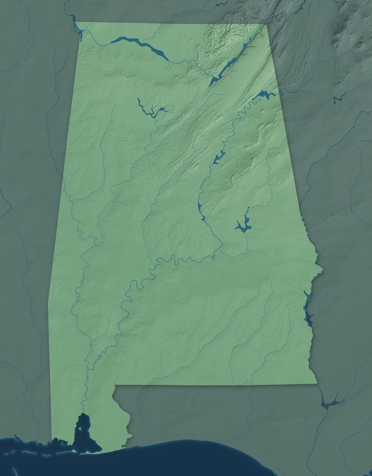
Alabama rises from the white sand beaches of the Gulf Coast to the southern end of the Appalachian Mountains. The Tennessee River sweeps across the north, and the dark soil of the Black Belt stretches across the middle. It became the 22nd state on December 14, 1819, after delegates wrote its first constitution that summer in Huntsville.
Alabama's biggest cities are Huntsville, Birmingham, Montgomery and Mobile. Many towns began as river landings, cotton towns or railroad stops. Others grew up around coal mines, ironworks and textile mills. The Poarch Band of Creek Indians, the only federally recognized tribe in Alabama, has its reservation near Atmore.
- Statehood
- December 14, 1819
- Capital
- Montgomery
- Population
- 5,193,0882025 Census estimate
- Highest point
- Cheaha Mountain, 2,405 feet
- Lowest point
- The Gulf coast, sea level
- Size
- 52,420 square miles, the 30th largest state
North Alabama and the Tennessee Valley
The Tennessee River runs past Decatur, Huntsville and Florence, and Guntersville, Fort Payne and Gadsden sit among the lakes and mountains of the northeast. In 1950 the Army brought a team of rocket engineers to Huntsville, where NASA later developed the Saturn V, the rocket that took astronauts to the Moon. Helen Keller was born in 1880 at Ivy Green in Tuscumbia, and the house is now a museum.


Birmingham and Central Alabama
Birmingham was founded in 1871 where two railroads crossed, near the iron ore, coal and limestone needed to make iron. It grew so fast that people called it the Magic City, and Sloss Furnaces, which made iron from 1882 to 1971, is now a museum. Vulcan, a cast iron statue made for the 1904 World's Fair, looks over the city from Red Mountain. Hoover, Bessemer, Pelham and Jasper are nearby, and Clanton is known for its peaches.


East Alabama
East Alabama runs along the Georgia line, from the hills around Anniston and Talladega down to Auburn, Opelika and Phenix City. Anniston began in the 1870s as a private iron company town. It opened to the public in 1883 and is still called the Model City. Auburn University opened in 1859 as East Alabama Male College, and Lake Martin filled in behind a dam near Alexander City that was finished in 1926.


Tuscaloosa and West Alabama
Tuscaloosa and Northport face each other across the Black Warrior River. Tuscaloosa was the state capital from 1826 to 1846, and the University of Alabama opened there in 1831. To the south, Moundville Archaeological Park protects 29 earthen mounds built by Native people who founded a town there around 1120. Farther south is the Black Belt prairie around Eutaw, Livingston and Demopolis, which French settlers founded on the Tombigbee River in 1817.


Montgomery and the Black Belt
The Black Belt, named for its dark soil, runs through Montgomery, Selma and Tuskegee, with Prattville and Wetumpka just north of the capital. Montgomery has been the capital since 1846, and in 1955 the arrest of Rosa Parks there started a bus boycott that lasted 381 days. In 1965, marchers for the right to vote walked from Selma to Montgomery on a route that's now a National Historic Trail. Booker T. Washington led Tuskegee Institute from its opening in 1881.


Dothan and the Wiregrass
The Wiregrass, named for the long-stemmed grass that grows among its longleaf pines, takes in Dothan, Enterprise, Ozark, Troy and Andalusia. Dothan held its first National Peanut Festival in 1938, with George Washington Carver as the guest speaker. In 1919 Enterprise put up a monument to the boll weevil, the beetle that wrecked the cotton crop and pushed farmers to plant peanuts. Eufaula, on a bluff above Lake Eufaula, holds Alabama's oldest tour of historic homes each April.


Mobile and the Gulf Coast
Mobile was founded by the French in 1702, and its Mardi Gras dates back to the early 1700s. Across Mobile Bay, Fairhope began in 1894 as a single tax colony, where settlers leased land from the colony instead of buying it. Gulf Shores and Orange Beach line the white sand beaches to the south. Inland, St. Stephens served as the territorial capital, and Monroeville is the hometown of Harper Lee, who wrote To Kill a Mockingbird.


- 12 × 18 inPrint $39.99Framed $89.99
- 18 × 24 inPrint $49.99Framed $129.99
- 24 × 36 inPrint $89.99Framed $199.99

Sizes and Prices
Every map comes in three sizes on archival matte paper. Framed prints come in black or white wood.
How each map is made
It starts with the real place
Streets, buildings, terrain and water form the map, drawn the way Alabama looks today.
Then the details
Local research and an old atlas style give each town its character.
Then it's yours
Look around the map, then pick a print to keep or give.