


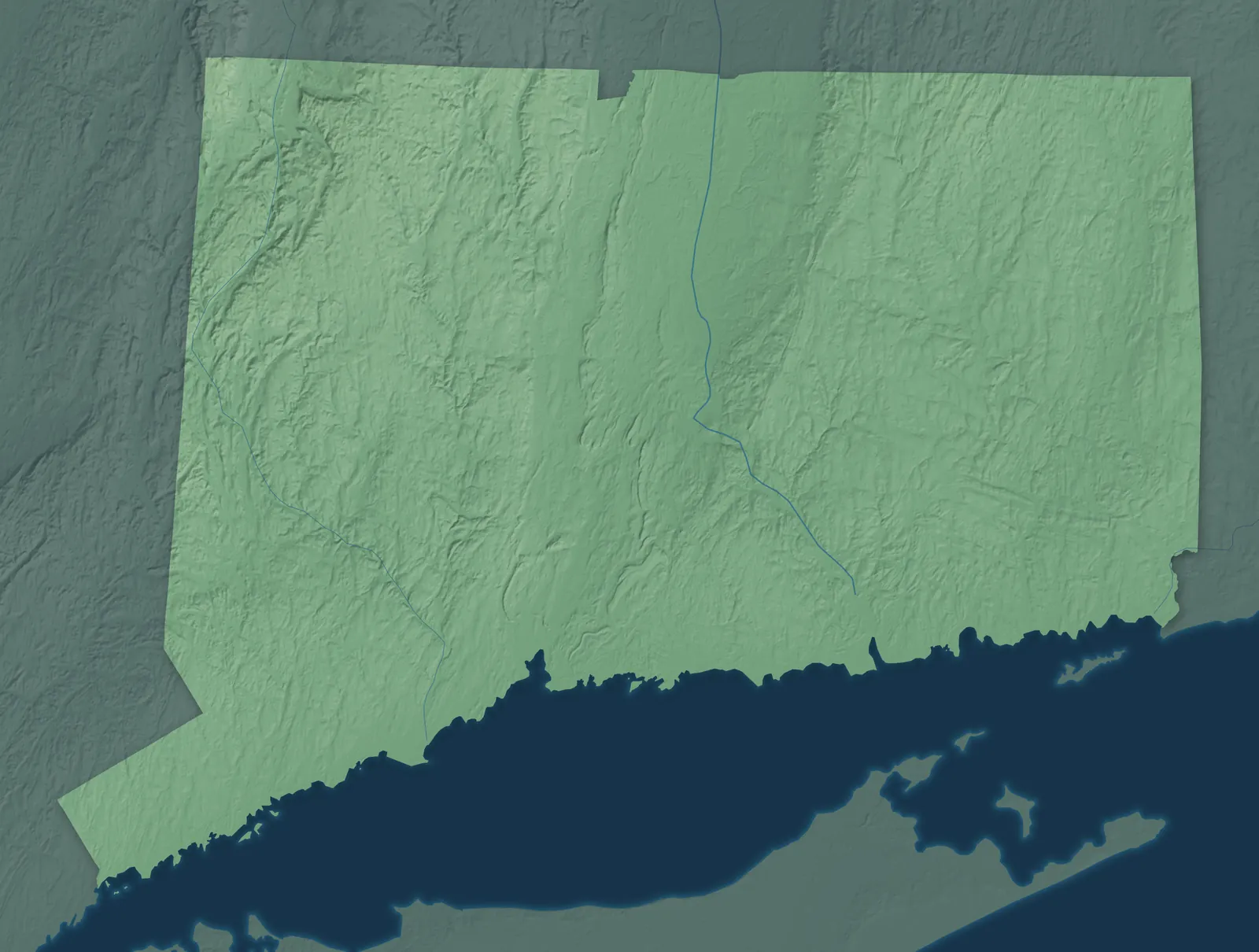
Connecticut Town Maps A to Z
All 382 town maps, from Amity to Yalesville. Each one opens its own page with the whole map.
A
B
- Ball Pond
- Baltic
- Bantam
- Bantam Lake
- Barkhamsted
- Barkhamsted Reservoir
- Beacon Falls
- Beaver Hills
- Berlin
- Bethany
- Bethel
- Bethlehem
- Bethlehem Village
- Bigelow Corners
- Black Rock
- Bloomfield
- Blue Hills
- Bogus Hill
- Bolton
- Botsford
- Bozrah
- Branchville
- Branford
- Branford Center
- Bridgeport
- Bridgewater
- Bristol
- Broad Brook
- Brookfield
- Brookfield Center
- Brooklyn
- Burlington
- Byram
C
- Canaan
- Candlewood Isle
- Candlewood Knolls
- Candlewood Lake
- Candlewood Lake Club
- Candlewood Orchards
- Candlewood Shores
- Cannondale
- Canterbury
- Canton
- Canton Valley
- Chaplin
- Cheshire
- Cheshire Village
- Chester
- Chester Center
- Chimney Point
- Clinton
- Colchester
- Colebrook
- Coleytown
- Collinsville
- Columbia
- Compo
- Conning Towers-Nautilus Park
- Cornwall
- Cornwall Bridge
- Cos Cob
- Coventry
- Coventry Lake
- Cromwell
- Crystal Lake
D
E
F
G
H
I
J
K
L
M
N
- Naugatuck
- New Britain
- New Canaan
- New Fairfield
- New Hartford
- New Hartford Center
- New Haven
- New London
- New Milford
- New Preston
- Newhallville
- Newington
- Newtown
- Niantic
- Nichols
- Noank
- Norfolk
- Noroton
- Noroton Heights
- North Branford
- North Canaan
- North Granby
- North Grosvenor Dale
- North Haven
- North Mianus
- North Stonington
- North Windham
- Northford
- Northville
- Northwest Harwinton
- Norwalk
- Norwich
O
P
Q
R
S
- Sacred Heart University
- Sail Harbor
- Salem
- Salisbury
- Salmon Brook
- Sandy Hook
- Saugatuck
- Saybrook Manor
- Scotland
- Seymour
- Sharon
- Shelton
- Sherman
- Sherwood Manor
- Simsbury
- Simsbury Center
- Somers
- South Coventry
- South Green
- South Wilton
- South Windham
- South Windsor
- South Woodstock
- Southbury
- Southington
- Southport
- Southwood Acres
- Sprague
- Spring Glen
- Stafford
- Stafford Springs
- Stamford
- Staples
- Stepney
- Sterling
- Stonington
- Storrs
- Stratfield
- Stratford
- Stratford Downtown
- Suffield
- Suffield Depot
T
U
V
W
- Wallingford
- Wallingford Center
- Warren
- Washington
- Waterbury
- Waterford
- Watertown
- Wauregan
- Weatogue
- West Cornwall
- West District
- West Hartford
- West Haven
- West Mountain
- West River
- West Simsbury
- West Stafford
- Westbrook
- Westbrook Center
- Weston
- Westport
- Westport Village
- Westville
- Wethersfield
- Willimantic
- Willington
- Wilton
- Wilton Center
- Winchester
- Windermere
- Windham
- Windsor
- Windsor Locks
- Winsted
- Winthrop
- Witches Woods
- Wolcott
- Woodbridge
- Woodbury
- Woodbury Center
- Woodmont
- Woodstock
- Wooster Square
Y
Don’t see your town? Ask us to draw it.
About Connecticut
Long Island Sound runs along Connecticut's whole southern shore, and the Connecticut River, New England's longest, cuts down the middle. The Litchfield Hills rise in the northwest, and the farms and woods of the Quiet Corner fill the northeast. Connecticut became the fifth state in 1788. A year earlier, its delegate Roger Sherman wrote the Connecticut Compromise, which gave Congress a House based on population and a Senate with two members from every state.
Three in four people in Connecticut live in Fairfield, Hartford and New Haven counties. The Connecticut Colony began in the 1630s with three river towns, Windsor, Wethersfield and Hartford. New Haven started as a separate colony in 1638. Later, factory towns made clocks, brass, hats and hardware. Connecticut has the highest share of Puerto Rican residents of any state.
- Statehood
- January 9, 1788
- Capital
- Hartford
- Population
- 3,688,4962025 Census estimate
- Highest point
- Mount Frissell's south slope, 2,386 feet
- Lowest point
- Long Island Sound, sea level
- Size
- 5,543 square miles, the 48th largest state
Fairfield County and Candlewood Lake
Greenwich, Stamford, Norwalk, Westport and Bridgeport line the shore of Long Island Sound, and wooded hills rise north to Danbury and Candlewood Lake. P. T. Barnum gave Bridgeport the land for Seaside Park in 1865 and later served as its mayor. Danbury was the Hat City, and by 1887 its 30 factories made about 5 million hats a year. Candlewood Lake, the largest lake in Connecticut, was created in 1928 by a power dam at New Milford.


Greater New Haven
Greater New Haven runs along the shoreline from Milford and New Haven to Branford, Guilford and Madison, and north to Wallingford and Meriden, the Silver City. Yale, the third-oldest college in the country, moved to New Haven in 1716. New Haven's coal-fired pizza, which locals call apizza, began at Frank Pepe's in 1925. Guilford's Henry Whitfield House, begun in 1639, is the oldest house in Connecticut.


The Lower Connecticut River Valley
The Connecticut River runs between wooded hills from Middletown past Haddam and Essex to Old Saybrook and Old Lyme, where it meets Long Island Sound. East Haddam's Goodspeed Opera House opened in 1877, and the musicals Annie and Man of La Mancha began there. Stage star William Gillette, best known as Sherlock Holmes, built Gillette Castle high above the river from 1914 to 1919. In Old Lyme, Florence Griswold ran a boardinghouse where American Impressionist painters lived and worked, and it's now a museum.


New London, Mystic and Norwich
Southeastern Connecticut's shore runs from Niantic and New London past Groton and Mystic to Stonington, with Norwich and Willimantic inland. The USS Nautilus, the world's first nuclear-powered submarine, was built in Groton, where it's now a museum ship. At Mystic Seaport, the whaleship Charles W. Morgan, launched in 1841, is the oldest surviving merchant ship in the world. The Mashantucket Pequot Tribal Nation and the Mohegan Tribe have their reservations here, in Ledyard and Montville.


The Quiet Corner
The Quiet Corner is Connecticut's rural northeast, with farms, woods and old mill villages from Thompson and Putnam down to Killingly and Plainfield. In 1833, Prudence Crandall opened a school for Black girls in Canterbury, and Connecticut named her its state heroine in 1995. Woodstock's pink Roseland Cottage, built in 1846, hosted four presidents at its Fourth of July celebrations. Putnam is named for Revolutionary War general Israel Putnam, who farmed in Brooklyn, where a statue of him on horseback stands.


Hartford and the Capitol Region
Greater Hartford spreads along the Connecticut River, with New Britain, the Hardware City, to the west and UConn's Storrs campus in the eastern hills. The ferry between Rocky Hill and Glastonbury has crossed the river since 1655, the oldest ferry still running in the country. In May 1781, George Washington met the French general Rochambeau at Wethersfield's Webb House to plan the campaign that ended at Yorktown. Mark Twain lived in his Hartford house while he wrote Tom Sawyer and Huckleberry Finn, and it's now a museum.


Waterbury and the Naugatuck Valley
The Naugatuck River runs south through hilly country past Waterbury, Naugatuck, Seymour and Ansonia to Derby, where it joins the Housatonic. Waterbury, the Brass City, was the country's leading center for brass goods through the first half of the 1900s. Thomaston is named for clockmaker Seth Thomas, who opened a factory there in 1812, and a Seth Thomas factory building still stands. Bristol is home to ESPN and to Lake Compounce, which opened in 1846 and is the country's oldest amusement park still running.


The Litchfield Hills
The Litchfield Hills fill the state's northwest corner with wooded ridges, lakes and river valleys, from Torrington and Winsted to Kent, Salisbury and Norfolk. In Litchfield, Tapping Reeve opened one of the country's first law schools, and two future vice presidents studied there. The covered bridge at West Cornwall, built around 1864, still carries cars across the Housatonic. Bantam Lake, between Litchfield and Morris, is the largest natural lake in Connecticut.


- 12 × 18 inPrint $39.99Framed $89.99
- 18 × 24 inPrint $49.99Framed $129.99
- 24 × 36 inPrint $89.99Framed $199.99

Sizes and Prices
Every map comes in three sizes on archival matte paper. Framed prints come in black or white wood.
How each map is made
It starts with the real place
Streets, buildings, terrain and water form the map, drawn the way Connecticut looks today.
Then the details
Local research and an old atlas style give each town its character.
Then it's yours
Look around the map, then pick a print to keep or give.